Gnosall

Settlement in Staffordshire Stafford

England

Gnosall

Plardiwick Bridge, Shropshire Union Canal Erected around 1830 as an agricultural accommodation bridge, and Grade II listed <span class="nowrap"><a title="https://britishlistedbuildings.co.uk/101273080-plardiwick-bridge-no-36-at-sj-815-206-gnosall#.YS5APo5KjIU" rel="nofollow ugc noopener" href="https://britishlistedbuildings.co.uk/101273080-plardiwick-bridge-no-36-at-sj-815-206-gnosall#.YS5APo5KjIU">Link</a><img style="margin-left:2px;" alt="External link" title="External link - shift click to open in new window" src="https://s1.geograph.org.uk/img/external.png" width="10" height="10"/></span> & <span class="nowrap"><a title="https://historicengland.org.uk/listing/the-list/list-entry/1273080" rel="nofollow ugc noopener" href="https://historicengland.org.uk/listing/the-list/list-entry/1273080">Link</a><img style="margin-left:2px;" alt="External link" title="External link - shift click to open in new window" src="https://s1.geograph.org.uk/img/external.png" width="10" height="10"/></span> in Oct 1991.
Plardiwick Bridge, Shropshire Union Canal Credit: Richard Law

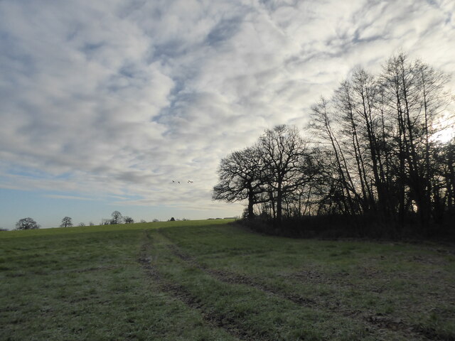
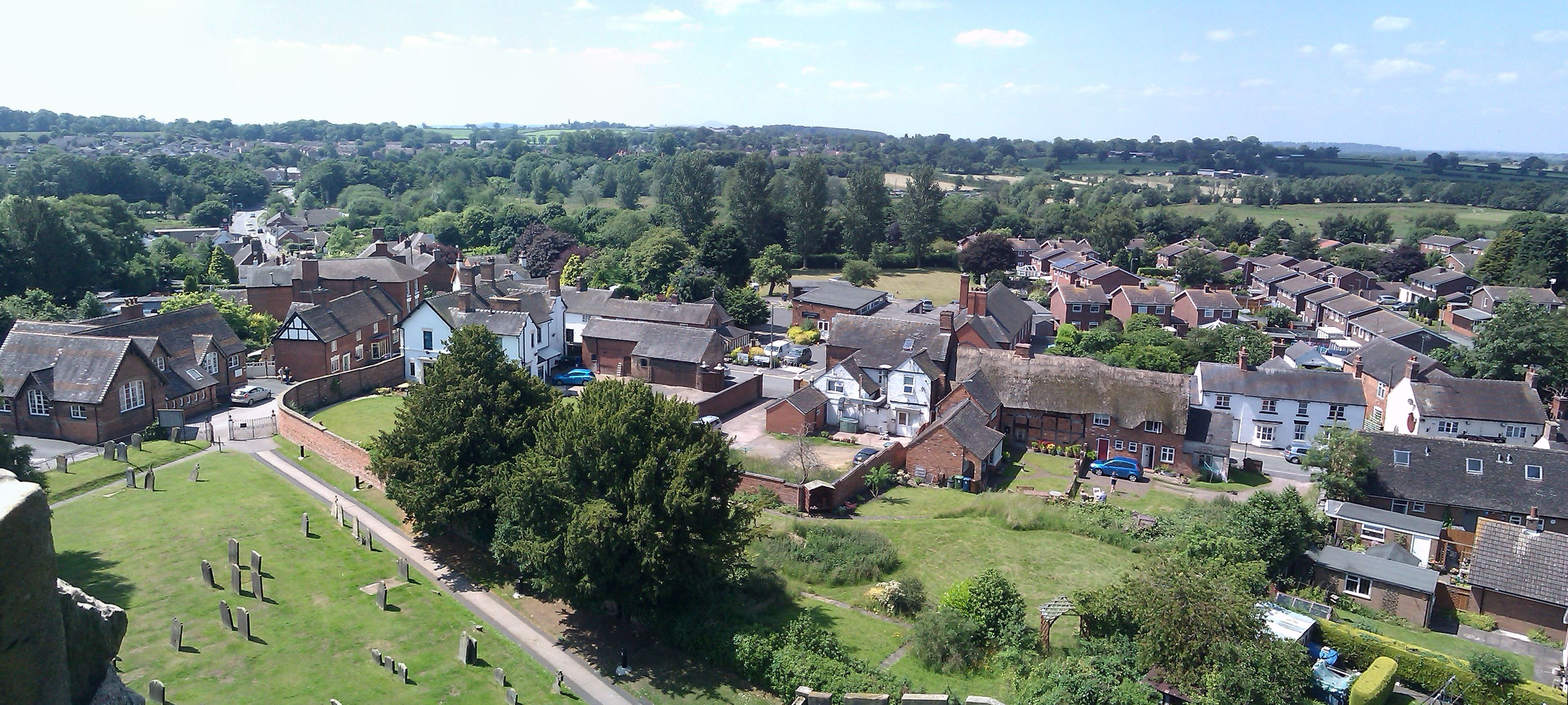
Gnosall is a small rural village located in the county of Staffordshire, England. Situated approximately 7 miles northeast of Stafford, the village is nestled within picturesque countryside, offering residents and visitors a tranquil and idyllic setting.

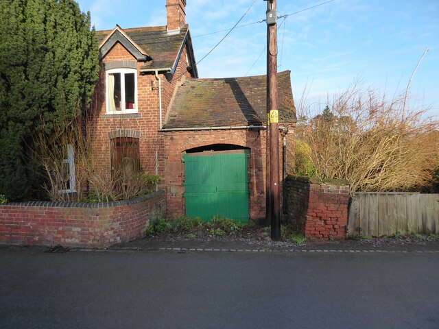
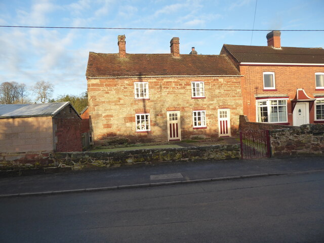
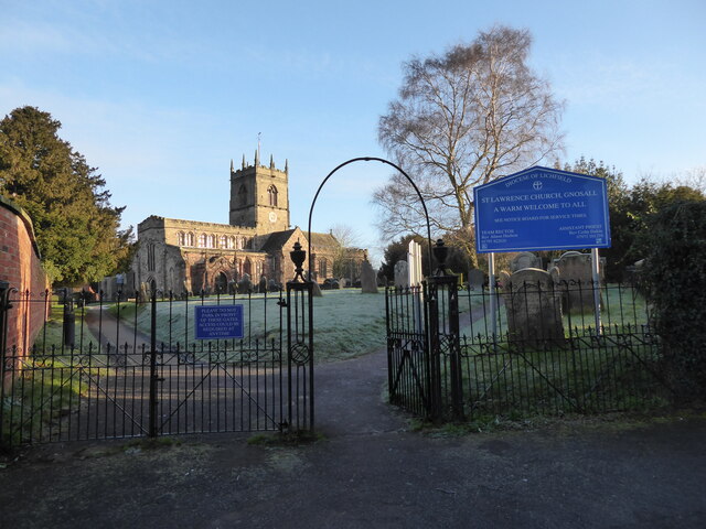
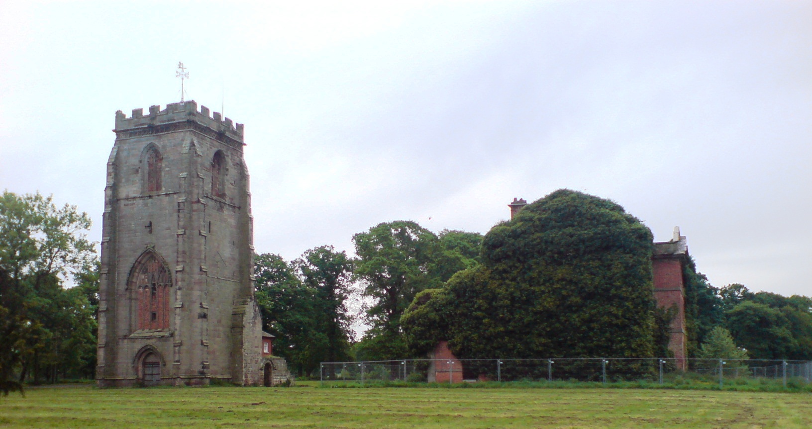
The history of Gnosall can be traced back to Roman times, with evidence of a Roman villa and a Roman road passing through the area. The village grew during the medieval period and still retains much of its historic charm, with several timber-framed buildings and a 12th-century church, St Lawrence's, which is a notable landmark.

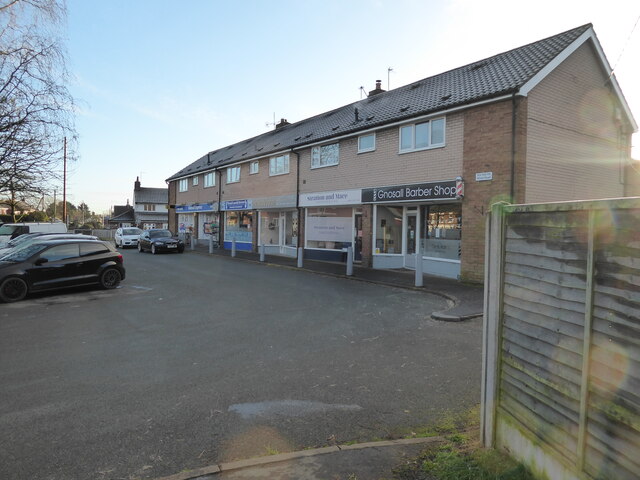
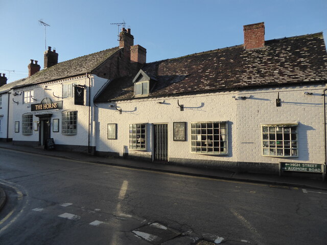
Despite its small size, Gnosall offers a range of amenities and services to its residents. There are several local shops, including a convenience store, post office, and a few small businesses. The village also boasts a primary school, providing education for local children.

For those seeking recreational activities, Gnosall has a vibrant community spirit with various clubs and organizations, including sports clubs, a drama group, and a history society. The village hosts annual events such as the G-Festival, a popular music and arts festival that attracts people from the surrounding areas.

Gnosall's location within Staffordshire provides easy access to the larger towns and cities in the area. With excellent transport links, residents can enjoy the benefits of both rural living and the amenities of nearby towns.

Overall, Gnosall offers a charming and peaceful environment, rich in history and community spirit, making it an attractive place to live or visit for those seeking a slower pace of life.

If you have any feedback on the listing, please let us know in the comments section below.
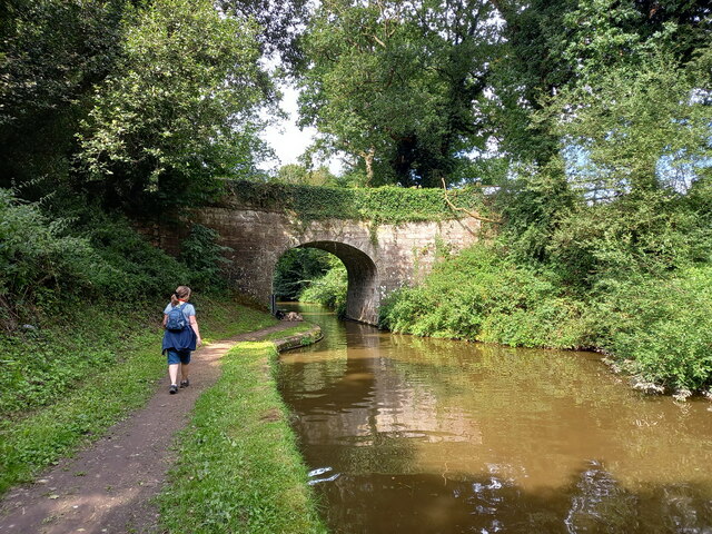
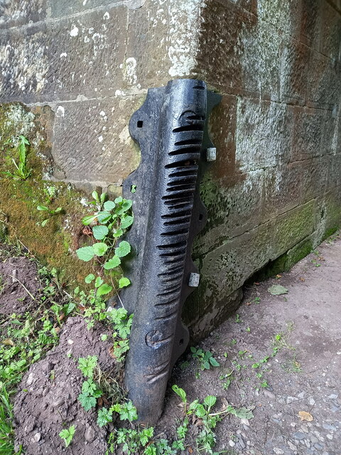
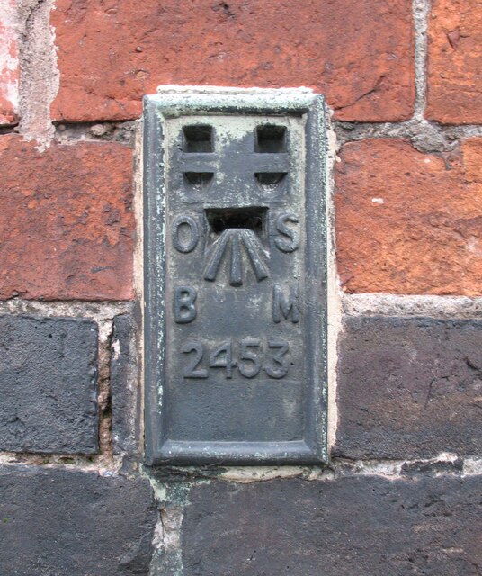
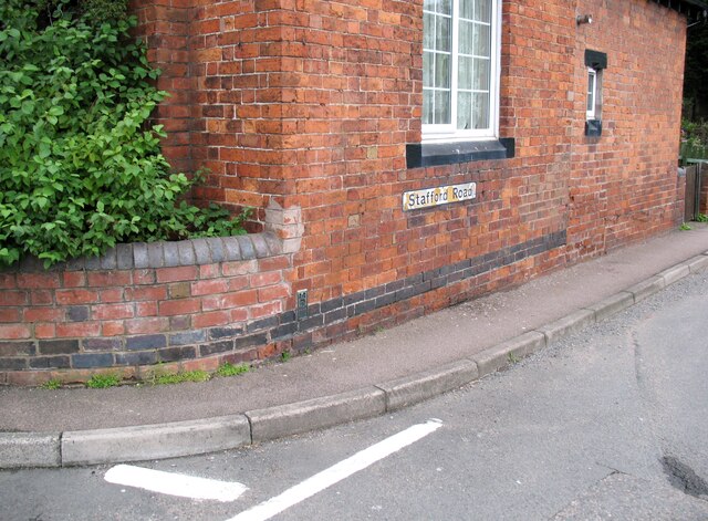
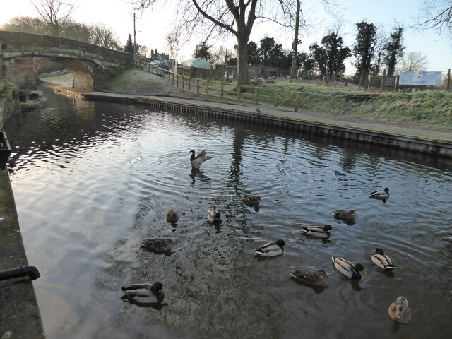
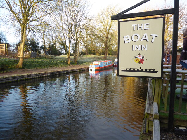
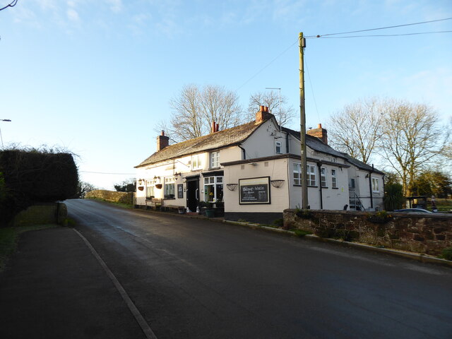
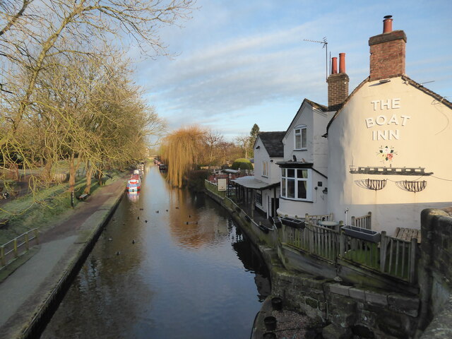
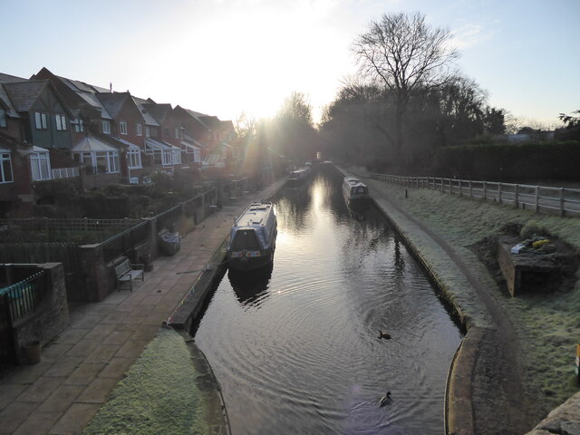
Gnosall Images

Images are sourced within 2km of 52.785541/-2.25482 or Grid Reference SJ8220. Thanks to Geograph Open Source API. All images are credited.

Plardiwick Bridge, Shropshire Union Canal Erected around 1830 as an agricultural accommodation bridge, and Grade II listed <span class="nowrap"><a title="https://britishlistedbuildings.co.uk/101273080-plardiwick-bridge-no-36-at-sj-815-206-gnosall#.YS5APo5KjIU" rel="nofollow ugc noopener" href="https://britishlistedbuildings.co.uk/101273080-plardiwick-bridge-no-36-at-sj-815-206-gnosall#.YS5APo5KjIU">Link</a><img style="margin-left:2px;" alt="External link" title="External link - shift click to open in new window" src="https://s1.geograph.org.uk/img/external.png" width="10" height="10"/></span> & <span class="nowrap"><a title="https://historicengland.org.uk/listing/the-list/list-entry/1273080" rel="nofollow ugc noopener" href="https://historicengland.org.uk/listing/the-list/list-entry/1273080">Link</a><img style="margin-left:2px;" alt="External link" title="External link - shift click to open in new window" src="https://s1.geograph.org.uk/img/external.png" width="10" height="10"/></span> in Oct 1991.
Plardiwick Bridge, Shropshire Union Canal
Erected around 1830 as an agricultural accommodation bridge, and Grade II listed LinkExternal link & LinkExternal link in Oct 1991.
Cast iron rope fender at Plardiwick Bridge One of the two well-worn rope fenders on the bridge at Plardiwick. It's included in the Grade II listing that the bridge holds.
Cast iron rope fender at Plardiwick Bridge
One of the two well-worn rope fenders on the bridge at Plardiwick. It's included in the Grade II listing that the bridge holds.
Benchmark, 1 High Street, Gnosall Detail of the Ordnance Survey flush bracket benchmark 2453 on the west angle of 1 High Street, Gnosall. The benchmark marks a height of 94.652m above mean sea level (Ordnance Datum Newlyn) last levelled in 1956 and verified in 1969 (location photograph <a href="https://www.geograph.org.uk/photo/6971154">SJ8220 : The corner of 1 High Street</a>).
Benchmark, 1 High Street, Gnosall
Detail of the Ordnance Survey flush bracket benchmark 2453 on the west angle of 1 High Street, Gnosall. The benchmark marks a height of 94.652m above mean sea level (Ordnance Datum Newlyn) last levelled in 1956 and verified in 1969 (location photograph SJ8220 : The corner of 1 High Street).
The corner of 1 High Street Formerly the police station, the south west face of 1 High Street faces onto the A518, Stafford Road.
There is an Ordnance Survey flush bracket benchmark low down near the corner of the wall (photograph <a href="https://www.geograph.org.uk/photo/6971120">SJ8220 : Benchmark, 1 High Street, Gnosall</a>).
The corner of 1 High Street
Formerly the police station, the south west face of 1 High Street faces onto the A518, Stafford Road. There is an Ordnance Survey flush bracket benchmark low down near the corner of the wall (photograph SJ8220 : Benchmark, 1 High Street, Gnosall).
Canalside scene in Gnosall Heath These quackers came over to say hello.
Canalside scene in Gnosall Heath
These quackers came over to say hello.
Canalside scene in Gnosall Heath Canals always succeed at being colourful.
Canalside scene in Gnosall Heath
Canals always succeed at being colourful.
The Boat Inn pub in Gnosall Heath Best pub I know.
The Boat Inn pub in Gnosall Heath
Best pub I know.
Part of the canal in Gnosall Heath Beautiful.
Part of the canal in Gnosall Heath
Beautiful.
Morning on the canal at Gnosall Heath Like me, the ducks here are stretching, moving about and getting ready to explore their environment.
Morning on the canal at Gnosall Heath
Like me, the ducks here are stretching, moving about and getting ready to explore their environment.
Small parade of shops on Wharf Road, Gnosall Heath A few local businesses and convenience shops.
Small parade of shops on Wharf Road, Gnosall Heath
A few local businesses and convenience shops.
Old building alongside a house on Wharf Road, Gnosall Heath A vehicle garage I assume, though possibly not for the house it is built alongside of any more. It looks a little dangerous now. Obviously long disused.
Old building alongside a house on Wharf Road, Gnosall Heath
A vehicle garage I assume, though possibly not for the house it is built alongside of any more. It looks a little dangerous now. Obviously long disused.
Old cottage on Wharf Road, Gnosall Heath Nice old place.
Old cottage on Wharf Road, Gnosall Heath
Nice old place.
Road linking Gnosall Heath with Gnosall Nice places.
Road linking Gnosall Heath with Gnosall
Nice places.
St Lawrence church in Gnosall Beautiful church on a hilltop.
St Lawrence church in Gnosall
Beautiful church on a hilltop.
The Horns pub in Gnosall Public house.
The Horns pub in Gnosall
Public house.
Footpath line across fields I can't wait to get along here.
Footpath line across fields
I can't wait to get along here.
Hedgerow with distant views View from the footpath line. 

That must be the Wrekin way down thereaways.
Hedgerow with distant views
View from the footpath line. That must be the Wrekin way down thereaways.
A January morning in the fields A skein of geese fly past, plaintively honking, the lovely sound cascading down to me. They had been heading on a course right overhead, but sadly of course they evaded me and passed me by.
A January morning in the fields
A skein of geese fly past, plaintively honking, the lovely sound cascading down to me. They had been heading on a course right overhead, but sadly of course they evaded me and passed me by.
Show me another place!

Gnosall is located at Grid Ref: SJ8220 (Lat: 52.785541, Lng: -2.25482)

Administrative County: Staffordshire

District: Stafford

Police Authority: Staffordshire

What 3 Words

///storming.agreed.unity. Near Gnosall, Staffordshire

Nearby Locations

Gnosall Gnosall Heath

Related Wikis

St Lawrence's Church, Gnosall

St Lawrence's Church is an Anglican church in Gnosall, Staffordshire, England. It is a Grade I listed building. The earliest parts of the church are of...

Gnosall

Gnosall () is a village and civil parish in the Borough of Stafford, Staffordshire, England, with a population of 4,736 across 2,048 households (2011 census...

Gnosall railway station

Gnosall railway station was a station in Gnosall, Staffordshire, England. The station was opened in June 1849 and closed on 7 September 1964. == References... ==

Coton, Staffordshire

Coton is a hamlet in the English county of Staffordshire.It lies on the A518 road some two miles west of Gnosall. == See also == Listed buildings in Gnosall...

Ranton Green

Ranton Green is a small village in Staffordshire about a mile southwest of Ranton, Staffordshire and a mile northeast of Gnosall. It consists of a few...

Haughton railway station

Haughton railway station was a station in Haughton, Staffordshire, England. The station was opened on 1 June 1849 and closed in May 1949. == References... ==

Abbey House, Ranton

Abbey House is an early 19th-century ruined stately home in Ranton, Staffordshire, England. == History == The red-brick Regency house was built in 1820...

Ranton Abbey

Ranton Abbey or Ranton Priory was an Augustinian Priory in Ranton, Staffordshire, England, built c.1150 by Robert fitz Noel of Ellenhall. The priory flourished...

Nearby Amenities

Located within 500m of 52.785541,-2.25482
Mini Roundabout
Direction: clockwise
Lat/Long: 52.7834986/-2.2553187
Mini Roundabout
Direction: clockwise
Lat/Long: 52.7855431/-2.2475464
Gnosall
Place: village
Source: npe
Wikidata: Q2082941
Wikipedia: en:Gnosall
Lat/Long: 52.7853852/-2.2542254
Pub
The Horns
Addr Housenumber: 23
Addr Postcode: ST20 0EX
Addr Street: High Street
Fhrs Id: 1195955
Source Addr: FHRS Open Data
Lat/Long: 52.7855112/-2.2548834
Pharmacy
Dispensing: yes
Healthcare: pharmacy
Lat/Long: 52.7898906/-2.2565759
Bus Stop
Post Office
Bus: yes
Naptan AtcoCode: 3800C703800
Naptan Bearing: S
Naptan CommonName: Post Office
Naptan Indicator: Adj
Naptan Landmark: Post Office
Naptan Street: High Street
Naptan Verified: no
Public Transport: platform
Source: naptan_import
Lat/Long: 52.7857451/-2.2548851
Bus Stop
Richmond Park
Bus: yes
Naptan AtcoCode: 3800C703900
Naptan Bearing: SE
Naptan CommonName: Richmond Park
Naptan Indicator: Adj
Naptan Landmark: Richmond Park
Naptan NaptanCode: stadadwg
Naptan Street: Manor Rd
Naptan Verified: no
Public Transport: platform
Source: naptan_import
Lat/Long: 52.7873717/-2.2509207
Bus Stop
Sharman Way
Bus: yes
Naptan AtcoCode: 3800C703901
Naptan Bearing: NW
Naptan CommonName: Sharman Way
Naptan Indicator: Opp
Naptan Landmark: Sharman Way
Naptan NaptanCode: stadadwj
Naptan Street: Manor Road
Naptan Verified: no
Public Transport: platform
Source: naptan_import
Lat/Long: 52.7871563/-2.2507712
Bus Stop
Greenfields Roundabout
Bus: yes
Naptan AtcoCode: 3800C707601
Naptan Bearing: NW
Naptan CommonName: Greenfields Roundabout
Naptan Indicator: Adj
Naptan Landmark: No 18
Naptan NaptanCode: stadadpw
Naptan Street: Greenfields
Naptan Verified: no
Public Transport: platform
Source: naptan_import
Lat/Long: 52.7881319/-2.2527638
Bus Stop
Greenfields Roundabout
Bus: yes
Naptan AtcoCode: 3800C707602
Naptan Bearing: SE
Naptan CommonName: Greenfields Roundabout
Naptan Indicator: Adj
Naptan Landmark: Roundabout
Naptan NaptanCode: stadadta
Naptan Street: Greenfields
Naptan Verified: no
Public Transport: platform
Source: naptan_import
Lat/Long: 52.7880609/-2.252363
Bus Stop
Audmore Road
Bus: yes
Naptan AtcoCode: 3800C730901
Naptan Bearing: SE
Naptan CommonName: Audmore Road
Naptan Indicator: Adj
Naptan Landmark: Audmore Road (N)
Naptan NaptanCode: stadadat
Naptan Street: Greenfields
Naptan Verified: no
Public Transport: platform
Source: naptan_import
Lat/Long: 52.7887055/-2.2535827
Bus Stop
Audmore Road
Bus: yes
Naptan AtcoCode: 3800C730902
Naptan Bearing: NW
Naptan CommonName: Audmore Road
Naptan Indicator: Adj
Naptan Landmark: Audmore Road (S)
Naptan NaptanCode: stadadaw
Naptan Street: Greenfields
Naptan Verified: no
Public Transport: platform
Source: naptan_import
Lat/Long: 52.7887765/-2.2540131
Bus Stop
Elton Way
Bus: yes
Naptan AtcoCode: 3800C731301
Naptan Bearing: NE
Naptan CommonName: Elton Way
Naptan Indicator: Opp
Naptan Landmark: Elton Way
Naptan NaptanCode: stadadga
Naptan Street: Brookhouse Road
Naptan Verified: no
Public Transport: platform
Source: naptan_import
Lat/Long: 52.7897608/-2.2561394
Bus Stop
Elton Way
Bus: yes
Naptan AtcoCode: 3800C731302
Naptan Bearing: SW
Naptan CommonName: Elton Way
Naptan Indicator: Adj
Naptan Landmark: Elton Way
Naptan NaptanCode: stadadgd
Naptan Street: Brookhouse Road
Naptan Verified: no
Public Transport: platform
Source: naptan_import
Lat/Long: 52.78931/-2.2567744
Bus Stop
Knightley Way
Bus: yes
Naptan AtcoCode: 3800C731401
Naptan Bearing: N
Naptan CommonName: Knightley Way
Naptan Indicator: Adj
Naptan Landmark: Knightley Way
Naptan NaptanCode: stadadgj
Naptan Street: Brookhouse Road
Naptan Verified: no
Public Transport: platform
Source: naptan_import
Lat/Long: 52.786817/-2.2580794
Bus Stop
Knightley Way
Bus: yes
Naptan AtcoCode: 3800C731402
Naptan Bearing: S
Naptan CommonName: Knightley Way
Naptan Indicator: Opp
Naptan Landmark: Knightley Way
Naptan NaptanCode: stadadgm
Naptan Street: Brookhouse Road
Naptan Verified: no
Public Transport: platform
Source: naptan_import
Lat/Long: 52.7866908/-2.2579267
Bus Stop
Station Rd
Bus: yes
Naptan AtcoCode: 3800C731701
Naptan Bearing: NW
Naptan CommonName: Station Rd
Naptan Indicator: Adj
Naptan Landmark: Station Rd
Naptan NaptanCode: stadagaw
Naptan Street: Brookhouse Rd
Naptan Verified: no
Public Transport: platform
Source: naptan_import
Lat/Long: 52.7837106/-2.2561928
Bus Stop
High Street
Bus: yes
Naptan AtcoCode: 3800C731702
Naptan Bearing: SE
Naptan CommonName: High Street
Naptan Indicator: Adj
Naptan Landmark: High St
Naptan NaptanCode: stadagda
Naptan Street: Brookhouse Rd
Naptan Verified: no
Public Transport: platform
Source: naptan_import
Lat/Long: 52.7837652/-2.2558966
Bus Stop
Middle Field
Bus: yes
Naptan AtcoCode: 3800C732401
Naptan Bearing: E
Naptan CommonName: Middle Field
Naptan Indicator: opp
Naptan Landmark: Middle Field
Naptan NaptanCode: stadadgp
Naptan Street: Manor Road
Naptan Verified: no
Public Transport: platform
Source: naptan_import
Lat/Long: 52.786316/-2.2484977
Bus Stop
Middle Field
Bus: yes
Naptan AtcoCode: 3800C732402
Naptan Bearing: W
Naptan CommonName: Middle Field
Naptan Indicator: adj
Naptan Landmark: Middle Field
Naptan NaptanCode: stadadgt
Naptan Street: Manor Road
Naptan Verified: no
Public Transport: platform
Source: naptan_import
Lat/Long: 52.7862993/-2.2478749
Bus Stop
Sellman Street
Bus: yes
Naptan AtcoCode: 3800C746901
Naptan Bearing: NE
Naptan BusStopType: CUS
Naptan CommonName: Sellman Street
Naptan Indicator: Adj
Naptan Landmark: Sellman Street
Naptan Street: Stafford Road
Naptan Verified: no
Public Transport: platform
Source: naptan_import
Lat/Long: 52.7840167/-2.2517762
Bus Stop
Ashmore Drive
Bus: yes
Naptan AtcoCode: 3800C751401
Naptan Bearing: SE
Naptan CommonName: Ashmore Drive
Naptan Indicator: adj
Naptan Landmark: Ashmore Drive
Naptan NaptanCode: stadadjw
Naptan Street: Knightley Road
Naptan Verified: no
Public Transport: platform
Source: naptan_import
Lat/Long: 52.7890356/-2.2547561
Bus Stop
St Lawrence School
Bus: yes
Naptan AtcoCode: 3800C792200
Naptan Bearing: W
Naptan BusStopType: CUS
Naptan CommonName: St Lawrence School
Naptan Indicator: Adj
Naptan Landmark: St Lawrence School
Naptan Street: Stafford Rd
Naptan Verified: no
Public Transport: platform
Source: naptan_import
Lat/Long: 52.7832954/-2.2527951
Post Box
Post Box Type: pillar
Ref: ST20 2001
Lat/Long: 52.7871052/-2.2507882
Barrier: cycle_barrier
Lat/Long: 52.7860054/-2.2520507
Richmond Park
Power: substation
Ref: 861826
Voltage: 11000
Lat/Long: 52.7867415/-2.249621
Post Box
Post Box Type: pillar
Ref: ST20 319
Lat/Long: 52.7856932/-2.254843
Stamp Machine
Lat/Long: 52.7857536/-2.2548333
Barrier: cycle_barrier
Lat/Long: 52.7888767/-2.2533687
Dentist
Gnosall Dental Practice
Healthcare: dentist
Lat/Long: 52.7847951/-2.2547702
Public Bookcase
BKV Book Swap Shop
Booth: K6
Colour: red
Disused Amenity: telephone
Man Made: telephone_box
Public Bookcase Type: phone_box
Lat/Long: 52.7858566/-2.2551126
Post Box
Operator: Royal Mail
Operator Wikidata: Q638098
Post Box Type: pillar
Ref: ST20 87
Lat/Long: 52.7837317/-2.2552062
Doley Close
Power: substation
Ref: 960734 ?
Voltage: 11000
Lat/Long: 52.786652/-2.2567819
Source: survey
Lat/Long: 52.7868428/-2.256887
Barrier: bollard
Lat/Long: 52.7883639/-2.2579577
Shop: optician
Lat/Long: 52.7830898/-2.2560134
Crossing
Crossing: traffic_signals
Lat/Long: 52.7820046/-2.2568815
Gnosall
Abandoned Railway: station
Railway: site
Lat/Long: 52.7815631/-2.2564784
Power: pole
Lat/Long: 52.7825747/-2.2580786
Power: pole
Lat/Long: 52.7821174/-2.2577655
Power: pole
Lat/Long: 52.7841583/-2.2615825
Power: pole
Lat/Long: 52.782961/-2.258919
Power: pole
Lat/Long: 52.7834669/-2.2600447
Power: pole
Lat/Long: 52.7830533/-2.2602915
Power: pole
Lat/Long: 52.7834053/-2.2610934
Power: pole
Lat/Long: 52.7821896/-2.2581049
Power: pole
Lat/Long: 52.7826/-2.2592762
Generator Method: photovoltaic
Generator Output Electricity: yes
Generator Source: solar
Generator Type: solar_photovoltaic_panel
Location: roof
Power: generator
Lat/Long: 52.7874788/-2.2561026
Generator Method: photovoltaic
Generator Output Electricity: yes
Generator Source: solar
Generator Type: solar_photovoltaic_panel
Location: roof
Power: generator
Lat/Long: 52.7883207/-2.2582591
Generator Method: photovoltaic
Generator Output Electricity: yes
Generator Source: solar
Generator Type: solar_photovoltaic_panel
Location: roof
Power: generator
Lat/Long: 52.787615/-2.2581545
Generator Method: photovoltaic
Generator Output Electricity: yes
Generator Source: solar
Generator Type: solar_photovoltaic_panel
Location: roof
Power: generator
Lat/Long: 52.7873133/-2.2581276
Generator Method: photovoltaic
Generator Orientation: 210
Generator Output Electricity: yes
Generator Place: roof
Generator Solar Modules: 16
Generator Source: solar
Generator Type: solar_photovoltaic_panel
Location: roof
Power: generator
Lat/Long: 52.7880368/-2.2495151
Generator Method: photovoltaic
Generator Output Electricity: yes
Generator Source: solar
Generator Type: solar_photovoltaic_panel
Location: roof
Power: generator
Lat/Long: 52.7875356/-2.2508481
Generator Method: photovoltaic
Generator Orientation: 210
Generator Output Electricity: yes
Generator Place: roof
Generator Solar Modules: 16
Generator Source: solar
Generator Type: solar_photovoltaic_panel
Location: roof
Power: generator
Lat/Long: 52.7870943/-2.249153
Generator Method: photovoltaic
Generator Orientation: 130
Generator Output Electricity: yes
Generator Place: roof
Generator Solar Modules: 16
Generator Source: solar
Generator Type: solar_photovoltaic_panel
Location: roof
Power: generator
Lat/Long: 52.7872971/-2.2487345
Generator Method: photovoltaic
Generator Orientation: 210
Generator Output Electricity: yes
Generator Place: roof
Generator Source: solar
Generator Type: solar_photovoltaic_panel
Location: roof
Power: generator
Lat/Long: 52.7864666/-2.2476992
Generator Method: photovoltaic
Generator Orientation: 210
Generator Output Electricity: yes
Generator Place: roof
Generator Solar Modules: 14
Generator Source: solar
Generator Type: solar_photovoltaic_panel
Location: roof
Power: generator
Lat/Long: 52.7865396/-2.2477958
Generator Method: photovoltaic
Generator Orientation: 210
Generator Output Electricity: yes
Generator Place: roof
Generator Solar Modules: 4
Generator Source: solar
Generator Type: solar_photovoltaic_panel
Location: roof
Power: generator
Lat/Long: 52.7832529/-2.2505236
Generator Method: photovoltaic
Generator Orientation: 155
Generator Output Electricity: yes
Generator Place: roof
Generator Solar Modules: 4
Generator Source: solar
Generator Type: solar_photovoltaic_panel
Location: roof
Power: generator
Lat/Long: 52.7834217/-2.2514141
Generator Method: photovoltaic
Generator Orientation: 155
Generator Output Electricity: yes
Generator Place: roof
Generator Solar Modules: 4
Generator Source: solar
Generator Type: solar_photovoltaic_panel
Location: roof
Power: generator
Lat/Long: 52.7834395/-2.2513416
Generator Method: photovoltaic
Generator Orientation: 120
Generator Output Electricity: yes
Generator Place: roof
Generator Solar Modules: 4
Generator Source: solar
Generator Type: solar_photovoltaic_panel
Location: roof
Power: generator
Lat/Long: 52.7834817/-2.2511485
Generator Method: photovoltaic
Generator Orientation: 120
Generator Output Electricity: yes
Generator Place: roof
Generator Solar Modules: 4
Generator Source: solar
Generator Type: solar_photovoltaic_panel
Location: roof
Power: generator
Lat/Long: 52.7835222/-2.2510546
Generator Method: photovoltaic
Generator Orientation: 120
Generator Output Electricity: yes
Generator Place: roof
Generator Solar Modules: 4
Generator Source: solar
Generator Type: solar_photovoltaic_panel
Location: roof
Power: generator
Lat/Long: 52.7835644/-2.2510332
Generator Method: photovoltaic
Generator Orientation: 122
Generator Output Electricity: yes
Generator Place: roof
Generator Solar Modules: 4
Generator Source: solar
Generator Type: solar_photovoltaic_panel
Location: roof
Power: generator
Lat/Long: 52.7834979/-2.2503305
Generator Method: photovoltaic
Generator Orientation: 122
Generator Output Electricity: yes
Generator Place: roof
Generator Solar Modules: 4
Generator Source: solar
Generator Type: solar_photovoltaic_panel
Location: roof
Power: generator
Lat/Long: 52.7835385/-2.2502795
Generator Method: photovoltaic
Generator Orientation: 122
Generator Output Electricity: yes
Generator Place: roof
Generator Solar Modules: 4
Generator Source: solar
Generator Type: solar_photovoltaic_panel
Location: roof
Power: generator
Lat/Long: 52.7835693/-2.2502285
Generator Method: photovoltaic
Generator Orientation: 215
Generator Output Electricity: yes
Generator Place: roof
Generator Solar Modules: 4
Generator Source: solar
Generator Type: solar_photovoltaic_panel
Location: roof
Power: generator
Lat/Long: 52.7837899/-2.2510117
Generator Method: photovoltaic
Generator Orientation: 95
Generator Output Electricity: yes
Generator Place: roof
Generator Solar Modules: 4
Generator Source: solar
Generator Type: solar_photovoltaic_panel
Location: roof
Power: generator
Lat/Long: 52.7836585/-2.251575
Generator Method: photovoltaic
Generator Orientation: 120
Generator Output Electricity: yes
Generator Place: roof
Generator Solar Modules: 4
Generator Source: solar
Generator Type: solar_photovoltaic_panel
Location: roof
Power: generator
Lat/Long: 52.7837137/-2.2515267
Generator Method: photovoltaic
Generator Orientation: 120
Generator Output Electricity: yes
Generator Place: roof
Generator Solar Modules: 4
Generator Source: solar
Generator Type: solar_photovoltaic_panel
Location: roof
Power: generator
Lat/Long: 52.7837607/-2.251465
Generator Method: photovoltaic
Generator Orientation: 120
Generator Output Electricity: yes
Generator Place: roof
Generator Solar Modules: 4
Generator Source: solar
Generator Type: solar_photovoltaic_panel
Location: roof
Power: generator
Lat/Long: 52.7838305/-2.2513604
Generator Method: photovoltaic
Generator Orientation: 120
Generator Output Electricity: yes
Generator Place: roof
Generator Solar Modules: 4
Generator Source: solar
Generator Type: solar_photovoltaic_panel
Location: roof
Power: generator
Lat/Long: 52.783871/-2.2513202
Generator Method: photovoltaic
Generator Orientation: 120
Generator Output Electricity: yes
Generator Place: roof
Generator Solar Modules: 4
Generator Source: solar
Generator Type: solar_photovoltaic_panel
Location: roof
Power: generator
Lat/Long: 52.7839521/-2.2512424
Generator Method: photovoltaic
Generator Orientation: 120
Generator Output Electricity: yes
Generator Place: roof
Generator Solar Modules: 4
Generator Source: solar
Generator Type: solar_photovoltaic_panel
Location: roof
Power: generator
Lat/Long: 52.7839862/-2.2511941
Generator Method: photovoltaic
Generator Orientation: 215
Generator Output Electricity: yes
Generator Place: roof
Generator Solar Modules: 4
Generator Source: solar
Generator Type: solar_photovoltaic_panel
Location: roof
Power: generator
Lat/Long: 52.7837673/-2.2509372
Generator Method: photovoltaic
Generator Orientation: 215
Generator Output Electricity: yes
Generator Place: roof
Generator Solar Modules: 4
Generator Source: solar
Generator Type: solar_photovoltaic_panel
Location: roof
Power: generator
Lat/Long: 52.7837215/-2.2508154
Generator Method: photovoltaic
Generator Orientation: 215
Generator Output Electricity: yes
Generator Place: roof
Generator Solar Modules: 4
Generator Source: solar
Generator Type: solar_photovoltaic_panel
Location: roof
Power: generator
Lat/Long: 52.7836834/-2.2507334
Generator Method: photovoltaic
Generator Orientation: 215
Generator Output Electricity: yes
Generator Place: roof
Generator Solar Modules: 4
Generator Source: solar
Generator Type: solar_photovoltaic_panel
Location: roof
Power: generator
Lat/Long: 52.7836415/-2.2506221
Generator Method: photovoltaic
Generator Orientation: 210
Generator Output Electricity: yes
Generator Place: roof
Generator Solar Modules: 4
Generator Source: solar
Generator Type: solar_photovoltaic_panel
Location: roof
Power: generator
Lat/Long: 52.7832259/-2.2504456
Generator Method: photovoltaic
Generator Orientation: 195
Generator Output Electricity: yes
Generator Place: roof
Generator Solar Modules: 4
Generator Source: solar
Generator Type: solar_photovoltaic_panel
Location: roof
Power: generator
Lat/Long: 52.7833098/-2.2506809
Generator Method: photovoltaic
Generator Orientation: 195
Generator Output Electricity: yes
Generator Place: roof
Generator Solar Modules: 4
Generator Source: solar
Generator Type: solar_photovoltaic_panel
Location: roof
Power: generator
Lat/Long: 52.7832996/-2.2506053
Generator Method: photovoltaic
Generator Orientation: 230
Generator Output Electricity: yes
Generator Place: roof
Generator Solar Modules: 4
Generator Source: solar
Generator Type: solar_photovoltaic_panel
Location: roof
Power: generator
Lat/Long: 52.7829235/-2.2508805
Generator Method: photovoltaic
Generator Orientation: 210
Generator Output Electricity: yes
Generator Place: roof
Generator Solar Modules: 4
Generator Source: solar
Generator Type: solar_photovoltaic_panel
Location: roof
Power: generator
Lat/Long: 52.7830531/-2.2509898
Generator Method: photovoltaic
Generator Orientation: 210
Generator Output Electricity: yes
Generator Place: roof
Generator Solar Modules: 4
Generator Source: solar
Generator Type: solar_photovoltaic_panel
Location: roof
Power: generator
Lat/Long: 52.7830963/-2.2510276
Generator Method: photovoltaic
Generator Orientation: 210
Generator Output Electricity: yes
Generator Place: roof
Generator Solar Modules: 4
Generator Source: solar
Generator Type: solar_photovoltaic_panel
Location: roof
Power: generator
Lat/Long: 52.7831421/-2.2510612
Generator Method: photovoltaic
Generator Orientation: 210
Generator Output Electricity: yes
Generator Place: roof
Generator Solar Modules: 4
Generator Source: solar
Generator Type: solar_photovoltaic_panel
Location: roof
Power: generator
Lat/Long: 52.7832412/-2.2511095
Crossing
Button Operated: yes
Crossing: traffic_signals
Crossing Island: no
Crossing Markings: dots
Tactile Paving: yes
Lat/Long: 52.7835642/-2.2523743
Crossing
Crossing: unmarked
Crossing Island: yes
Crossing Markings: no
Tactile Paving: yes
Lat/Long: 52.7836716/-2.2519783
Give Way
Direction: backward
Lat/Long: 52.7837145/-2.2520387
Bank Top Garage
Addr City: Gnosall
Addr Postcode: ST20 0EU
Addr Street: Stafford Road
Opening Hours: Mo-Fr 08:00-18:00; Sa 08:00-12:00
Second Hand: only
Service Vehicle Mot: yes
Service Vehicle Sales: yes
Shop: car
Website: https://www.m-banktopgarage.co.uk/
Lat/Long: 52.7830023/-2.2532901
Barrier: cycle_barrier
Cycle Barrier: double
Lat/Long: 52.784037/-2.2567501
Leisure: fitness_station
Sport: fitness
Lat/Long: 52.7837612/-2.2567268
The data included in this document is from www.openstreetmap.org. The data is made available under ODbL.

Have you been to Gnosall?

Leave your review of Gnosall below (or comments, questions and feedback).