An Gorm-loch

Lake, Pool, Pond, Freshwater Marsh in Ross-shire

Scotland

An Gorm-loch

Sgùrr Fhuar-thuill and Creag Ghorm a' Bhealaich Strathfarrar and Glen Orrin high tops seen across Glen Orrin.
Sgùrr Fhuar-thuill and Creag Ghorm a' Bhealaich Credit: Richard Webb

An Gorm-loch, located in Ross-shire, Scotland, is a picturesque freshwater loch nestled within the stunning Scottish Highlands. Spanning an area of approximately 20 acres, it is a popular destination for nature enthusiasts, anglers, and those seeking tranquility amidst the breathtaking scenery.

The loch is renowned for its crystal-clear blue waters, which give it its name "An Gorm-loch," meaning "the blue loch" in Gaelic. Surrounded by lush greenery, including native trees and shrubs, it creates a serene and idyllic atmosphere that attracts a wide variety of bird species.

An Gorm-loch is home to a diverse range of freshwater wildlife. The loch supports several species of fish, including brown trout and pike, making it a prime spot for anglers. The surrounding marshland provides a habitat for numerous bird species, such as ducks, swans, and herons, offering ample opportunities for birdwatching.

The loch is easily accessible, with a small car park and a path leading to its shores. Visitors can enjoy leisurely walks around its perimeter, taking in the stunning vistas and enjoying the peaceful ambiance. Its tranquil waters also provide a perfect setting for boating and kayaking.

An Gorm-loch is a hidden gem in the Scottish Highlands, offering a serene escape from the hustle and bustle of city life. Whether it's fishing, birdwatching, or simply immersing oneself in nature, this enchanting loch has something to offer for everyone seeking solace in the beauty of the Scottish countryside.

If you have any feedback on the listing, please let us know in the comments section below.
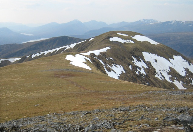
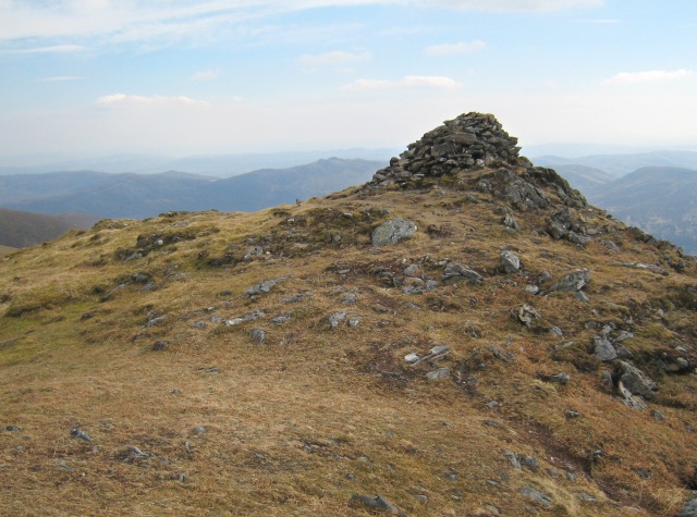
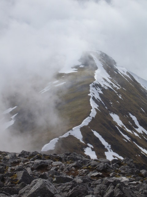
An Gorm-loch Images

Images are sourced within 2km of 57.459301/-4.9615576 or Grid Reference NH2244. Thanks to Geograph Open Source API. All images are credited.

Sgùrr Fhuar-thuill and Creag Ghorm a' Bhealaich Strathfarrar and Glen Orrin high tops seen across Glen Orrin.
Sgùrr Fhuar-thuill and Creag Ghorm a' Bhealaich
Strathfarrar and Glen Orrin high tops seen across Glen Orrin.
Loch na Caoidhe, looking east The ruin in the foreground is Coye, not shown on the 1:50,000 OS Map but marked on the 1:25,000 map. Coye is probably an anglicised version of Caoidhe, the name of the loch behind it and the highest loch in Glen Orrin.
Loch na Caoidhe, looking east
The ruin in the foreground is Coye, not shown on the 1:50,000 OS Map but marked on the 1:25,000 map. Coye is probably an anglicised version of Caoidhe, the name of the loch behind it and the highest loch in Glen Orrin.
Loch na Caoidhe A view of Loch na Caoidhe from the footpath in the upper reaches of Glen Orrin.
Loch na Caoidhe
A view of Loch na Caoidhe from the footpath in the upper reaches of Glen Orrin.
Loch na Caoidhe Very full streams flowing down the slope into Loch na Caoidhe.
Loch na Caoidhe
Very full streams flowing down the slope into Loch na Caoidhe.
West from Sgurr Fhuar-thuill, Strathfarrar The ridge to Sgurr na Fearstaig seen from the summit cairn (1049m).
West from Sgurr Fhuar-thuill, Strathfarrar
The ridge to Sgurr na Fearstaig seen from the summit cairn (1049m).
Summit region of Carn an Alltain Riabhaich This photo shows hills on each side of upper Glen Orrin, though of course the glen itself cannot be seen. Ahead to the right is Carn nam Fiacail, 520m at NH247460. Straight ahead and a bit further away is the long ridge of the Graham Beinn Mheadhoin, 663m at NH258477. On the right in the distance are the lower northern slopes of the Strathfarrar Munros. I think the distant hills on the left are the southern outliers of Ben Wyvis.
Summit region of Carn an Alltain Riabhaich
This photo shows hills on each side of upper Glen Orrin, though of course the glen itself cannot be seen. Ahead to the right is Carn nam Fiacail, 520m at NH247460. Straight ahead and a bit further away is the long ridge of the Graham Beinn Mheadhoin, 663m at NH258477. On the right in the distance are the lower northern slopes of the Strathfarrar Munros. I think the distant hills on the left are the southern outliers of Ben Wyvis.
The Final Push From the summit of Sgurr Fhuar-thuill looking towards the hills of Glen Carron and the struggle of these 5 chaps as they make their final push to the summit. I have just done my fourth Munro of the day while they have just about done their first.
The Final Push
From the summit of Sgurr Fhuar-thuill looking towards the hills of Glen Carron and the struggle of these 5 chaps as they make their final push to the summit. I have just done my fourth Munro of the day while they have just about done their first.
South-western end of Loch na Caoidhe Loch na Caoidhe in upper Glen Orrin.
South-western end of Loch na Caoidhe
Loch na Caoidhe in upper Glen Orrin.
Path across the upper southeast slopes of Sgurr na Fearstaig In places it was still covered in avalanche debris from the winter, and this snow had also brought down large huge rocks.
Path across the upper southeast slopes of Sgurr na Fearstaig
In places it was still covered in avalanche debris from the winter, and this snow had also brought down large huge rocks.
Ridge Walk Heading west from Sgurr Fhuar-thuill to the top Sgurr na Fearstaig, in the distance can be seen Loch Monar and the hills of Achnashelach
Ridge Walk
Heading west from Sgurr Fhuar-thuill to the top Sgurr na Fearstaig, in the distance can be seen Loch Monar and the hills of Achnashelach
Sgurr Fhuar-thuill - Summit Cairn
Sgurr na Fearstaig Looking east from Sgurr na Fearstaig to Sgurr Fhuar-thuill, the distant hill is that of Sgurr a' Choire Ghlais.
Sgurr na Fearstaig
Looking east from Sgurr na Fearstaig to Sgurr Fhuar-thuill, the distant hill is that of Sgurr a' Choire Ghlais.
Aerial Housing? It would appear that this substantial fibreglass shelter, that presumably must have been lifted here by helicopter was to house a television aerial, the coax cable can be seen heading in the direction of Monar Lodge some 3 miles away. They must have been so disappointed after all that effort and expense to see the junk that the rest of us get on TV!
Aerial Housing?
It would appear that this substantial fibreglass shelter, that presumably must have been lifted here by helicopter was to house a television aerial, the coax cable can be seen heading in the direction of Monar Lodge some 3 miles away. They must have been so disappointed after all that effort and expense to see the junk that the rest of us get on TV!
Creag a' Ghormlaich Small lochans form in the bealach between Carn Eiteige and Sgurr na Fearstaig
Creag a' Ghormlaich
Small lochans form in the bealach between Carn Eiteige and Sgurr na Fearstaig
Carn Eiteige Approaching Carn Eiteige northern ridge.
Carn Eiteige
Approaching Carn Eiteige northern ridge.
Warning to pilots Some clouds have rocks in them.

Sgurr na Fearstaig's snow covered summit just visible in the clouds.
Warning to pilots
Some clouds have rocks in them. Sgurr na Fearstaig's snow covered summit just visible in the clouds.
Summit cairn, Sgurr na Fearstaig The soft focus effect comes from the mist and the rain
Summit cairn, Sgurr na Fearstaig
The soft focus effect comes from the mist and the rain
Solitary camp in Glen Orrin View towards Loch na Caoidhe
Solitary camp in Glen Orrin
View towards Loch na Caoidhe
Show me another place!

An Gorm-loch is located at Grid Ref: NH2244 (Lat: 57.459301, Lng: -4.9615576)

Unitary Authority: Highland

Police Authority: Highlands and Islands

What 3 Words

///slip.stammer.calibrate. Near Achnasheen, Highland

Nearby Locations

An Gorm-loch

Related Wikis

Sgùrr a' Choire Ghlais

Sgurr a' Choire Ghlais is a mountain in the North-west Highlands of Scotland. It lies between Glen Strathfarrar and Glen Orrin and it is an excellent viewpoint...

Bac an Eich

Bac an Eich (849 m) is a mountain in Ross and Cromarty in the Northwest Highlands of Scotland. A very remote mountain, it lies at the head of Strathconan...

Càrn nan Gobhar (Strathfarrar)

Càrn nan Gobhar is a mountain rising to 992 metres (3,255 ft) in the Northwest Highlands of Scotland. It lies north of Glen Strathfarrar and south of Glen...

Northwest Highlands

The Northwest Highlands are located in the northern third of Scotland that is separated from the Grampian Mountains by the Great Glen (Glen More). The...

Nearby Amenities

Located within 500m of 57.459301,-4.9615576
The data included in this document is from www.openstreetmap.org. The data is made available under ODbL.

Have you been to An Gorm-loch?

Leave your review of An Gorm-loch below (or comments, questions and feedback).