Lochan Mhic Leòid

Lake, Pool, Pond, Freshwater Marsh in Sutherland

Scotland

Lochan Mhic Leòid

The old A837 fading away
The old A837 fading away Credit: Peter Moore

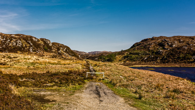
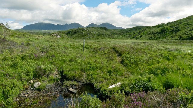
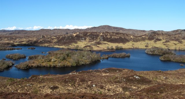
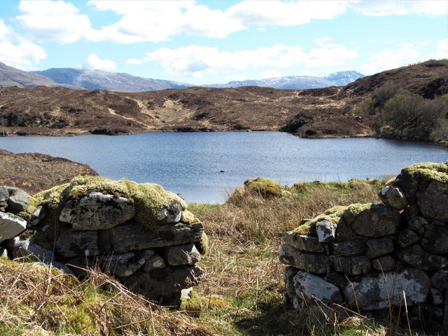
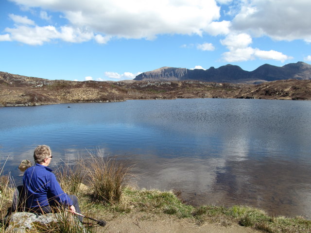
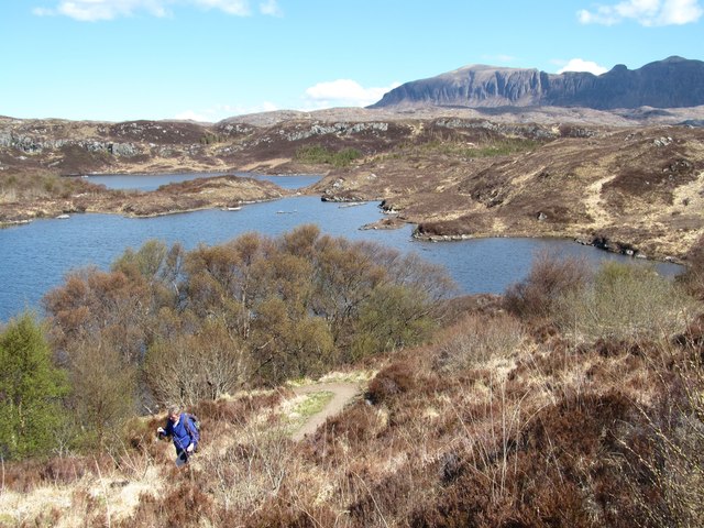
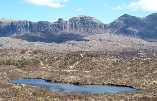
Lochan Mhic Leòid is a picturesque freshwater loch situated in the county of Sutherland, in the Scottish Highlands. It is located near the village of Lairg and lies within the expansive landscape of the Flow Country, a vast area of wetlands and blanket peat bog.

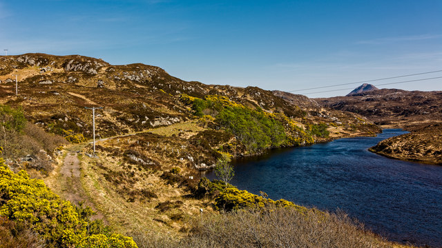
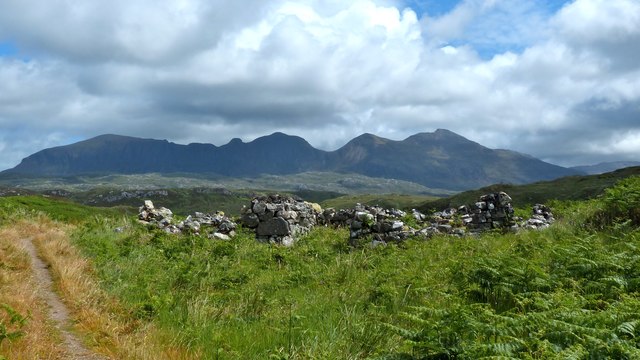
Covering an area of approximately 1.5 hectares, this small lochan is surrounded by lush green hills and heather moorland, providing a stunning backdrop for visitors. Lochan Mhic Leòid is fed by a number of small streams, ensuring a constant flow of fresh water into the loch.

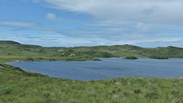
The lochan itself is relatively shallow, with an average depth of around 2 meters. Its water is crystal clear, exhibiting a rich blue hue that reflects the surrounding landscape. The loch is home to a variety of freshwater fish species, including brown trout and Arctic char, making it a popular spot for anglers.

The area around Lochan Mhic Leòid is also known for its diverse birdlife. The loch provides a habitat for several species of waterfowl, such as mallards and tufted ducks, as well as wading birds like redshanks and curlews. Birdwatchers can often be seen observing and photographing these beautiful creatures in their natural surroundings.

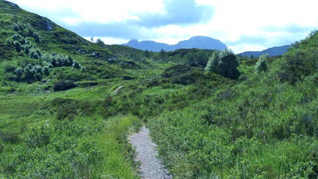
The loch is easily accessible, with a small parking area nearby and a path leading to its shores. Visitors can enjoy a peaceful walk around the loch, taking in the tranquil atmosphere and breathtaking views. Lochan Mhic Leòid offers a serene and idyllic setting, perfect for those seeking a peaceful escape amidst the natural beauty of the Scottish Highlands.

If you have any feedback on the listing, please let us know in the comments section below.

Lochan Mhic Leòid Images

Images are sourced within 2km of 58.177742/-5.1486706 or Grid Reference NC1425. Thanks to Geograph Open Source API. All images are credited.
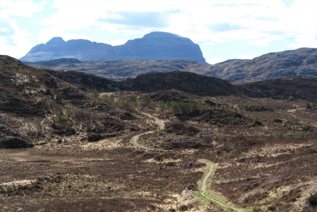
The old A837 fading away
The old A837 which kept closer to the River Inver
Culag Community Woodland Trust shelter, Loch an t-Sabhail Appropriate for the "loch of the barn", the Trust have built this wooden framed shelter beside the loch. Quinag is the background hill.
Culag Community Woodland Trust shelter, Loch an t-Sabhail
Appropriate for the "loch of the barn", the Trust have built this wooden framed shelter beside the loch. Quinag is the background hill.
Loch Uidh na Geadaig, Assynt A fine June day among the Assynt lochs.
Loch Uidh na Geadaig, Assynt
A fine June day among the Assynt lochs.
Assynt path network On the other side of the burn, the post marks the junction of a deer track with one of the well-made Assynt paths. Quinag is the distant hill.
Assynt path network
On the other side of the burn, the post marks the junction of a deer track with one of the well-made Assynt paths. Quinag is the distant hill.
Assynt path The view along the continuation of the path mentioned in  <a href="https://www.geograph.org.uk/photo/5022072">NC1426 : Assynt path network</a>  With deer fenced out, natural regeneration of mixed woodland is taking place. The distinctive shape of Suilven dominates the horizon.
Assynt path
The view along the continuation of the path mentioned in NC1426 : Assynt path network With deer fenced out, natural regeneration of mixed woodland is taking place. The distinctive shape of Suilven dominates the horizon.
Assynt sheilings One of the easier photos to place with absolute certainty! The path, part of the Assynt path network, makes the walk up to the ruins easy.  Bealach a' Chornaidh on Quinag  is the obvious dip in the skyline behind the sheiling walls.
Assynt sheilings
One of the easier photos to place with absolute certainty! The path, part of the Assynt path network, makes the walk up to the ruins easy. Bealach a' Chornaidh on Quinag is the obvious dip in the skyline behind the sheiling walls.
Cnoc and loch country east of Lochinver The tangled landscape of the country to the east of Lochinver where Lewisian Gneiss is the underlying rock.
Cnoc and loch country east of Lochinver
The tangled landscape of the country to the east of Lochinver where Lewisian Gneiss is the underlying rock.
Shallow valley in rough country This might be rough country with rock, bog and lochs, but the Little Assynt estate has created a network of good paths that make access easy. The long western flanks of Quinag in the distance.
Shallow valley in rough country
This might be rough country with rock, bog and lochs, but the Little Assynt estate has created a network of good paths that make access easy. The long western flanks of Quinag in the distance.
Ruins on the moor A series of ruins on a dry patch of moor. The OS map shows 'sheilings' in this area, although the shape of some of the ruins would suggest blackhouses.
Ruins on the moor
A series of ruins on a dry patch of moor. The OS map shows 'sheilings' in this area, although the shape of some of the ruins would suggest blackhouses.
Little Assynt estate path An excellent path that winds its way over low craggy hills and around lochans and bogs through the Little Assynt estate. The view here is along the path with Suilven on the skyline.
Little Assynt estate path
An excellent path that winds its way over low craggy hills and around lochans and bogs through the Little Assynt estate. The view here is along the path with Suilven on the skyline.
Loch Beannach The view over an oddly shaped loch from a hilltop on 'Ken's Path', which is on the Little Assynt estate.  Much of this area now has deer fencing in an effort to rejuvenate woodland, which is seen here on the small islands where only the most determined red deer would venture.
Loch Beannach
The view over an oddly shaped loch from a hilltop on 'Ken's Path', which is on the Little Assynt estate. Much of this area now has deer fencing in an effort to rejuvenate woodland, which is seen here on the small islands where only the most determined red deer would venture.
East from point 116m The well marked and maintained path through the area leads over two small hills, this view being from the 116m spot height, and which includes the other small rocky hill [the path can be seen to the left]  at 130m. The distant view is dominated by the long serrated ridge of Quirang, one of the finest mountains in the NW Highlands.
East from point 116m
The well marked and maintained path through the area leads over two small hills, this view being from the 116m spot height, and which includes the other small rocky hill [the path can be seen to the left] at 130m. The distant view is dominated by the long serrated ridge of Quirang, one of the finest mountains in the NW Highlands.
Old sheiling above Loch an t-Sabhail On the drier slopes above this loch are the remains of several sheilings. The question is, were they just summer pasture shelters or something more permanent?
Old sheiling above Loch an t-Sabhail
On the drier slopes above this loch are the remains of several sheilings. The question is, were they just summer pasture shelters or something more permanent?
Loch an t-Sabhail Small loch set amongst the knobbly terrain below Quinag.
Loch an t-Sabhail
Small loch set amongst the knobbly terrain below Quinag.
Path ascending from the lochside On one of the Little Assynt estate paths as it climbs a small rocky hill above Loch an t-Sabhail. Beyond the loch is its slightly larger neighbour, Loch an Ruighein, and beyond that again a line of small crags denote the edge of the promised land of a 'virgin' grid square.  This contributor did attempt to reach the square via the moor on the west side of the lochs, but after floundering in thick vegetation and bog for some time decided that the prize wasn't worth the effort.
Path ascending from the lochside
On one of the Little Assynt estate paths as it climbs a small rocky hill above Loch an t-Sabhail. Beyond the loch is its slightly larger neighbour, Loch an Ruighein, and beyond that again a line of small crags denote the edge of the promised land of a 'virgin' grid square. This contributor did attempt to reach the square via the moor on the west side of the lochs, but after floundering in thick vegetation and bog for some time decided that the prize wasn't worth the effort.
Unnamed lochan on the moor It would be a very hard task to count all the lochs and lochans on OS Explorer sheet 442, and it is not surprising that many are not named. However this lochan does provide some foreground interest in a fine view of Quinag's western flanks. This area which is part of the Little Assynt estate is surrounded by deer fences and there are efforts being made to encourage tree growth through natural seeding and through planting. However there are a few deer within the fenced area as we came across deer slots in mud.
Unnamed lochan on the moor
It would be a very hard task to count all the lochs and lochans on OS Explorer sheet 442, and it is not surprising that many are not named. However this lochan does provide some foreground interest in a fine view of Quinag's western flanks. This area which is part of the Little Assynt estate is surrounded by deer fences and there are efforts being made to encourage tree growth through natural seeding and through planting. However there are a few deer within the fenced area as we came across deer slots in mud.
The old road and the river The A837 is a fine road running west from Skiag Bridge to Lochinver along the shores of Loch Assynt and below the impressive flanks of Quinag. The road must have been re-engineered in the 1970's as it is shown as two way along the loch side and as single track from Little Assynt to Lochinver in a rather old [1976] road atlas of mine. Here is a small section of the old road running alongside the River Inver.
The old road and the river
The A837 is a fine road running west from Skiag Bridge to Lochinver along the shores of Loch Assynt and below the impressive flanks of Quinag. The road must have been re-engineered in the 1970's as it is shown as two way along the loch side and as single track from Little Assynt to Lochinver in a rather old [1976] road atlas of mine. Here is a small section of the old road running alongside the River Inver.
Show me another place!

Lochan Mhic Leòid is located at Grid Ref: NC1425 (Lat: 58.177742, Lng: -5.1486706)

Unitary Authority: Highland

Police Authority: Highlands and Islands

What 3 Words

///remotes.oasis.suspends. Near Inchnadamph, Highland

Related Wikis

Loch Beannach, Assynt

Loch Beannach is a small v-shaped loch, located 2 miles to the west of Loch Assynt and 3 miles northeast of Lochinver within the Assynt area of Sutherland...

Loch Leitir Easaidh

Loch Leitir Easaidh is a small shallow irregular shaped freshwater lochan that flows directly into the northwestern end of Loch Assynt in Assynt, Sutherland...

Loch an Tuirc

Loch an Tuirc is a large irregular shaped, shallow loch, located about two miles north-by-north-east of Lochinver in the Assynt district of Sutherland...

Assynt Castle

Assynt Castle was a castle, located on Eilean Assynt located in Loch Assynt, Highland in Scotland. == History == The Murray of Culbin family held lands...

Nearby Amenities

Located within 500m of 58.177742,-5.1486706
Parking
Source: survey
Lat/Long: 58.1769959/-5.1490973
Power: pole
Lat/Long: 58.1773041/-5.1564324
Power: pole
Lat/Long: 58.1773756/-5.1549433
Power: pole
Lat/Long: 58.1774472/-5.1536994
Power: pole
Lat/Long: 58.1774899/-5.1530146
Power: pole
Lat/Long: 58.1774066/-5.1523745
Power: pole
Lat/Long: 58.1772282/-5.1511224
Power: pole
Lat/Long: 58.1770295/-5.1495949
Power: pole
Lat/Long: 58.1768896/-5.1485333
Power: pole
Lat/Long: 58.1767379/-5.1474251
Power: pole
Lat/Long: 58.1766663/-5.1467323
Power: pole
Lat/Long: 58.1765542/-5.1454276
Power: pole
Lat/Long: 58.1764548/-5.1441776
Power: pole
Lat/Long: 58.1762657/-5.1421193
The data included in this document is from www.openstreetmap.org. The data is made available under ODbL.

Have you been to Lochan Mhic Leòid?

Leave your review of Lochan Mhic Leòid below (or comments, questions and feedback).