Glenrath
Settlement in Peeblesshire
Scotland
Glenrath

Glenrath is a small village located in the Peeblesshire region of Scotland. Situated in the picturesque Scottish Borders, the village is known for its stunning natural beauty and charming rural atmosphere.
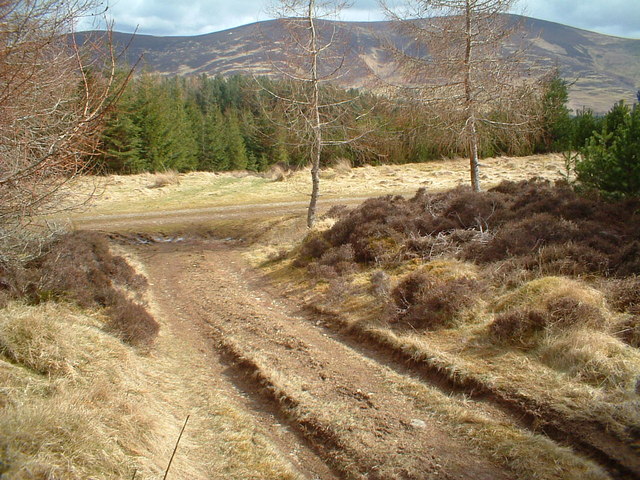
The village of Glenrath is nestled in a valley surrounded by rolling hills and lush greenery, offering residents and visitors breathtaking views of the surrounding countryside. The area is characterized by its tranquil and peaceful ambiance, making it an ideal destination for those seeking a retreat from the hustle and bustle of city life.
Glenrath is primarily an agricultural community, with farming playing a significant role in the local economy. The village is surrounded by farmland, and residents are often involved in various agricultural activities such as sheep farming and crop cultivation. The fertile soil and favorable climate of the region make it well-suited for agriculture, contributing to the village's prosperity.
Despite its small size, Glenrath offers a range of amenities to its residents. The village has a few local shops and businesses, catering to the basic needs of the community. For more extensive shopping and entertainment options, residents can visit nearby towns such as Peebles, which is approximately 7 miles away.
The village also boasts a strong sense of community spirit, with various social and recreational activities taking place throughout the year. These include village fairs, community gatherings, and sports events, fostering a close-knit and friendly atmosphere among the residents.
Overall, Glenrath is a charming village that showcases the natural beauty of the Scottish Borders while providing a peaceful and tight-knit community for its residents.
If you have any feedback on the listing, please let us know in the comments section below.
Glenrath Images
Images are sourced within 2km of 55.584048/-3.2706754 or Grid Reference NT2033. Thanks to Geograph Open Source API. All images are credited.


Glenrath is located at Grid Ref: NT2033 (Lat: 55.584048, Lng: -3.2706754)
Unitary Authority: The Scottish Borders
Police Authority: The Lothians and Scottish Borders
What 3 Words
///froth.snacking.access. Near Peebles, Scottish Borders
Related Wikis

Posso Tower
Posso Tower is a 16th-century tower house, about 6.0 miles (9.7 km) south and west of Peebles, Scottish Borders, Scotland, and west of Manor Water. �...
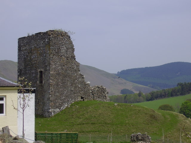
Castlehill Tower
Castlehill Tower, also known as Castle Hill of Manor, is a ruined oblong tower house dating from the end of the 15th century, situated in the parish of...

Lyne Water
The Lyne Water is a tributary of the River Tweed that rises in the Pentland Hills of southern Scotland at Baddinsgill Reservoir. It runs through West Linton...

Dawyck Chapel
Dawyck Chapel, also known as Dalwick Church, is located (NGR NT 16798 34933) within the Parish of Drumelzier in the Scottish Borders area of Scotland....
Nearby Amenities
Located within 500m of 55.584048,-3.2706754Have you been to Glenrath?
Leave your review of Glenrath below (or comments, questions and feedback).