Abermagwr

Settlement in Cardiganshire

Wales

Abermagwr

Fields west of Cnwch Coch Enclosed grazing to the west of the village of Cnwch Coch.  The nameless stream running in the wooded ditch on the left soon joins the Nant Magwr, a tributary of the Afon Ystwyth.
Fields west of Cnwch Coch Credit: Rudi Winter

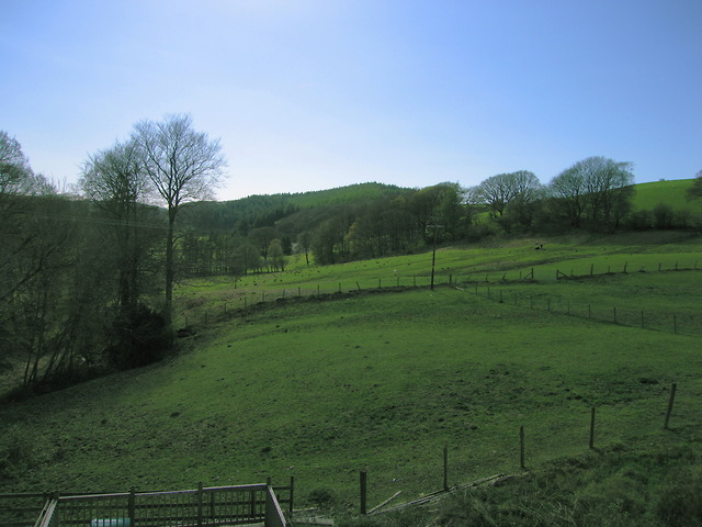
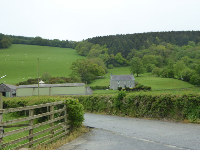
Abermagwr is a small village located in the county of Cardiganshire, Wales. Situated along the banks of the River Aeron, it is nestled amidst scenic countryside and offers a tranquil atmosphere for its residents and visitors alike. The village lies approximately 5 miles southwest of Aberystwyth, a popular coastal town.

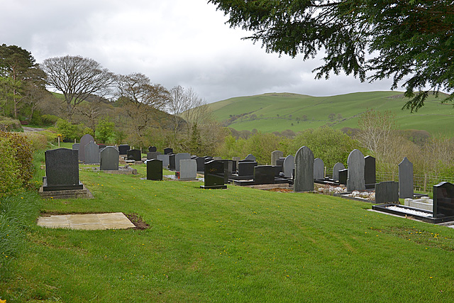
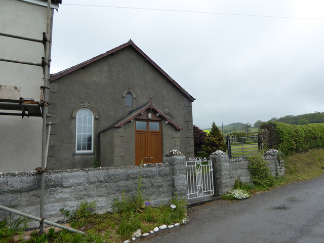
Abermagwr is rich in history, with evidence of human settlements dating back to prehistoric times. The village is known for its ancient church, St. David's Church, which dates back to the 13th century. The church is a significant landmark and serves as a reminder of Abermagwr's historical roots.

The village is home to a close-knit community, with a population of around 500 people. Its picturesque surroundings and charming rural setting make it an attractive place for those seeking a quieter lifestyle away from the hustle and bustle of larger towns and cities.

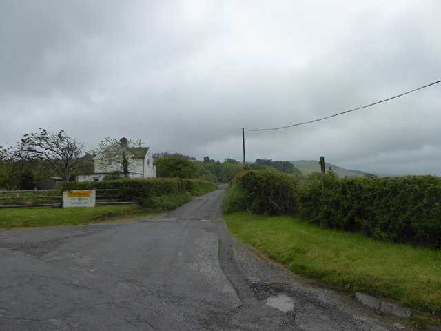
Abermagwr offers a range of amenities to its residents, including a primary school, a village hall, and a local pub. The village is well-connected to surrounding areas through road networks, making it easily accessible for commuters and tourists.

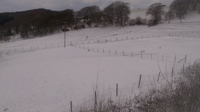
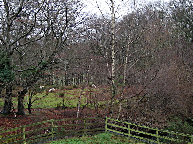
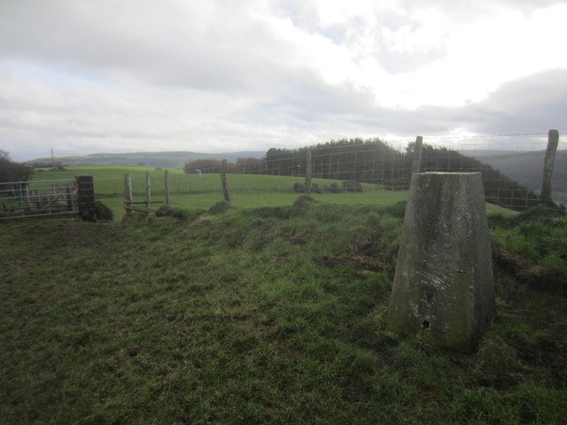
Nature enthusiasts can take advantage of the stunning countryside surrounding Abermagwr, with ample opportunities for walking, hiking, and exploring the nearby woodlands and fields. The River Aeron also provides a scenic spot for fishing and boating enthusiasts.

Overall, Abermagwr is a picturesque village with a rich history, offering a peaceful and idyllic lifestyle for its residents, as well as a charming destination for visitors seeking tranquility amidst the Welsh countryside.

If you have any feedback on the listing, please let us know in the comments section below.
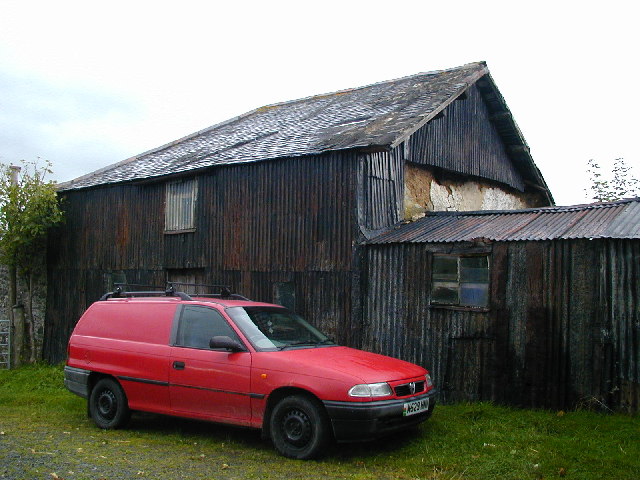
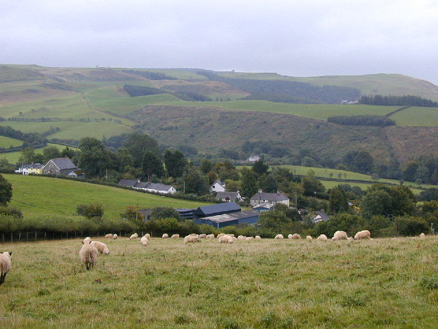
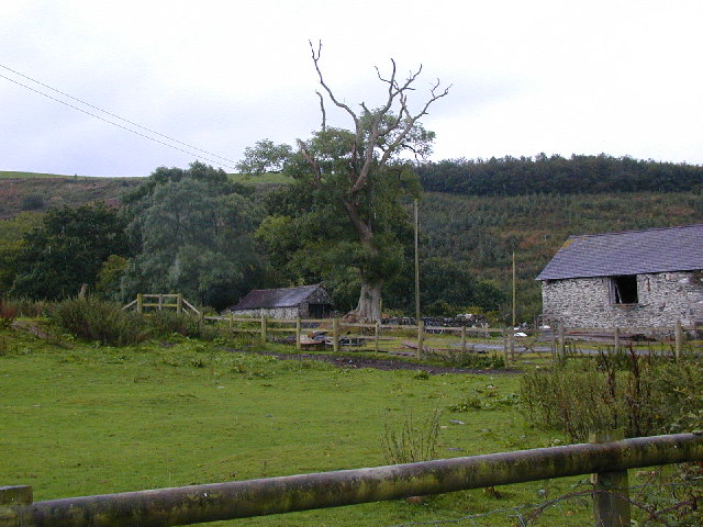
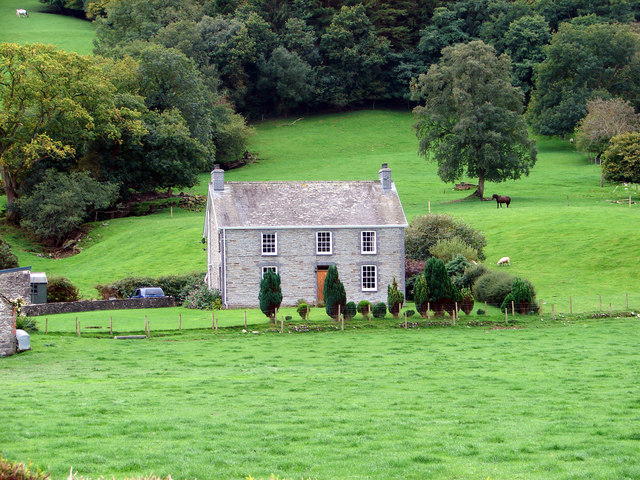
Abermagwr Images

Images are sourced within 2km of 52.345453/-3.958478 or Grid Reference SN6673. Thanks to Geograph Open Source API. All images are credited.

Fields west of Cnwch Coch Enclosed grazing to the west of the village of Cnwch Coch.  The nameless stream running in the wooded ditch on the left soon joins the Nant Magwr, a tributary of the Afon Ystwyth.
Fields west of Cnwch Coch
Enclosed grazing to the west of the village of Cnwch Coch. The nameless stream running in the wooded ditch on the left soon joins the Nant Magwr, a tributary of the Afon Ystwyth.
Snowy fields, Cnwch Coch Heavy snow had been forecast for the night, but most of it ended up in southeast Wales.  North Ceredigion got all the fun but little of the worry.
Snowy fields, Cnwch Coch
Heavy snow had been forecast for the night, but most of it ended up in southeast Wales. North Ceredigion got all the fun but little of the worry.
The cemetery, Cnwch Coch
Sheep pasture at Cnwch Coch A flock of sheep occupy a long narrow field speckled with trees on the south bank of the local stream, which is a tributary of the Nant Magwr.
Sheep pasture at Cnwch Coch
A flock of sheep occupy a long narrow field speckled with trees on the south bank of the local stream, which is a tributary of the Nant Magwr.
Triangulation Pillar (S5446) Pen-Lan-Isaf 3rd Order Triangulation Point carries Flush bracket S5446. The pillar stands at 182m,
Triangulation Pillar (S5446)
Pen-Lan-Isaf 3rd Order Triangulation Point carries Flush bracket S5446. The pillar stands at 182m,
Tynyberllan, near Crosswood A farm just off the B4575
Tynyberllan, near Crosswood
A farm just off the B4575
Ystwyth Trail near Crosswood The Ystwyth Trail is a 32.1km/20M footpath and cycle route linking Tregaron and Aberystwyth. Part of the trail follows the track of the old Great Western Railway line. Here is where it crosses the B7545
Ystwyth Trail near Crosswood
The Ystwyth Trail is a 32.1km/20M footpath and cycle route linking Tregaron and Aberystwyth. Part of the trail follows the track of the old Great Western Railway line. Here is where it crosses the B7545
The River Ystwyth at Trawscoed From the bridge connecting the B4575 and the B4340
The River Ystwyth at Trawscoed
From the bridge connecting the B4575 and the B4340
A small stream running into the river Ystwyth at Trawscoed
Black Covert parking area Forestry Commission carpark near the river Ystwyth at Trawscoed
Black Covert parking area
Forestry Commission carpark near the river Ystwyth at Trawscoed
Fferm Trawscoed/Trawscoed Farm This is an research farm run by the Institute of Biological, Environmental and Rural Sciences of Aberystwyth University
Fferm Trawscoed/Trawscoed Farm
This is an research farm run by the Institute of Biological, Environmental and Rural Sciences of Aberystwyth University
Wayside chapel A small 19th century chapel beside the road leading to Cnwch Coch
Wayside chapel
A small 19th century chapel beside the road leading to Cnwch Coch
Trawsgoed Railway Bridge A long-abandoned bridge on the former Carmarthen to Aberystwyth railway line marks the only road into the tiny village of Crosswood.
Trawsgoed Railway Bridge
A long-abandoned bridge on the former Carmarthen to Aberystwyth railway line marks the only road into the tiny village of Crosswood.
Corrugated iron barn Nicely decayed corrugated iron barn.
Corrugated iron barn
Nicely decayed corrugated iron barn.
Hamlet of Cnwch Coch Taken from the hill to the north-west, notice the chapel for such a small settlement.
Hamlet of Cnwch Coch
Taken from the hill to the north-west, notice the chapel for such a small settlement.
Old tree, old stone barns and young conifers. Cwmnewidion Isaf is the name of the farm.
Old tree, old stone barns and young conifers.
Cwmnewidion Isaf is the name of the farm.
Disused Railway Bridge on the B4575 road. This bridge once carried the Carmarthen to Aberystwyth railway line. The abutment on the left is intact but that on the right has been demolished to provide access to the new Ystwyth Trail (Tregaron to Aberystwyth) cycle route.
Disused Railway Bridge on the B4575 road.
This bridge once carried the Carmarthen to Aberystwyth railway line. The abutment on the left is intact but that on the right has been demolished to provide access to the new Ystwyth Trail (Tregaron to Aberystwyth) cycle route.
Tynberllan Farm In the north-west corner of the square, viewed from the B4575 road.
Tynberllan Farm
In the north-west corner of the square, viewed from the B4575 road.
Show me another place!

Abermagwr is located at Grid Ref: SN6673 (Lat: 52.345453, Lng: -3.958478)

Unitary Authority: Ceredigion

Police Authority: Dyfed Powys

Also known as: Aber-Magwr

What 3 Words

///unspoiled.turkey.quibble. Near Llanilar, Ceredigion

Related Wikis

Abermagwr

Abermagwr is a small settlement in the county of Ceredigion, Wales. It is on the B4340 road and is 11 kilometres (7 mi) southeast of the town of Aberystwyth...

Trawsgoed

Trawsgoed (Welsh for "Crosswood") is both a community and an estate in Ceredigion, Wales. The estate is 8 miles (13 km) southeast of Aberystwyth, and has...

Trawscoed railway station

Trawscoed railway station was located on the Carmarthen to Aberystwyth Line (originally called the Manchester and Milford Railway before being transferred...

Hendre-Rhys

Hendre-Rhys is a small village in the community of Trawsgoed, Ceredigion, Wales, which is 67.8 miles (109.2 km) from Cardiff and 173 miles (278.4 km)...

Felindyffryn Halt railway station

Felindyffryn Halt was located on the Carmarthen to Aberystwyth Line, originally called the Manchester and Milford Railway, before being transferred to...

Banc-y-môr

Banc-y-môr is a small village in the community of Trawsgoed, Ceredigion, Wales, which is 69.4 miles (111.6 km) from Cardiff and 173.5 miles (279.1 km...

Wenallt

Wenallt is a hamlet in the community of Trawsgoed, Ceredigion, Wales, 10 miles (16 km) southeast of Aberystwyth. Wenallt is represented in the Senedd...

Llanafan, Ceredigion

Llanafan is a small village between Tregaron and Aberystwyth, Ceredigion, in Wales. Llanafan is around ten miles from Aberystwyth and Tregaron. It is named...

Nearby Amenities

Located within 500m of 52.345453,-3.958478
Source: npe
Lat/Long: 52.3445804/-3.9631531
Source: npe
Lat/Long: 52.3436938/-3.9596536
Source: npe
Lat/Long: 52.3432187/-3.9593311
Abermagwr
Is In: Ceredigion, Wales, UK
Place: hamlet
Wikidata: Q3401742
Wikipedia: en:Abermagwr
Lat/Long: 52.3455332/-3.9603883
Post Box
Ref: SY23 53
Lat/Long: 52.3462218/-3.9605262
Abermagwr Roman Villa
Historic: archaeological_site
Lat/Long: 52.3494048/-3.9559529
Direction: SSE
Generator Method: photovoltaic
Generator Output Electricity: yes
Generator Solar Modules: 16
Generator Source: solar
Generator Type: solar_photovoltaic_panel
Location: roof
Power: generator
Lat/Long: 52.3456156/-3.9603943
Give Way
Direction: forward
Lat/Long: 52.3461503/-3.9601254
Man Made: mast
Lat/Long: 52.3444445/-3.9546559
Man Made: utility_pole
Lat/Long: 52.3427273/-3.9640329
The data included in this document is from www.openstreetmap.org. The data is made available under ODbL.

Have you been to Abermagwr?

Leave your review of Abermagwr below (or comments, questions and feedback).