Lochan Sgeireach

Lake, Pool, Pond, Freshwater Marsh in Ross-shire

Scotland

Lochan Sgeireach

Drumchort to Fionn Loch Track Track is running along the shore of Loch na Moine Buige.  Looking North-West ish, you can see the end of the island marked on the map, although it just blends in from this viewpoint.
Drumchort to Fionn Loch Track Credit: Roger McLachlan

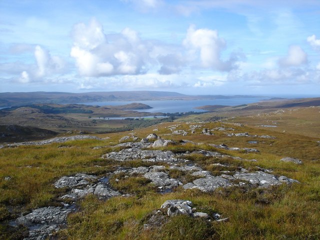
Lochan Sgeireach is a small, freshwater loch located in the county of Ross-shire in Scotland. Situated in a remote and picturesque setting, the loch is surrounded by rugged hills and moorland, making it a popular destination for outdoor enthusiasts and nature lovers.

Measuring approximately 200 meters in length and 50 meters in width, Lochan Sgeireach is relatively shallow with a maximum depth of around 5 meters. The water in the loch is clear and pristine, providing a habitat for a variety of aquatic plants and wildlife.

Visitors to Lochan Sgeireach can enjoy a range of activities such as fishing, bird watching, and hiking along the scenic shoreline. The loch is home to a diverse range of bird species, including ducks, herons, and swans, making it a prime spot for birdwatching.

Overall, Lochan Sgeireach offers a tranquil and secluded escape from the hustle and bustle of everyday life, providing a peaceful retreat for those looking to connect with nature in a pristine and unspoiled environment.

If you have any feedback on the listing, please let us know in the comments section below.

Lochan Sgeireach Images

Images are sourced within 2km of 57.774042/-5.5076062 or Grid Reference NG9181. Thanks to Geograph Open Source API. All images are credited.

Drumchort to Fionn Loch Track Track is running along the shore of Loch na Moine Buige.  Looking North-West ish, you can see the end of the island marked on the map, although it just blends in from this viewpoint.
Drumchort to Fionn Loch Track
Track is running along the shore of Loch na Moine Buige. Looking North-West ish, you can see the end of the island marked on the map, although it just blends in from this viewpoint.
Drystone wall next to the burn which flows from Loch na Moine Buige to Fionn Loch The view is looking towards Fionn Loch which occupies much of this square and a host of others.  This is an entertaining place the thin strip between to two lochs.  Really good view - well worth a visit.
Drystone wall next to the burn which flows from Loch na Moine Buige to Fionn Loch
The view is looking towards Fionn Loch which occupies much of this square and a host of others. This is an entertaining place the thin strip between to two lochs. Really good view - well worth a visit.
Carn na Craoibhe-caoruinn Looking North-West across the grid square.  There are hundreds of erratics.  Where the summit was is not entirely clear on the ground as there were humps and bumps everywhere.
Carn na Craoibhe-caoruinn
Looking North-West across the grid square. There are hundreds of erratics. Where the summit was is not entirely clear on the ground as there were humps and bumps everywhere.
Lochans above Fionn Loch There are a host of lochans in this area, some are even named.  Fionn Loch in the background, so am looking Eastish.
Lochans above Fionn Loch
There are a host of lochans in this area, some are even named. Fionn Loch in the background, so am looking Eastish.
Loch an Eilein Looking Eastish.  The large body of water behind is Fionn Loch.  A'Mhaighdean right of centre background.
Loch an Eilein
Looking Eastish. The large body of water behind is Fionn Loch. A'Mhaighdean right of centre background.
Road quarry on Fionn Loch to Kernsary Track Estate tracks frequently have these mini-quarries which are used to do running repairs to the tracks.    Small unnamed lochan just behind quarry.  Beinn Arrigh Char, Meall Mhiennidh, Beinn Lair and A'Mhaighdean in the background.
Road quarry on Fionn Loch to Kernsary Track
Estate tracks frequently have these mini-quarries which are used to do running repairs to the tracks. Small unnamed lochan just behind quarry. Beinn Arrigh Char, Meall Mhiennidh, Beinn Lair and A'Mhaighdean in the background.
Dividing Line Forestry on the right of fence is about a quarter of the grid square.  Open moorland on the right of fence makes up the rest.  Looking South-East toward Fisherfield Forest.
Dividing Line
Forestry on the right of fence is about a quarter of the grid square. Open moorland on the right of fence makes up the rest. Looking South-East toward Fisherfield Forest.
Loch Phail
Loch Phail
North end of Loch Phail
Outflow from Loch Phail
Allt Loch Phail It really is a very wriggly river.
Allt Loch Phail
It really is a very wriggly river.
Bog or very nearly a lochan Sometimes when you pick a route, the going can get surprisingly wet.  Dog seems to like this kind of stuff.
Bog or very nearly a lochan
Sometimes when you pick a route, the going can get surprisingly wet. Dog seems to like this kind of stuff.
Loch nan Uain Taken from the high ground and convenient brew stop.
Loch nan Uain
Taken from the high ground and convenient brew stop.
View from Meall na Meine The summit is not far off the middle of the square, this view is towards Fionn Loch and the Fisherfield Forest.
View from Meall na Meine
The summit is not far off the middle of the square, this view is towards Fionn Loch and the Fisherfield Forest.
View west from Meall na Meine Loch Ewe seen in the distance.
View west from Meall na Meine
Loch Ewe seen in the distance.
View north from Meall na Meine Right hand side is Loch Phail the southern end is just outside the grid square.
Left and back is Loch nan Uain.
View north from Meall na Meine
Right hand side is Loch Phail the southern end is just outside the grid square. Left and back is Loch nan Uain.
North west ridge of Meall na Meine A surprising well defined ridge leads to the summit.
North west ridge of Meall na Meine
A surprising well defined ridge leads to the summit.
Narrows in the unnamed loch The 1:50000 shows a narrowing of the loch at this point, but not to the extent that you can cross the loch.  The 1:25000 gives a better idea.
Narrows in the unnamed loch
The 1:50000 shows a narrowing of the loch at this point, but not to the extent that you can cross the loch. The 1:25000 gives a better idea.
Show me another place!

Lochan Sgeireach is located at Grid Ref: NG9181 (Lat: 57.774042, Lng: -5.5076062)

Unitary Authority: Highland

Police Authority: Highlands and Islands

What 3 Words

///trickling.commended.circulate. Near Gairloch, Highland

Nearby Locations

Lochan Sgeireach

Related Wikis

Tournaig

Tournaig is a remote scattered crofting and fishing hamlet, that sits on the confluence of the sea loch, Loch Thùrnaig to the west, and Loch Nan Dailthean...

Londubh

Londubh (Scottish Gaelic: An Lòn Dubh) is a village on the south shore of Loch Ewe in Poolewe, Ross-shire, Scottish Highlands and is in the Scottish council...

Beinn Airigh Charr

Beinn Airigh Charr (792 m) is a mountain in the Northwest Highlands of Scotland. It lies in Wester Ross, on the northern side of Loch Maree, near to the...

Inverewe Garden

Inverewe Garden (Scottish Gaelic: Gàradh Inbhir Iù) is a botanical garden in Wester Ross in the Scottish Highlands. It is located just to the north of...

Have you been to Lochan Sgeireach?

Leave your review of Lochan Sgeireach below (or comments, questions and feedback).