Lochan Meall nan Damh

Lake, Pool, Pond, Freshwater Marsh in Argyllshire

Scotland

Lochan Meall nan Damh

An erratic on the lower slopes of Meall nan Damh Looking towards the Glenfinnan mountains
An erratic on the lower slopes of Meall nan Damh Credit: Alan Reid

Lochan Meall nan Damh is a small freshwater loch located in Argyllshire, Scotland. Situated in a remote and picturesque area, the loch is surrounded by rolling hills and dense forests, offering a tranquil and secluded setting for visitors to enjoy.

The loch is relatively shallow, with a maximum depth of around 10 meters, and covers an area of approximately 5 hectares. It is fed by a small stream that flows into the loch from the surrounding hills, providing a constant supply of fresh water.

The shores of Lochan Meall nan Damh are lined with a variety of vegetation, including grasses, reeds, and small shrubs, creating a lush and vibrant ecosystem. The loch is home to a diverse range of wildlife, including various species of birds, fish, and insects.

Visitors to Lochan Meall nan Damh can enjoy a range of outdoor activities, such as fishing, birdwatching, and hiking along the scenic trails that surround the loch. The peaceful and serene atmosphere of the loch makes it an ideal destination for those looking to escape the hustle and bustle of everyday life and connect with nature.

If you have any feedback on the listing, please let us know in the comments section below.

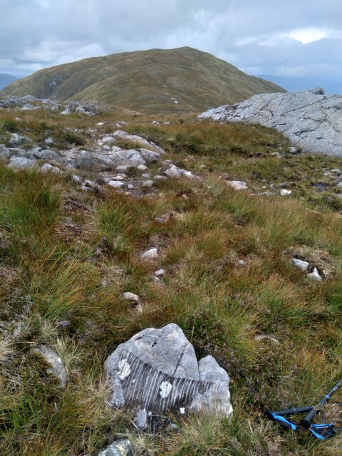
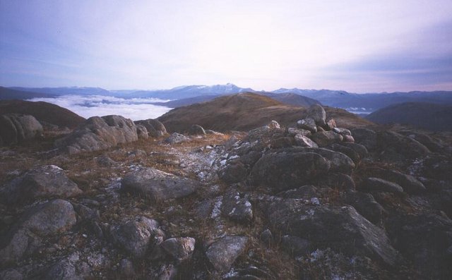
Lochan Meall nan Damh Images

Images are sourced within 2km of 56.814528/-5.4217232 or Grid Reference NM9174. Thanks to Geograph Open Source API. All images are credited.

An erratic on the lower slopes of Meall nan Damh Looking towards the Glenfinnan mountains
An erratic on the lower slopes of Meall nan Damh
Looking towards the Glenfinnan mountains
Rock strewn landscape near Glas Bhealach Looking north-eastward towards Glas Bhienn.
The markings on the rock in the foreground can be seen in more detail here : <a title="https://www.geograph.org.uk/photo/7268909" href="https://www.geograph.org.uk/photo/7268909">Link</a>
Rock strewn landscape near Glas Bhealach
Looking north-eastward towards Glas Bhienn. The markings on the rock in the foreground can be seen in more detail here : Link
Strangely marked rock Markings appear naturally made but if anyone can suggest their origin I will be happy to include more detail.
Strangely marked rock
Markings appear naturally made but if anyone can suggest their origin I will be happy to include more detail.
Track in Cona Glen beside the Cona River Looking east towards Tom na h-Eilde.
Track in Cona Glen beside the Cona River
Looking east towards Tom na h-Eilde.
Moorland tree in Cona Glen
Allt Bealach a' Charrain in Cona Glen
Old bridle road in Cona Glen The old route through the glen, now overgrown and boggy.
The old OS map shows the route beside the Cona River marked as BR ... Bridle Road ... presumably one that is suitable for horses. A higher route to the north is marked FP ... Foot Path ... presumably one that is only suitable for walkers. For the old OS map, see 
<span class="nowrap"><a title="https://maps.nls.uk/geo/explore/#zoom=15.3&lat=56.80361&lon=-5.41791&layers=6&b=1" rel="nofollow ugc noopener" href="https://maps.nls.uk/geo/explore/#zoom=15.3&lat=56.80361&lon=-5.41791&layers=6&b=1">Link</a><img style="margin-left:2px;" alt="External link" title="External link - shift click to open in new window" src="https://s1.geograph.org.uk/img/external.png" width="10" height="10"/></span> 
and for the old OS Conventional Signs and Writing, see 
<span class="nowrap"><a title="https://maps.nls.uk/view/128076891" rel="nofollow ugc noopener" href="https://maps.nls.uk/view/128076891">Link</a><img style="margin-left:2px;" alt="External link" title="External link - shift click to open in new window" src="https://s1.geograph.org.uk/img/external.png" width="10" height="10"/></span>
Old bridle road in Cona Glen
The old route through the glen, now overgrown and boggy. The old OS map shows the route beside the Cona River marked as BR ... Bridle Road ... presumably one that is suitable for horses. A higher route to the north is marked FP ... Foot Path ... presumably one that is only suitable for walkers. For the old OS map, see LinkExternal link and for the old OS Conventional Signs and Writing, see LinkExternal link
End of the track in Cona Glen The route continues as a footpath to Glenfinnan
End of the track in Cona Glen
The route continues as a footpath to Glenfinnan
Looking down into upper Cona Glen The meanderings of the upper Cona River can be seen in the flat bottomed glen. Across the glen, the ridge rises to the summit of Meall Mor (763m).
Looking down into upper Cona Glen
The meanderings of the upper Cona River can be seen in the flat bottomed glen. Across the glen, the ridge rises to the summit of Meall Mor (763m).
Meall nan Damh Meall nan Damh, a Graham has two tops; the east top at the right side of the image reaches 723m which is one metre higher than the west top from which the image was taken. Glas Bheinn, another Graham, is the other peak in view.
Meall nan Damh
Meall nan Damh, a Graham has two tops; the east top at the right side of the image reaches 723m which is one metre higher than the west top from which the image was taken. Glas Bheinn, another Graham, is the other peak in view.
Meall na Cuartaige Meall na Cuartaige seen from the descent of Sgor Craobh Chaorainn
Meall na Cuartaige
Meall na Cuartaige seen from the descent of Sgor Craobh Chaorainn
West ridge of Meall nan Damh The head waters of the Cona River lie down below
West ridge of Meall nan Damh
The head waters of the Cona River lie down below
The boulder ridge of Meall nan Damh gives a glimpse of distant Loch Linnhe
Callop Glen Path running up the Callop Glen, between Meall nan Damh and Sgurr Craobh a'Chaoruinn.
Callop Glen
Path running up the Callop Glen, between Meall nan Damh and Sgurr Craobh a'Chaoruinn.
West Ridge of Meall nan Damh Rocky ridge  above the head of the Cona Glen. Sgurr Ghuibhsachan, the hill often seen in photos of the '45 monument in Glenfinnan is the hill in the background. Typical Ardgour hill scenery, rock and bog.
West Ridge of Meall nan Damh
Rocky ridge above the head of the Cona Glen. Sgurr Ghuibhsachan, the hill often seen in photos of the '45 monument in Glenfinnan is the hill in the background. Typical Ardgour hill scenery, rock and bog.
Meall nan Damh 723m summit of Meall nan Damh
Meall nan Damh
723m summit of Meall nan Damh
East ridge of Meall nam Damh Looking down the grassy east ridge of Meall nam Damh. Cona Glen is down to the right.
East ridge of Meall nam Damh
Looking down the grassy east ridge of Meall nam Damh. Cona Glen is down to the right.
North ridge of Meall nam Damh From the north ridge of Meall nam Damh on a hazy day. The distant hill on the left is Streap.
North ridge of Meall nam Damh
From the north ridge of Meall nam Damh on a hazy day. The distant hill on the left is Streap.
Show me another place!

Lochan Meall nan Damh is located at Grid Ref: NM9174 (Lat: 56.814528, Lng: -5.4217232)

Unitary Authority: Highland

Police Authority: Highlands and Islands

What 3 Words

///balance.hamsters.vest. Near Fort William, Highland

Related Wikis

Sgùrr Ghiubhsachain

Sgùrr Ghiubhsachain is a mountain in the Lochaber area in the west of Scotland. Its summit is the highest point in a group of mountains that stand south...

Càrn na Nathrach

Carn na Nathrach (786 m) is a mountain in the Northwest Highlands of Scotland. It is located in the Ardgour area of Lochaber. A very remote mountain, it...

Glenfinnan Monument

The Glenfinnan Monument is a Category A listed monument in Glenfinnan, Scotland, erected in 1814 and dedicated to the Highlanders who fought in support...

River Finnan

The River Finnan is a river in Highland, Scotland that flows the Glen Finnan glen (valley). Rising from the waters of two streams near Corryhully, one...

Have you been to Lochan Meall nan Damh?

Leave your review of Lochan Meall nan Damh below (or comments, questions and feedback).