Glascoed

Settlement in Flintshire

Wales

Glascoed

Pond with a lonely swan Near the St Asaph business park
Pond with a lonely swan Credit: Eirian Evans

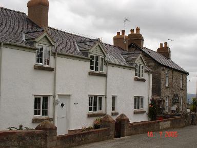
Glascoed is a small village located in the county of Flintshire, Wales. Situated approximately 3 miles north of Mold, it is nestled in the scenic countryside of northeast Wales. The village is surrounded by lush green fields and rolling hills, offering a picturesque and tranquil setting for its residents.

Glascoed has a relatively small population, with approximately 400 inhabitants. The village is known for its tight-knit community, where neighbors often come together to organize events and support local initiatives. The sense of community is further enhanced by the presence of the village pub, which serves as a gathering place for residents.

In terms of amenities, Glascoed primarily relies on neighboring towns for services such as shopping, healthcare, and education. Despite its rural location, the village benefits from good transport links, with easy access to the A541 road, connecting it to nearby towns and cities.

One notable landmark in Glascoed is the historic St. Michael's Church, which dates back to the 12th century. The church serves as a focal point for the community and offers a glimpse into the village's rich history.

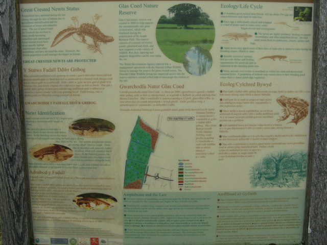
For outdoor enthusiasts, Glascoed is a great starting point for exploring the surrounding countryside. The area offers ample opportunities for walking, cycling, and enjoying the natural beauty of the Welsh landscape.

Overall, Glascoed is a charming village that provides a peaceful and close-knit community for its residents, while also offering easy access to the amenities and attractions of nearby towns.

If you have any feedback on the listing, please let us know in the comments section below.

Glascoed Images

Images are sourced within 2km of 53.248621/-3.5023573 or Grid Reference SH9973. Thanks to Geograph Open Source API. All images are credited.

Pond with a lonely swan Near the St Asaph business park
Pond with a lonely swan
Near the St Asaph business park
Carreg Wen Cottage Near the roundabout at St Asaph Business Park
Carreg Wen Cottage
Near the roundabout at St Asaph Business Park
Glascoed Nature Reserve Grassy area with ponds for greater crested newts. This was created when St Asaph Business Park was being created.
Glascoed Nature Reserve
Grassy area with ponds for greater crested newts. This was created when St Asaph Business Park was being created.
Gwarchodfa Natur Glascoed Entrance to the Glascoed Nature Reserve. Created for the relocation of newts displaced by the building of the St Asaph Business Park.
Gwarchodfa Natur Glascoed
Entrance to the Glascoed Nature Reserve. Created for the relocation of newts displaced by the building of the St Asaph Business Park.
Glascoed Nature Reserve Information board about the reserve, created in 2000 particularly to support the Great Crested Newt, which was being threatened here by the creation of the St Asaph Business Park. It now has a wide range of wildlife.
Glascoed Nature Reserve
Information board about the reserve, created in 2000 particularly to support the Great Crested Newt, which was being threatened here by the creation of the St Asaph Business Park. It now has a wide range of wildlife.
Glascoed Nature Reserve Looking south from the access point at the western end of the St Asaph Business Park, across the southernmost of the three fields that make up the reserve.
Glascoed Nature Reserve
Looking south from the access point at the western end of the St Asaph Business Park, across the southernmost of the three fields that make up the reserve.
The Glascoed Nature Reserve Double hedge that forms the eastern boundary of the reserve.
The Glascoed Nature Reserve
Double hedge that forms the eastern boundary of the reserve.
View from the A55
View from the A55
View to Bodelwyddan Castle from the park A view to Bodelwyddan Castle from the park (seen from grid square SJ0074). The castle as seen today is mostly a Victorian facade but covers a core that could possibly date back to the 13th century. Archaeologists have found Roman remains on the site, and suspect they relate to a settlement adjacent to the nearby Roman road.

Wikipedia <span class="nowrap"><a title="http://en.wikipedia.org/wiki/Bodelwyddan_Castle#Gardens" rel="nofollow ugc noopener" href="http://en.wikipedia.org/wiki/Bodelwyddan_Castle#Gardens">Link</a><img style="margin-left:2px;" alt="External link" title="External link - shift click to open in new window" src="https://s1.geograph.org.uk/img/external.png" width="10" height="10"/></span>

Bodelwyddan Castle <span class="nowrap"><a title="http://www.bodelwyddan-castle.co.uk/index.html" rel="nofollow ugc noopener" href="http://www.bodelwyddan-castle.co.uk/index.html">Link</a><img style="margin-left:2px;" alt="External link" title="External link - shift click to open in new window" src="https://s1.geograph.org.uk/img/external.png" width="10" height="10"/></span>
View to Bodelwyddan Castle from the park
A view to Bodelwyddan Castle from the park (seen from grid square SJ0074). The castle as seen today is mostly a Victorian facade but covers a core that could possibly date back to the 13th century. Archaeologists have found Roman remains on the site, and suspect they relate to a settlement adjacent to the nearby Roman road. Wikipedia LinkExternal link Bodelwyddan Castle LinkExternal link
B5381 looking west A back road from St Asaph. An interesting wall on the right.
B5381 looking west
A back road from St Asaph. An interesting wall on the right.
B5381 Blascoed Road The walls are part of the boundary to Bodelwyddan Park.
B5381 Blascoed Road
The walls are part of the boundary to Bodelwyddan Park.
Spire of the "Marble Church" at Bodelwyddan Wonderfully restored spire of this church seen from the A55 nearby. It exceeds 200' in height.
Spire of the "Marble Church" at Bodelwyddan
Wonderfully restored spire of this church seen from the A55 nearby. It exceeds 200' in height.
A55 Dual Carriageway The A55 seen from the flyover at Llanelwy Business Park
A55 Dual Carriageway
The A55 seen from the flyover at Llanelwy Business Park
Fountain at St. Asaph Business Park Landscaping at St.Asaph Business Park including a lake and fountain
Fountain at St. Asaph Business Park
Landscaping at St.Asaph Business Park including a lake and fountain
Farmland at Cefn Meiriadog View of open farmland from Cefn Meiriadog in Denbighshire
Farmland at Cefn Meiriadog
View of open farmland from Cefn Meiriadog in Denbighshire
Pentre Mawr Hamlet named Pentre Mawr in Denbighshire
Pentre Mawr
Hamlet named Pentre Mawr in Denbighshire
Cottages at Groesfford Marli Cottages at Groesfford Marli  (Marli Crossroads) in Denbighshire
Cottages at Groesfford Marli
Cottages at Groesfford Marli (Marli Crossroads) in Denbighshire
Farm Buildings at Cefn Meiriadog Farm out buildings in the Cefn Meiriadog area
Farm Buildings at Cefn Meiriadog
Farm out buildings in the Cefn Meiriadog area
Show me another place!

Glascoed is located at Grid Ref: SH9973 (Lat: 53.248621, Lng: -3.5023573)

Unitary Authority: Denbighshire

Police Authority: North Wales

What 3 Words

///replaces.teaches.commuted. Near Bodelwyddan, Denbighshire

Related Wikis

Cefn Meiriadog

Cefn Meiriadog (sometimes Cefnmeriadog) is a rural community in Denbighshire, Wales, just south-west of the city of St Asaph. The boundary of the community...
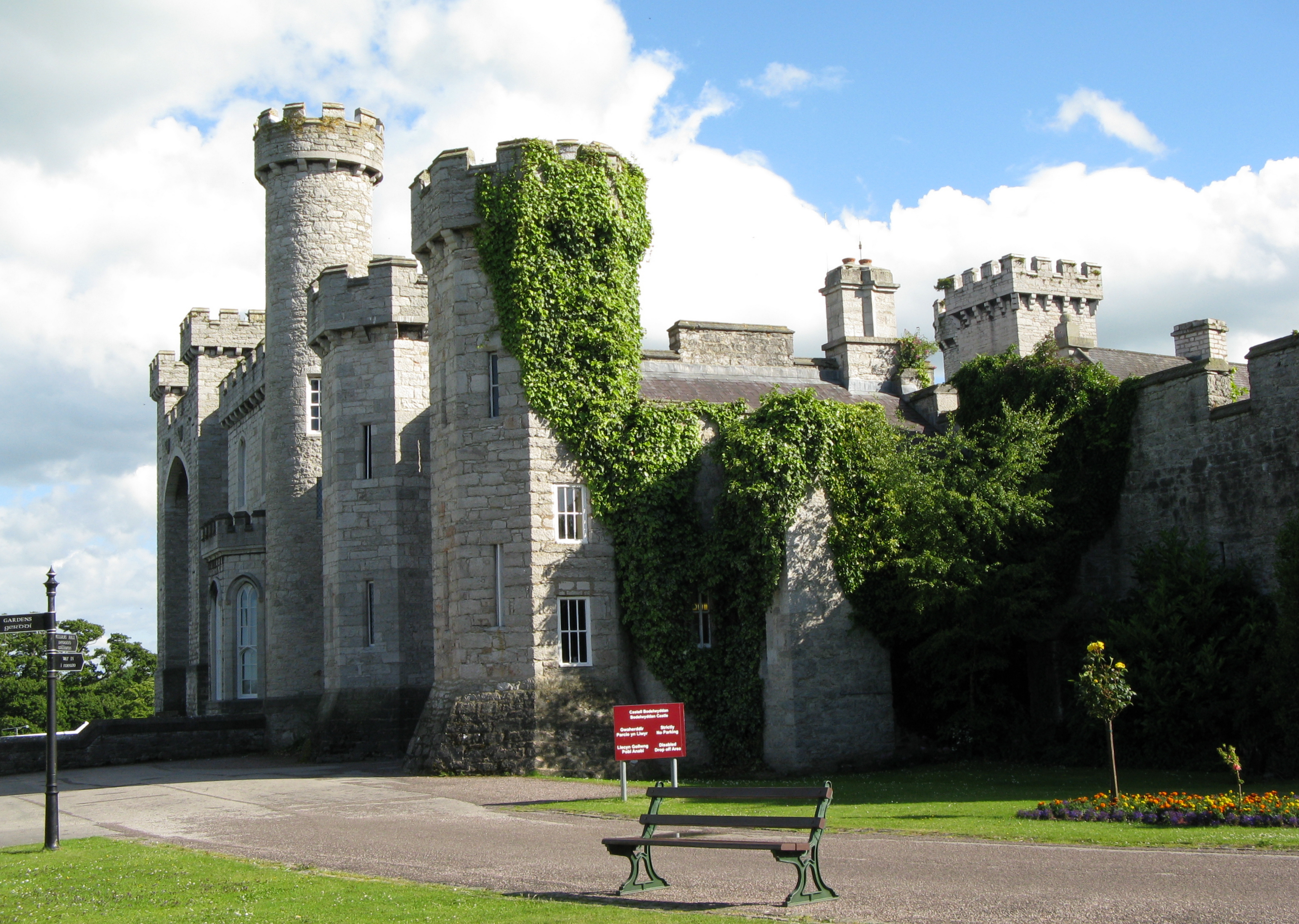
Bodelwyddan Castle

Bodelwyddan Castle (Welsh: Castell Bodelwyddan), close to the village of Bodelwyddan, near Rhyl, Denbighshire in Wales, was built around 1460 by the Humphreys...

Bedd-y-Cawr Hillfort

Bedd-y-Cawr Hillfort, or Bedd y Cawr Hillfort, is an Iron Age hillfort on a natural inland promontory in the community of Cefnmeiriadog in Denbighshire...

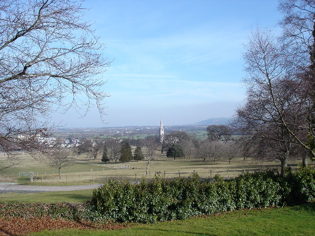
Marble Church, Bodelwyddan

St Margaret's Church, Bodelwyddan, nicknamed the Marble Church, is a Decorated Gothic Style parish church in the lower Vale of Clwyd in Denbighshire, Wales...

Bodelwyddan

Bodelwyddan (Welsh pronunciation: [bɔdɛlˈwəðan]) is a village, electoral ward and community in Denbighshire, Wales, approximately 5 miles (8 km) South...
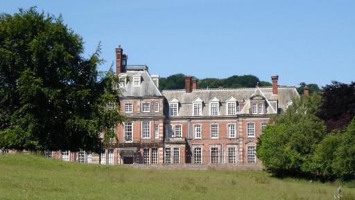
Kinmel Hall

Kinmel Hall is a large country mansion within Kimnel Park near the village of St. George, close to the coastal town of Abergele, in Conwy county borough...

Kinmel Park Training Area

Kinmel Park Training Area is an army training ground in what was once the grounds of Kinmel Hall, near Abergele, in Conwy county borough, Wales. The camp...
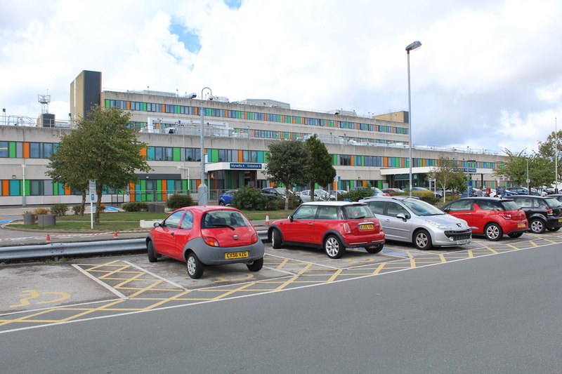
Glan Clwyd Hospital

Glan Clwyd Hospital (Welsh: Ysbyty Glan Clwyd) is a hospital in Bodelwyddan, Denbighshire, Wales. It is managed by the Betsi Cadwaladr University Health...

Nearby Amenities

Located within 500m of 53.248621,-3.5023573
Operator: National Grid
Operator Wikidata: Q1465461
Power: tower
Lat/Long: 53.2507919/-3.5044415
Operator: National Grid
Operator Wikidata: Q1465461
Power: tower
Lat/Long: 53.2514865/-3.4993858
Power: tower
Lat/Long: 53.2501766/-3.5088999
Power: tower
Lat/Long: 53.2518281/-3.5056794
Power: tower
Lat/Long: 53.2518731/-3.5012913
Groesffordd Marli
Place: hamlet
Wikidata: Q20598611
Lat/Long: 53.2486252/-3.4979282
Power: pole
Lat/Long: 53.2515344/-3.501956
Power: pole
Lat/Long: 53.2514723/-3.5034521
Power: pole
Lat/Long: 53.2514286/-3.5045714
Power: pole
Lat/Long: 53.2513871/-3.5056291
Power: pole
Lat/Long: 53.248082/-3.4955868
Power: pole
Lat/Long: 53.248072/-3.4962449
Power: pole
Lat/Long: 53.2481181/-3.4969203
Power: pole
Lat/Long: 53.2482457/-3.4982265
Power: pole
Lat/Long: 53.2484284/-3.5009252
Power: pole
Lat/Long: 53.2484639/-3.4995079
Power: pole
Lat/Long: 53.2481808/-3.4975734
Power: pole
Lat/Long: 53.2481388/-3.4995308
Clwb Cefn After School Club
Addr City: Abergele
Addr Country: GB
Addr Housename: Ysgol Cefn Meiriadog
Addr Place: Groesffordd Marli
Addr Postcode: LL22 9DS
Fhrs Authority: Denbighshire
Fhrs Id: 921377
Fhrs Local Authority Id: 703456
Name En: Clwb Cefn After School Club
Lat/Long: 53.248535/-3.4996015
Colour: black
Direction: SSW
Generator Method: photovoltaic
Generator Output Electricity: 4.0 KW
Generator Solar Modules: 16
Generator Source: solar
Generator Type: solar_photovoltaic_panel
Location: roof
Power: generator
Start Date: 2015
Lat/Long: 53.2489788/-3.5025521
Direction: ESE
Generator Method: photovoltaic
Generator Output Electricity: yes
Generator Solar Modules: 14
Generator Source: solar
Generator Type: solar_photovoltaic_panel
Location: roof
Power: generator
Lat/Long: 53.2490937/-3.5017172
Design: h-frame
Material: wood
Operator: SP Energy Networks
Operator Wikidata: Q116022116
Power: pole
Lat/Long: 53.2493361/-3.5031055
Power: pole
Lat/Long: 53.2492267/-3.5084397
Power: pole
Lat/Long: 53.2487892/-3.5088722
Power: pole
Lat/Long: 53.2480997/-3.5095438
Post Box
Brand: Royal Mail
Brand Wikidata: Q638098
Collection Times: Mo-Fr 11:00; Sa 10:00
Operator: Royal Mail
Operator Wikidata: Q638098
Post Box Type: lamp
Ref: LL22 100
Royal Cypher: EIIR
Royal Cypher Wikidata: Q33102113
Lat/Long: 53.2481901/-3.4970021
Bench
Material: wood
Lat/Long: 53.2482311/-3.4969227
Man Made: tower
Tower Construction: tower
Tower Type: bell_tower
Lat/Long: 53.2483833/-3.5004277
Noexit: yes
Lat/Long: 53.248479/-3.5009449
Direction: SSE
Generator Method: photovoltaic
Generator Output Electricity: yes
Generator Solar Modules: 7
Generator Source: solar
Generator Type: solar_photovoltaic_panel
Location: roof
Power: generator
Lat/Long: 53.2529217/-3.501585
Direction: SSE
Generator Method: photovoltaic
Generator Output Electricity: yes
Generator Solar Modules: 4
Generator Source: solar
Generator Type: solar_photovoltaic_panel
Location: roof
Power: generator
Lat/Long: 53.2528856/-3.501593
Direction: 215
Generator Method: photovoltaic
Generator Output Electricity: yes
Generator Solar Modules: 14
Generator Source: solar
Generator Type: solar_photovoltaic_panel
Location: roof
Power: generator
Lat/Long: 53.2522919/-3.5051858
Advertising: board
Lit: no
Support: ground
Visibility: house
Lat/Long: 53.2488196/-3.5028601
Crossing
Lat/Long: 53.249004/-3.5032263
Street Lamp
Lat/Long: 53.2489192/-3.5029773
Direction: 315
Maxspeed: 20 mph
Traffic Sign: maxspeed
Lat/Long: 53.2493953/-3.5035058
Direction: 315
Maxspeed: 20 mph
Traffic Sign: maxspeed
Lat/Long: 53.2493528/-3.5035729
Man Made: utility_pole
Utility: telecom
Lat/Long: 53.2488298/-3.5028919
Man Made: utility_pole
Utility: telecom
Lat/Long: 53.2485701/-3.5023766
Man Made: utility_pole
Utility: power
Lat/Long: 53.2490007/-3.5028523
The data included in this document is from www.openstreetmap.org. The data is made available under ODbL.

Have you been to Glascoed?

Leave your review of Glascoed below (or comments, questions and feedback).