Am Feur-loch

Lake, Pool, Pond, Freshwater Marsh in Inverness-shire

Scotland

Am Feur-loch

Ruined houses at Doire Dubh Marked on some maps as shielings, these were in fact permanent dwellings.
Ruined houses at Doire Dubh Credit: David Tyers

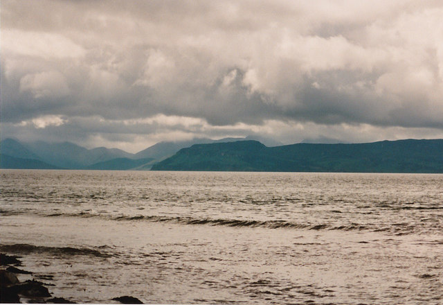
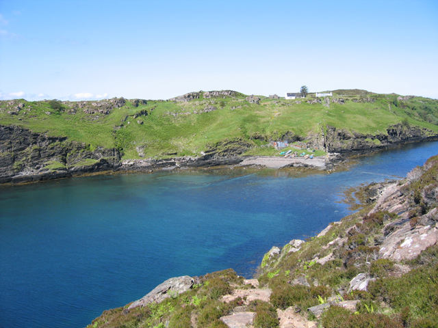
Am Feur-loch is a picturesque freshwater loch located in Inverness-shire, Scotland. The loch is surrounded by lush greenery and rolling hills, creating a tranquil and scenic setting for visitors to enjoy. The water in Am Feur-loch is crystal clear and teeming with various species of fish and other aquatic life.

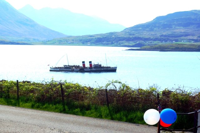
The loch is a popular spot for fishing, with anglers often visiting to try their luck at catching brown trout, pike, and perch. The calm waters of Am Feur-loch make it an ideal location for those looking to relax and unwind while casting a line.

In addition to fishing, the loch is also a great spot for birdwatching, with a variety of bird species calling the area home. Visitors may catch a glimpse of ospreys, herons, and even the occasional eagle soaring overhead.

Surrounded by nature and offering a peaceful retreat from the hustle and bustle of everyday life, Am Feur-loch is a hidden gem in the Scottish Highlands that is sure to leave a lasting impression on all who visit.

If you have any feedback on the listing, please let us know in the comments section below.

Am Feur-loch Images

Images are sourced within 2km of 57.470454/-6.0050926 or Grid Reference NG5949. Thanks to Geograph Open Source API. All images are credited.

Ruined houses at Doire Dubh Marked on some maps as shielings, these were in fact permanent dwellings.
Ruined houses at Doire Dubh
Marked on some maps as shielings, these were in fact permanent dwellings.
View to Raasay From the edge of the sandy beach at Sand looking across the water towards Raasay and beyond to Skye.
View to Raasay
From the edge of the sandy beach at Sand looking across the water towards Raasay and beyond to Skye.
Kyle of Rona Footpath on the Isle of Raasay View along the footpath from Arnish to the Kyle of Rona at the northern end of the Isle of Raasay.  The view here is facing east along the path from the saddle point just the south of Beinn na h-Iolaire, the hill of the eagle.  The land across the water is mainland Britain.
Kyle of Rona Footpath on the Isle of Raasay
View along the footpath from Arnish to the Kyle of Rona at the northern end of the Isle of Raasay. The view here is facing east along the path from the saddle point just the south of Beinn na h-Iolaire, the hill of the eagle. The land across the water is mainland Britain.
North end of the Isle of Raasay, Scotland View facing south from near the summit of the hill Beinn na h-Iolaire, at the north end of the Isle of Raasay, in the Hebridean Sea, Scotland.
North end of the Isle of Raasay, Scotland
View facing south from near the summit of the hill Beinn na h-Iolaire, at the north end of the Isle of Raasay, in the Hebridean Sea, Scotland.
The eastern coast A rocky outcrop at the coast.  The Applecross peninsula on the mainland in the background.
The eastern coast
A rocky outcrop at the coast. The Applecross peninsula on the mainland in the background.
Junction of the Umachan path The marker shows where the indistinct path to Umachan leaves the track from Torran to Caol Rona.
Junction of the Umachan path
The marker shows where the indistinct path to Umachan leaves the track from Torran to Caol Rona.
Bridge on the path to Umachan A well constructed bridge on a well constructed path that is seldom used today. It was once the access route to the now deserted township of Umachan.
Bridge on the path to Umachan
A well constructed bridge on a well constructed path that is seldom used today. It was once the access route to the now deserted township of Umachan.
Coastline at Umachan Looking down to the Inner Sound from below the ruins at Umachan.
Coastline at Umachan
Looking down to the Inner Sound from below the ruins at Umachan.
Ruin at Umachan The best preserved of the 14 buildings in the deserted township, which lies at the end of a rough track and path about 4km from the end of the public road at Arnish. It is situated on a terrace some 60m above the Inner Sound. There are very few areas here that would have been suitable for cultivation. Most of it must have been confined to small areas on the surrounding terraces.
A close shot of the construction can be seen here: <a href="https://www.geograph.org.uk/photo/923074">NG6049 : Stonework on a ruin at Umachan</a>
Ruin at Umachan
The best preserved of the 14 buildings in the deserted township, which lies at the end of a rough track and path about 4km from the end of the public road at Arnish. It is situated on a terrace some 60m above the Inner Sound. There are very few areas here that would have been suitable for cultivation. Most of it must have been confined to small areas on the surrounding terraces. A close shot of the construction can be seen here: NG6049 : Stonework on a ruin at Umachan
Stonework on a ruin at Umachan Detail of the front wall of <a href="https://www.geograph.org.uk/photo/923070">NG6049 : Ruin at Umachan</a> showing the complexity of the construction.
Stonework on a ruin at Umachan
Detail of the front wall of NG6049 : Ruin at Umachan showing the complexity of the construction.
The coast east of Arnish with the mainland in the background
The coast  north east of Arnish
The coast north east of Arnish
Bealach a' Chruidh A steep approach to the pass on the Caol Rona path. The upper section of the single zigzag is seen in the centre of the picture.
Bealach a' Chruidh
A steep approach to the pass on the Caol Rona path. The upper section of the single zigzag is seen in the centre of the picture.
Raasay in the Mists Taken from the Leac Tressirnish viewpoint at the East coast of Trotternish peninsula (A855) on an overcast morning. View over the Sound of Raasay to the namesake island. The view is centred at Loch Arnish (<a href="https://www.geograph.org.uk/gridref/NG5848">NG5848</a>), which is surrounded by those portions of Raasay which come out clearest from the surrounding mist.
Raasay in the Mists
Taken from the Leac Tressirnish viewpoint at the East coast of Trotternish peninsula (A855) on an overcast morning. View over the Sound of Raasay to the namesake island. The view is centred at Loch Arnish (NG5848), which is surrounded by those portions of Raasay which come out clearest from the surrounding mist.
Footpath from Arnish to the north of Raasay This footpath starts from the end of the surfaced road to Arnish, and goes to the north of Raasay.

<a href="https://www.geograph.org.uk/photo/2836137">NG5948 : End of the public road at Arnish, Raasay</a>.
Footpath from Arnish to the north of Raasay
This footpath starts from the end of the surfaced road to Arnish, and goes to the north of Raasay. NG5948 : End of the public road at Arnish, Raasay.
End of the public road at Arnish, Raasay The public road goes no further than this point. The last section to here was dug out by one man, before the Council surfaced it, and it is commonly known as Calum's Road, in tribute to him. The great irony is that, by the time that was done, Calum and his wife were the only people still living here. There are a very few cottages nearby, which may now be lived in permanently, but more likely are holiday cottages. On the left is the start of the footpath to the north of the island.

<a href="https://www.geograph.org.uk/photo/2836062">NG5948 : Footpath from Arnish to the north of Raasay</a>.
End of the public road at Arnish, Raasay
The public road goes no further than this point. The last section to here was dug out by one man, before the Council surfaced it, and it is commonly known as Calum's Road, in tribute to him. The great irony is that, by the time that was done, Calum and his wife were the only people still living here. There are a very few cottages nearby, which may now be lived in permanently, but more likely are holiday cottages. On the left is the start of the footpath to the north of the island. NG5948 : Footpath from Arnish to the north of Raasay.
Signpost at Arnish, Raasay Located at the beginning of the footpath to the north of the island, and giving distances to various places.

<a href="https://www.geograph.org.uk/photo/2836137">NG5948 : End of the public road at Arnish, Raasay</a>.
Signpost at Arnish, Raasay
Located at the beginning of the footpath to the north of the island, and giving distances to various places. NG5948 : End of the public road at Arnish, Raasay.
The road south from Arnish, Raasay This is the only road in this part of the island. It goes a few kilometres south from Arnish, through rugged terrain, providing a link to both the ferry at Clachan and the main centre of population at Inverarish, passing through Brochel on its way. On the right is part of the small parking area at Arnish. Cars can go no further north, but it is a useful place to leave your vehicle and explore the north of the island by foot.
The road south from Arnish, Raasay
This is the only road in this part of the island. It goes a few kilometres south from Arnish, through rugged terrain, providing a link to both the ferry at Clachan and the main centre of population at Inverarish, passing through Brochel on its way. On the right is part of the small parking area at Arnish. Cars can go no further north, but it is a useful place to leave your vehicle and explore the north of the island by foot.
Show me another place!

Am Feur-loch is located at Grid Ref: NG5949 (Lat: 57.470454, Lng: -6.0050926)

Unitary Authority: Highland

Police Authority: Highlands and Islands

What 3 Words

///nourished.hotspot.overdone. Near Portree, Highland

Related Wikis

Eilean Fladday

Eilean Fladday (also Fladda; Scottish Gaelic: Eilean Fladaigh) is a previously populated tidal island off Raasay, near the Isle of Skye, Scotland. ��2...

Eilean Tigh

Eilean Tigh (Scottish Gaelic: Eilean Taighe) is a tidal island in the Sound of Raasay of Scotland, that lies between Rona and Raasay. Approximately 54...

Sound of Raasay

The Sound of Raasay (Scottish Gaelic: Linne Ratharsair) is the sound between the islands of Raasay and Skye. == See also == Inner Sound, Scotland Isle...

Bearreraig Sandstone Formation

The Bearreraig Sandstone Formation is a geological formation in Scotland. It preserves fossils dating back to the lower to middle parts of the Jurassic...

Nearby Amenities

Located within 500m of 57.470454,-6.0050926
Meall Dearg
Natural: peak
Lat/Long: 57.4719367/-6.0095853
The data included in this document is from www.openstreetmap.org. The data is made available under ODbL.

Have you been to Am Feur-loch?

Leave your review of Am Feur-loch below (or comments, questions and feedback).