Loch na Faing

Lake, Pool, Pond, Freshwater Marsh in Ross-shire

Scotland

Loch na Faing

Loch an Umhlaich One of the more remote lochs on the Lewis moorland
Loch an Umhlaich Credit: Philip

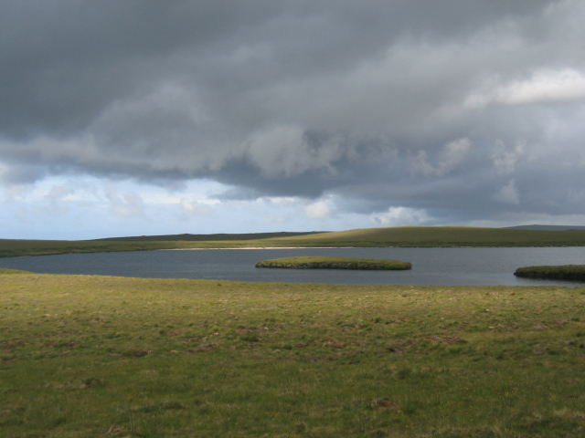
Loch na Faing is a picturesque freshwater loch located in Ross-shire, Scotland. Situated in the scenic Scottish Highlands, this natural water body offers stunning views and a tranquil environment for visitors to enjoy.

Covering an area of approximately 5 hectares, Loch na Faing is a small yet beautiful freshwater lake. The loch is surrounded by rolling hills and green meadows, creating a picturesque setting that attracts nature enthusiasts and photographers alike. Its crystal-clear waters reflect the surrounding landscape, providing a perfect spot for capturing breathtaking photographs.

The loch also serves as a vital habitat for various species of plants and animals. Its calm waters provide a suitable environment for different types of aquatic plants, such as water lilies and reeds, which thrive in its nutrient-rich waters. These plants, in turn, support a diverse range of wildlife, including waterfowl, dragonflies, and various fish species.

Visitors to Loch na Faing can indulge in a range of activities. Fishing enthusiasts can try their luck at catching brown trout, which are known to inhabit the loch. The peaceful surroundings also make it an excellent spot for picnicking, birdwatching, or simply unwinding and taking in the natural beauty.

Access to Loch na Faing is relatively easy, with a parking area nearby and well-maintained walking paths leading to the water's edge. The loch's remote location ensures a sense of tranquility and isolation, making it a hidden gem for those seeking a peaceful escape from the hustle and bustle of everyday life.

In conclusion, Loch na Faing is a small yet captivating freshwater loch in Ross-shire, Scotland. With its stunning scenery, diverse wildlife, and recreational opportunities, it is a must-visit destination for nature lovers and those seeking a serene retreat in the Scottish Highlands.

If you have any feedback on the listing, please let us know in the comments section below.

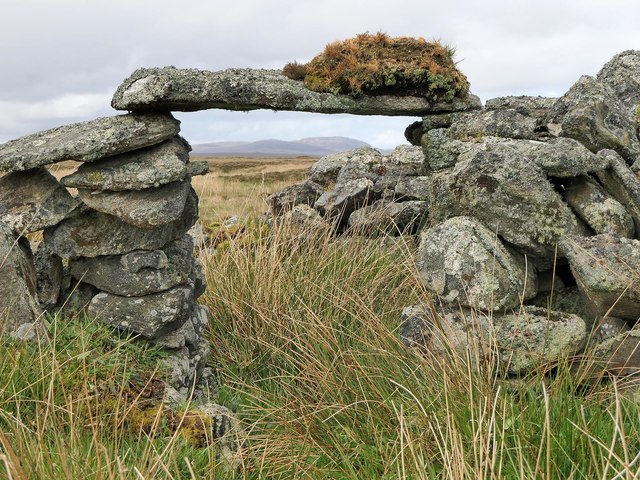
Loch na Faing Images

Images are sourced within 2km of 58.350957/-6.4064278 or Grid Reference NB4248. Thanks to Geograph Open Source API. All images are credited.

Loch an Umhlaich One of the more remote lochs on the Lewis moorland
Loch an Umhlaich
One of the more remote lochs on the Lewis moorland
Loch nan Leac Loch nan Leac on an October afternoon.
Loch nan Leac
Loch nan Leac on an October afternoon.
Loch nan Leac Loch nan Leac on a calm September day.
Loch nan Leac
Loch nan Leac on a calm September day.
Gleann Euscleit, Isle of Lewis The OS Name Book of 1848-1852 says that Gleann Euscleit is the name of the burn, rather than the glen through which it flows. On modern maps it is written in black type, not blue, and so presumably is now considered to be the name of the glen, not the burn.
Gleann Euscleit, Isle of Lewis
The OS Name Book of 1848-1852 says that Gleann Euscleit is the name of the burn, rather than the glen through which it flows. On modern maps it is written in black type, not blue, and so presumably is now considered to be the name of the glen, not the burn.
Shieling hut, Gearraidh Euscleit, Isle of Lewis The 1st Edition OS map, surveyed in 1852, shows there to have been nearly forty shieling huts along this stretch of Gleann Euscleit.  The OS Name Book of 1848-1852 describes them as being "generally in good repair".
Shieling hut, Gearraidh Euscleit, Isle of Lewis
The 1st Edition OS map, surveyed in 1852, shows there to have been nearly forty shieling huts along this stretch of Gleann Euscleit. The OS Name Book of 1848-1852 describes them as being "generally in good repair".
Shieling hut, Gearraidh Euscleit, Isle of Lewis The 1st Edition OS map, surveyed in 1852, shows there to have been nearly forty shieling huts along this stretch of Gleann Euscleit. The OS Name Book of 1848-1852 describes them as being "generally in good repair".
Shieling hut, Gearraidh Euscleit, Isle of Lewis
The 1st Edition OS map, surveyed in 1852, shows there to have been nearly forty shieling huts along this stretch of Gleann Euscleit. The OS Name Book of 1848-1852 describes them as being "generally in good repair".
Gleann Euscleit, Isle of Lewis The OS Name Book of 1848-1852 says that Gleann Euscleit is the name of the burn, rather than the glen through which it flows. On modern maps it is written in black type, not blue, and so presumably is now considered to be the name of the glen, not the burn.
Gleann Euscleit, Isle of Lewis
The OS Name Book of 1848-1852 says that Gleann Euscleit is the name of the burn, rather than the glen through which it flows. On modern maps it is written in black type, not blue, and so presumably is now considered to be the name of the glen, not the burn.
Shieling hut, Gearraidh Euscleit, Isle of Lewis Looking towards Beinn Choinnich and Beinn Bhragair.

The 1st Edition OS map, surveyed in 1852, shows there to have been nearly forty shieling huts along this stretch of Gleann Euscleit. The OS Name Book of 1848-1852 describes them as being "generally in good repair".
Shieling hut, Gearraidh Euscleit, Isle of Lewis
Looking towards Beinn Choinnich and Beinn Bhragair. The 1st Edition OS map, surveyed in 1852, shows there to have been nearly forty shieling huts along this stretch of Gleann Euscleit. The OS Name Book of 1848-1852 describes them as being "generally in good repair".
Shieling hut, Gearraidh Euscleit, Isle of Lewis The 1st Edition OS map, surveyed in 1852, shows there to have been nearly forty shieling huts along this stretch of Gleann Euscleit. The OS Name Book of 1848-1852 describes them as being "generally in good repair".
Shieling hut, Gearraidh Euscleit, Isle of Lewis
The 1st Edition OS map, surveyed in 1852, shows there to have been nearly forty shieling huts along this stretch of Gleann Euscleit. The OS Name Book of 1848-1852 describes them as being "generally in good repair".
Loch nan Leac Reputed to be one of the best trout lochs in the Western Isles this loch is a long hard walk from the road and the moor in this area is extremely dangerous. In truth its fame means that the loch is almost always devoid of fish as they are removed by poaching.
Loch nan Leac
Reputed to be one of the best trout lochs in the Western Isles this loch is a long hard walk from the road and the moor in this area is extremely dangerous. In truth its fame means that the loch is almost always devoid of fish as they are removed by poaching.
Loch nan Leac A 'Leac' is a flat stone which could for example be used for paving. This Loch takes its name from the number of flat stones to be found in the shallows near the shore.
Loch nan Leac
A 'Leac' is a flat stone which could for example be used for paving. This Loch takes its name from the number of flat stones to be found in the shallows near the shore.
Loch na Faing The small Island in this Loch and sandy beach make it one of the more easily identifiable lochs in this relatively featureless landscape.
Loch na Faing
The small Island in this Loch and sandy beach make it one of the more easily identifiable lochs in this relatively featureless landscape.
Loch Alabhat
Loch Alabhat
Stone Age Kitchen at Airigh Allt Skalagro Clear evidence of an organised people who built their own "kitchen cupboards" with the available commodity - stone.
Stone Age Kitchen at Airigh Allt Skalagro
Clear evidence of an organised people who built their own "kitchen cupboards" with the available commodity - stone.
Lochann Sanndabhat Distinctive Lochann because of the peninsula in it in an otherwise generally flat landscape. Muirneag at 248m can be seen in the distance.
Lochann Sanndabhat
Distinctive Lochann because of the peninsula in it in an otherwise generally flat landscape. Muirneag at 248m can be seen in the distance.
Show me another place!

Loch na Faing is located at Grid Ref: NB4248 (Lat: 58.350957, Lng: -6.4064278)

Unitary Authority: Na h-Eileanan an Iar

Police Authority: Highlands and Islands

What 3 Words

///rare.clearly.clearcut. Near North Tolsta, Na h-Eileanan Siar

Related Wikis

Steinacleit

Steinacleit is a prehistoric archeological site on the west coast of Lewis in the Outer Hebrides of Scotland. The site consists of an array of boulders...

Barvas

Barvas (Scottish Gaelic: Barabhas or Barbhas, pronounced [baravəs]) is a settlement, community and civil parish on the Isle of Lewis in Scotland. It developed...

Baile an Truiseil

Ballantrushal (Scottish Gaelic: Baile an Truiseil) is a village on the Isle of Lewis in the West Side district, in the Outer Hebrides, Scotland. Ballantrushal...

West Side, Lewis

The West Side (Scottish Gaelic: An Taobh Siar) is the name used for the (predominantly Gaelic-speaking) settlements along the NW coast of the Isle of Lewis...

Have you been to Loch na Faing?

Leave your review of Loch na Faing below (or comments, questions and feedback).