Loch Dubh

Lake, Pool, Pond, Freshwater Marsh in Ross-shire

Scotland

Loch Dubh

Loch na Buaile Duibhe The sea can just be seen in the distance.
Loch na Buaile Duibhe Credit: Rob Burke

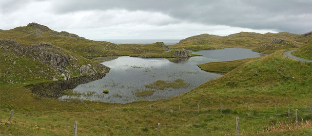
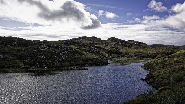
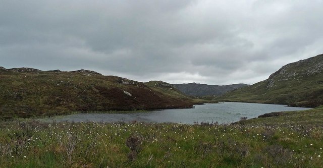
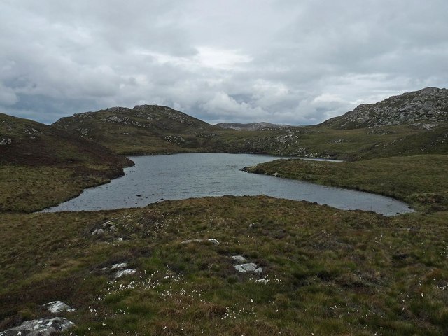
Loch Dubh, located in Ross-shire, Scotland, is a stunning freshwater loch nestled amidst the picturesque landscape of the Scottish Highlands. This tranquil body of water is often referred to as a loch due to its size and characteristics, covering an area of approximately 50 hectares.

Surrounded by rolling hills and dense forests, Loch Dubh offers a breathtaking view for visitors. Its calm waters reflect the natural beauty of the surrounding landscape, creating a serene and peaceful atmosphere. The loch is known for its dark, peaty water, which gives it its name, "Dubh," meaning black in Scottish Gaelic.

Loch Dubh supports a rich and diverse ecosystem. Its shores are lined with a variety of vegetation, including reeds, rushes, and water lilies. These provide an ideal habitat for numerous species of birds, such as swans, ducks, and herons, making it a popular spot for birdwatchers.

The loch is also home to various species of fish, including brown trout, perch, and pike. Anglers are drawn to Loch Dubh for its excellent fishing opportunities, with the calm waters providing an ideal environment for casting a line.

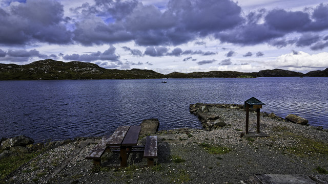
Visitors to Loch Dubh can enjoy a range of recreational activities. Fishing, boating, and kayaking are popular pastimes on the loch, allowing visitors to explore its tranquil waters and immerse themselves in the stunning natural surroundings. Additionally, the loch offers several walking trails, enabling hikers to experience the beauty of the area up close.

Overall, Loch Dubh is a hidden gem in the Scottish Highlands, offering a peaceful retreat for nature enthusiasts and an opportunity to experience the beauty of Scotland's freshwater ecosystems.

If you have any feedback on the listing, please let us know in the comments section below.
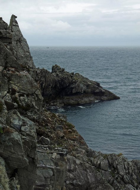
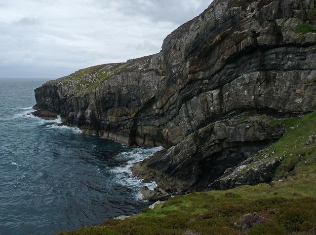
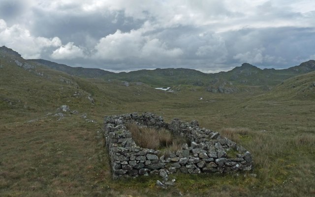
Loch Dubh Images

Images are sourced within 2km of 58.06782/-6.3835129 or Grid Reference NB4117. Thanks to Geograph Open Source API. All images are credited.

Loch na Buaile Duibhe The sea can just be seen in the distance.
Loch na Buaile Duibhe
The sea can just be seen in the distance.
Telephone Box, Marvig (Marbhig) In case you don't recognize the classic bright red K6 telephone box for what it is, there is a splendid enamelled sign with a wrought iron frame to make sure you do !
Telephone Box, Marvig (Marbhig)
In case you don't recognize the classic bright red K6 telephone box for what it is, there is a splendid enamelled sign with a wrought iron frame to make sure you do !
Islet with purple flowers I thought at first that the purple flowers adding a dash of colour to this tiny islet in the middle of Loch a' Ghruagaich just south of Marvig (Marbhig) were rhododendrons - but on closer inspection I'm not so sure. They almost look like giant heather ... [Edit] Now confirmed - they are heather ... very healthy specimens !
Islet with purple flowers
I thought at first that the purple flowers adding a dash of colour to this tiny islet in the middle of Loch a' Ghruagaich just south of Marvig (Marbhig) were rhododendrons - but on closer inspection I'm not so sure. They almost look like giant heather ... [Edit] Now confirmed - they are heather ... very healthy specimens !
Mol nam Braithrean Looking towards the South Entrance of Loch Marvig. "Mol" is Gaelic for shingle and "braithrean" is brothers. People in the village talk of "going for a walk to the mol".
Mol nam Braithrean
Looking towards the South Entrance of Loch Marvig. "Mol" is Gaelic for shingle and "braithrean" is brothers. People in the village talk of "going for a walk to the mol".
Branch of Loch nam Faoileag
Ruins above Calbost
Ruins above Calbost
Loch na Buaile Duibhe
Bench and pier on Loch Chaitiosbhal
West boundary of Marvig at Loch Caitiosbhal
Loch side road outside Marvig
Cairn, Sidhean Rubha na Creige Mòire, Isle of Lewis Under the cairn is an OS bolt.  It is marked with the triangulation pillar symbol on the OS 1:25,000 map, but is not shown on the 1:50,000.
Cairn, Sidhean Rubha na Creige Mòire, Isle of Lewis
Under the cairn is an OS bolt. It is marked with the triangulation pillar symbol on the OS 1:25,000 map, but is not shown on the 1:50,000.
Coastline, Rubha na Creige Mòire, Isle of Lewis Looking along the east coast of Lewis as far as the Raerinis peninsula.
Coastline, Rubha na Creige Mòire, Isle of Lewis
Looking along the east coast of Lewis as far as the Raerinis peninsula.
Loch Lite Sithinn, Isle of Lewis The OS Name Book of 1848-1852 describes the loch as, "A long narrow fresh water loch about 16 chains long by three wide, which receives two small streams on the north and discharges one on the south into Loch Odhairn".
Loch Lite Sithinn, Isle of Lewis
The OS Name Book of 1848-1852 describes the loch as, "A long narrow fresh water loch about 16 chains long by three wide, which receives two small streams on the north and discharges one on the south into Loch Odhairn".
Coastline to the north of Mol an Eich, Isle of Lewis Maybe not so clear in the photo, but the rock on the skyline has the appearance of a horse looking out to sea.
Coastline to the north of Mol an Eich, Isle of Lewis
Maybe not so clear in the photo, but the rock on the skyline has the appearance of a horse looking out to sea.
Rubha Iosal, Isle of Lewis The OS Name Book of 1848-1852 describes Rubha Iosal as, "A tolerably prominent headland of considerable extent, embracing the whole of the rugged district between Camas Chalaboist and Loch Odhairn".
Rubha Iosal, Isle of Lewis
The OS Name Book of 1848-1852 describes Rubha Iosal as, "A tolerably prominent headland of considerable extent, embracing the whole of the rugged district between Camas Chalaboist and Loch Odhairn".
Ruined farmstead below Sidhean Rubha na Creige Mòire, Isle of Lewis The island in <a href="https://www.geograph.org.uk/photo/926371">NB4118 : Loch na Buaile Duibhe</a> can just be seen in the distance.
Ruined farmstead below Sidhean Rubha na Creige Mòire, Isle of Lewis
The island in NB4118 : Loch na Buaile Duibhe can just be seen in the distance.
Cotton grass on the southern slopes of Druim nan Caorach, Isle of Lewis The OS Name Book of 1848-1852 describes Druim nan Caorach as, "a large, low range of rocky, heathy pasture knolls which are dry and afford tolerably good summer pasturage.  Signifies Sheep Eminence".
Cotton grass on the southern slopes of Druim nan Caorach, Isle of Lewis
The OS Name Book of 1848-1852 describes Druim nan Caorach as, "a large, low range of rocky, heathy pasture knolls which are dry and afford tolerably good summer pasturage. Signifies Sheep Eminence".
Loch na h-Airigh, Isle of Lewis The name of the loch means "Shieling Loch".
Loch na h-Airigh, Isle of Lewis
The name of the loch means "Shieling Loch".
Show me another place!

Loch Dubh is located at Grid Ref: NB4117 (Lat: 58.06782, Lng: -6.3835129)

Unitary Authority: Na h-Eileanan an Iar

Police Authority: Highlands and Islands

What 3 Words

///brotherly.giggle.public. Near Leurbost, Na h-Eileanan Siar

Related Wikis

Calbost

Calbost (Scottish Gaelic: Calabost) is a village on the Isle of Lewis in the Outer Hebrides, Scotland. Calbost is within the parish of Lochs, and within...

Gravir

Gravir (Scottish Gaelic: Grabhair), is a village on the shore of Loch Odhairn (a sea loch) in the Park district of the Isle of Lewis. Gravir is within...

Cromore

Cromore (Scottish Gaelic: Crò Mòr) is a crofting township on the Isle of Lewis in the district of Pairc, in the Outer Hebrides, Scotland. The settlement...

Eilean Chaluim Chille

Eilean Chaluim Chille (Gaelic: island of Saint Columba, Calum Cille) is an unpopulated island in the Outer Hebrides. It lies off the east coast of Lewis...

Nearby Amenities

Located within 500m of 58.06782,-6.3835129
Created By: dmgroom_coastlines
Lat/Long: 58.06996/-6.37798
Created By: dmgroom_coastlines
Lat/Long: 58.06946/-6.37826
Bus Stop
Calbost
Bus: yes
Naptan AtcoCode: 6010731579
Naptan Bearing: N
Naptan BusStopType: CUS
Naptan CommonName: Calbost
Naptan Indicator: Village
Naptan Landmark: Road junction with shore road
Naptan NaptanCode: 94723726
Naptan Street: Village
Naptan Verified: no
Source: naptan_import
Lat/Long: 58.0689659/-6.3884054
Passing Place
Lat/Long: 58.070831/-6.3885047
Passing Place
Lat/Long: 58.0680903/-6.3888225
Passing Place
Lat/Long: 58.0691715/-6.3875715
Passing Place
Lat/Long: 58.0678707/-6.3872639
Turning Circle
Lat/Long: 58.0661411/-6.3829413
Calabost
Name En: Calbost
Name Gd: Calabost
Place: village
Wikidata: Q3776615
Wikipedia: en:Calbost
Lat/Long: 58.0690282/-6.3878198
Barrier: cattle_grid
Lat/Long: 58.0668512/-6.3908262
Passing Place
Lat/Long: 58.0668412/-6.3903448
Power: pole
Lat/Long: 58.0666736/-6.3916917
Power: pole
Lat/Long: 58.0667294/-6.3907805
Power: pole
Lat/Long: 58.0667634/-6.3897586
Power: pole
Lat/Long: 58.0671834/-6.3892558
Power: pole
Lat/Long: 58.0675314/-6.3888373
Power: pole
Lat/Long: 58.0703154/-6.3889283
Power: pole
Lat/Long: 58.0694826/-6.3885963
Power: pole
Lat/Long: 58.0689292/-6.3883822
Power: pole
Lat/Long: 58.0685218/-6.3882149
Power: pole
Lat/Long: 58.0680822/-6.3878074
Power: pole
Lat/Long: 58.067612/-6.3874499
Power: pole
Lat/Long: 58.0671873/-6.3871392
Power: pole
Lat/Long: 58.0668837/-6.386222
Power: pole
Lat/Long: 58.0666072/-6.385337
Power: pole
Lat/Long: 58.066317/-6.3844299
Power: pole
Lat/Long: 58.0661191/-6.3834151
Power: pole
Lat/Long: 58.0659934/-6.3826178
Power: pole
Lat/Long: 58.0661327/-6.3818548
Power: pole
Lat/Long: 58.0662253/-6.3814738
Power: pole
Lat/Long: 58.068049/-6.3884314
Power: pole
Lat/Long: 58.0695433/-6.3859357
Power: pole
Lat/Long: 58.0697227/-6.3865245
Power: pole
Lat/Long: 58.0693929/-6.3854784
Power: pole
Lat/Long: 58.069207/-6.3848078
Power: pole
Lat/Long: 58.0696411/-6.3872674
Power: pole
Lat/Long: 58.0695756/-6.3877858
Power: pole
Lat/Long: 58.0689127/-6.3867179
Power: pole
Lat/Long: 58.0685588/-6.386439
Power: pole
Lat/Long: 58.0692809/-6.3869928
Power: pole
Lat/Long: 58.0685366/-6.3880591
Power: pole
Lat/Long: 58.0702687/-6.3880834
Power: pole
Lat/Long: 58.0701002/-6.3876165
Power: pole
Lat/Long: 58.0705438/-6.3884708
Natural: rock
Lat/Long: 58.0689436/-6.3835395
Passing Place
Lat/Long: 58.0670998/-6.3867325
The data included in this document is from www.openstreetmap.org. The data is made available under ODbL.

Have you been to Loch Dubh?

Leave your review of Loch Dubh below (or comments, questions and feedback).