Lochan Dubh

Lake, Pool, Pond, Freshwater Marsh in Argyllshire

Scotland

Lochan Dubh

Down the Allt na h-Uamha Here the Allt na h-Uamha joins with another small stream, flowing out of Coire nan Grunnd. It then heads down the steep hill towards the coast, crossing the Dibidil path.
Down the Allt na h-Uamha Credit: Craig Wallace

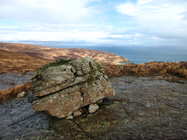
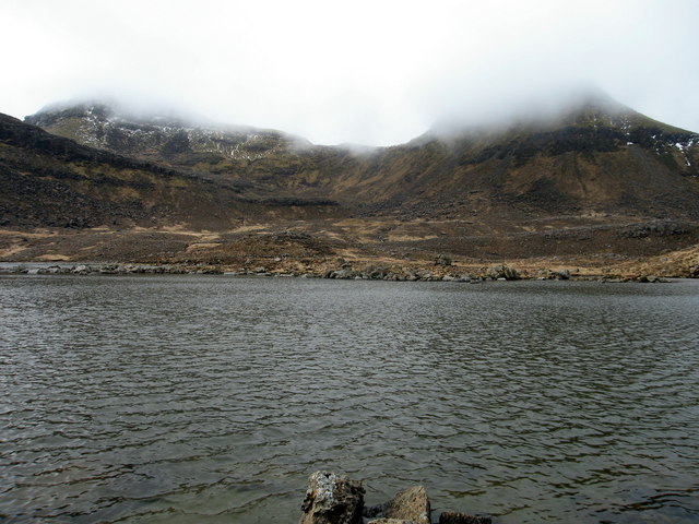
Lochan Dubh, located in Argyllshire, Scotland, is a small freshwater loch nestled amidst picturesque landscapes. With its serene surroundings, it attracts nature enthusiasts and visitors seeking tranquility. The loch is characterized by its calm and crystal-clear waters, which reflect the surrounding hills and vegetation.

Covering an area of approximately 10 acres, Lochan Dubh offers a peaceful retreat for both locals and tourists alike. The loch's depth varies, with some sections reaching up to 10 meters, providing a habitat for a diverse range of aquatic flora and fauna. Lush reeds and water lilies adorn the edges of the loch, creating a vibrant and colorful atmosphere.

The loch is home to various species of fish, including brown trout and perch, making it a popular spot for fishing enthusiasts. Anglers can be seen casting their lines from the shores or in small boats, enjoying the tranquility and hoping for a successful catch.

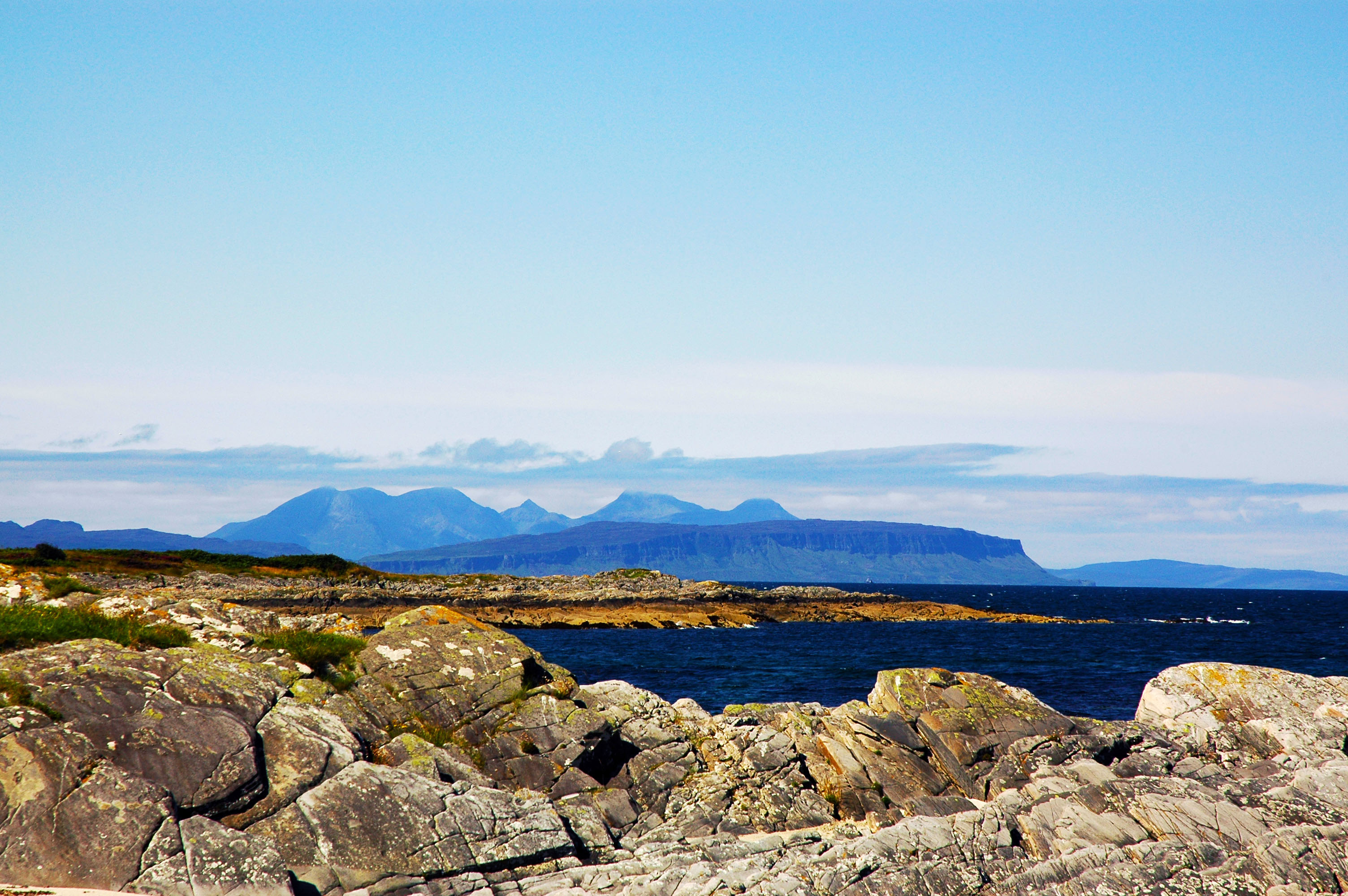
Surrounded by rolling hills, Lochan Dubh offers stunning panoramic views, particularly during the golden hours of sunrise and sunset when the loch's surface reflects an array of vibrant colors. The area also boasts a rich birdlife, attracting birdwatchers who can spot species such as herons, ducks, and swans.

For those seeking a peaceful stroll, there are walking trails around the loch, providing opportunities to explore the surrounding natural beauty. Lochan Dubh truly encompasses the essence of a peaceful and idyllic Scottish loch, offering visitors a chance to connect with nature and unwind in its serene environment.

If you have any feedback on the listing, please let us know in the comments section below.

Lochan Dubh Images

Images are sourced within 2km of 56.976223/-6.2546334 or Grid Reference NM4195. Thanks to Geograph Open Source API. All images are credited.

Down the Allt na h-Uamha Here the Allt na h-Uamha joins with another small stream, flowing out of Coire nan Grunnd. It then heads down the steep hill towards the coast, crossing the Dibidil path.
Down the Allt na h-Uamha
Here the Allt na h-Uamha joins with another small stream, flowing out of Coire nan Grunnd. It then heads down the steep hill towards the coast, crossing the Dibidil path.
Boulder, Fearann Làimhrig There are a number of large rocks on the slopes of Fearann Làimhrig.

Good views looking over the coast at Bàgh na h-Uamha.
Boulder, Fearann Làimhrig
There are a number of large rocks on the slopes of Fearann Làimhrig. Good views looking over the coast at Bàgh na h-Uamha.
Loch Coire nan Grunnd
Coire nan Grunnd from Hallival
Askival and Allt na h-Uamha A view from the path to Dibidil.

Isle of Rum field trip 1983
Pictures I took a long time ago during a week spent on the island. I didn’t record the locations of the shots and while some are obvious, others have taken a bit of time with maps, Google Earth and other Geographs in order to place them.
I am fairly confident I have done it successfully, but if you know the island and can see I have got something wrong then please let me know the details and I will correct it.
Askival and Allt na h-Uamha
A view from the path to Dibidil. Isle of Rum field trip 1983 Pictures I took a long time ago during a week spent on the island. I didn’t record the locations of the shots and while some are obvious, others have taken a bit of time with maps, Google Earth and other Geographs in order to place them. I am fairly confident I have done it successfully, but if you know the island and can see I have got something wrong then please let me know the details and I will correct it.
Askival from the Dibidil path Dibidil-Kinloch path passing below Askival, Rum's highest peak. Approaching the Allt na h-Uamha.
Askival from the Dibidil path
Dibidil-Kinloch path passing below Askival, Rum's highest peak. Approaching the Allt na h-Uamha.
Allt nam Ba Waterfall where the burn running off the Cuillin encounters a ravine along the course of a dyke. The softer shattered dyke rock has been preferentially eroded leaving a deep slot in the surrounding gabbro. Eigg lies offshore.
Warning! This is not typical Rum weather.
Allt nam Ba
Waterfall where the burn running off the Cuillin encounters a ravine along the course of a dyke. The softer shattered dyke rock has been preferentially eroded leaving a deep slot in the surrounding gabbro. Eigg lies offshore. Warning! This is not typical Rum weather.
Stone at Bagh na h-Uamha  inscribed with Cross The stone was discovered on the beach head in 1977.  It is believed to date from the 5th Century and is probably of Viking origin.
Stone at Bagh na h-Uamha inscribed with Cross
The stone was discovered on the beach head in 1977. It is believed to date from the 5th Century and is probably of Viking origin.
Waterfall on South Coast of Rum Large waterfall in box canyon of South Coast of Rum.
Waterfall on South Coast of Rum
Large waterfall in box canyon of South Coast of Rum.
Ruined houses at Laimhrig A collection of three houses at Laimhrig (landing place), abandoned when the owner of Rum forced 300 people to leave in 1826 to make way for sheep. Until the early 19th century, the use of high or remote pastures during the summer months was an important part of the farming calendar and  cluster of small huts such as these signify sites of these 'shielings'. View over to Eigg.
Ruined houses at Laimhrig
A collection of three houses at Laimhrig (landing place), abandoned when the owner of Rum forced 300 people to leave in 1826 to make way for sheep. Until the early 19th century, the use of high or remote pastures during the summer months was an important part of the farming calendar and cluster of small huts such as these signify sites of these 'shielings'. View over to Eigg.
Erratic Glacial action is evident all over Rum. View over to the Sound Of Rum
Erratic
Glacial action is evident all over Rum. View over to the Sound Of Rum
Burn on the Kinloch to Dibidil path Plenty of blanket bog in this area ensuring interesting walking off the track.
Burn on the Kinloch to Dibidil path
Plenty of blanket bog in this area ensuring interesting walking off the track.
Burn crossing the Kinloch to Dibidil track Plenty of blanket bog in this area ensuring interesting walking off the track.
Burn crossing the Kinloch to Dibidil track
Plenty of blanket bog in this area ensuring interesting walking off the track.
Loch Coire nan Grunnd, Rum Peaks of Askival (left) and Hallival (right) not quite visible through the mist.
Loch Coire nan Grunnd, Rum
Peaks of Askival (left) and Hallival (right) not quite visible through the mist.
Standing Stone? At Fearann Laimhrige, Rum. Not marked on map as a standing stone but looked like one. Was very much off the beaten track!
Standing Stone?
At Fearann Laimhrige, Rum. Not marked on map as a standing stone but looked like one. Was very much off the beaten track!
Mountain Pool Next to Loch Coire nan Grunnd, Rum.
Mountain Pool
Next to Loch Coire nan Grunnd, Rum.
Allt na h-Uamha The wide bowl below the viewpoint is drained by the Allt na h-Uamha, which enters the sea close to the Allt Mor na h-Uamha. On the skyline is Askival, with cloud just beginning to descend on it, and the peak in the centre is Clough's Crag.
Allt na h-Uamha
The wide bowl below the viewpoint is drained by the Allt na h-Uamha, which enters the sea close to the Allt Mor na h-Uamha. On the skyline is Askival, with cloud just beginning to descend on it, and the peak in the centre is Clough's Crag.
Allt na h-Uamha The lower part of the bowl of the Allt na h-Uamha, seen in gathering gloom as the clouds gather over Rum. In the distance is the Isle of Eigg.
Allt na h-Uamha
The lower part of the bowl of the Allt na h-Uamha, seen in gathering gloom as the clouds gather over Rum. In the distance is the Isle of Eigg.
Show me another place!

Lochan Dubh is located at Grid Ref: NM4195 (Lat: 56.976223, Lng: -6.2546334)

Unitary Authority: Highland

Police Authority: Highlands and Islands

What 3 Words

///buns.harp.hardening. Near Elgol, Highland

Nearby Locations

Lochan Dubh

Related Wikis

Small Isles

The Small Isles (Scottish Gaelic: Na h-Eileanan Tarsainn) are a small archipelago of islands in the Inner Hebrides, off the west coast of Scotland. They...

Askival

Askival is the highest mountain on the island of Rùm, in the Inner Hebrides of Scotland. It is located 5 kilometres (3.1 mi) south of Kinloch, the main...

Trollabhal

Trollabhal (also known as Trallval) (702 m) is a mountain in the island of Rùm in Lochaber, Scotland. Although the lowest of the 'Rum Cuillin' in the south...

Ainshval

Ainshval is the second highest mountain on the island of Rùm, in the Inner Hebrides of Scotland, after Askival. It is part of the Rùm Cuillin, a range...

Nearby Amenities

Located within 500m of 56.976223,-6.2546334
Welshman's Rock
Place: locality
Lat/Long: 56.9729635/-6.253192
The data included in this document is from www.openstreetmap.org. The data is made available under ODbL.

Have you been to Lochan Dubh?

Leave your review of Lochan Dubh below (or comments, questions and feedback).