Allt Pairc a' Gheamhraidh

Lake, Pool, Pond, Freshwater Marsh in Argyllshire

Scotland

Allt Pairc a' Gheamhraidh

Views towards Coil A Ghuail
Views towards Coil A Ghuail Credit: thejackrustles

Allt Pairc a' Gheamhraidh is a freshwater marsh located in Argyllshire, Scotland. It is a picturesque landscape feature that encompasses a lake, pool, pond, and marsh, making it a diverse and ecologically rich area.

The lake within Allt Pairc a' Gheamhraidh is a large body of water, fed by streams and springs, which provides a habitat for various aquatic plants and animals. It is surrounded by lush vegetation, including reeds, cattails, and water lilies, creating a vibrant and colorful environment. The lake is also home to a variety of fish species, such as trout and perch, which attract anglers and fishing enthusiasts.

Adjacent to the lake is a smaller pool, which is a shallower body of water. This pool is often teeming with smaller aquatic creatures, such as tadpoles, frogs, and various invertebrates. It serves as a breeding ground and nursery for many species, contributing to the overall biodiversity of the area.

The pond within Allt Pairc a' Gheamhraidh is a smaller, more secluded water feature. It is usually surrounded by dense vegetation, providing a haven for waterfowl and other bird species. The pond is an important stopover point for migratory birds, offering them a place to rest and refuel during their long journeys.

The freshwater marsh is a wetland area characterized by its waterlogged soil and abundance of grasses and sedges. It acts as a natural filter, helping to purify water and supporting a range of plant and animal life. The marsh is home to various bird species, including ducks, herons, and egrets, which nest and forage among the tall grasses.

Overall, Allt Pairc a' Gheamhraidh is a diverse and important ecosystem, providing a habitat for a wide range of plant and animal species. It offers visitors a unique opportunity to observe and appreciate the

If you have any feedback on the listing, please let us know in the comments section below.

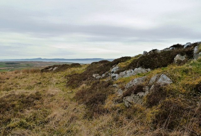
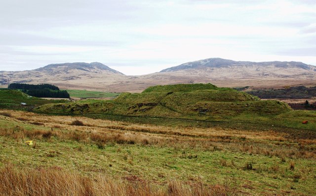
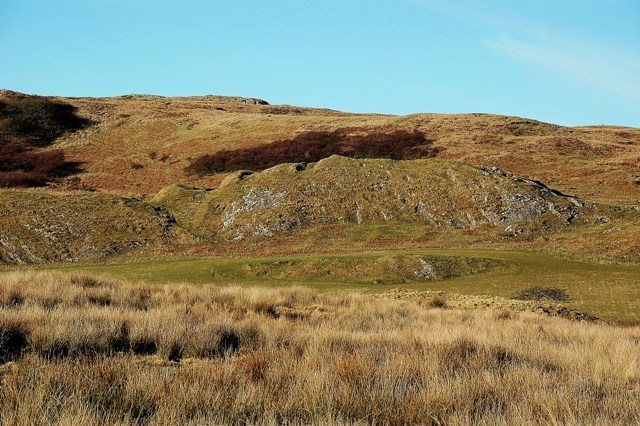
Allt Pairc a' Gheamhraidh Images

Images are sourced within 2km of 55.76041/-6.1774961 or Grid Reference NR3859. Thanks to Geograph Open Source API. All images are credited.

Views towards Coil A Ghuail
Coil A Ghuail Trigpoint Flush Bracket S9007
Dun Nosebridge Fort
Dun Nosebridge Fort
Rough grazing, Barr The fields give way to very wet moorland.
Rough grazing, Barr
The fields give way to very wet moorland.
The Glen Road, Catterdale
Dun Nosebridge fort This iron age fort is a little out of the way, but if you are interested in history it is well worth a visit.
Dun Nosebridge fort
This iron age fort is a little out of the way, but if you are interested in history it is well worth a visit.
From Creag Mhòr Looking towards Loch Indaal on a dullish April morning.
From Creag Mhòr
Looking towards Loch Indaal on a dullish April morning.
Dun Nosebridge Fort This large fort was defended by steep cliffs on the south-east side supplemented by ramparts and ditches elsewhere.  It’s still a prominent and fascinating site. The name probably comes from the Norse “Knausborg”, meaning “the fort on the crag” but the site is much older, dating back to the Iron Age. This shot was taken on a dullish April day - I'll just have to go back!
Dun Nosebridge Fort
This large fort was defended by steep cliffs on the south-east side supplemented by ramparts and ditches elsewhere. It’s still a prominent and fascinating site. The name probably comes from the Norse “Knausborg”, meaning “the fort on the crag” but the site is much older, dating back to the Iron Age. This shot was taken on a dullish April day - I'll just have to go back!
View from the bridge at Cattadale Cattadale River below.
View from the bridge at Cattadale
Cattadale River below.
View across the moors from Cattadale Towards Glas Bheinn.
View across the moors from Cattadale
Towards Glas Bheinn.
Cattadale
Cattadale
Edge of the moorland
View from, and including the rim of the Iron Age fort at Dun Nosebridge. Looking towards Bowmore from the Iron Age fort at Dun Nosebridge.
View from, and including the rim of the Iron Age fort at Dun Nosebridge.
Looking towards Bowmore from the Iron Age fort at Dun Nosebridge.
Cattadale Sunset The last sunshine of the day, giving a lovely rosy glow to this view.
Cattadale Sunset
The last sunshine of the day, giving a lovely rosy glow to this view.
Grazing Land Sheep grazing on improved pasture near Cattadale, with one of the snow-topped Paps of Jura in the far distance.
Grazing Land
Sheep grazing on improved pasture near Cattadale, with one of the snow-topped Paps of Jura in the far distance.
Dun Nosebridge Fort Viewed from outside the square, this fort was built during the Iron Age, 600BC-AD400.  The ramparts and ditches are visible on the left-hand side of this shot.  The name "Nosebridge" originates in old Norse language.  (Source: "Islay" by Norman S Newton).
Dun Nosebridge Fort
Viewed from outside the square, this fort was built during the Iron Age, 600BC-AD400. The ramparts and ditches are visible on the left-hand side of this shot. The name "Nosebridge" originates in old Norse language. (Source: "Islay" by Norman S Newton).
Oddly unparallel lines in the countryside The drystone dyke, ruined farm outbuilding, near and far horizons all form quasi-linear shapes which are not quite parallel, thus giving the viewer a wobbly sense.
Oddly unparallel lines in the countryside
The drystone dyke, ruined farm outbuilding, near and far horizons all form quasi-linear shapes which are not quite parallel, thus giving the viewer a wobbly sense.
Trigpoint, Cnoc Donn, Islay
Show me another place!

Allt Pairc a' Gheamhraidh is located at Grid Ref: NR3859 (Lat: 55.76041, Lng: -6.1774961)

Unitary Authority: Argyll and Bute

Police Authority: Argyll and West Dunbartonshire

What 3 Words

///whimpered.paraded.inclined. Near Bridgend, Argyll & Bute

Related Wikis

Dun Nosebridge

Dun Nosebridge is an Iron Age fort southeast of Bridgend, Islay, Scotland. The fort is on the right bank of the River Laggan.The name's origin is probably...

Mulindry House

Mulindry House, also known as Caisteal Mhic Dhomhnuill or Mullintrae House, was a fortified house north of Mulindry Farm, Islay, Scotland. == History... ==

Islay

Islay ( EYE-lə; Scottish Gaelic: Ìle, Scots: Ila) is the southernmost island of the Inner Hebrides of Scotland. Known as "The Queen of the Hebrides",...

Dun Bhruichlinn

Dun Bhruichlinn is an Iron Age fort south of Esknish, Islay, Scotland. The fort, or dun is circular with an internal diameter of 16 metres and the walls...

Nearby Amenities

Located within 500m of 55.76041,-6.1774961
Power: pole
Lat/Long: 55.7595261/-6.1838627
Power: pole
Lat/Long: 55.7612393/-6.1791274
Power: pole
Lat/Long: 55.7625633/-6.173884
Power: pole
Lat/Long: 55.7628625/-6.1725432
Power: pole
Lat/Long: 55.7590974/-6.1850365
Power: pole
Lat/Long: 55.7599572/-6.182671
Power: pole
Lat/Long: 55.7603836/-6.1814925
Power: pole
Lat/Long: 55.760815/-6.1803002
Power: pole
Lat/Long: 55.7618529/-6.1770915
Power: pole
Lat/Long: 55.7616439/-6.1780478
Power: pole
Lat/Long: 55.7620908/-6.1760171
Power: pole
Lat/Long: 55.7623194/-6.1749851
Power: pole
Lat/Long: 55.7629876/-6.1711498
The data included in this document is from www.openstreetmap.org. The data is made available under ODbL.

Have you been to Allt Pairc a' Gheamhraidh?

Leave your review of Allt Pairc a' Gheamhraidh below (or comments, questions and feedback).