Loch Beag na Craoibhe

Lake, Pool, Pond, Freshwater Marsh in Ross-shire

Scotland

Loch Beag na Craoibhe

A Forest of Power Lines I know they are necessary, but there seem to be an enormous number of power lines marching across the landscape here.
A Forest of Power Lines Credit: Anne Burgess

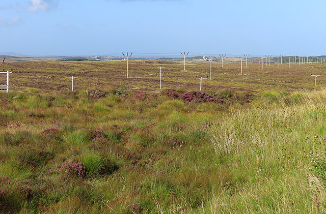
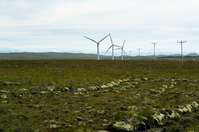
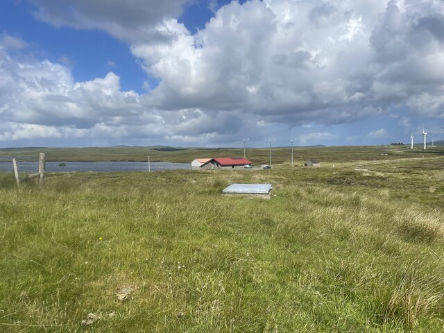
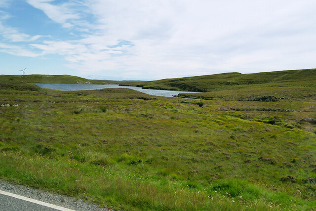
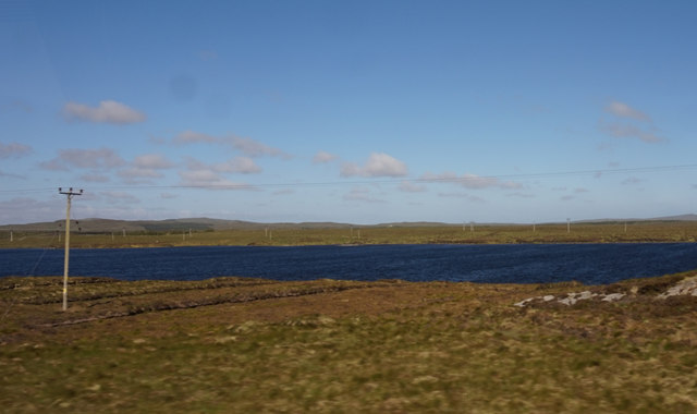
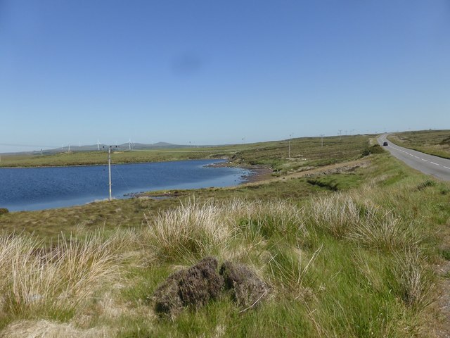
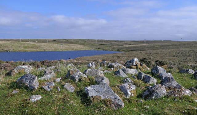
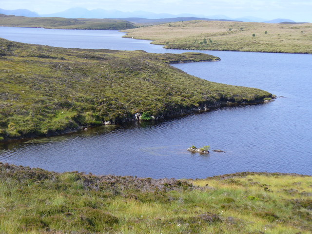
Loch Beag na Craoibhe, located in Ross-shire, Scotland, is a small freshwater body encompassing the characteristics of a lake, pool, pond, and freshwater marsh. Nestled amidst the picturesque Scottish Highlands, this natural gem covers an approximate area of 10 acres.

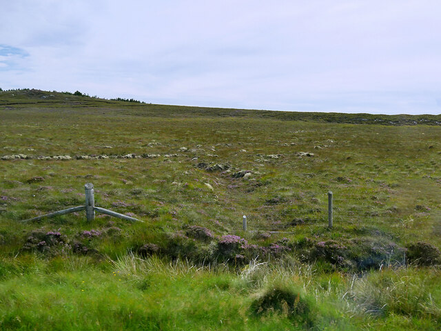
The loch is surrounded by lush greenery, with dense vegetation and trees providing a serene ambiance. Its calm, crystal-clear waters reflect the stunning landscape, offering a breathtaking view. Loch Beag na Craoibhe is fed by several streams and springs, ensuring a consistent water supply throughout the year.

The diverse ecosystem of the loch supports a wide range of flora and fauna. The marshy areas around the water's edge are home to various aquatic plants such as water lilies, reeds, and rushes. These plants provide crucial habitats for insects, amphibians, and birds.

Birdwatchers frequent the area, as the loch attracts a plethora of avian species. From majestic swans gliding gracefully on the water's surface to diving ducks and wading birds, Loch Beag na Craoibhe offers a haven for bird enthusiasts.

The loch also hosts a variety of fish species, including brown trout and pike, providing an opportunity for recreational fishing. Anglers can enjoy the tranquility and challenge of casting their lines in hopes of catching a prized fish.

Overall, Loch Beag na Craoibhe is a haven of natural beauty and biodiversity. Its stunning landscape, diverse flora and fauna, and recreational activities make it an appealing destination for nature lovers, photographers, and those seeking a peaceful retreat amidst the captivating Scottish Highlands.

If you have any feedback on the listing, please let us know in the comments section below.

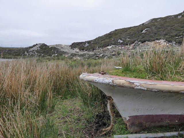
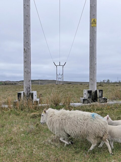
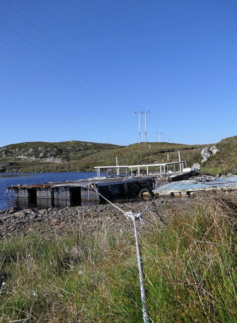
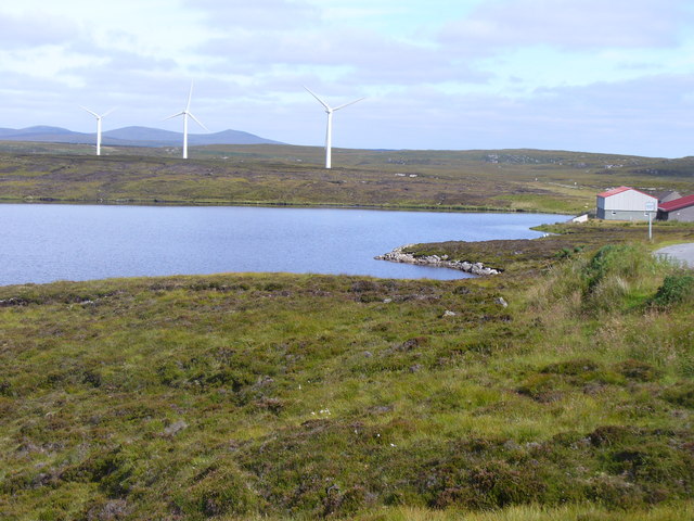
Loch Beag na Craoibhe Images

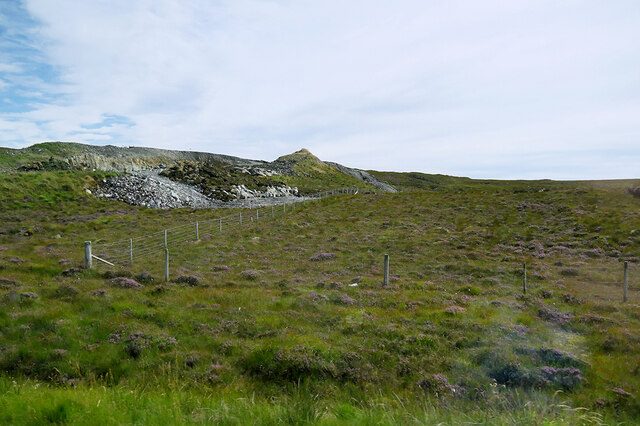
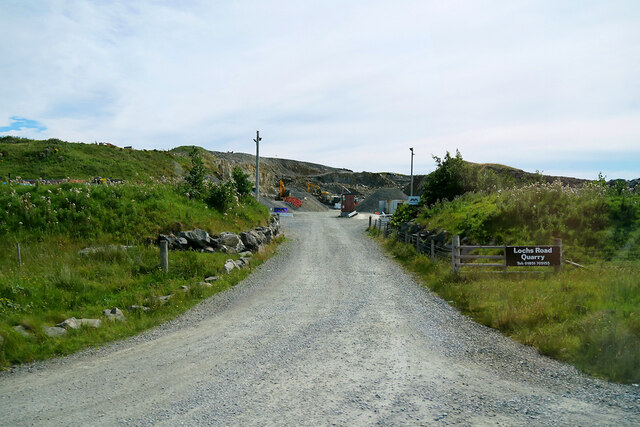
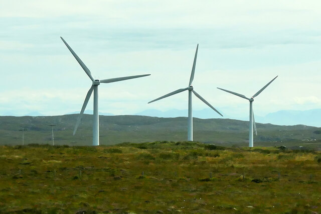
Images are sourced within 2km of 58.174721/-6.4610313 or Grid Reference NB3729. Thanks to Geograph Open Source API. All images are credited.

A Forest of Power Lines I know they are necessary, but there seem to be an enormous number of power lines marching across the landscape here.
A Forest of Power Lines
I know they are necessary, but there seem to be an enormous number of power lines marching across the landscape here.
View towards the Arnish Moor Turbines Looking towards the three turbines of the Arnish Moor Wind Farm.
View towards the Arnish Moor Turbines
Looking towards the three turbines of the Arnish Moor Wind Farm.
Water Works at the lochside Geocaching is a type of global treasure hunt of people looking for caches, or hidden stashes of objects. Geocaching may also be described as a series of hide-and-seek games, where hiders provide online clues for seekers. Seekers use global positioning system (GPS) devices to find hidden caches
Water Works at the lochside
Geocaching is a type of global treasure hunt of people looking for caches, or hidden stashes of objects. Geocaching may also be described as a series of hide-and-seek games, where hiders provide online clues for seekers. Seekers use global positioning system (GPS) devices to find hidden caches
Moorland near Cnoc Dubh
Stone Workings, Lochs Quarry
Entrance to Lochs Road Quarry
View across the moor towards Loch Beag na Craoibhe
Arnish Moor Wind Farm The three wind turbines on Arnish Moor.
Arnish Moor Wind Farm
The three wind turbines on Arnish Moor.
Loch Breugach Taken from the A859.
Loch Breugach
Taken from the A859.
The northern end of Loch Breugach, next to the A859
Boat by an unnamed lochan to the north of Loch Leiniscal, Isle of Lewis The track on which the sheep are standing was relatively new at the time the photo was taken and provides access to overhead power lines.
Boat by an unnamed lochan to the north of Loch Leiniscal, Isle of Lewis
The track on which the sheep are standing was relatively new at the time the photo was taken and provides access to overhead power lines.
Power lines to the west of Loch Breugach, Isle of Lewis Another one for the nosy sheep collection.
Power lines to the west of Loch Breugach, Isle of Lewis
Another one for the nosy sheep collection.
Remains of a shieling hut, Cnoc Iaruinn, Isle of Lewis Shielings were moorland summer grazings for cattle.  Shieling huts (often also referred to as shielings) were dwellings located within the shieling.  They were usually occupied from May until the “flitting” in September.  In early May the men of a village would go onto the moor to check and repair the shieling huts.  They would be joined by the women and children for one night before the men returned to the village to tend to crops or to travel away for summer work such as fishing.  The women and children would spend the summer at the shielings tending the cattle and making cheese and butter, some of which was for immediate use but most was salted to preserve it for the winter.  Peat cutting for fuel would also be done.  Evenings would be spent making music and story telling.  Visits were made between the shielings of different villages.

The shieling huts were made from materials available in the immediate vicinity.  They usually had walls made of stone or turf, turf roofs and compacted earth or clay floors.  In coastal areas and on the islands rafters would be made from locally collected driftwood.  Usually there would be a single doorway, facing away from the prevailing wind (although some shieling huts have two doors opposite each other), and often no windows.  Furniture built into shieling huts included stone or turf beds covered with heather, turf seats and cupboards and niches built into the stone wall, often one above the door.  Other furniture would be carried out onto the moor for the season.  In places where the practice of using shielings continued into the 20th century, shieling huts can be found which are constructed making more extensive use of timber than in the traditional type, along with other materials such as tin and bitumen.  There are also examples of buses and caravans used as shieling huts.

The Clearances and ongoing changes in agricultural methods meant that the shieling tradition had generally ended by the close of the nineteenth century.  In places it continued for longer and, particularly on Lewis, some shieling huts are still used today during the peat cutting season and as summer retreats.

The remains of shieling huts can be seen as

changes in vegetation: <a href="https://www.geograph.org.uk/photo/1962348">ND1340 : Shieling site by the Allt a' Cheracher</a> ;
shieling mounds where successive shieling huts have been built on the same site: <a href="https://www.geograph.org.uk/photo/5238987">NB5059 : Shieling mounds by the Abhainn Dhail, Isle of Lewis</a> ;
footings: <a href="https://www.geograph.org.uk/photo/5027765">NB5357 : Shieling footings beside the Feadan Mòr, Isle of Lewis</a> ; and
more substantial remains: <a href="https://www.geograph.org.uk/photo/5238993">NB3040 : Shieling above Gleann Leitir, Isle of Lewis</a> .

Examples of modern shielings are shown at:

<a href="https://www.geograph.org.uk/photo/5238999">NB5458 : Shieling, Airigh A' Bhealaich, Isle of Lewis</a> and <a href="https://www.geograph.org.uk/photo/5048077">NB5458 : Disused shieling, Airigh A' Bhealaich, Isle of Lewis</a> .
Remains of a shieling hut, Cnoc Iaruinn, Isle of Lewis
Shielings were moorland summer grazings for cattle. Shieling huts (often also referred to as shielings) were dwellings located within the shieling. They were usually occupied from May until the “flitting” in September. In early May the men of a village would go onto the moor to check and repair the shieling huts. They would be joined by the women and children for one night before the men returned to the village to tend to crops or to travel away for summer work such as fishing. The women and children would spend the summer at the shielings tending the cattle and making cheese and butter, some of which was for immediate use but most was salted to preserve it for the winter. Peat cutting for fuel would also be done. Evenings would be spent making music and story telling. Visits were made between the shielings of different villages. The shieling huts were made from materials available in the immediate vicinity. They usually had walls made of stone or turf, turf roofs and compacted earth or clay floors. In coastal areas and on the islands rafters would be made from locally collected driftwood. Usually there would be a single doorway, facing away from the prevailing wind (although some shieling huts have two doors opposite each other), and often no windows. Furniture built into shieling huts included stone or turf beds covered with heather, turf seats and cupboards and niches built into the stone wall, often one above the door. Other furniture would be carried out onto the moor for the season. In places where the practice of using shielings continued into the 20th century, shieling huts can be found which are constructed making more extensive use of timber than in the traditional type, along with other materials such as tin and bitumen. There are also examples of buses and caravans used as shieling huts. The Clearances and ongoing changes in agricultural methods meant that the shieling tradition had generally ended by the close of the nineteenth century. In places it continued for longer and, particularly on Lewis, some shieling huts are still used today during the peat cutting season and as summer retreats. The remains of shieling huts can be seen as changes in vegetation: ND1340 : Shieling site by the Allt a' Cheracher ; shieling mounds where successive shieling huts have been built on the same site: NB5059 : Shieling mounds by the Abhainn Dhail, Isle of Lewis ; footings: NB5357 : Shieling footings beside the Feadan Mòr, Isle of Lewis ; and more substantial remains: NB3040 : Shieling above Gleann Leitir, Isle of Lewis . Examples of modern shielings are shown at: NB5458 : Shieling, Airigh A' Bhealaich, Isle of Lewis and NB5458 : Disused shieling, Airigh A' Bhealaich, Isle of Lewis .
Fish farm, Loch Leiniscal, Isle of Lewis This loch is listed on the Scotland's Aquaculture website as being used for the production of rainbow trout.
Fish farm, Loch Leiniscal, Isle of Lewis
This loch is listed on the Scotland's Aquaculture website as being used for the production of rainbow trout.
Sorry Dave Fergusson, I'm still here... Despite Dave Fergusson's plea <a href="https://www.geograph.org.uk/photo/200058">NB3830 : Bus Shelter</a> this is still present 5 years later and being used during a very sharp, cold shower (note rain on lens).
Sorry Dave Fergusson, I'm still here...
Despite Dave Fergusson's plea NB3830 : Bus Shelter this is still present 5 years later and being used during a very sharp, cold shower (note rain on lens).
Loch Orasaigh Freshwater loch set in rough moorland south of Stornoway. The hills of Harris are on the skyline.
Loch Orasaigh
Freshwater loch set in rough moorland south of Stornoway. The hills of Harris are on the skyline.
Loch Orasaigh from Druim Linuisg Freshwater loch set in heather moorland. Three wind turbines and the waterworks buildings bring a bit of human life to the scene.
Loch Orasaigh from Druim Linuisg
Freshwater loch set in heather moorland. Three wind turbines and the waterworks buildings bring a bit of human life to the scene.
Arnish Moor: three wind turbines Looking along this line of three wind turbines from the B897 which passes all of them.
Arnish Moor: three wind turbines
Looking along this line of three wind turbines from the B897 which passes all of them.
Show me another place!

Loch Beag na Craoibhe is located at Grid Ref: NB3729 (Lat: 58.174721, Lng: -6.4610313)

Unitary Authority: Na h-Eileanan an Iar

Police Authority: Highlands and Islands

What 3 Words

///instance.masses.dish. Near Leurbost, Na h-Eileanan Siar

Related Wikis

Rainish Eilean Mòr

Rainish Eilean Mòr is an uninhabited island in Loch Orasaigh, north of the village of Leurbost in the area of South Lochs on the Isle of Lewis, Lewis and...

Leurbost

Leurbost (Scottish Gaelic: Liùrbost) is a village on the east coast of the Isle of Lewis in the Outer Hebrides of Scotland. It is approximately 6 miles...

North Lochs

North Lochs, (Scottish Gaelic: Ceann a Tuath nan Loch), an area in eastern Lewis, Outer Hebrides, Scotland, is named for the many lochans (small lochs...

Crossbost

Crossbost is a village on the Isle of Lewis in the parish of North Lochs, in the Outer Hebrides, Scotland. It is located approximately ten miles away...

Nearby Amenities

Located within 500m of 58.174721,-6.4610313
Power: pole
Lat/Long: 58.1779599/-6.4668676
Power: pole
Lat/Long: 58.1774946/-6.4675704
Power: pole
Lat/Long: 58.1769091/-6.4684045
The data included in this document is from www.openstreetmap.org. The data is made available under ODbL.

Have you been to Loch Beag na Craoibhe?

Leave your review of Loch Beag na Craoibhe below (or comments, questions and feedback).