Loch Dubh an Duine

Lake, Pool, Pond, Freshwater Marsh in Ross-shire

Scotland

Loch Dubh an Duine

Beinn Mholach Bagged from the SSW road between the two bridges and taking in a TuMP on the way there plus one on the way back with Martin Richardson.
Name: Beinn Mholach
Hill number: 1575
Height: 292m / 958ft
Area: 24A: Lewis and Nearby Islands
Class: Ma,2
Grid ref: NB 35564 38707
Summit feature: cairn
Drop: 255m
Col: 37m  NB235263
Beinn Mholach Credit: Rude Health

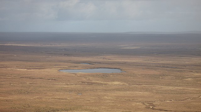
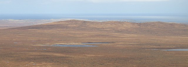
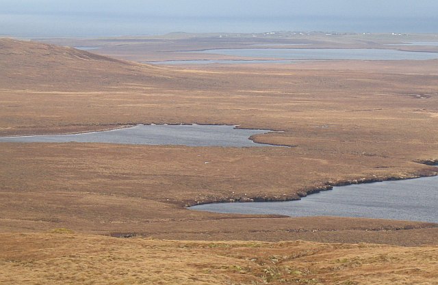
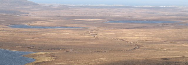
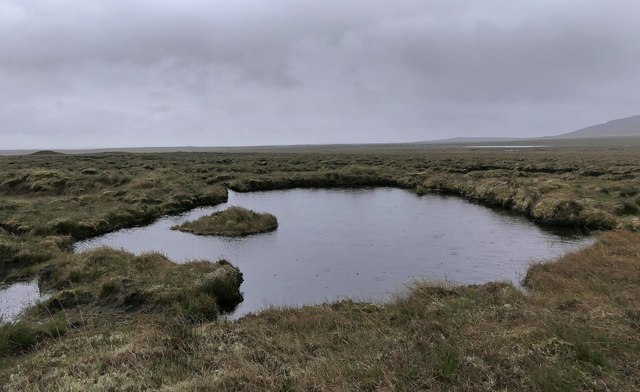
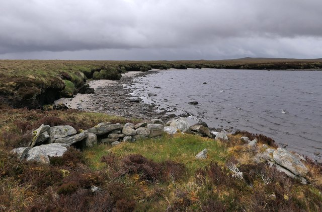
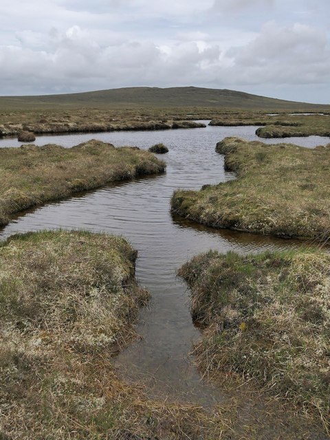
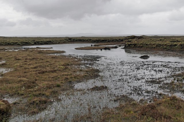
Loch Dubh an Duine is a small freshwater loch located in Ross-shire, Scotland. The loch is surrounded by lush greenery and rolling hills, creating a picturesque and tranquil setting. The name "Loch Dubh an Duine" translates to "the dark loch of the man" in Gaelic, adding to the mysterious and enchanting atmosphere of the area.

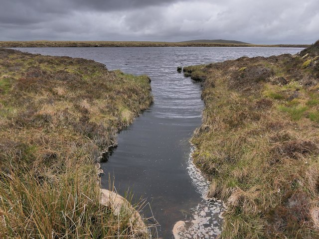
The loch itself is relatively small, with a surface area of approximately 5 acres. It is fed by a small stream that flows into the loch from the surrounding hills. The water in the loch is clear and pristine, providing a habitat for a variety of freshwater fish and aquatic plants.

Loch Dubh an Duine is a popular spot for fishing enthusiasts, who come to try their luck at catching trout and perch in the crystal-clear waters. The loch is also a haven for birdwatchers, with a variety of bird species making their home in the surrounding marshland.

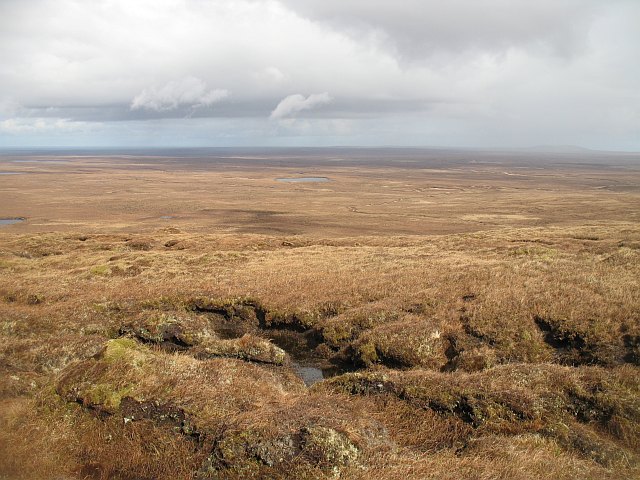
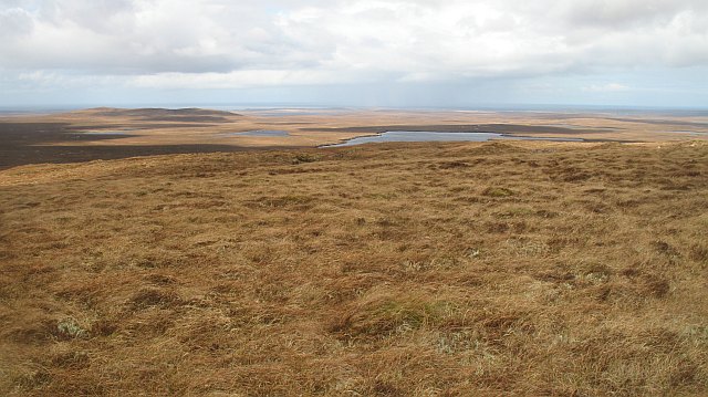
Visitors to Loch Dubh an Duine can enjoy peaceful walks along the shore, taking in the stunning views of the surrounding countryside. The tranquility and natural beauty of this hidden gem make it a must-visit destination for nature lovers and outdoor enthusiasts alike.

If you have any feedback on the listing, please let us know in the comments section below.

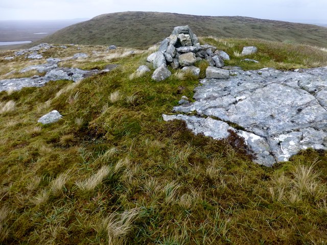
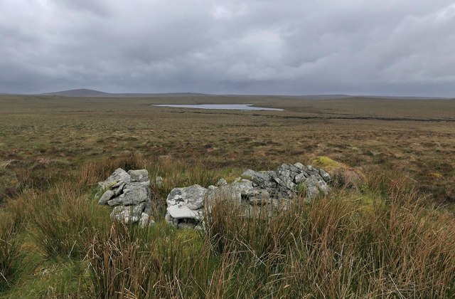
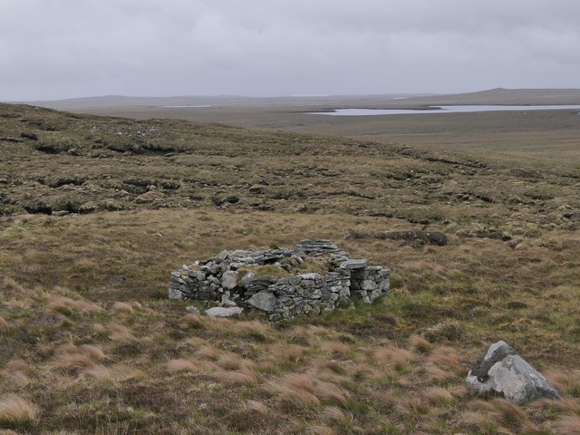
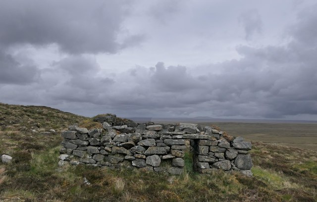
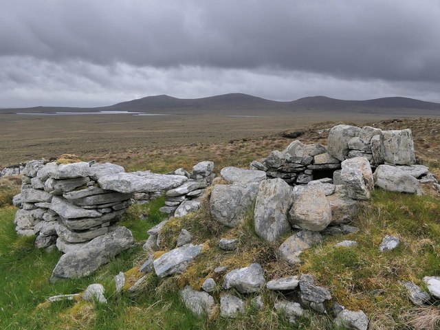
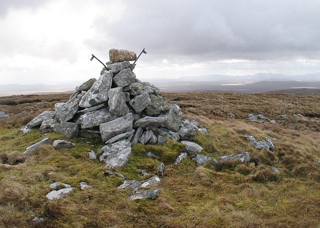
Loch Dubh an Duine Images

Images are sourced within 2km of 58.273722/-6.5183071 or Grid Reference NB3540. Thanks to Geograph Open Source API. All images are credited.

Beinn Mholach Bagged from the SSW road between the two bridges and taking in a TuMP on the way there plus one on the way back with Martin Richardson.
Name: Beinn Mholach
Hill number: 1575
Height: 292m / 958ft
Area: 24A: Lewis and Nearby Islands
Class: Ma,2
Grid ref: NB 35564 38707
Summit feature: cairn
Drop: 255m
Col: 37m  NB235263
Beinn Mholach
Bagged from the SSW road between the two bridges and taking in a TuMP on the way there plus one on the way back with Martin Richardson. Name: Beinn Mholach Hill number: 1575 Height: 292m / 958ft Area: 24A: Lewis and Nearby Islands Class: Ma,2 Grid ref: NB 35564 38707 Summit feature: cairn Drop: 255m Col: 37m NB235263
Loch Chlachan a' Choire One of the many small lochs on the flat moors of Lewis.
Loch Chlachan a' Choire
One of the many small lochs on the flat moors of Lewis.
Roiseal Mòr A small hill, but one of few on the moors of Lewis. View from Beinn Mholach.
Roiseal Mòr
A small hill, but one of few on the moors of Lewis. View from Beinn Mholach.
Loch Dubh an Duine The middle loch in this photograph is Loch Dubh an Duine with a corner of Loch Scarabhat Mhòr in front.
Loch Dubh an Duine
The middle loch in this photograph is Loch Dubh an Duine with a corner of Loch Scarabhat Mhòr in front.
Gleann Suainagadail Gleann is a relative term, the moor being very flat. The burn running along the shallow valley attempts to drain Loch nan Caorann (bottom left) to Loch Suainagadail.  View from Beinn Mholach.
Gleann Suainagadail
Gleann is a relative term, the moor being very flat. The burn running along the shallow valley attempts to drain Loch nan Caorann (bottom left) to Loch Suainagadail. View from Beinn Mholach.
Shieling hut, Airighean Suainagadail, Isle of Lewis Looking towards Loch an Ois, part of which lies within the grid square.
Shieling hut, Airighean Suainagadail, Isle of Lewis
Looking towards Loch an Ois, part of which lies within the grid square.
Shieling hut, Ròiseal Mòr, Isle of Lewis Looking towards Loch Sgarabhat Mhòr.
Shieling hut, Ròiseal Mòr, Isle of Lewis
Looking towards Loch Sgarabhat Mhòr.
Moorland pool, Druim Allt an Daimh, Isle of Lewis From the OS Name Book of 1848-1852: "A large heathy hill, Druim Allt an Daimh signifies The Ox's Streams Eminence".
Moorland pool, Druim Allt an Daimh, Isle of Lewis
From the OS Name Book of 1848-1852: "A large heathy hill, Druim Allt an Daimh signifies The Ox's Streams Eminence".
Shieling hut, Ròiseal Mòr, Isle of Lewis The OS Name Book of 1848-1852 describes Ròiseal Mòr as, "A rocky, heathy hill on which there is a Trig Station".
Shieling hut, Ròiseal Mòr, Isle of Lewis
The OS Name Book of 1848-1852 describes Ròiseal Mòr as, "A rocky, heathy hill on which there is a Trig Station".
Shieling hut, Ròiseal Mòr, Isle of Lewis Looking towards the Beinn Mholach group of hills.

The OS Name Book of 1848-1852 describes Ròiseal Mòr as, "A rocky, heathy hill on which there is a Trig Station".
Shieling hut, Ròiseal Mòr, Isle of Lewis
Looking towards the Beinn Mholach group of hills. The OS Name Book of 1848-1852 describes Ròiseal Mòr as, "A rocky, heathy hill on which there is a Trig Station".
Shieling hut by Loch Sgarabhat Mhòr, Isle of Lewis Shielings were moorland summer grazings for cattle.  Shieling huts (often also referred to as shielings) were dwellings located within the shieling.  They were usually occupied from May until the “flitting” in September.  In early May the men of a village would go onto the moor to check and repair the shieling huts.  They would be joined by the women and children for one night before the men returned to the village to tend to crops or to travel away for summer work such as fishing.  The women and children would spend the summer at the shielings tending the cattle and making cheese and butter, some of which was for immediate use but most was salted to preserve it for the winter.  Peat cutting for fuel would also be done.  Evenings would be spent making music and story telling.  Visits were made between the shielings of different villages.

The shieling huts were made from materials available in the immediate vicinity.  They usually had walls made of stone or turf, turf roofs and compacted earth or clay floors.  In coastal areas and on the islands rafters would be made from locally collected driftwood.  Usually there would be a single doorway, facing away from the prevailing wind (although some shieling huts have two doors opposite each other), and often no windows.  Furniture built into shieling huts included stone or turf beds covered with heather, turf seats and cupboards and niches built into the stone wall, often one above the door.  Other furniture would be carried out onto the moor for the season.  In places where the practice of using shielings continued into the 20th century, shieling huts can be found which are constructed making more extensive use of timber than in the traditional type, along with other materials such as tin and bitumen.  There are also examples of buses and caravans used as shieling huts.

The Clearances and ongoing changes in agricultural methods meant that the shieling tradition had generally ended by the close of the nineteenth century.  In places it continued for longer and, particularly on Lewis, some shieling huts are still used today during the peat cutting season and as summer retreats.

The remains of shieling huts can be seen as

changes in vegetation: <a href="https://www.geograph.org.uk/photo/1962348">ND1340 : Shieling site by the Allt a' Cheracher</a> ;
shieling mounds where successive shieling huts have been built on the same site: <a href="https://www.geograph.org.uk/photo/5238987">NB5059 : Shieling mounds by the Abhainn Dhail, Isle of Lewis</a> ;
footings: <a href="https://www.geograph.org.uk/photo/5027765">NB5357 : Shieling footings beside the Feadan Mòr, Isle of Lewis</a> ; and
more substantial remains: <a href="https://www.geograph.org.uk/photo/5238993">NB3040 : Shieling above Gleann Leitir, Isle of Lewis</a> .

Examples of modern shielings are shown at:

<a href="https://www.geograph.org.uk/photo/5238999">NB5458 : Shieling, Airigh A' Bhealaich, Isle of Lewis</a> and <a href="https://www.geograph.org.uk/photo/5048077">NB5458 : Disused shieling, Airigh A' Bhealaich, Isle of Lewis</a> .
Shieling hut by Loch Sgarabhat Mhòr, Isle of Lewis
Shielings were moorland summer grazings for cattle. Shieling huts (often also referred to as shielings) were dwellings located within the shieling. They were usually occupied from May until the “flitting” in September. In early May the men of a village would go onto the moor to check and repair the shieling huts. They would be joined by the women and children for one night before the men returned to the village to tend to crops or to travel away for summer work such as fishing. The women and children would spend the summer at the shielings tending the cattle and making cheese and butter, some of which was for immediate use but most was salted to preserve it for the winter. Peat cutting for fuel would also be done. Evenings would be spent making music and story telling. Visits were made between the shielings of different villages. The shieling huts were made from materials available in the immediate vicinity. They usually had walls made of stone or turf, turf roofs and compacted earth or clay floors. In coastal areas and on the islands rafters would be made from locally collected driftwood. Usually there would be a single doorway, facing away from the prevailing wind (although some shieling huts have two doors opposite each other), and often no windows. Furniture built into shieling huts included stone or turf beds covered with heather, turf seats and cupboards and niches built into the stone wall, often one above the door. Other furniture would be carried out onto the moor for the season. In places where the practice of using shielings continued into the 20th century, shieling huts can be found which are constructed making more extensive use of timber than in the traditional type, along with other materials such as tin and bitumen. There are also examples of buses and caravans used as shieling huts. The Clearances and ongoing changes in agricultural methods meant that the shieling tradition had generally ended by the close of the nineteenth century. In places it continued for longer and, particularly on Lewis, some shieling huts are still used today during the peat cutting season and as summer retreats. The remains of shieling huts can be seen as changes in vegetation: ND1340 : Shieling site by the Allt a' Cheracher ; shieling mounds where successive shieling huts have been built on the same site: NB5059 : Shieling mounds by the Abhainn Dhail, Isle of Lewis ; footings: NB5357 : Shieling footings beside the Feadan Mòr, Isle of Lewis ; and more substantial remains: NB3040 : Shieling above Gleann Leitir, Isle of Lewis . Examples of modern shielings are shown at: NB5458 : Shieling, Airigh A' Bhealaich, Isle of Lewis and NB5458 : Disused shieling, Airigh A' Bhealaich, Isle of Lewis .
Moorland pool, Druim Loch Sgaravat Beag, Isle of Lewis Looking towards Ròiseal Mòr.
Moorland pool, Druim Loch Sgaravat Beag, Isle of Lewis
Looking towards Ròiseal Mòr.
Bog to the east of Loch Sgarabhat Mhòr, Isle of Lewis The hill in the distance is Muirneag.
Bog to the east of Loch Sgarabhat Mhòr, Isle of Lewis
The hill in the distance is Muirneag.
Outflow from Loch Sgarabhat Beag, Isle of Lewis The outflow is the source of the Eidhbhat Loch Sgaravat Beag.  Current large-scale OS maps show the Gaelic version of the word Sgarabhat for the loch name and the Anglicised word Sgaravat for the name of the burn.
Outflow from Loch Sgarabhat Beag, Isle of Lewis
The outflow is the source of the Eidhbhat Loch Sgaravat Beag. Current large-scale OS maps show the Gaelic version of the word Sgarabhat for the loch name and the Anglicised word Sgaravat for the name of the burn.
Moorland north of Beinn Bharabhais Looking down from the high ground on the Beinn Mholach group of hills towards Loch Clachan a' Choire and the flat moors of North Lewis.
Moorland north of Beinn Bharabhais
Looking down from the high ground on the Beinn Mholach group of hills towards Loch Clachan a' Choire and the flat moors of North Lewis.
North side of Beinn Mholach Rough moorland with a view over Loch Scarabhat Mhòr to the north coast of Lewis.
North side of Beinn Mholach
Rough moorland with a view over Loch Scarabhat Mhòr to the north coast of Lewis.
Summit of Beinn Mholach One of the few hills in the northern part of Lewis, Beinn Mholach is as expected a fine viewpoint.
Summit of Beinn Mholach
One of the few hills in the northern part of Lewis, Beinn Mholach is as expected a fine viewpoint.
Northeast side of Beinn Mholach Dissected peat bog on Beinn Mholach.
Northeast side of Beinn Mholach
Dissected peat bog on Beinn Mholach.
Show me another place!

Loch Dubh an Duine is located at Grid Ref: NB3540 (Lat: 58.273722, Lng: -6.5183071)

Unitary Authority: Na h-Eileanan an Iar

Police Authority: Highlands and Islands

What 3 Words

///topples.ranted.departure. Near Stornoway, Na h-Eileanan Siar

Related Wikis

Lewis Peatlands

Lewis Peatlands (Scottish Gaelic: mòinteach Leòdhais) is a large area of blanket bog covering more than one third of the Isle of Lewis, off the west coast...

Newvalley, Lewis

Newvalley (Scottish Gaelic: An Gleann Ùr) is a hamlet on the Isle of Lewis in the Outer Hebrides, Scotland. Newvalley is within the parish of Stornoway...

West Side, Lewis

The West Side (Scottish Gaelic: An Taobh Siar) is the name used for the (predominantly Gaelic-speaking) settlements along the NW coast of the Isle of Lewis...

Marybank, Lewis

Marybank (Scottish Gaelic: Bruach Màiri, IPA:[ˈpɾuəxˈmaːɾʲɪ]) is a settlement on the outskirts of Stornoway, Isle of Lewis in the Outer Hebrides of Scotland...

Have you been to Loch Dubh an Duine?

Leave your review of Loch Dubh an Duine below (or comments, questions and feedback).