Loch Bhatandìop

Lake, Pool, Pond, Freshwater Marsh in Ross-shire

Scotland

Loch Bhatandìop

The Lone Meeting House and The Tent Ancient and modern accommodation in the Outer  Hebrides
The Lone Meeting House and The Tent Credit: Enid Astley

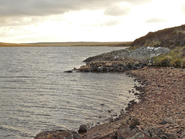
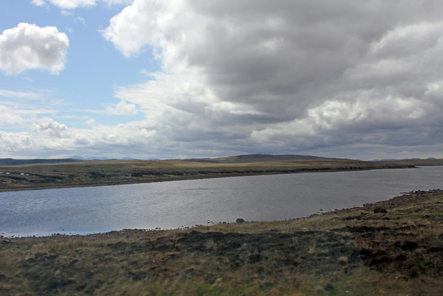
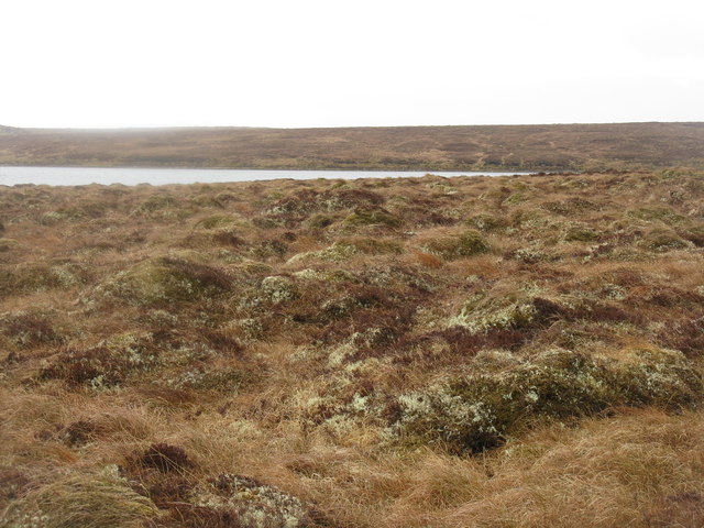
Loch Bhatandìop is a freshwater loch located in Ross-shire, Scotland. Situated amidst the stunning Highland landscape, it covers an area of approximately 20 hectares. The loch is surrounded by lush green hills and is fed by several small streams originating from the nearby mountains.

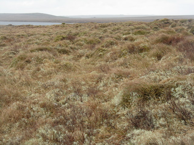
With its calm and serene waters, Loch Bhatandìop serves as a haven for various species of aquatic plants and animals. The loch boasts a diverse ecosystem, supporting a wide range of flora and fauna. Its shores are adorned with a variety of reeds, rushes, and water lilies, creating a beautiful and vibrant display of colors.

The loch is home to numerous species of freshwater fish, including brown trout and pike, which attract anglers from far and wide. Fishing enthusiasts can often be seen casting their lines from the shores or venturing out in small boats to explore the deeper waters.

The surrounding area of Loch Bhatandìop is a paradise for birdwatchers. The loch provides a vital habitat for various waterbirds, such as mallards, tufted ducks, and common pochards. Additionally, it serves as a breeding ground for several species of waders, including lapwings and redshanks.

Loch Bhatandìop is a popular destination for nature lovers, photographers, and those seeking tranquility. Visitors can enjoy peaceful walks along its shores, taking in the breathtaking scenery and observing the abundant wildlife. The stunning reflections of the surrounding hills on the loch's surface create a picturesque and captivating setting, making it a must-visit location in Ross-shire.

If you have any feedback on the listing, please let us know in the comments section below.

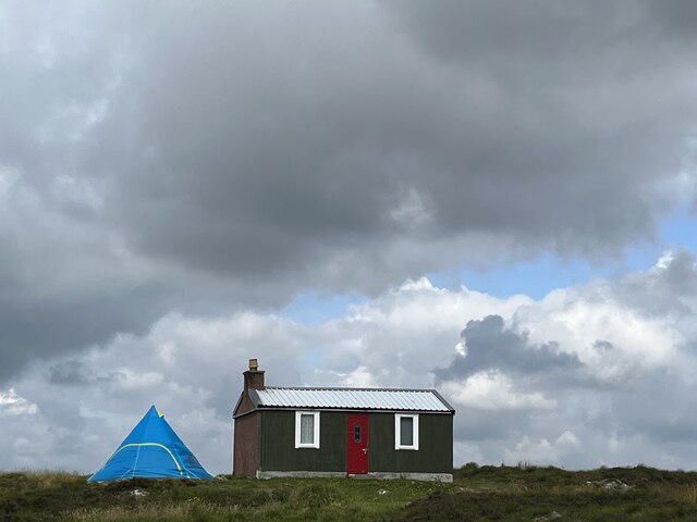
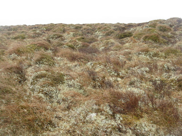
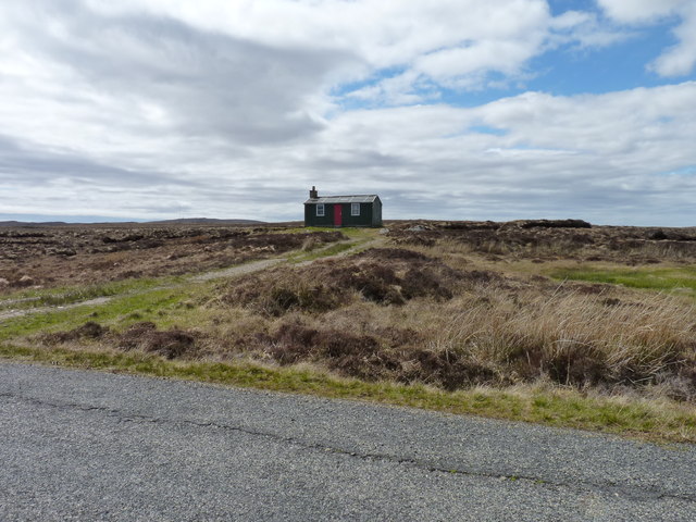
Loch Bhatandìop Images

Images are sourced within 2km of 58.211514/-6.513386 or Grid Reference NB3533. Thanks to Geograph Open Source API. All images are credited.

The Lone Meeting House and The Tent Ancient and modern accommodation in the Outer  Hebrides
The Lone Meeting House and The Tent
Ancient and modern accommodation in the Outer Hebrides
Airigh a' Chreagain A brightly painted shieling beside the A858, with a view across the bogs of central Leòdhas (Lewis) towards the group of low hills in the centre of the island: Beinn a' Sgridhe (268 metres), Beinn Bhearnach (278 metres), Beinn Mholach (292 metres) and Beinn Bharabhais (280 metres).
Airigh a' Chreagain
A brightly painted shieling beside the A858, with a view across the bogs of central Leòdhas (Lewis) towards the group of low hills in the centre of the island: Beinn a' Sgridhe (268 metres), Beinn Bhearnach (278 metres), Beinn Mholach (292 metres) and Beinn Bharabhais (280 metres).
Abhainn Ghrioda The river cutting through a shelf of rock here drains Loch an Ois into Loch a' Chlachain and ultimately enters the sea near Stèornabhagh (Stornoway). The older maps, which use the anglicised spelling, name it River Greeta or River Creed. The hut on the skyline is a shieling at Airigh na Gile.
Abhainn Ghrioda
The river cutting through a shelf of rock here drains Loch an Ois into Loch a' Chlachain and ultimately enters the sea near Stèornabhagh (Stornoway). The older maps, which use the anglicised spelling, name it River Greeta or River Creed. The hut on the skyline is a shieling at Airigh na Gile.
Airigh na Gile This is one of a scattering of shielings just a few miles out of Steòrnabhagh, along the old A858. No doubt it is a pleasant spot on a warm summer day, but today there were only a ewe and her lamb to be seen.
Airigh na Gile
This is one of a scattering of shielings just a few miles out of Steòrnabhagh, along the old A858. No doubt it is a pleasant spot on a warm summer day, but today there were only a ewe and her lamb to be seen.
Airigh na Gile Another of the old shielings, evidently still in use, at Airigh na Gile by the old A858 a few miles west of Steòrnabhagh .
Airigh na Gile
Another of the old shielings, evidently still in use, at Airigh na Gile by the old A858 a few miles west of Steòrnabhagh .
Old jetty, Loch Bhatandìp, Lewis I am happy to report that, contrary to the information provided in <a href="https://www.geograph.org.uk/photo/732350">NB3533 : Loch Bhatandiob</a>, the fish population is in a healthy state. The last sampling was carried out 31/5/12 using a variety of methods (clan chief and silver dabbler being the two most successful!) and nine brown trout were taken and returned in less than two hours.
Old jetty, Loch Bhatandìp, Lewis
I am happy to report that, contrary to the information provided in NB3533 : Loch Bhatandiob, the fish population is in a healthy state. The last sampling was carried out 31/5/12 using a variety of methods (clan chief and silver dabbler being the two most successful!) and nine brown trout were taken and returned in less than two hours.
Loch Bhatandiop from Pentland Road
Boggy moorland on Lewis Looking southeastwards towards the westward end of Loch Bhatandìp. Extremely wet moorland - very hard going to travel any distance.
Boggy moorland on Lewis
Looking southeastwards towards the westward end of Loch Bhatandìp. Extremely wet moorland - very hard going to travel any distance.
Wet moorland on Lewis Very wet and boggy land, between the Rathad a' Phentland and Loch Bhatandìp. Mosses, lichens, grasses and the occasional heather.
Wet moorland on Lewis
Very wet and boggy land, between the Rathad a' Phentland and Loch Bhatandìp. Mosses, lichens, grasses and the occasional heather.
Loch Bhatandìp A shallow loch, made deeper by a dam at the western end. One of many small patches of water in this boggy landscape of Lewis, which consists of soft hummocks of moss and lichen, with wetter patches in between, and peat underneath.
Loch Bhatandìp
A shallow loch, made deeper by a dam at the western end. One of many small patches of water in this boggy landscape of Lewis, which consists of soft hummocks of moss and lichen, with wetter patches in between, and peat underneath.
Junction, Rathad a' Phentland The parting of the ways by Cnoc an Rathaid - straight on to Breascleit and Carloway, left to Acha Mòr and the A858.
Junction, Rathad a' Phentland
The parting of the ways by Cnoc an Rathaid - straight on to Breascleit and Carloway, left to Acha Mòr and the A858.
The road to Stornoway The Rathad a' Phentland, looking east, with a conifer plantation on the slopes of Beinn Greidaig
The road to Stornoway
The Rathad a' Phentland, looking east, with a conifer plantation on the slopes of Beinn Greidaig
Dual fuel at Cnoc an Rathaid Peat cutting and wind turbines.
Dual fuel at Cnoc an Rathaid
Peat cutting and wind turbines.
Feadan Mor Loch Beag a' Chòcair Burn flowing from Loch Beag a' Chòcair with a background of wind turbines.
Feadan Mor Loch Beag a' Chòcair
Burn flowing from Loch Beag a' Chòcair with a background of wind turbines.
Boggy moorland and wind turbines Viewed from the Pentland Road south of Loch Mòr a' Chòcair.
Boggy moorland and wind turbines
Viewed from the Pentland Road south of Loch Mòr a' Chòcair.
Boggy moorland and wind turbines Seen from the Pentland Road this stretch of moorland is crossed by the old road to Stornoway and the horizon is now lined with wind turbines.
Boggy moorland and wind turbines
Seen from the Pentland Road this stretch of moorland is crossed by the old road to Stornoway and the horizon is now lined with wind turbines.
Peat-cutters' sheiling One of several huts scattered on the moors near here, used by peat-cutters in season and also as holiday accommodation at other times.
Peat-cutters' sheiling
One of several huts scattered on the moors near here, used by peat-cutters in season and also as holiday accommodation at other times.
Peat-cutter's shieling There are several of these huts on the moors near here, all brightly coloured and used as accommodation for workers during the peat-cutting season and, it is said, as holiday accommodation at other times.
Peat-cutter's shieling
There are several of these huts on the moors near here, all brightly coloured and used as accommodation for workers during the peat-cutting season and, it is said, as holiday accommodation at other times.
Show me another place!

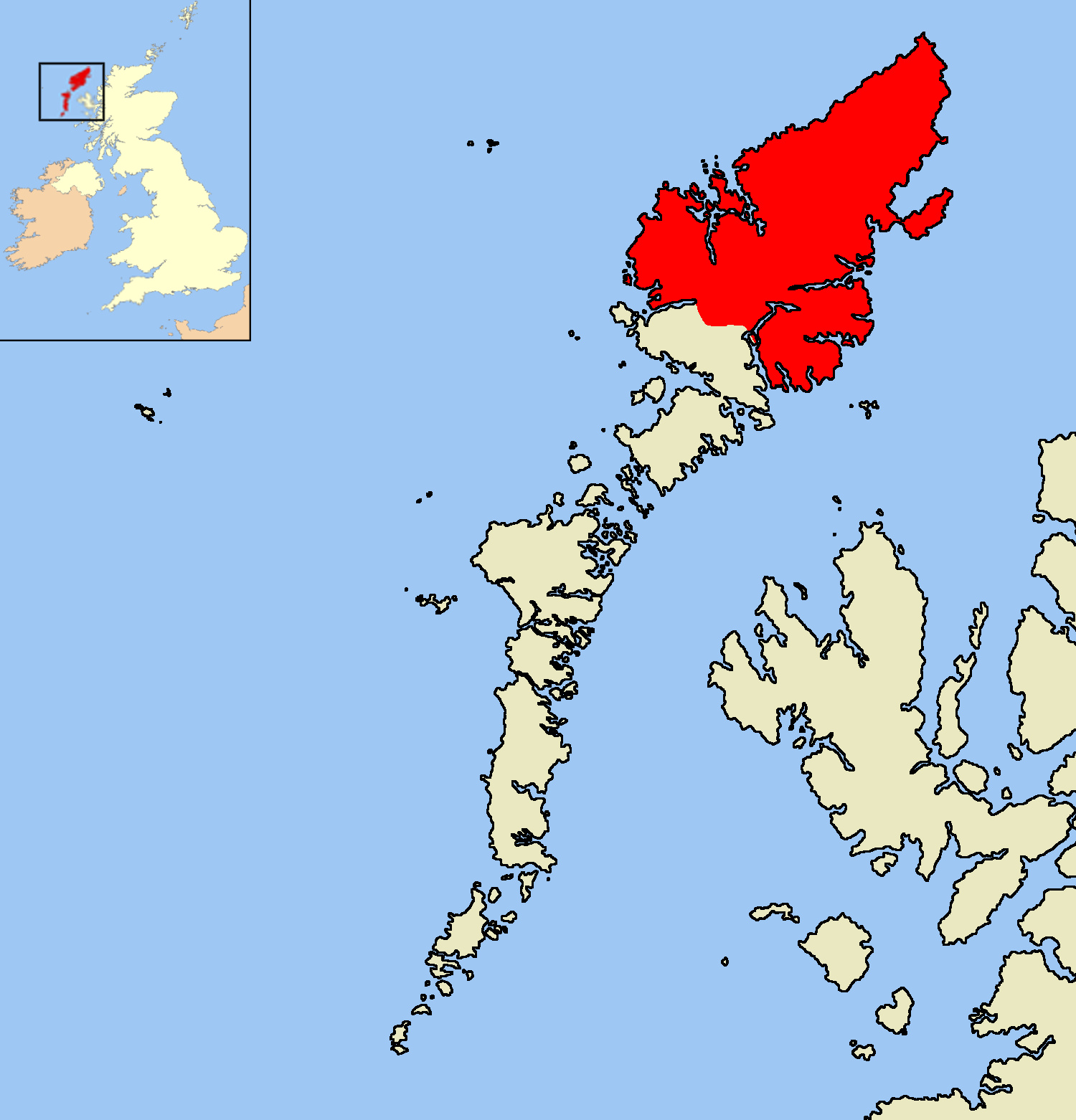
Loch Bhatandìop is located at Grid Ref: NB3533 (Lat: 58.211514, Lng: -6.513386)

Unitary Authority: Na h-Eileanan an Iar

Police Authority: Highlands and Islands

What 3 Words

///steadier.insisting.drive. Near Stornoway, Na h-Eileanan Siar

Nearby Locations

Loch Bhatandìop

Related Wikis

Isle of Lewis

The Isle of Lewis (Scottish Gaelic: Eilean Leòdhais) or simply Lewis (Scottish Gaelic: Leòdhas, pronounced [ˈʎɔːəs̪] ) is the northern part of Lewis and...

Achmore, Lewis

Achmore (Scottish Gaelic: An t-Acha Mòr; marked on some maps as Acha Mòr) is a village in the Scottish Outer Hebrides, on the Isle of Lewis. The name means...

Marybank, Lewis

Marybank (Scottish Gaelic: Bruach Màiri, IPA:[ˈpɾuəxˈmaːɾʲɪ]) is a settlement on the outskirts of Stornoway, Isle of Lewis in the Outer Hebrides of Scotland...

Lewis Peatlands

Lewis Peatlands (Scottish Gaelic: mòinteach Leòdhais) is a large area of blanket bog covering more than one third of the Isle of Lewis, off the west coast...

Nearby Amenities

Located within 500m of 58.211514,-6.513386
Passing Place
Lat/Long: 58.2156646/-6.5109503
Passing Place
Lat/Long: 58.2154173/-6.509227
The data included in this document is from www.openstreetmap.org. The data is made available under ODbL.

Have you been to Loch Bhatandìop?

Leave your review of Loch Bhatandìop below (or comments, questions and feedback).