Loch Suardal

Lake, Pool, Pond, Freshwater Marsh in Inverness-shire

Scotland

Loch Suardal

Is Loch Suardal a dried-up lake? A lacustrine plain, perhaps?
Is Loch Suardal a dried-up lake? A lacustrine plain, perhaps? Credit: Mick Garratt

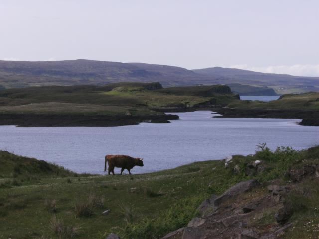
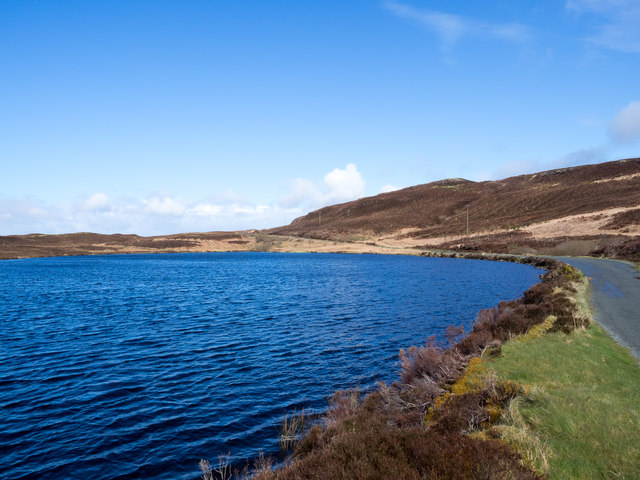
Loch Suardal is a picturesque freshwater loch located in Inverness-shire, Scotland. Nestled in the heart of the Scottish Highlands, this captivating natural beauty attracts visitors from all over the world.

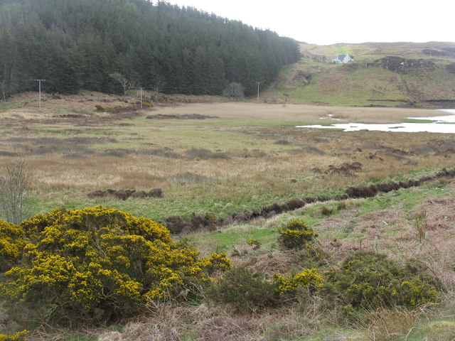
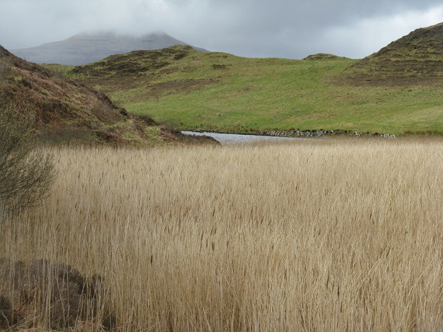
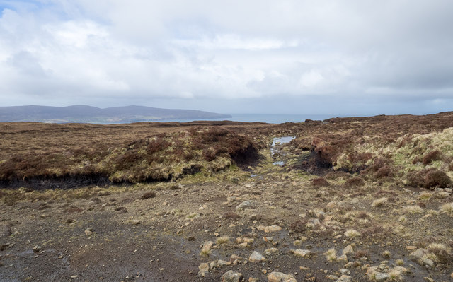
The loch stretches over an area of approximately 2.5 square kilometers, making it a modest-sized body of water. It is surrounded by rolling hills and dense forests, creating a serene and tranquil atmosphere. The crystal-clear waters of Loch Suardal are fed by numerous small streams and rivers that drain into the loch, ensuring a constant flow of freshwater.

As a freshwater ecosystem, Loch Suardal supports a diverse range of flora and fauna. The surrounding marshy areas are home to an abundance of aquatic plants such as reeds, water lilies, and cattails. These provide a habitat for various species of water birds, including ducks, swans, and herons. Anglers are also drawn to the loch due to its rich population of fish, including brown trout and pike.

The area surrounding Loch Suardal is a haven for outdoor enthusiasts. Visitors can explore the scenic surroundings by embarking on hiking trails that wind through the hills, offering breathtaking panoramic views of the loch. The tranquil waters of the loch also provide opportunities for kayaking, canoeing, and sailing.

For those seeking solitude and a connection with nature, Loch Suardal is the ideal destination. Its untouched beauty and peaceful atmosphere make it a haven for wildlife and a paradise for nature lovers.

If you have any feedback on the listing, please let us know in the comments section below.

Loch Suardal Images

Images are sourced within 2km of 57.465506/-6.6049757 or Grid Reference NG2351. Thanks to Geograph Open Source API. All images are credited.

Is Loch Suardal a dried-up lake? A lacustrine plain, perhaps?
Oh great, yet another stunning masterpiece of Loch Corlarach. Can't contain my excitement!
Highland Cattle at Loch Dunvegan Taken from the Claigan road North of Dunvegan Castle. View over blooming meadows to Fiadhairt peninsula with the open Loch beyond. Across Loch Dunvegan lie the hamlets Uig, Borreraig and Galtrigill with Ben Skriaig and Biod an Athair rising behind them.
Highland Cattle at Loch Dunvegan
Taken from the Claigan road North of Dunvegan Castle. View over blooming meadows to Fiadhairt peninsula with the open Loch beyond. Across Loch Dunvegan lie the hamlets Uig, Borreraig and Galtrigill with Ben Skriaig and Biod an Athair rising behind them.
Dam across Loch Suardal Constructed of stone and earth infill, just north of Dunvegan Castle/Caisteal Dhun Bhegan.
Dam across Loch Suardal
Constructed of stone and earth infill, just north of Dunvegan Castle/Caisteal Dhun Bhegan.
Loch Suardal, near Dunvegan Viewed from the dam, which carries the road up the glen.
Loch Suardal, near Dunvegan
Viewed from the dam, which carries the road up the glen.
Reeds in Loch Suardal Looking south at the part of the loch below the dam, and what is presumably the lower dam, marked on the map at the normal tide line, can be seen at the narrow point.
Reeds in Loch Suardal
Looking south at the part of the loch below the dam, and what is presumably the lower dam, marked on the map at the normal tide line, can be seen at the narrow point.
Looking north to Coralach From the head of Loch Suardal, north of Dunvegan.
Looking north to Coralach
From the head of Loch Suardal, north of Dunvegan.
Loch Suardal A wet drained area feeding into the loch. The plantation beyond appears nameless, but is on the slope of Creag a' Mhill.
Loch Suardal
A wet drained area feeding into the loch. The plantation beyond appears nameless, but is on the slope of Creag a' Mhill.
Loch Suardal Looking north from the eastern end of the dam to extensive reed beds and conifer plantations in the next square north.
Loch Suardal
Looking north from the eastern end of the dam to extensive reed beds and conifer plantations in the next square north.
Reeds by Loch Suardal A large patch abounding with warblers and other bird song, on the lower side of the dam. Macleod's Table North/Healabhal Mhòr is the peak in cloud in the distance.
Reeds by Loch Suardal
A large patch abounding with warblers and other bird song, on the lower side of the dam. Macleod's Table North/Healabhal Mhòr is the peak in cloud in the distance.
Rainbow over Fiadhairt A low afternoon rainbow is seen over Fiadhairt across Loch Dunvegan from Colbost.  The islands in the foreground are the Eilean Glas and Eilean Dubh Beag.
Rainbow over Fiadhairt
A low afternoon rainbow is seen over Fiadhairt across Loch Dunvegan from Colbost. The islands in the foreground are the Eilean Glas and Eilean Dubh Beag.
Sea Cloud II Viewed from Colbost, the windjammer Sea Cloud II lies at anchor off the Fiadhairt peninsula in Loch Dunvegan.  She is a 3-masted barque of 3,849 tons built in Castropol in northern Spain in 2000 and registered in Valetta, Malta.  For more details see the following:

Marine Traffic <span class="nowrap"><a title="http://www.marinetraffic.com/en/ais/details/ships/248953000" rel="nofollow ugc noopener" href="http://www.marinetraffic.com/en/ais/details/ships/248953000">Link</a><img style="margin-left:2px;" alt="External link" title="External link - shift click to open in new window" src="https://s1.geograph.org.uk/img/external.png" width="10" height="10"/></span>
Wikipedia <span class="nowrap"><a title="http://en.wikipedia.org/wiki/Sea_Cloud_II" rel="nofollow ugc noopener" href="http://en.wikipedia.org/wiki/Sea_Cloud_II">Link</a><img style="margin-left:2px;" alt="External link" title="External link - shift click to open in new window" src="https://s1.geograph.org.uk/img/external.png" width="10" height="10"/></span>
and the ship's own site <span class="nowrap"><a title="http://www.seacloud.com/en/the-yachts/sea-cloud-2/" rel="nofollow ugc noopener" href="http://www.seacloud.com/en/the-yachts/sea-cloud-2/">Link</a><img style="margin-left:2px;" alt="External link" title="External link - shift click to open in new window" src="https://s1.geograph.org.uk/img/external.png" width="10" height="10"/></span>
Sea Cloud II
Viewed from Colbost, the windjammer Sea Cloud II lies at anchor off the Fiadhairt peninsula in Loch Dunvegan. She is a 3-masted barque of 3,849 tons built in Castropol in northern Spain in 2000 and registered in Valetta, Malta. For more details see the following: Marine Traffic LinkExternal link Wikipedia LinkExternal link and the ship's own site LinkExternal link
Rushes at south end of Loch Suardal Loch Suardal lies to the north of a minor road which crosses a dam separating it from another loch; it's seen from that road at the eastern side of the dam.
Rushes at south end of Loch Suardal
Loch Suardal lies to the north of a minor road which crosses a dam separating it from another loch; it's seen from that road at the eastern side of the dam.
Loch Corlarach Loch Corlarach lies beside the minor road extending northwards from Dunvegan.
Loch Corlarach
Loch Corlarach lies beside the minor road extending northwards from Dunvegan.
Scarred area of estate road on slope of Beinn Bhreac An estate road climbs from Claigan to the area named as Creag-a' Ghuail, on the west side of Beinn Bhreac. It begins as a decent hill road but high on the slope it deteriorates significantly.
Scarred area of estate road on slope of Beinn Bhreac
An estate road climbs from Claigan to the area named as Creag-a' Ghuail, on the west side of Beinn Bhreac. It begins as a decent hill road but high on the slope it deteriorates significantly.
Saga Pearl II at anchor in Loch Dunvegan The ship, which carries around 450 passengers, stopped for shore visits on Skye. It was en-route to St Kilda on a National Trust for Scotland cruise.
Saga Pearl II at anchor in Loch Dunvegan
The ship, which carries around 450 passengers, stopped for shore visits on Skye. It was en-route to St Kilda on a National Trust for Scotland cruise.
Loch Suardal Loch Suardal lies to the north of Dunvegan and is seen here from a minor road out of that village heading northwards.
Loch Suardal
Loch Suardal lies to the north of Dunvegan and is seen here from a minor road out of that village heading northwards.
Loch Corlarach Loch Corlarach lies beside a minor road connecting the small settlement at Claigan with the village of Dunvegan. Macleod's Tables are the distant mountains.
Loch Corlarach
Loch Corlarach lies beside a minor road connecting the small settlement at Claigan with the village of Dunvegan. Macleod's Tables are the distant mountains.
Show me another place!

Loch Suardal is located at Grid Ref: NG2351 (Lat: 57.465506, Lng: -6.6049757)

Unitary Authority: Highland

Police Authority: Highlands and Islands

What 3 Words

///bookmark.fears.quantity. Near Dunvegan, Highland

Related Wikis

Dun Fiadhairt

Dun Fiadhairt is an Iron Age broch located on the north coast of the island of Skye, in Scotland (grid reference NG23115042). == Location == Dun Fiadhairt...

Dunvegan Castle

Dunvegan Castle (Caisteal Dhùn Bheagain) is located 1 mile (1.6 km) to the north of Dunvegan on the Isle of Skye, off the west coast of Scotland. It is...

Claigan

Claigan (Scottish Gaelic: An Claigeann) is a small coastal settlement on the north east shore of the sea loch, Loch Dunvegan, on the Waternish peninsula...

Eilean Mòr, Loch Dunvegan

Eilean Mòr is an uninhabited island in Loch Dunvegan in north west Skye, Scotland. At low water the island is connected to Eilean Dubh. == Footnotes ==

Related Videos

Dunvegan Castle, Scotland - 360 video walking behind castle

Walking behind Dunvegan Castle, overlooking the lake.

Dunvegan Castle On Visit To Isle Of Skye Inner Hebrides Scotland

Tour Scotland travel video clip, with Scottish music, of Dunvegan Castle on ancestry visit to the West Coast of the Isle Of Skye, ...

Nearby Amenities

Located within 500m of 57.465506,-6.6049757
Barrier: cattle_grid
Source: survey
Lat/Long: 57.4620432/-6.6034677
Power: pole
Lat/Long: 57.4633379/-6.5995564
Power: pole
Lat/Long: 57.4640427/-6.6008427
Power: pole
Lat/Long: 57.4644595/-6.6016238
Power: pole
Lat/Long: 57.4655757/-6.6031073
Power: pole
Lat/Long: 57.4665479/-6.604295
Power: pole
Lat/Long: 57.4669885/-6.6048445
Power: pole
Lat/Long: 57.4680234/-6.605543
Power: pole
Lat/Long: 57.4688038/-6.6060704
Power: pole
Lat/Long: 57.4698506/-6.6067609
The data included in this document is from www.openstreetmap.org. The data is made available under ODbL.

Have you been to Loch Suardal?

Leave your review of Loch Suardal below (or comments, questions and feedback).