Loch a' Bhuilg Iosal

Lake, Pool, Pond, Freshwater Marsh in Ross-shire

Scotland

Loch a' Bhuilg Iosal

View towards Tolsta Chaolais
View towards Tolsta Chaolais Credit: David Dixon

Loch a' Bhuilg Iosal is a picturesque freshwater body located in Ross-shire, Scotland. Nestled amidst the stunning Scottish Highlands, this natural wonder is known for its stunning beauty and tranquil surroundings. The name "Loch a' Bhuilg Iosal" translates to "lower loch of the bag," which is derived from the Gaelic language.

With a surface area of approximately 10 hectares, Loch a' Bhuilg Iosal is not particularly large, but it boasts a remarkable depth that reaches up to 20 meters. The loch is surrounded by lush vegetation, including heather-covered hills and rocky outcrops, which enhances its scenic appeal. The water itself is crystal clear, reflecting the surrounding landscape and providing a sense of serenity.

Loch a' Bhuilg Iosal is renowned for its diverse wildlife, making it a popular destination for nature enthusiasts. The loch is home to a variety of fish species, including brown trout and pike, which attracts fishing enthusiasts throughout the year. Additionally, the surrounding marshes provide a habitat for numerous bird species, such as mallards, tufted ducks, and common sandpipers.

Visitors can enjoy the tranquility of the loch by taking a leisurely stroll around its shores or engaging in activities like fishing and birdwatching. The surrounding area also offers opportunities for hiking and exploration, with scenic trails that lead to breathtaking viewpoints.

Overall, Loch a' Bhuilg Iosal offers a captivating natural experience, combining stunning landscapes, diverse wildlife, and a peaceful ambiance. Whether it's for a relaxing day out or a chance to immerse oneself in nature, this hidden gem in Ross-shire is sure to leave a lasting impression on any visitor.

If you have any feedback on the listing, please let us know in the comments section below.

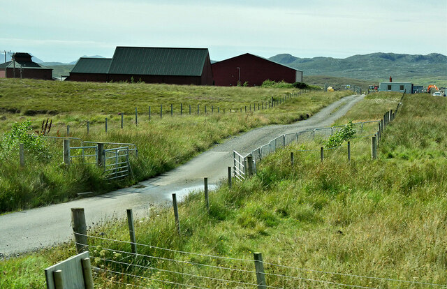
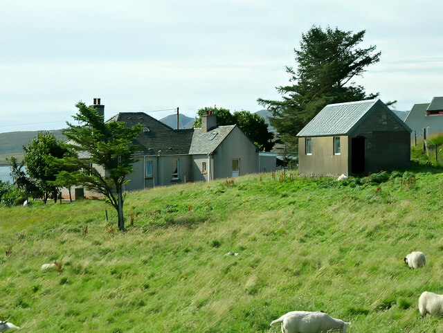
Loch a' Bhuilg Iosal Images

Images are sourced within 2km of 58.235397/-6.7516529 or Grid Reference NB2137. Thanks to Geograph Open Source API. All images are credited.

View towards Tolsta Chaolais
West Point
West Point
The Road to Tolsta Chaolais
Fish Farm Cages, Loch na Muilne
Loch na Muilne
Loch na Muilne
Croft near Breasclete
House on a hill near Breasclete
Farm Track at Breascleit
Sheep grazing at Breascleit
Port a' Chaoil Stream flowing from Loch a' Bhaile enters Loch Rog an Ear, a sea loch, at Aird na Moine.
Port a' Chaoil
Stream flowing from Loch a' Bhaile enters Loch Rog an Ear, a sea loch, at Aird na Moine.
Loch a' Bhaile The narrow loch, hemmed in by steep hillsides, flows out into Loch Rog an Ear, a sea loch, via a short river.
Loch a' Bhaile
The narrow loch, hemmed in by steep hillsides, flows out into Loch Rog an Ear, a sea loch, via a short river.
Loch a' Bhaile Loch a' Bhaile & Tolastadh a' Chaolais beyond.
Loch a' Bhaile
Loch a' Bhaile & Tolastadh a' Chaolais beyond.
Tolstachaolais: along the shore of Loch a' Bhaile Looking across the loch, which runs alongside the road through the village. However, this is the far side that we are looking along.
Tolstachaolais: along the shore of Loch a' Bhaile
Looking across the loch, which runs alongside the road through the village. However, this is the far side that we are looking along.
Tolstachaolais: postbox № HS2 62 This postbox stands more or less in the centre of the village, in front of a house that is set particularly well back from the road. The larger-scale map still marks that house as a post office, although it has actually (as reflected in the 1:50,000 and 1:25,000 map) relocated just over a kilometre to the north - see <a href="https://www.geograph.org.uk/photo/3086624">NB1939 : Tolstachaolais: the post office</a>.
Tolstachaolais: postbox № HS2 62
This postbox stands more or less in the centre of the village, in front of a house that is set particularly well back from the road. The larger-scale map still marks that house as a post office, although it has actually (as reflected in the 1:50,000 and 1:25,000 map) relocated just over a kilometre to the north - see NB1939 : Tolstachaolais: the post office.
Tolstachaolais: Loch a’ Bhaile Looking down this loch from its northern end, with the main part of the village visible far right.
Tolstachaolais: Loch a’ Bhaile
Looking down this loch from its northern end, with the main part of the village visible far right.
Tolstachaolais: hillside cows and Bernera view Looking across the sound separating the eastern side of Bernera from the Lewis mainland, beyond three cows grazing on the slopes to the south of Tolstachaolais village.
Tolstachaolais: hillside cows and Bernera view
Looking across the sound separating the eastern side of Bernera from the Lewis mainland, beyond three cows grazing on the slopes to the south of Tolstachaolais village.
Outlet from Loch a' Bhaile into Port a' Chaoil At the crofting community of Tolastadh a' Chaolais.
Outlet from Loch a' Bhaile into Port a' Chaoil
At the crofting community of Tolastadh a' Chaolais.
Loch a' Bhaile In the crofting community of Tolastadh a' Chaolais.
Loch a' Bhaile
In the crofting community of Tolastadh a' Chaolais.
Show me another place!

Loch a' Bhuilg Iosal is located at Grid Ref: NB2137 (Lat: 58.235397, Lng: -6.7516529)

Unitary Authority: Na h-Eileanan an Iar

Police Authority: Highlands and Islands

What 3 Words

///myth.originals.anode. Near Carloway, Na h-Eileanan Siar

Related Wikis

Tolsta Chaolais

Tolsta Chaolais (also Tolastadh Chaolais, Tolstadh a' Chaolais) is a village on the Isle of Lewis, Scotland. It consists of about forty houses, clustered...

Breasclete

Breasclete (Scottish Gaelic: Brèascleit) is a village and community on the west side of the Isle of Lewis, in the Outer Hebrides, Scotland. Breasclete...

Ceabhaigh

Ceabhaigh is a small island in an arm of Loch Ròg on the west coast of Lewis in the Outer Hebrides of Scotland. It is about 25 hectares (62 acres) in extent...

Callanish

Callanish (Scottish Gaelic: Calanais) is a village (township) on the west side of the Isle of Lewis, in the Outer Hebrides (Western Isles), Scotland. Callanish...

Nearby Amenities

Located within 500m of 58.235397,-6.7516529
Beannan Beag
Place: locality
Lat/Long: 58.2372294/-6.7588225
The data included in this document is from www.openstreetmap.org. The data is made available under ODbL.

Have you been to Loch a' Bhuilg Iosal?

Leave your review of Loch a' Bhuilg Iosal below (or comments, questions and feedback).