An Dubh Loch

Lake, Pool, Pond, Freshwater Marsh in Inverness-shire

Scotland

An Dubh Loch

Across Lorgill valley This is a lovely view across the valley with Autumnal colours everywhere.
Across Lorgill valley Credit: Carol Walker

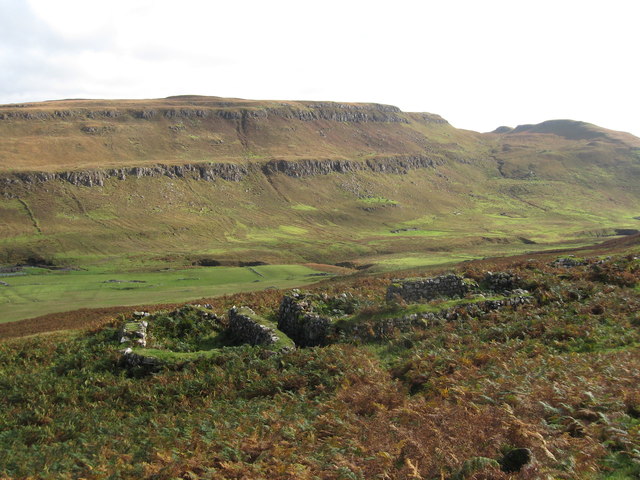
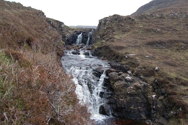
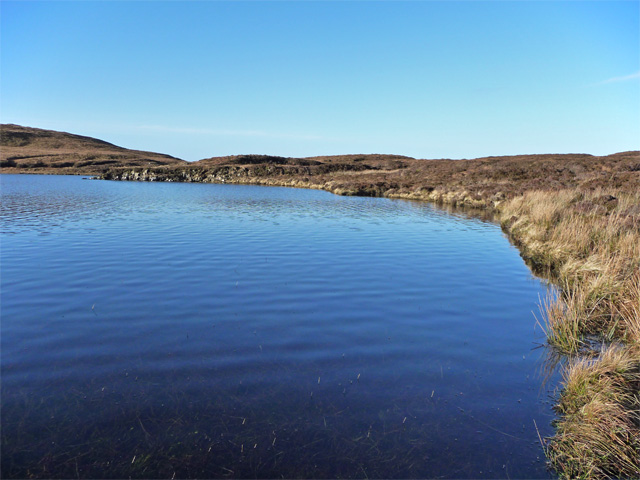
An Dubh Loch, also known as Loch Dubh, is a stunning freshwater lake located in the Inverness-shire region of Scotland. Nestled amidst the picturesque Scottish Highlands, this tranquil body of water offers a captivating natural beauty that attracts visitors from far and wide.

Covering an area of approximately 5 square kilometers, An Dubh Loch boasts crystal-clear waters that reflect the surrounding mountainous landscape. Its name, which translates to "The Black Lake" in English, comes from the dark color of its waters, caused by the peat-rich soil in the area.

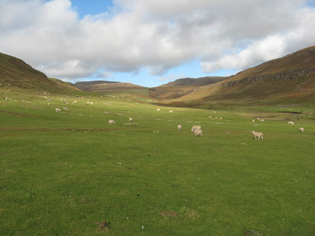
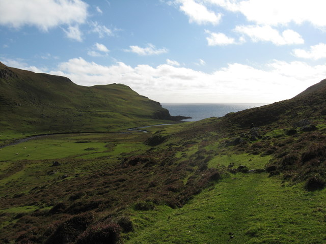
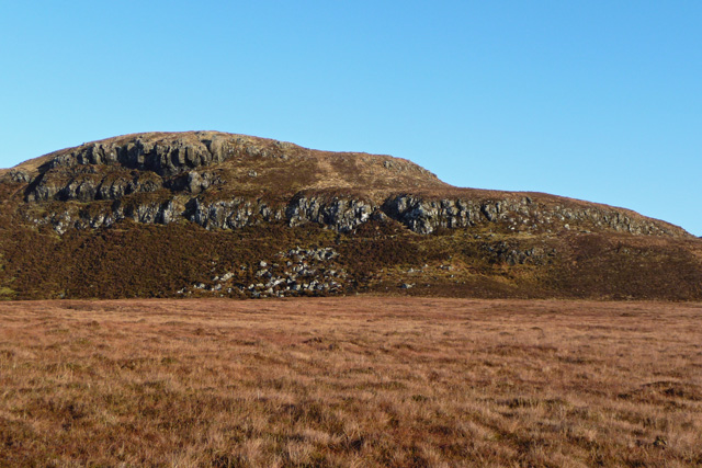
The lake is surrounded by lush greenery, with heather-covered hills and dense forests creating a magnificent backdrop. This creates an idyllic environment for a variety of wildlife, including otters, water birds, and even golden eagles, making it a haven for nature enthusiasts and birdwatchers.

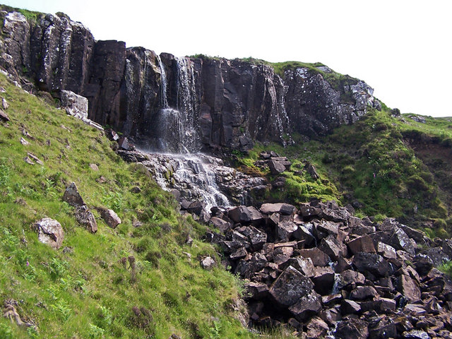
An Dubh Loch is not only a sight to behold but also offers recreational activities such as fishing. The lake is home to a variety of fish species, including brown trout and arctic char, providing anglers with ample opportunities to test their skills.

For those seeking a peaceful and serene getaway, An Dubh Loch provides the perfect setting. Whether it's a leisurely stroll along the lakeside, a picnic on its banks, or simply soaking in the breathtaking views, this hidden gem of Inverness-shire is a must-visit for anyone looking to immerse themselves in the beauty of the Scottish Highlands.

If you have any feedback on the listing, please let us know in the comments section below.

An Dubh Loch Images

Images are sourced within 2km of 57.390005/-6.6796756 or Grid Reference NG1842. Thanks to Geograph Open Source API. All images are credited.

Across Lorgill valley This is a lovely view across the valley with Autumnal colours everywhere.
Across Lorgill valley
This is a lovely view across the valley with Autumnal colours everywhere.
Sheep grazing in Lorgill valley
Heather on valley sides at Lorgill
Deer fence on the summit  This is close to the summit of Ben Corkeval. The flat topped hills in the background are Macleod's Tables. The deer fence continues for miles, enclosing a very large area of the north east facing slope of the hill. Parts of the enclosed hillside have been planted with broadleaf trees.
Deer fence on the summit
This is close to the summit of Ben Corkeval. The flat topped hills in the background are Macleod's Tables. The deer fence continues for miles, enclosing a very large area of the north east facing slope of the hill. Parts of the enclosed hillside have been planted with broadleaf trees.
Ruins in Lorgill Two of the houses from which the residents were removed in the clearance of 1830.
Ruins in Lorgill
Two of the houses from which the residents were removed in the clearance of 1830.
Ford on the Lorgill track Where the old cart track crosses the Lon Ban.
Ford on the Lorgill track
Where the old cart track crosses the Lon Ban.
Lorgill Village Sheep making the most of the land that was cleared of humans to make way for them.

The inhabitants of Lorgill were forcibly shipped from here to Nova Scotia in 1830.
Lorgill Village
Sheep making the most of the land that was cleared of humans to make way for them. The inhabitants of Lorgill were forcibly shipped from here to Nova Scotia in 1830.
Waterfall on the Lorgill River The river falls here as it enters the Lorgill valley.
Waterfall on the Lorgill River
The river falls here as it enters the Lorgill valley.
Creag na h-Aire Crags to the east of the Lorgill valley.
Creag na h-Aire
Crags to the east of the Lorgill valley.
From Lon Ban towards Neist Point Lighthouse
Lorgill ruins The ruins are all that are left to show where the once thriving community of a dozen or more families once lived.In 1830, at very short notice,they were ordered to leave to make way for tenant farmers and their sheep.
Lorgill ruins
The ruins are all that are left to show where the once thriving community of a dozen or more families once lived.In 1830, at very short notice,they were ordered to leave to make way for tenant farmers and their sheep.
Waterfall down into Lorgill
Summit of Ben Corkeval The 350m high point is unmarked, and probably seldom visited. The view is to the two Macleod's Tables, Healabhal Mhor on the left and Healabhal Bheag on the right.
Summit of Ben Corkeval
The 350m high point is unmarked, and probably seldom visited. The view is to the two Macleod's Tables, Healabhal Mhor on the left and Healabhal Bheag on the right.
Peat hag on Ben Corkeval Just to the west of the summit of the hill. The peat is very dry at this time of year.
In the distance is the back of Waterstein Head.
Peat hag on Ben Corkeval
Just to the west of the summit of the hill. The peat is very dry at this time of year. In the distance is the back of Waterstein Head.
North end of An Dubh Loch Looking a lot more 'gorm' than 'dubh' on a perfect January morning.
North end of An Dubh Loch
Looking a lot more 'gorm' than 'dubh' on a perfect January morning.
Ben Allarnish The hill is just a step in the basalt lava plateaux of Duirinish. It is seen here across the moorland above Gleann a' Phuill.
Ben Allarnish
The hill is just a step in the basalt lava plateaux of Duirinish. It is seen here across the moorland above Gleann a' Phuill.
Lon Ban The Lon Ban snaking across the moor towards Ramasaig Bay, seen from the lower slopes of Ben Allarnish.
Lon Ban
The Lon Ban snaking across the moor towards Ramasaig Bay, seen from the lower slopes of Ben Allarnish.
Gleann a' Phuill Looking up the glen. The burn in the view is the Allt Dorch.
Gleann a' Phuill
Looking up the glen. The burn in the view is the Allt Dorch.
Show me another place!

An Dubh Loch is located at Grid Ref: NG1842 (Lat: 57.390005, Lng: -6.6796756)

Unitary Authority: Highland

Police Authority: Highlands and Islands

What 3 Words

///entitle.boardroom.camped. Near Glendale, Highland

Nearby Locations

An Dubh Loch

Related Wikis

Ramasaig

Ramasaig is a small township on the western shore of the Duirinish peninsula, on Dunvegan, Isle of Skye and is in the Scottish Highlands and is in the...

Eas Mòr, Durinish

Eas Mòr is a waterfall on the Duirinish peninsula of the island of Skye in Scotland. It lies on the Allt Mhicheil, a tributary of the Dibidal River below...

Healabhal Bheag

Healabhal Bheag is a hill located on the Duirinish peninsula of the Isle of Skye in the Inner Hebrides, Scotland. It is also known as MacLeod's Table South...

Borrodale

Borrodale (Scottish Gaelic: Borodail) is small hamlet on the Isle of Skye, in the Inner Hebrides of Scotland. Borrodale is part of Glendale and the Glendale...

Duirinish, Skye

Duirinish (Scottish Gaelic: Diùirinis) is a peninsula and civil parish on the island of Skye in Scotland. It is situated in the north west between Loch...

Colbost

Colbost (Scottish Gaelic: Cealabost) is a scattered hamlet on the B884 road, in the Glendale estate, overlooking Loch Dunvegan on the Scottish island of...

The Three Chimneys

The Three Chimneys is a restaurant in Colbost, Isle of Skye, Scotland. While in operation beforehand, the restaurant came to prominence after being taken...

Glendale, Skye

Glendale (Scottish Gaelic: Gleann Dail) is a community-owned estate on the north-western coastline of the Duirinish peninsula on the island of Skye and...

Have you been to An Dubh Loch?

Leave your review of An Dubh Loch below (or comments, questions and feedback).