Loch a' Mhonaidh

Lake, Pool, Pond, Freshwater Marsh in Inverness-shire

Scotland

Loch a' Mhonaidh

Drinishader A bay on the west side of islet-studded Loch Tairbeart, the largest of the sea-lochs on the east side of Harris.
Drinishader Credit: Anne Burgess

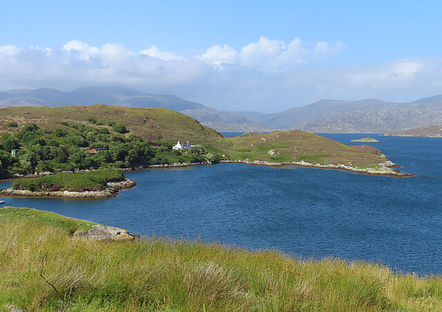
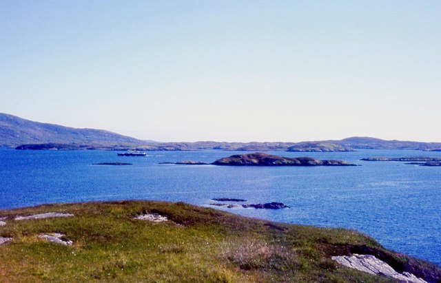
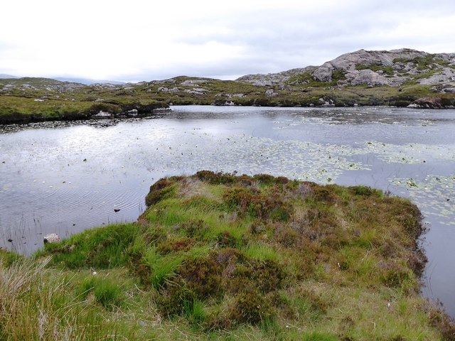
Loch a' Mhonaidh, located in Inverness-shire, Scotland, is a picturesque freshwater lake nestled amidst the stunning Scottish Highlands. Spanning an area of approximately 75 acres, the loch is known for its tranquil beauty and diverse wildlife.

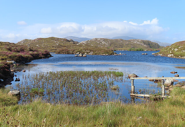
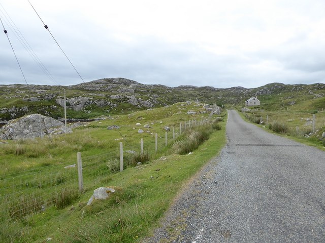
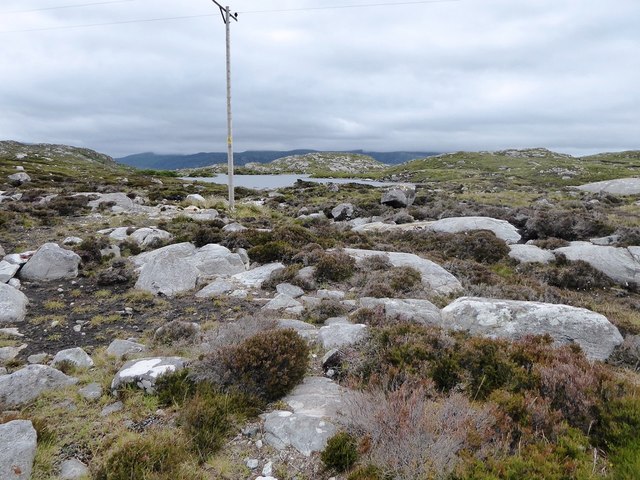
Surrounded by rolling hills and dense forests, Loch a' Mhonaidh offers visitors a serene and peaceful environment. The crystal-clear waters of the lake are fed by numerous small streams originating from the surrounding mountains, ensuring a constant supply of fresh water. The lake's depth varies, with some areas reaching up to 30 feet, providing an ideal habitat for a variety of aquatic species.

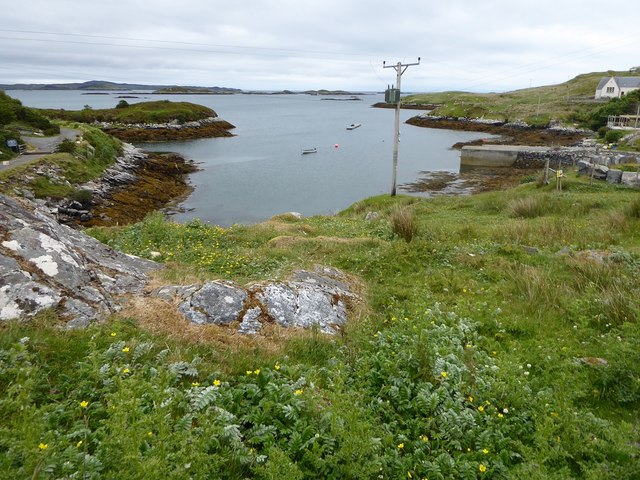
The shores of Loch a' Mhonaidh are rich in vegetation, with reeds, rushes, and water lilies lining the edges. This flourishing plant life sustains a wide range of bird species, making the loch a haven for birdwatchers. Visitors can spot an array of waterfowl, including swans, ducks, and herons, as well as rare species such as the osprey and golden eagle that occasionally grace the area with their presence.

Anglers are drawn to Loch a' Mhonaidh's reputation as a prime fishing spot. The lake is home to several species of fish, including brown trout and pike, offering ample opportunities for both seasoned anglers and beginners to cast their lines.

For those seeking outdoor activities, Loch a' Mhonaidh is a popular location for boating and kayaking. Its calm waters and picturesque surroundings make it an ideal spot for leisurely exploration or an adventurous day out on the water.

Overall, Loch a' Mhonaidh is a natural gem, offering visitors a chance to immerse themselves in the tranquility of the Scottish Highlands and connect with nature's beauty.

If you have any feedback on the listing, please let us know in the comments section below.

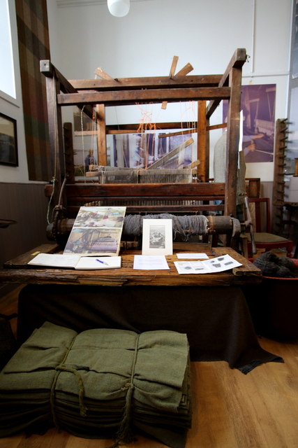
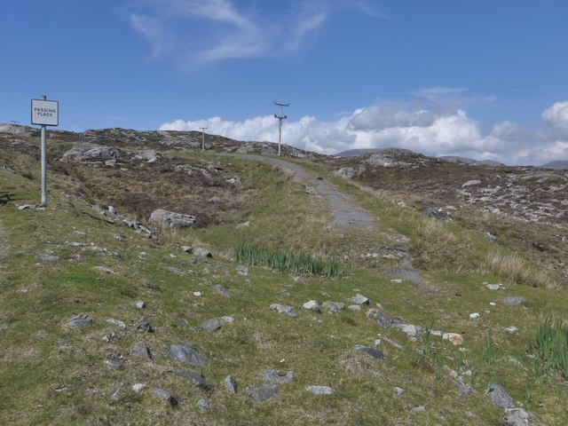
Loch a' Mhonaidh Images

Images are sourced within 2km of 57.858292/-6.7889518 or Grid Reference NG1695. Thanks to Geograph Open Source API. All images are credited.

Drinishader A bay on the west side of islet-studded Loch Tairbeart, the largest of the sea-lochs on the east side of Harris.
Drinishader
A bay on the west side of islet-studded Loch Tairbeart, the largest of the sea-lochs on the east side of Harris.
Loch Drinisiadair This is just the southern tip of one of the larger lochs in eastern Harris.
Loch Drinisiadair
This is just the southern tip of one of the larger lochs in eastern Harris.
In the driving seat of the Hattersley Mk1 at Drinisiadar Built in Keighley, West Yorkshire and one time Luddite bait the loom was designed by George Hattersley and from 1919 to the present has proved a godsend to the people of Harris.
In the driving seat of the Hattersley Mk1 at Drinisiadar
Built in Keighley, West Yorkshire and one time Luddite bait the loom was designed by George Hattersley and from 1919 to the present has proved a godsend to the people of Harris.
All trades their gear, tackle, and trim.. The loom and some of the products at the exhibition at Drinisiadar.
All trades their gear, tackle, and trim..
The loom and some of the products at the exhibition at Drinisiadar.
Original Harris Tweed Introduced to Harris in 1919 the Hattersley cottage loom which was manufactured by George Hattersley of Keighley, West Yorkshire and proved a godsend for the people of Harris.
Original Harris Tweed
Introduced to Harris in 1919 the Hattersley cottage loom which was manufactured by George Hattersley of Keighley, West Yorkshire and proved a godsend for the people of Harris.
Nostalgia's not what it used to be! If ever a poem ran in parallel with Yeats' Lake Isle of Innisfree then this is the one.
Nostalgia's not what it used to be!
If ever a poem ran in parallel with Yeats' Lake Isle of Innisfree then this is the one.
The Spinning Wheels of Harris Before you weave, first spin the wool.
The Spinning Wheels of Harris
Before you weave, first spin the wool.
The old road to Tarbert, Harris The remains of the old road just show here, at a passing place on the newer road, which is still pretty narrow and tortuous - known as "The Golden Road".
The old road to Tarbert, Harris
The remains of the old road just show here, at a passing place on the newer road, which is still pretty narrow and tortuous - known as "The Golden Road".
Road to the south Leading to the Golden Road and, eventually, Rodel. Long and winding through an amazing rocky landscape.
Road to the south
Leading to the Golden Road and, eventually, Rodel. Long and winding through an amazing rocky landscape.
Road Junction  at Miabhaig The east coast road from Rodel meets the main A859 Tairbeart-Roghadal road.
Road Junction at Miabhaig
The east coast road from Rodel meets the main A859 Tairbeart-Roghadal road.
Electricity transmission lines A familiar feature in the rocky landscape of Harris.
Electricity transmission lines
A familiar feature in the rocky landscape of Harris.
South end of Loch Drinisiadair
Rubha na Mòine The ferry heading in to Tarbert past the Gloraigs.
Rubha na Mòine
The ferry heading in to Tarbert past the Gloraigs.
Minor road among rock outcrops east of Meavag
Rocks and heather next to the 'Golden Road' looking towards Loch Drinisiadair
The harbour at Drinisiadair
Lilies in unnamed loch south of Loch Tallabreck
The A859 at the junction with the road to Rodel, Isle of Harris
Show me another place!

Loch a' Mhonaidh is located at Grid Ref: NG1695 (Lat: 57.858292, Lng: -6.7889518)

Unitary Authority: Na h-Eileanan an Iar

Police Authority: Highlands and Islands

What 3 Words

///position.landowner.imagined. Near Tarbert, Na h-Eileanan Siar

Related Wikis

East Loch Tarbert

East Loch Tarbert (Scottish Gaelic: Loch an Tairbeairt) is a sea loch that lies to the east of Harris in the Outer Hebrides of Scotland. The loch contains...

Sgeotasaigh

Scotasay (Scottish Gaelic: Sgeotasaigh) is small island in the Outer Hebrides of Scotland. It lies 1 kilometre (0.6 miles) off the east coast of Harris...

Harris distillery

Harris distillery is a Scotch whisky and Gin distillery in Tarbert on the Isle of Harris, Scotland. The distillery was the first legal distillery ever...

Tarbert, Harris

Tarbert (Scottish Gaelic: An Tairbeart [ən̪ˠ ˈt̪ɛrʲɛbərˠʃt̪]) is the main community on Harris in the Western Isles of Scotland. The name means "isthmus...

Stockinish Island

Stockinish Island (Scottish Gaelic: Eilean Stocainis) is an uninhabited island off Harris, in the Outer Hebrides. == Geography and geology == Stockinish...

Harris, Outer Hebrides

Harris (Scottish Gaelic: Na Hearadh, pronounced [nə ˈhɛɾəɣ] ) is the southern and more mountainous part of Lewis and Harris, the largest island in the...

Scalpay, Outer Hebrides

Scalpay (; Scottish Gaelic: Sgalpaigh or Sgalpaigh na Hearadh; i.e. "Scalpay of Harris" to distinguish it from Scalpay off Skye) is an island in the Outer...

Ardhasaig

Ardhasaig (Scottish Gaelic: Àird Àsaig) is a settlement on the western coast of north Harris, in the Outer Hebrides, Scotland. Ardhasaig is also within...

Nearby Amenities

Located within 500m of 57.858292,-6.7889518
Passing Place
Lat/Long: 57.858275/-6.7830232
Barrier: cattle_grid
Source: survey
Lat/Long: 57.8614476/-6.7877846
Passing Place
Lat/Long: 57.8621935/-6.7881323
Passing Place
Lat/Long: 57.8617559/-6.7880794
Passing Place
Lat/Long: 57.8608182/-6.7869508
Passing Place
Lat/Long: 57.8596976/-6.7860421
Passing Place
Lat/Long: 57.8591629/-6.7851609
Passing Place
Lat/Long: 57.8589171/-6.7843942
Passing Place
Lat/Long: 57.8577777/-6.7820174
Cnoc na h-Uamha
Place: locality
Lat/Long: 57.8593513/-6.7948058
Material: wood
Power: pole
Lat/Long: 57.8577733/-6.7813557
Material: wood
Power: pole
Lat/Long: 57.8588264/-6.7832896
Material: wood
Power: pole
Lat/Long: 57.8581559/-6.7820582
Material: wood
Power: pole
Lat/Long: 57.859206/-6.7840031
Material: wood
Power: pole
Lat/Long: 57.8595799/-6.784687
Material: wood
Power: pole
Lat/Long: 57.8601606/-6.7857385
Material: wood
Power: pole
Lat/Long: 57.8608712/-6.7862561
Material: wood
Power: pole
Lat/Long: 57.8622995/-6.787329
Material: wood
Power: pole
Lat/Long: 57.8615104/-6.7867336
The data included in this document is from www.openstreetmap.org. The data is made available under ODbL.

Have you been to Loch a' Mhonaidh?

Leave your review of Loch a' Mhonaidh below (or comments, questions and feedback).