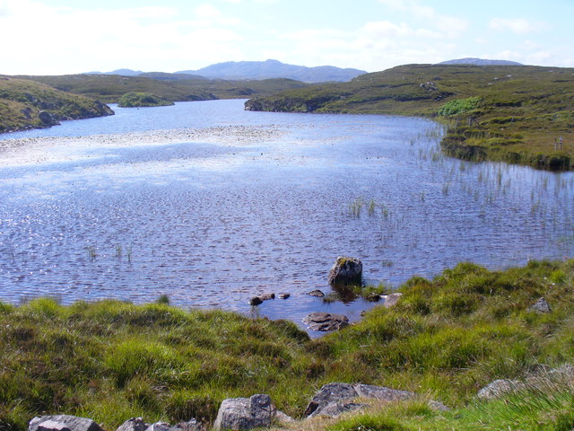
Loch Dubh nan Dromannan Mòra

Lake, Pool, Pond, Freshwater Marsh in Ross-shire

Scotland

Loch Dubh nan Dromannan Mòra
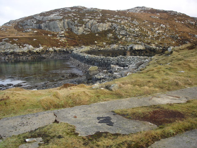
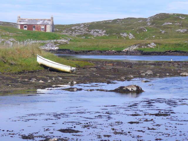
Old hardstandings at Tob Blar Meadha Abandoned lobster loading hardstandings at the lobster pond.
Old hardstandings at Tob Blar Meadha Credit: Gus Macdonald

Loch Dubh nan Dromannan Mòra is a freshwater loch located in the county of Ross-shire, in the Scottish Highlands. With its name translating to "Black Loch of the Big Ridges," it is nestled amidst a picturesque landscape, surrounded by rolling hills and stunning natural beauty.

Covering an approximate area of 50 hectares, the loch is home to a diverse range of flora and fauna. Its shores are adorned with lush vegetation, including reeds, grasses, and wildflowers, providing a habitat for various species of birds, insects, and small mammals. The loch itself sustains a healthy population of fish, such as trout and pike, attracting anglers from near and far.

The water of Loch Dubh nan Dromannan Mòra is known for its clarity and reflects the surrounding landscape with a mirror-like surface. This makes it a popular spot for leisure activities such as boating, kayaking, and canoeing. Visitors can also enjoy peaceful walks along the loch's shores, taking in the tranquil atmosphere and observing the abundant wildlife.

The loch is easily accessible, with a well-maintained path leading to its shores from the nearby village. Loch Dubh nan Dromannan Mòra offers a haven of tranquility, allowing visitors to escape the hustle and bustle of everyday life and immerse themselves in the serenity of nature. Whether for a leisurely stroll, a day of fishing, or simply a moment of reflection, this loch provides a delightful retreat for all who venture to its shores.

If you have any feedback on the listing, please let us know in the comments section below.

Loch Dubh nan Dromannan Mòra Images

Images are sourced within 2km of 58.232231/-6.8476886 or Grid Reference NB1537. Thanks to Geograph Open Source API. All images are credited.
Old hardstandings at Tob Blar Meadha Abandoned lobster loading hardstandings at the lobster pond.
Old hardstandings at Tob Blar Meadha
Abandoned lobster loading hardstandings at the lobster pond.
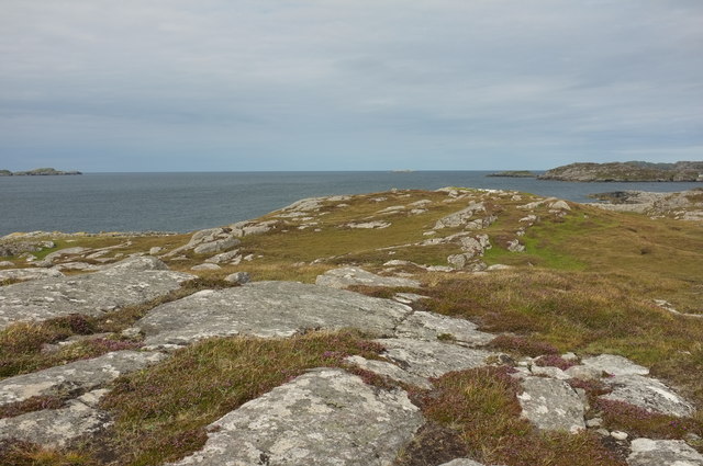
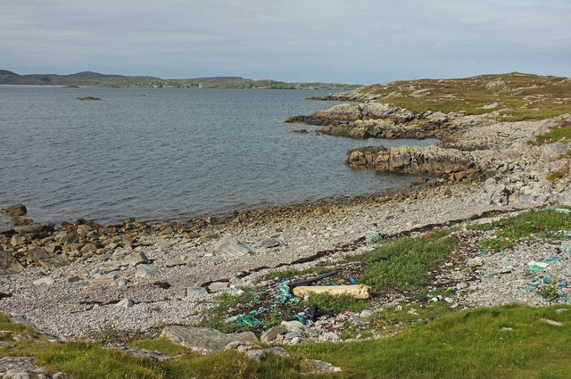
West coast of Great Bernera This is the west side of a spit of land extending south of Tobson. The ground is rocky with a thin covering of grass.

In the distance, on the left is the tip of the island of Pabaigh Mor .. and on the right Geodha Mor (west of Tobson).
West coast of Great Bernera
This is the west side of a spit of land extending south of Tobson. The ground is rocky with a thin covering of grass. In the distance, on the left is the tip of the island of Pabaigh Mor .. and on the right Geodha Mor (west of Tobson).
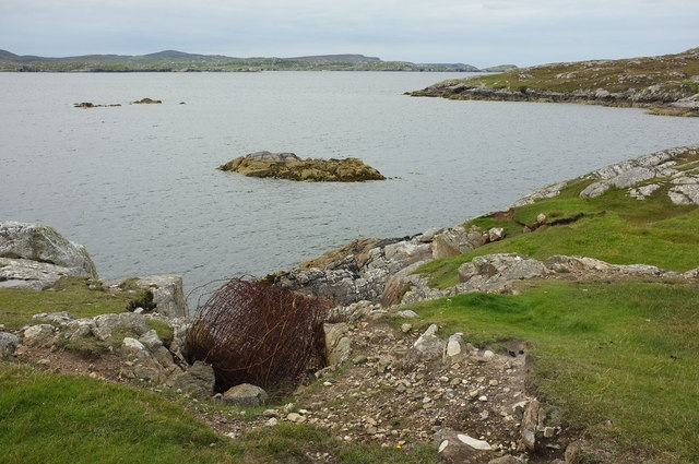
Camas Sanndaig Looking across the bay. In the distance is the low island of Pabaigh Mor with the headland of Bhaltos beyond.

A bundle of fencing wire is abandoned in the rocky gully above the sea.
Camas Sanndaig
Looking across the bay. In the distance is the low island of Pabaigh Mor with the headland of Bhaltos beyond. A bundle of fencing wire is abandoned in the rocky gully above the sea.
Beach north of Bhalasaigh
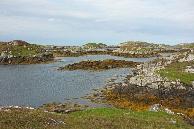
Sea loch west of Loch Veiravat Although it isn't obvious from here, this is the start of a long channel that leads out to the sea.
Sea loch west of Loch Veiravat
Although it isn't obvious from here, this is the start of a long channel that leads out to the sea.
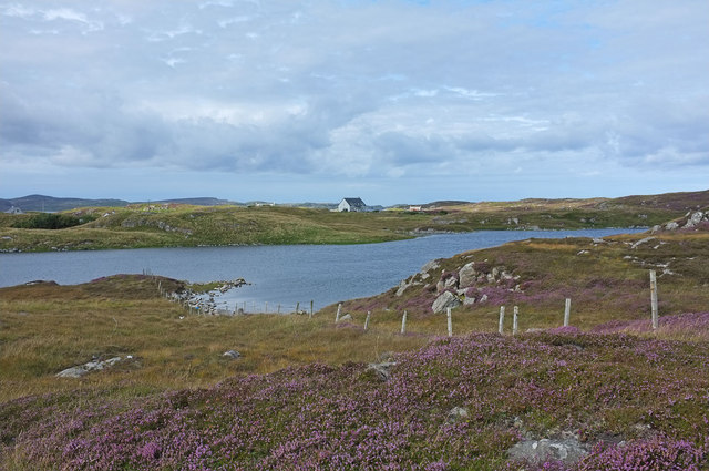
Moorland and loch on Great Bernera The loch is unnamed on the map, but the Allt Loch an Fheoir flows into it, so this must be Loch an Fheoir.

The houses in the distance are on the road south of Bhalasaigh.
Moorland and loch on Great Bernera
The loch is unnamed on the map, but the Allt Loch an Fheoir flows into it, so this must be Loch an Fheoir. The houses in the distance are on the road south of Bhalasaigh.
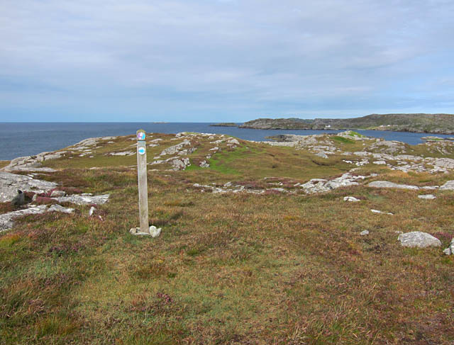
Waymarked coastal walk There are clear waymarks on the route from the community centre to Bosta on Great Bernera. Return by the same route or on the road.
Waymarked coastal walk
There are clear waymarks on the route from the community centre to Bosta on Great Bernera. Return by the same route or on the road.
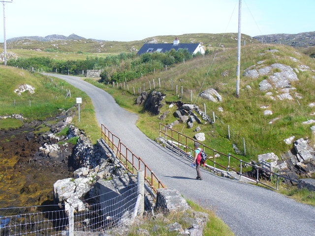
Bridge at Bhalasaigh Looking back to the road end on the main island of Great Bernera.
Bridge at Bhalasaigh
Looking back to the road end on the main island of Great Bernera.
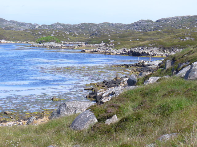
West coast of Great Bernera A complicated coastline with many interesting features.
West coast of Great Bernera
A complicated coastline with many interesting features.
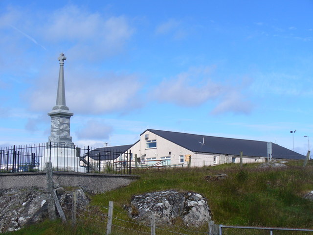
War Memorial, Breacleit The memorial stands on a mound at the crossroads in the centre of Breacleit / Breaclete, the capital of Great Bernera / Bearnaraigh. On the skyline is the Bernera Community Centre.
<span class="nowrap"><a title="http://www.uigandbernera.com/" rel="nofollow ugc noopener" href="http://www.uigandbernera.com/">Link</a><img style="margin-left:2px;" alt="External link" title="External link - shift click to open in new window" src="https://s1.geograph.org.uk/img/external.png" width="10" height="10"/></span>
War Memorial, Breacleit
The memorial stands on a mound at the crossroads in the centre of Breacleit / Breaclete, the capital of Great Bernera / Bearnaraigh. On the skyline is the Bernera Community Centre. LinkExternal link
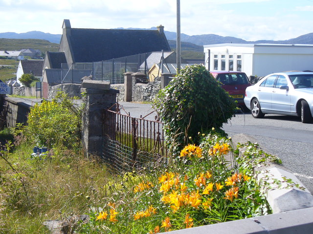
Breacleit, Bernera Summer flowers, church and school in the village centre.
<span class="nowrap"><a title="http://www.uigandbernera.com/" rel="nofollow ugc noopener" href="http://www.uigandbernera.com/">Link</a><img style="margin-left:2px;" alt="External link" title="External link - shift click to open in new window" src="https://s1.geograph.org.uk/img/external.png" width="10" height="10"/></span>
Breacleit, Bernera
Summer flowers, church and school in the village centre. LinkExternal link
Loch Ionail Freshwater loch on the island of Great Bernera / Bearnaraigh.
<span class="nowrap"><a title="http://www.uigandbernera.com/" rel="nofollow ugc noopener" href="http://www.uigandbernera.com/">Link</a><img style="margin-left:2px;" alt="External link" title="External link - shift click to open in new window" src="https://s1.geograph.org.uk/img/external.png" width="10" height="10"/></span>
Loch Ionail
Freshwater loch on the island of Great Bernera / Bearnaraigh. LinkExternal link
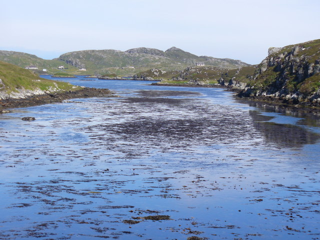
Tob Bhalasaigh Tidal lagoon with a mix of rare seaweeds on Great Bernera / Bearnaraigh.
<span class="nowrap"><a title="http://www.uigandbernera.com/" rel="nofollow ugc noopener" href="http://www.uigandbernera.com/">Link</a><img style="margin-left:2px;" alt="External link" title="External link - shift click to open in new window" src="https://s1.geograph.org.uk/img/external.png" width="10" height="10"/></span>
Tob Bhalasaigh
Tidal lagoon with a mix of rare seaweeds on Great Bernera / Bearnaraigh. LinkExternal link
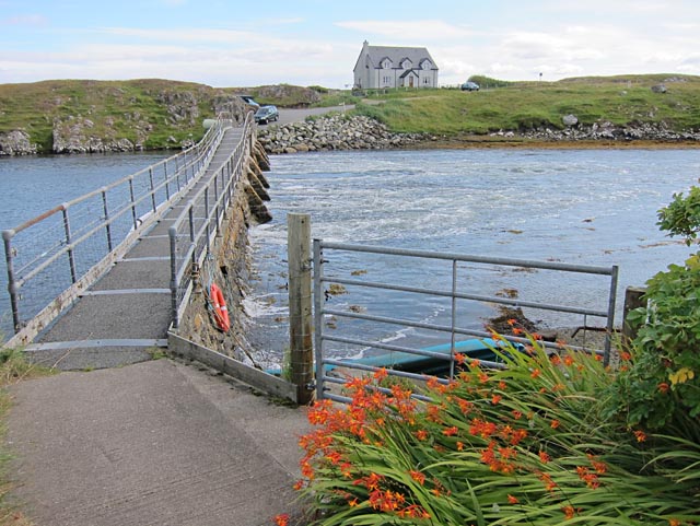
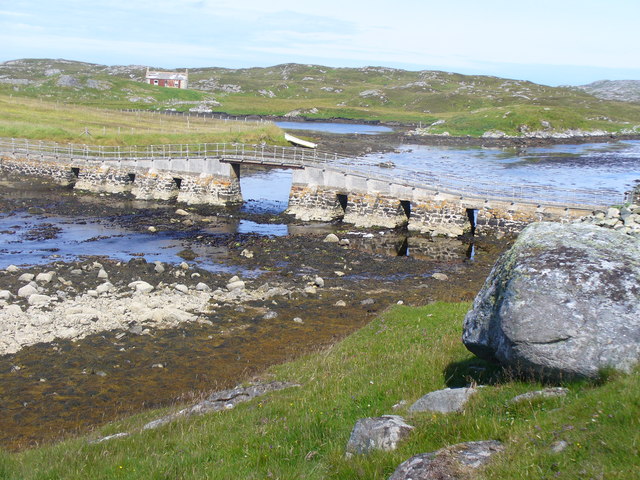
Valasay Bridge Carrying the single track road across an outlet of the tidal lagoon, Tob Bhalasaigh on Great Bernera / Bearnaraigh.
<span class="nowrap"><a title="http://www.uigandbernera.com/" rel="nofollow ugc noopener" href="http://www.uigandbernera.com/">Link</a><img style="margin-left:2px;" alt="External link" title="External link - shift click to open in new window" src="https://s1.geograph.org.uk/img/external.png" width="10" height="10"/></span>
Valasay Bridge
Carrying the single track road across an outlet of the tidal lagoon, Tob Bhalasaigh on Great Bernera / Bearnaraigh. LinkExternal link
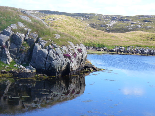
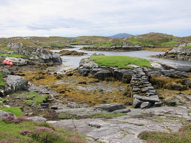
Shoreline at Tob Bhalasaigh Rocks and heather at the edge of the tidal lagoon in Valasay.
<span class="nowrap"><a title="http://www.uigandbernera.com/" rel="nofollow ugc noopener" href="http://www.uigandbernera.com/">Link</a><img style="margin-left:2px;" alt="External link" title="External link - shift click to open in new window" src="https://s1.geograph.org.uk/img/external.png" width="10" height="10"/></span>
Shoreline at Tob Bhalasaigh
Rocks and heather at the edge of the tidal lagoon in Valasay. LinkExternal link
Valasay Footbridge The bridge across the tidal Tob Bhalasaigh was built in 1898.
<span class="nowrap"><a title="http://www.uigandbernera.com/" rel="nofollow ugc noopener" href="http://www.uigandbernera.com/">Link</a><img style="margin-left:2px;" alt="External link" title="External link - shift click to open in new window" src="https://s1.geograph.org.uk/img/external.png" width="10" height="10"/></span>
Valasay Footbridge
The bridge across the tidal Tob Bhalasaigh was built in 1898. LinkExternal link
Tidal Lagoon, Valasay Tob Bhalasaigh, on the island of Great Bernera / Bearnaraigh.
<span class="nowrap"><a title="http://www.uigandbernera.com/" rel="nofollow ugc noopener" href="http://www.uigandbernera.com/">Link</a><img style="margin-left:2px;" alt="External link" title="External link - shift click to open in new window" src="https://s1.geograph.org.uk/img/external.png" width="10" height="10"/></span>
Tidal Lagoon, Valasay
Tob Bhalasaigh, on the island of Great Bernera / Bearnaraigh. LinkExternal link
Tob Bhalasaigh from the Footbridge View northwards, along the narrow tidal lagoon, to Tobson 2 kilometres away in the distance.
Tob Bhalasaigh from the Footbridge
View northwards, along the narrow tidal lagoon, to Tobson 2 kilometres away in the distance.
Show me another place!

Loch Dubh nan Dromannan Mòra is located at Grid Ref: NB1537 (Lat: 58.232231, Lng: -6.8476886)

Unitary Authority: Na h-Eileanan an Iar

Police Authority: Highlands and Islands

What 3 Words

///conjured.challenge.bucks. Near Carloway, Na h-Eileanan Siar

Related Wikis

Great Bernera

Great Bernera (; Scottish Gaelic: Beàrnaraigh Mòr), often known just as Bernera (Scottish Gaelic: Beàrnaraigh), is an island and community in the Outer...

Breaclete

Breacleit (or Roulanish; Scottish Gaelic: Breacleit; Old Norse: Breiðiklettr) is the central village on Great Bernera in the Outer Hebrides, Scotland....

Dun Bharabhat, Great Bernera

Dun Bharabhat (or Dun Baravat) is an Iron Age galleried dun or "semi-broch" situated on the island of Great Bernera near Lewis in Scotland (grid reference...

Bernera Riot

The Bernera Riot occurred in 1874, on the island of Great Bernera, in Scotland in response to the Highland Clearances. The use of the term 'Bernera Riot...

Nearby Amenities

Located within 500m of 58.232231,-6.8476886
Passing Place
Lat/Long: 58.2305008/-6.8428949
Passing Place
Lat/Long: 58.2331661/-6.8450152
Barrier: cattle_grid
Source: Bing
Lat/Long: 58.2348354/-6.8507804
Passing Place
Lat/Long: 58.2322823/-6.8438078
Passing Place
Lat/Long: 58.2334877/-6.8471358
Barrier: cattle_grid
Lat/Long: 58.2335232/-6.8464432
Passing Place
Lat/Long: 58.2337647/-6.8484703
Power: pole
Lat/Long: 58.2356631/-6.8531195
Power: pole
Lat/Long: 58.2350006/-6.8524781
Power: pole
Lat/Long: 58.2344637/-6.851172
Power: pole
Lat/Long: 58.2339227/-6.8498897
Power: pole
Lat/Long: 58.2335722/-6.8489868
Power: pole
Lat/Long: 58.2332767/-6.847789
Power: pole
Lat/Long: 58.2331452/-6.8471887
Power: pole
Lat/Long: 58.232973/-6.8464929
Power: pole
Lat/Long: 58.2328108/-6.8457961
Power: pole
Lat/Long: 58.2321503/-6.8453572
Power: pole
Lat/Long: 58.2316595/-6.845048
Power: pole
Lat/Long: 58.2307979/-6.8444611
Power: pole
Lat/Long: 58.2300956/-6.8440729
Power: pole
Lat/Long: 58.2295514/-6.8437637
Power: pole
Lat/Long: 58.2288824/-6.843419
Power: pole
Lat/Long: 58.2291147/-6.8422787
Power: pole
Lat/Long: 58.2293247/-6.8412525
Power: pole
Lat/Long: 58.2312626/-6.8398928
The data included in this document is from www.openstreetmap.org. The data is made available under ODbL.

Have you been to Loch Dubh nan Dromannan Mòra?

Leave your review of Loch Dubh nan Dromannan Mòra below (or comments, questions and feedback).