Loch Uamasbroc

Lake, Pool, Pond, Freshwater Marsh in Ross-shire

Scotland

Loch Uamasbroc

Heronry on cliff face, Loch Rog Beag, North Harris These herons are very unusual nesting on the open cliff face rather than in tree tops.  The eggs are very vulnerable to predation by Buzzards and Ravens.  Despite our guided tour RIB remaining well away we observed 2 eggs being taken by groups of Ravens attacking, distracting the parents and "sneaking in".  Nature is hard to observe sometimes.
Heronry on cliff face, Loch Rog Beag, North Harris Credit: Hazel Hambidge

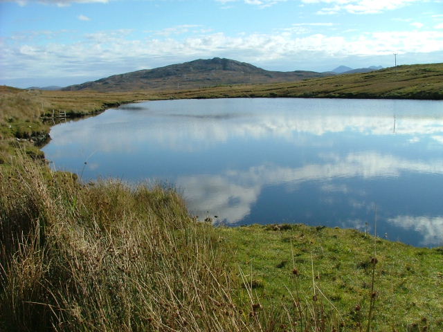
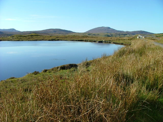
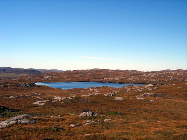
Loch Uamasbroc, located in Ross-shire, Scotland, is a picturesque freshwater body known for its serene beauty and diverse ecosystem. Spanning across an area of approximately 50 acres, it is often referred to as a lake, pool, pond, or freshwater marsh due to its varied characteristics.

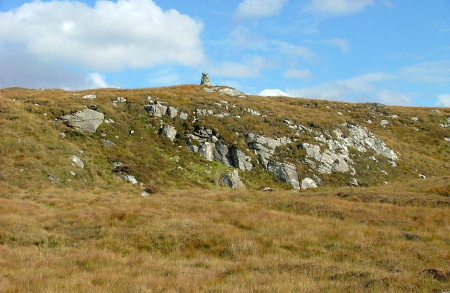
Surrounded by lush greenery and rolling hills, Loch Uamasbroc offers a tranquil environment for both nature enthusiasts and wildlife alike. The lake is fed by several small streams originating from nearby mountains, ensuring a constant flow of fresh water. Its depth ranges from shallow areas, resembling a pond or pool, to deeper sections that exhibit the characteristics of a lake.

The diverse aquatic vegetation in Loch Uamasbroc provides a vital habitat for a wide array of plant and animal species. Water lilies, reeds, and rushes grow abundantly along the edges, offering shelter and food for various waterfowl and insects. The lake is home to numerous fish species, including brown trout and pike, attracting anglers from far and wide.

The surrounding freshwater marsh is a haven for birdlife, with species such as mallards, teal, and herons frequently spotted in the area. The marshland's muddy banks provide an ideal nesting ground for waterfowl, adding to the lake's ecological significance.

Visitors to Loch Uamasbroc can enjoy a range of activities, including fishing, birdwatching, and leisurely walks along its shores. Its idyllic setting and diverse ecosystem make it a popular destination for nature lovers seeking solace and the opportunity to witness the beauty of Scotland's countryside.

If you have any feedback on the listing, please let us know in the comments section below.

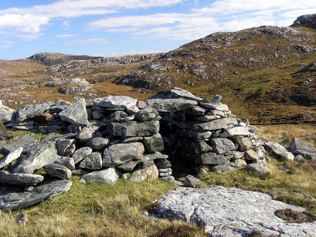
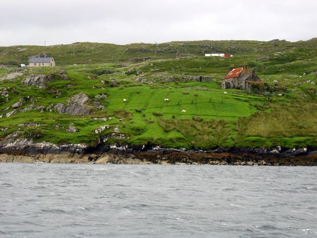
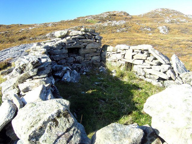
Loch Uamasbroc Images

Images are sourced within 2km of 58.151187/-6.8623165 or Grid Reference NB1428. Thanks to Geograph Open Source API. All images are credited.

Heronry on cliff face, Loch Rog Beag, North Harris These herons are very unusual nesting on the open cliff face rather than in tree tops.  The eggs are very vulnerable to predation by Buzzards and Ravens.  Despite our guided tour RIB remaining well away we observed 2 eggs being taken by groups of Ravens attacking, distracting the parents and "sneaking in".  Nature is hard to observe sometimes.
Heronry on cliff face, Loch Rog Beag, North Harris
These herons are very unusual nesting on the open cliff face rather than in tree tops. The eggs are very vulnerable to predation by Buzzards and Ravens. Despite our guided tour RIB remaining well away we observed 2 eggs being taken by groups of Ravens attacking, distracting the parents and "sneaking in". Nature is hard to observe sometimes.
West Bank, Loch Rog Beag, North Harris View almost south from RIB towards west bank of this narrow sea loch.
West Bank, Loch Rog Beag, North Harris
View almost south from RIB towards west bank of this narrow sea loch.
Old tractor I'm no expert but I think this is a Ferguson TEA20 of about 1950 vintage with Loch Ròg Beag as a backdrop.
Old tractor
I'm no expert but I think this is a Ferguson TEA20 of about 1950 vintage with Loch Ròg Beag as a backdrop.
Enaclete: rainbow over Loch Ròg Beag Having visited the Flannan Isles today, in fine weather, it was clear as we approached the Lewis coast on our return that Lewis itself had not fared so fortunately. However, sunshine did break through as we approached Miavaig harbour and, by the time we set foot ashore the sun was shining brightly.

This would be a shortlived break in the showers, though, as this rainbow across the Loch testifies.

The B8011 has very recently been upgraded (not yet included on the 1:50,000 mapping but updated at 1:25,000 scale) and Enaclete village is now bypassed by a two-carriageway road. I am not certain but the track immediately in front of us may derive from the course of the old road.
Enaclete: rainbow over Loch Ròg Beag
Having visited the Flannan Isles today, in fine weather, it was clear as we approached the Lewis coast on our return that Lewis itself had not fared so fortunately. However, sunshine did break through as we approached Miavaig harbour and, by the time we set foot ashore the sun was shining brightly. This would be a shortlived break in the showers, though, as this rainbow across the Loch testifies. The B8011 has very recently been upgraded (not yet included on the 1:50,000 mapping but updated at 1:25,000 scale) and Enaclete village is now bypassed by a two-carriageway road. I am not certain but the track immediately in front of us may derive from the course of the old road.
Loch Ròg Beag Viewed from Einacleite.
Loch Ròg Beag
Viewed from Einacleite.
Ruined blackhouse, Ungaisidar
Phonebox and Loch Rog Beag
Heading along the B8011 The B8011 is a scenic road leading to remote communities in west Lewis. Much of it has been upgraded in recent years.
Heading along the B8011
The B8011 is a scenic road leading to remote communities in west Lewis. Much of it has been upgraded in recent years.
Loch Ruadh Southeast of Scaliscro Lodge.
Loch Ruadh
Southeast of Scaliscro Lodge.
Cairn on the Lower Slopes of Sgeun East of the Scaliscro road.
Cairn on the Lower Slopes of Sgeun
East of the Scaliscro road.
Loch Ruadh The pillars of the gateway to Scaliscro Lodge can be seen on the right.
Loch Ruadh
The pillars of the gateway to Scaliscro Lodge can be seen on the right.
Shieling above Strome Ruined shieling on high ground above Strome and Drovinish.
Shieling above Strome
Ruined shieling on high ground above Strome and Drovinish.
Shieling above Strome Ruined shieling above Strome and Drovinish.  The hill behind is Creag na h-Iolaire, the rock of the eagle.
Shieling above Strome
Ruined shieling above Strome and Drovinish. The hill behind is Creag na h-Iolaire, the rock of the eagle.
Enaclete, Uig From across Little Loch Roag.  The red-roofed house belongs to Croft No.1.
Enaclete, Uig
From across Little Loch Roag. The red-roofed house belongs to Croft No.1.
Loch Uamasbroc
Loch Uamasbroc
Croft near Einacleite Taken from boat in Loch Ròg Beag. A more distant view is shown in <a href="https://www.geograph.org.uk/photo/727392">NB1228 : Enaclete, Uig</a>
Croft near Einacleite
Taken from boat in Loch Ròg Beag. A more distant view is shown in NB1228 : Enaclete, Uig
Shieling near Strome Ruined shieling (and another visible in the distance) on moorland below Sron Mhor.
Shieling near Strome
Ruined shieling (and another visible in the distance) on moorland below Sron Mhor.
Show me another place!

Loch Uamasbroc is located at Grid Ref: NB1428 (Lat: 58.151187, Lng: -6.8623165)

Unitary Authority: Na h-Eileanan an Iar

Police Authority: Highlands and Islands

What 3 Words

///private.pulsing.palettes. Near Carloway, Na h-Eileanan Siar

Related Wikis

Gisla Hydro-Electric Scheme

Gisla Hydro-Electric Scheme was a small scheme promoted by the North of Scotland Hydro-Electric Board on the Isle of Lewis, Outer Hebrides, Scotland. It...

Fuaigh Beag

Fuaigh Beag or Vuia Be(a)g is an island in the Outer Hebrides. It is off the west coast of Lewis near Great Bernera in Loch Roag. Its name means "little...

Loch Ròg

Loch Ròg or Loch Roag is a large sea loch on the west coast of Lewis, Outer Hebrides. It is broadly divided into East Loch Roag and West Loch Roag with...

Flodaigh, Lewis

Flodaigh is a small island in Loch Roag on the west coast of Lewis in the Outer Hebrides of Scotland. It is about 33 hectares (82 acres) in extent and...

Have you been to Loch Uamasbroc?

Leave your review of Loch Uamasbroc below (or comments, questions and feedback).