Loch Uamadail

Lake, Pool, Pond, Freshwater Marsh in Inverness-shire

Scotland

Loch Uamadail

West Loch Tarbert from the pier
West Loch Tarbert from the pier Credit: Alan Reid

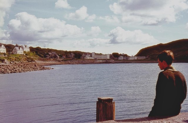
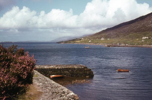
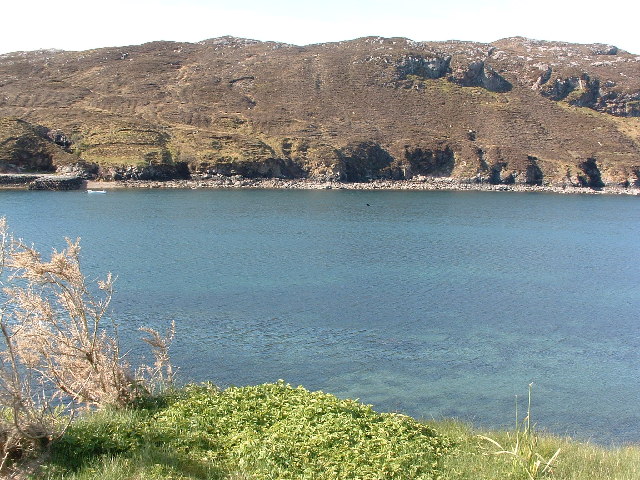
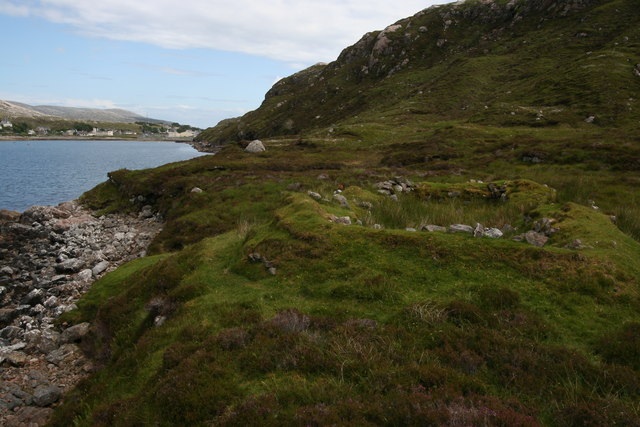
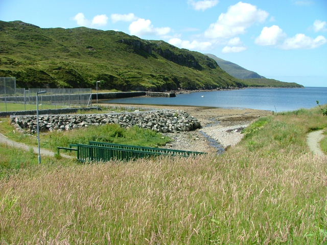
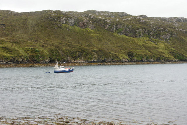
Loch Uamadail is a picturesque freshwater loch located in Inverness-shire, Scotland. It is nestled within the breathtaking scenery of the Scottish Highlands, surrounded by rolling hills and dense forests. The loch covers an area of approximately 100 acres and is known for its crystal-clear waters.

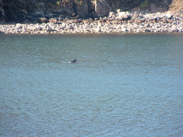
As a freshwater body, Loch Uamadail serves as a vital habitat for numerous species of flora and fauna. The loch is home to a variety of fish, such as brown trout and pike, which thrive in its cool and clean waters. Anglers are often drawn to Loch Uamadail for its excellent fishing opportunities.

Surrounding the loch, there is a diverse ecosystem of wetland vegetation, including reeds and rushes. This creates a freshwater marsh environment, attracting a wide range of bird species. Birdwatchers can spot common waterfowl like ducks and swans, as well as more elusive species such as herons and ospreys.

The tranquil atmosphere and stunning scenery of Loch Uamadail make it a popular destination for nature lovers and outdoor enthusiasts. Visitors can enjoy activities such as boating, kayaking, and hiking along the loch's shoreline. There are also several walking trails in the vicinity, offering panoramic views of the surrounding landscape.

Whether it's the peaceful ambiance, the abundance of wildlife, or the breathtaking views, Loch Uamadail is a must-visit destination for those seeking a serene and nature-filled experience in the heart of Inverness-shire.

If you have any feedback on the listing, please let us know in the comments section below.

Loch Uamadail Images

Images are sourced within 2km of 57.886571/-6.8345218 or Grid Reference NG1398. Thanks to Geograph Open Source API. All images are credited.

West Loch Tarbert from the pier
West Loch Tarbert piers
View of West Bay at Tarbert View from the pier on the north side of the bay towards the pier on the south side, the interesting bit of the photo is the dorsal fin a bit right and up from the centre.
View of West Bay at Tarbert
View from the pier on the north side of the bay towards the pier on the south side, the interesting bit of the photo is the dorsal fin a bit right and up from the centre.
Tarbert bay Whale presumably a Minke whale, not huge but the biggest I've seen
Tarbert bay Whale
presumably a Minke whale, not huge but the biggest I've seen
Remains of blackhouse The old drystone walls of a blackhouse can be seen on the south shore of West Loch Tarbert. The village of Tarbert can be seen in the background.
Remains of blackhouse
The old drystone walls of a blackhouse can be seen on the south shore of West Loch Tarbert. The village of Tarbert can be seen in the background.
Ruined croft building Below Cnoc na Cloiche.
Ruined croft building
Below Cnoc na Cloiche.
Moorland above Tarbert Looking towards Loch a Siar and the football pitch beside the junior secondary school.

The cream-coloured concrete carbuncle is the Old Hostel. This was once used to house the school kids that couldn't get home every night from classes -in the days when there were poor roads and no public transport. The Hostel is now the hub for community-related organisations including the Council, Harris Voluntary Services, North Harris Trust and the dentist and school canteen.
It is scheduled to be demolished in the near future following a major redevelopment of Sir E Scott school.
Moorland above Tarbert
Looking towards Loch a Siar and the football pitch beside the junior secondary school. The cream-coloured concrete carbuncle is the Old Hostel. This was once used to house the school kids that couldn't get home every night from classes -in the days when there were poor roads and no public transport. The Hostel is now the hub for community-related organisations including the Council, Harris Voluntary Services, North Harris Trust and the dentist and school canteen. It is scheduled to be demolished in the near future following a major redevelopment of Sir E Scott school.
Moorland above Tarbert Looking east towards the village.
Moorland above Tarbert
Looking east towards the village.
Old Pier Road Tarbert.
Old Pier Road
Tarbert.
Kayaks and mobile climbing wall Situated behind the local junior secondary school in Tarbert.
Kayaks and mobile climbing wall
Situated behind the local junior secondary school in Tarbert.
The old pier in West Tarbert At the head of Loch a' Siar.
The old pier in West Tarbert
At the head of Loch a' Siar.
Walkway in West Tarbert Looking towards the old pier on Loch a' Siar.
Walkway in West Tarbert
Looking towards the old pier on Loch a' Siar.
Old pier on West Loch Tarbert Seen across the head of the loch.
Old pier on West Loch Tarbert
Seen across the head of the loch.
The old pier at the end of Old Pier Road, Tarbert (An Tairbeart)
Ruined house above Old Pier Road, Tarbert This was a cottar house, a house without associated land and was not part of a croft. It was occupied until the early 1930s. Loch a' Siar is in the background.
Ruined house above Old Pier Road, Tarbert
This was a cottar house, a house without associated land and was not part of a croft. It was occupied until the early 1930s. Loch a' Siar is in the background.
Ruined house above Old Pier Road, Tarbert
Sir Edward Scott Junior Secondary School, Tarbert The school is currently being extended. The grey primary school is across the road. A ruined house is in the foreground.
Sir Edward Scott Junior Secondary School, Tarbert
The school is currently being extended. The grey primary school is across the road. A ruined house is in the foreground.
Boat in Loch a' Siar, Tarbert With the small cliff of Creag Raibistin on the far side of the loch.
Boat in Loch a' Siar, Tarbert
With the small cliff of Creag Raibistin on the far side of the loch.
Show me another place!

Loch Uamadail is located at Grid Ref: NG1398 (Lat: 57.886571, Lng: -6.8345218)

Unitary Authority: Na h-Eileanan an Iar

Police Authority: Highlands and Islands

What 3 Words

///something.spoken.honest. Near Tarbert, Na h-Eileanan Siar

Nearby Locations

Loch Uamadail

Related Wikis

Tarbert, Harris

Tarbert (Scottish Gaelic: An Tairbeart [ən̪ˠ ˈt̪ɛrʲɛbərˠʃt̪]) is the main community on Harris in the Western Isles of Scotland. The name means "isthmus...

Harris distillery

Harris distillery is a Scotch whisky and Gin distillery in Tarbert on the Isle of Harris, Scotland. The distillery was the first legal distillery ever...

Harris, Outer Hebrides

Harris (Scottish Gaelic: Na Hearadh, pronounced [nə ˈhɛɾəɣ] ) is the southern and more mountainous part of Lewis and Harris, the largest island in the...

Ardhasaig

Ardhasaig (Scottish Gaelic: Àird Àsaig) is a settlement on the western coast of north Harris, in the Outer Hebrides, Scotland. Ardhasaig is also within...

Have you been to Loch Uamadail?

Leave your review of Loch Uamadail below (or comments, questions and feedback).