Lochan Sgeireach

Lake, Pool, Pond, Freshwater Marsh in Ross-shire

Scotland

Lochan Sgeireach

View Back Towards Sgalabhal Mula A photo taken after descending the steep and rocky slopes of Sgalabhal Mula.
View Back Towards Sgalabhal Mula Credit: Rude Health

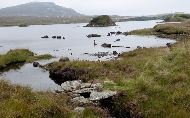
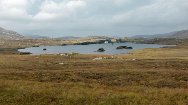
Lochan Sgeireach is a small freshwater loch located in Ross-shire, Scotland. Situated amidst the stunning Scottish Highlands, this body of water is a hidden gem that attracts both locals and tourists alike.

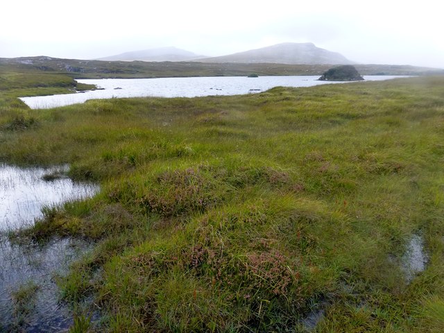
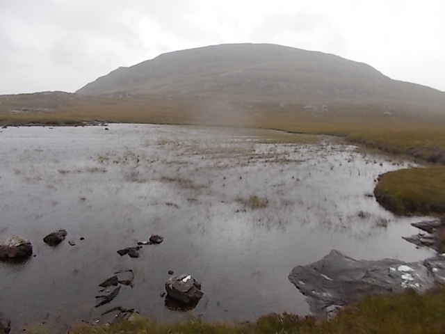
Covering an area of approximately 10 acres, Lochan Sgeireach is surrounded by picturesque landscapes, including rolling hills and lush greenery. Its tranquil setting offers a peaceful escape from the hustle and bustle of everyday life.

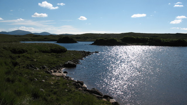
The loch is known for its crystal-clear waters, which are fed by natural springs and streams. This pristine water source supports a diverse range of aquatic life, including various species of fish, amphibians, and invertebrates. Angling enthusiasts are drawn to Lochan Sgeireach for its excellent fishing opportunities, particularly for trout.

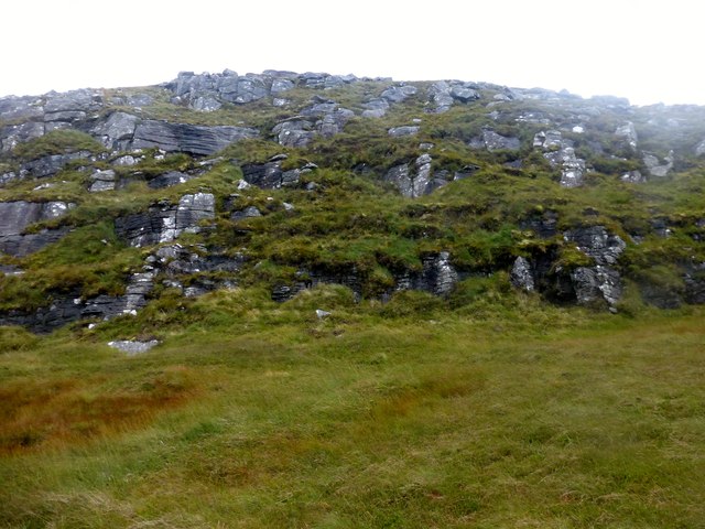
The shoreline of Lochan Sgeireach is lined with dense vegetation, creating a thriving ecosystem for numerous bird species. Swans, ducks, and other waterfowl can often be spotted gliding across the surface of the loch, while the surrounding reeds provide a habitat for smaller birds, such as warblers and reed buntings.

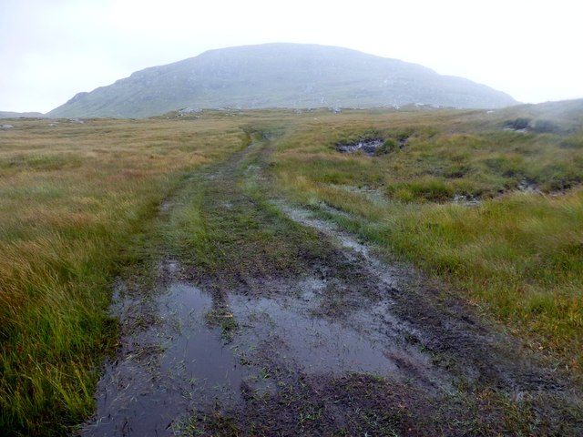
Visitors to Lochan Sgeireach can enjoy a range of outdoor activities, including walking, picnicking, and wildlife watching. There are several walking trails that encircle the loch, offering breathtaking views of the surrounding countryside. Nature enthusiasts can also explore the nearby freshwater marsh, which is home to a variety of plant and animal species.

Overall, Lochan Sgeireach is a peaceful and idyllic spot that showcases the natural beauty of the Scottish Highlands. Whether it's for fishing, birdwatching, or simply immersing oneself in the tranquility of nature, this loch provides a memorable experience for all who visit.

If you have any feedback on the listing, please let us know in the comments section below.

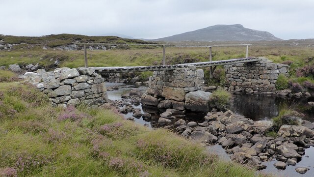
Lochan Sgeireach Images

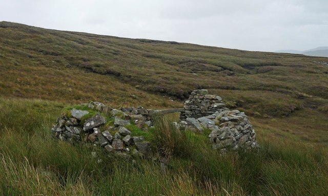
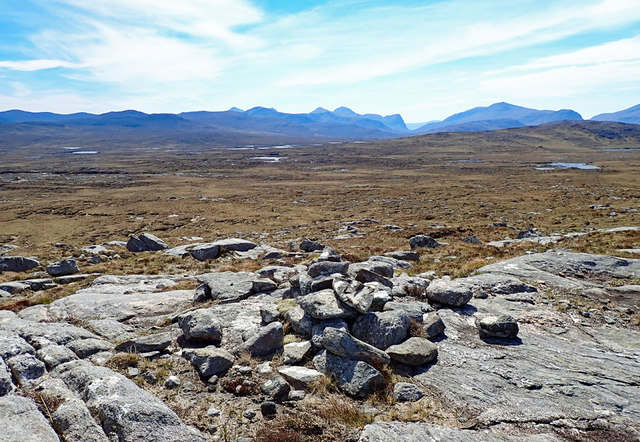
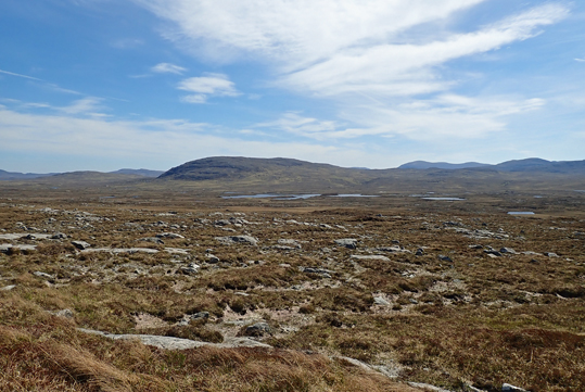
Images are sourced within 2km of 58.082481/-6.8837547 or Grid Reference NB1220. Thanks to Geograph Open Source API. All images are credited.

View Back Towards Sgalabhal Mula A photo taken after descending the steep and rocky slopes of Sgalabhal Mula.
View Back Towards Sgalabhal Mula
A photo taken after descending the steep and rocky slopes of Sgalabhal Mula.
Wet Track Wet track and view back towards Sgalabhal Mula.
Wet Track
Wet track and view back towards Sgalabhal Mula.
Loch Morsgail A view towards Loch Morsgail.
Loch Morsgail
A view towards Loch Morsgail.
Three conjoined shielings at Gearraidh Bheinn Na Gile The central shieling still has its original corbelled roof. <span class="nowrap"><a title="https://canmore.org.uk/site/4078/lewis-gearraidh-bheinn-na-gile" rel="nofollow ugc noopener" href="https://canmore.org.uk/site/4078/lewis-gearraidh-bheinn-na-gile">Link</a><img style="margin-left:2px;" alt="External link" title="External link - shift click to open in new window" src="https://s1.geograph.org.uk/img/external.png" width="10" height="10"/></span>
Three conjoined shielings at Gearraidh Bheinn Na Gile
The central shieling still has its original corbelled roof. LinkExternal link
Beehive house or Bothan Flat stone dwelling from ancient times.  This one is complete.
Beehive house or Bothan
Flat stone dwelling from ancient times. This one is complete.
Crossing the Druim Bheinn na Gile The bleak yet beautiful landscape of the Morsgail Forest of North Harris/South Lewis. This photo taken on the return to our tent at the head of Loch Reasort after an excursion to the beehive dwellings (possibly sheilings) at <a href="https://www.geograph.org.uk/gridref/NB131201">NB131201</a>. Very rough going and boggy with scant evidence of the paths marked on the OS maps!

The view is looking west of south with the mountains of North Harris on the horizon- Sròn Ulladale is evident as a dark cliff to the right of Kenny.
Crossing the Druim Bheinn na Gile
The bleak yet beautiful landscape of the Morsgail Forest of North Harris/South Lewis. This photo taken on the return to our tent at the head of Loch Reasort after an excursion to the beehive dwellings (possibly sheilings) at NB131201. Very rough going and boggy with scant evidence of the paths marked on the OS maps! The view is looking west of south with the mountains of North Harris on the horizon- Sròn Ulladale is evident as a dark cliff to the right of Kenny.
Shieling ruin near Loch nan Creaganan Groid The best preserved of the four shielings that lie along the small stream running between Loch Leatha and Loch nan Creaganan Groid.
Shieling ruin near Loch nan Creaganan Groid
The best preserved of the four shielings that lie along the small stream running between Loch Leatha and Loch nan Creaganan Groid.
Beehive dwellings below Sgalabhal Three of us could picnic inside the complete beehive dwelling out of the rain and very high winds hence quality of photo. It was very sheltered and waterproof inside. Photo shows dwellings adjacent to footpath and wobbly and slightly rotten single plank bridge over stream
Beehive dwellings below Sgalabhal
Three of us could picnic inside the complete beehive dwelling out of the rain and very high winds hence quality of photo. It was very sheltered and waterproof inside. Photo shows dwellings adjacent to footpath and wobbly and slightly rotten single plank bridge over stream
Mointeach a' Lòin A ghastly weather day, but this view looks towards Mointeach a' Lòin, with glimpse of Loch an Fheior and Lochan Sgeireach. Truly inhospitable terrain and weather.
Mointeach a' Lòin
A ghastly weather day, but this view looks towards Mointeach a' Lòin, with glimpse of Loch an Fheior and Lochan Sgeireach. Truly inhospitable terrain and weather.
Unnamed lochan below Sgalabhal
Shieling, Airighean An Fhorsa, Isle of Lewis This shieling was still in use by people from Bhaltos at the time of the writing of the OS Name Book in 1849.
Shieling, Airighean An Fhorsa, Isle of Lewis
This shieling was still in use by people from Bhaltos at the time of the writing of the OS Name Book in 1849.
Moorland Vista Looking over the east half of the grid square to the hills of Harris.
Moorland Vista
Looking over the east half of the grid square to the hills of Harris.
Moorland Vista Looking southeast to Loch Craghach and the hill Scalabhal Mula.
Moorland Vista
Looking southeast to Loch Craghach and the hill Scalabhal Mula.
Southern shore of Loch Morsgail
Footbridge next to Loch Morsgail
A pair of shielings at Gearraidh Bheinn Na Gile The two northern shielings within this group. <span class="nowrap"><a title="https://canmore.org.uk/site/4078/lewis-gearraidh-bheinn-na-gile" rel="nofollow ugc noopener" href="https://canmore.org.uk/site/4078/lewis-gearraidh-bheinn-na-gile">Link</a><img style="margin-left:2px;" alt="External link" title="External link - shift click to open in new window" src="https://s1.geograph.org.uk/img/external.png" width="10" height="10"/></span>
A pair of shielings at Gearraidh Bheinn Na Gile
The two northern shielings within this group. LinkExternal link
Loch Morsgail
Loch Morsgail
Islets in Loch Morsgail The south end of the loch has 3 tiny islands. The hills of North Harris can be seen in the distance.
Islets in Loch Morsgail
The south end of the loch has 3 tiny islands. The hills of North Harris can be seen in the distance.
Show me another place!

Lochan Sgeireach is located at Grid Ref: NB1220 (Lat: 58.082481, Lng: -6.8837547)

Unitary Authority: Na h-Eileanan an Iar

Police Authority: Highlands and Islands

What 3 Words

///zones.entertainer.squirted. Near Tarbert, Na h-Eileanan Siar

Related Wikis

Gisla Hydro-Electric Scheme

Gisla Hydro-Electric Scheme was a small scheme promoted by the North of Scotland Hydro-Electric Board on the Isle of Lewis, Outer Hebrides, Scotland. It...

Uladail

Uladail is a location near Amhuinnsuidhe, on Harris in the Outer Hebrides, Scotland. Sron Ulladail is a sheer cliff which at 370 metres (1,210 ft) is one...

Eilean Mòr, Loch Langavat

Eilean Mòr is an island in Loch Langavat on the Isle of Lewis in the Outer Hebrides of Scotland. == Footnotes ==

Have you been to Lochan Sgeireach?

Leave your review of Lochan Sgeireach below (or comments, questions and feedback).