Loch a' Choin

Lake, Pool, Pond, Freshwater Marsh in Inverness-shire

Scotland

Loch a' Choin

Solitary White house Geocaching is a type of global treasure hunt of people looking for caches, or hidden stashes of objects. Geocaching may also be described as a series of hide-and-seek games, where hiders provide online clues for seekers. Seekers use global positioning system (GPS) devices to find hidden caches
Solitary White house Credit: Ralph Greig

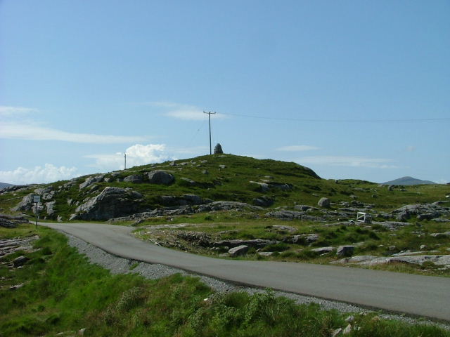
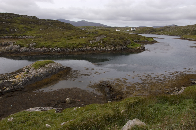
Loch a' Choin, located in Inverness-shire, Scotland, is a stunning freshwater loch encompassing an area of approximately 2 square kilometers. Also known as Loch a'Choinn, it is nestled within the picturesque Scottish Highlands, about 20 kilometers southwest of the town of Inverness. This natural water body is situated at an elevation of around 70 meters above sea level.

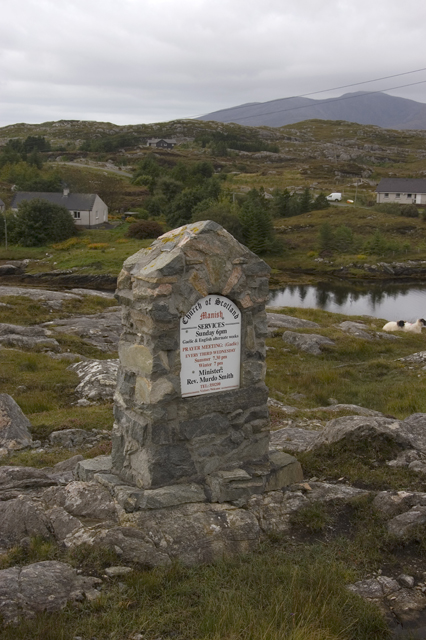
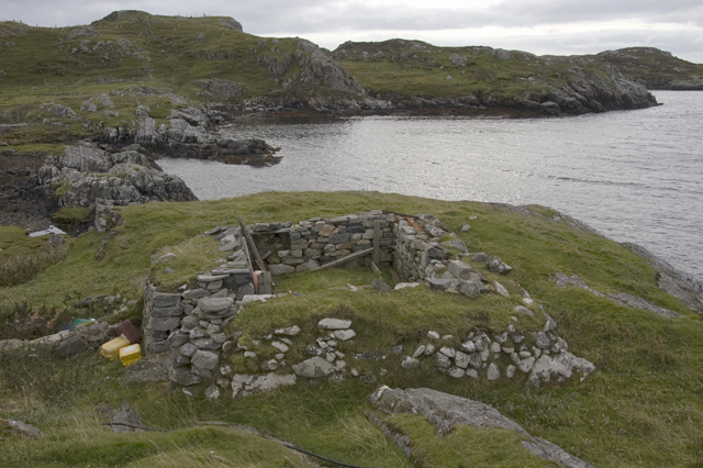
Loch a' Choin is characterized by its tranquil and idyllic setting, surrounded by rolling hills and verdant landscapes. The loch itself boasts crystal-clear waters that reflect the beauty of the surrounding scenery, creating a picturesque and serene atmosphere. It is a popular spot for nature enthusiasts and photographers, who are drawn to the breathtaking views and the abundance of wildlife that can be found here.

The diverse ecosystem of Loch a' Choin supports a variety of flora and fauna. The loch serves as a habitat for numerous species of fish, including brown trout and salmon, making it a favored spot for anglers. The surrounding marshes and wetlands are home to a range of waterfowl, such as ducks, geese, and swans, providing a haven for birdwatchers.

Visitors to Loch a' Choin can indulge in a range of recreational activities. Fishing is a popular pastime, with several fishing spots dotted along its shores. Additionally, the tranquil surroundings make it an ideal location for boating and kayaking, allowing visitors to explore the loch's nooks and crannies.

Overall, Loch a' Choin offers a peaceful and picturesque retreat in the heart of the Scottish Highlands, providing a haven for nature lovers and outdoor enthusiasts alike.

If you have any feedback on the listing, please let us know in the comments section below.

Loch a' Choin Images

Images are sourced within 2km of 57.801974/-6.8631442 or Grid Reference NG1189. Thanks to Geograph Open Source API. All images are credited.

Solitary White house Geocaching is a type of global treasure hunt of people looking for caches, or hidden stashes of objects. Geocaching may also be described as a series of hide-and-seek games, where hiders provide online clues for seekers. Seekers use global positioning system (GPS) devices to find hidden caches
Solitary White house
Geocaching is a type of global treasure hunt of people looking for caches, or hidden stashes of objects. Geocaching may also be described as a series of hide-and-seek games, where hiders provide online clues for seekers. Seekers use global positioning system (GPS) devices to find hidden caches
Flodabay postbox Geocaching is a type of global treasure hunt of people looking for caches, or hidden stashes of objects. Geocaching may also be described as a series of hide-and-seek games, where hiders provide online clues for seekers. Seekers use global positioning system (GPS) devices to find hidden caches
Flodabay postbox
Geocaching is a type of global treasure hunt of people looking for caches, or hidden stashes of objects. Geocaching may also be described as a series of hide-and-seek games, where hiders provide online clues for seekers. Seekers use global positioning system (GPS) devices to find hidden caches
Church welcome sign A stone "noticeboard" on the side of the main road through Manish, inviting you to the Church of Scotland
Church welcome sign
A stone "noticeboard" on the side of the main road through Manish, inviting you to the Church of Scotland
Inlet of Loch Gheocrab
Turning for Aird Shleibhe
Unnamed Lochan on Flodabay Point Should have put my boots on for this one! Very wet underfoot
Unnamed Lochan on Flodabay Point
Should have put my boots on for this one! Very wet underfoot
House around Ob Leasaid near Manais Old and new houses around Ob Leasaid - a typical inlet in the Bays area of South Harris
House around Ob Leasaid near Manais
Old and new houses around Ob Leasaid - a typical inlet in the Bays area of South Harris
Old school at Manais
Shed at Manais The wood carving looks to be a copy of one of the Lewis Chessmen. The sign to the right of the carving has been taken? borrowed? nicked? from the Roghadal Hotel.
Shed at Manais
The wood carving looks to be a copy of one of the Lewis Chessmen. The sign to the right of the carving has been taken? borrowed? nicked? from the Roghadal Hotel.
Part of the Golden Road at Manais
Old school and Telephone box at Manais
Ob Leasaid At Manais
Ob Leasaid
At Manais
Cairn above Manais
Cairn above Manais
Manais Church sign
Manais Church sign
Church of Scotland, Manais
Ruins at Manais
Ruins at Manais
Ob Leasaid from Aird Shleibhe road
Church of Scotland Manais
Show me another place!

Loch a' Choin is located at Grid Ref: NG1189 (Lat: 57.801974, Lng: -6.8631442)

Unitary Authority: Na h-Eileanan an Iar

Police Authority: Highlands and Islands

What 3 Words

///mixer.headed.triangles. Near Leverburgh, Na h-Eileanan Siar

Related Wikis

Stockinish Island

Stockinish Island (Scottish Gaelic: Eilean Stocainis) is an uninhabited island off Harris, in the Outer Hebrides. == Geography and geology == Stockinish...

Borsham

Borsham (Scottish Gaelic: Boirseam) is a village in the 'Bays' area of Harris in the Outer Hebrides, Scotland. Borsham is within the parish of Harris....

Lingarabay

Lingarabay (also Lingerabay or Lingerbay; Scottish Gaelic: Lingreabhagh) is a small coastal settlement on Harris, in the Outer Hebrides of Scotland. It...

Harris Superquarry

The Harris Super Quarry was a super quarry at Lingerbay, Harris, Scotland proposed by Redland Aggregates in 1991. The plan was to surface mine aggregate...

Nearby Amenities

Located within 500m of 57.801974,-6.8631442
Passing Place
Lat/Long: 57.8008216/-6.869752
Passing Place
Lat/Long: 57.801063/-6.868804
Passing Place
Lat/Long: 57.8019538/-6.8669701
Passing Place
Lat/Long: 57.8042153/-6.8648336
Passing Place
Lat/Long: 57.8060918/-6.8643801
Telephone
Booth: K6
Covered: booth
Operator: BT
Phone: +44 1859 530201
Source: survey
Lat/Long: 57.8019104/-6.8669826
Bus Stop
Manish
Bench: no
Naptan AtcoCode: 6010731746
Naptan Bearing: S
Naptan CommonName: Manish
Naptan Indicator: Village
Naptan Landmark: Village
Naptan NaptanCode: 94723629
Naptan Street: Village
Naptan Verified: no
Shelter: yes
Source: naptan_import
Lat/Long: 57.8018324/-6.8665285
Passing Place
Lat/Long: 57.8031074/-6.8655983
Passing Place
Lat/Long: 57.803655/-6.8648247
Passing Place
Lat/Long: 57.8048122/-6.8636128
Location Transition: yes
Power: pole
Lat/Long: 57.8055453/-6.8633264
Power: pole
Lat/Long: 57.8061622/-6.8638285
Àird Shlèibhe
Name En: Ardslave
Name Gd: Àird Shlèibhe
Place: hamlet
Lat/Long: 57.7994264/-6.8627822
Material: wood
Power: pole
Lat/Long: 57.8000092/-6.8648898
Material: wood
Power: pole
Lat/Long: 57.7995715/-6.8646048
Material: wood
Power: pole
Lat/Long: 57.7993338/-6.8640979
Material: wood
Power: pole
Lat/Long: 57.7990962/-6.8635883
Material: wood
Power: pole
Lat/Long: 57.7987603/-6.8628882
Material: wood
Power: pole
Lat/Long: 57.7986035/-6.8622974
Material: wood
Power: pole
Lat/Long: 57.8002818/-6.8650688
Material: wood
Power: pole
Lat/Long: 57.8006894/-6.865327
Material: wood
Power: pole
Lat/Long: 57.8005229/-6.8646578
Material: wood
Power: pole
Lat/Long: 57.8012599/-6.8698108
Material: wood
Power: pole
Lat/Long: 57.801635/-6.8684622
Material: wood
Power: pole
Lat/Long: 57.8020852/-6.8668456
Material: wood
Power: pole
Lat/Long: 57.8022761/-6.8660235
Material: wood
Power: pole
Lat/Long: 57.8031693/-6.8660638
Material: wood
Power: pole
Lat/Long: 57.8037427/-6.8658466
Material: wood
Power: pole
Lat/Long: 57.8043348/-6.8656274
Material: wood
Power: pole
Lat/Long: 57.8048529/-6.8654484
Material: wood
Power: pole
Lat/Long: 57.8058738/-6.8654454
Material: wood
Power: pole
Lat/Long: 57.8015032/-6.8674786
Aird Leimhe
Place: locality
Lat/Long: 57.8012518/-6.8625523
Access: private
Entrance: yes
Lat/Long: 57.8060053/-6.8644706
Beicribhig
Name En: Beacravik
Name Gd: Beicribhig
Place: hamlet
Lat/Long: 57.8057013/-6.8646287
Power: pole
Lat/Long: 57.8013331/-6.8662697
Power: pole
Lat/Long: 57.8014037/-6.8668023
Power: pole
Lat/Long: 57.801153/-6.8652
Power: pole
Lat/Long: 57.8016396/-6.8656216
Power: pole
Lat/Long: 57.8016312/-6.8683115
Power: pole
Lat/Long: 57.8061808/-6.8649934
Power: pole
Lat/Long: 57.8026084/-6.8662341
Power: pole
Lat/Long: 57.7984841/-6.8618551
Material: wood
Power: pole
Lat/Long: 57.8008496/-6.8712739
Seamark Type: cable_submarine
Lat/Long: 57.8051125/-6.8623929
The data included in this document is from www.openstreetmap.org. The data is made available under ODbL.

Have you been to Loch a' Choin?

Leave your review of Loch a' Choin below (or comments, questions and feedback).