Loch Collas Sgairbhe

Lake, Pool, Pond, Freshwater Marsh in Inverness-shire

Scotland

Loch Collas Sgairbhe

Loch Chliostair dam, North Harris
Loch Chliostair dam, North Harris Credit: Alan Reid

The requested URL returned error: 429 Too Many Requests

If you have any feedback on the listing, please let us know in the comments section below.

Loch Collas Sgairbhe Images

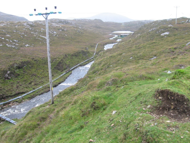
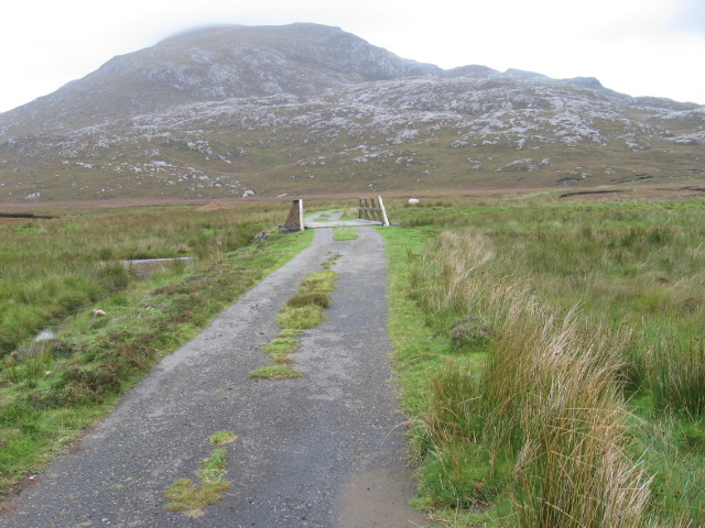
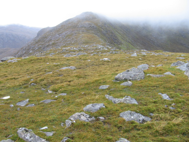
Images are sourced within 2km of 57.972079/-6.9548066 or Grid Reference NB0708. Thanks to Geograph Open Source API. All images are credited.

Loch Chliostair dam, North Harris
Lochan Beag with view towards Tiorga Mor, Harris
Trig Point on Cleiseabhal with view to Leosabhal & Tiorga Mor The walk to the summit of Cleiseabhal is surprisingly easy after leaving the B887 at NB065072 and making for the southwest ridge, however the first few hundred feet there is tussicky grass to cross.
Trig Point on Cleiseabhal with view to Leosabhal & Tiorga Mor
The walk to the summit of Cleiseabhal is surprisingly easy after leaving the B887 at NB065072 and making for the southwest ridge, however the first few hundred feet there is tussicky grass to cross.
Ridge leading northeast from Cleiseabhal This grassy ridge looks easy to walk but part way down, a rock band bisects the ridge which requires a short 'down scramble'.
Ridge leading northeast from Cleiseabhal
This grassy ridge looks easy to walk but part way down, a rock band bisects the ridge which requires a short 'down scramble'.
Rock band between Cleiseabhal & Bidigidh This rock band bisects the ridge and involves a short scramble.
Rock band between Cleiseabhal & Bidigidh
This rock band bisects the ridge and involves a short scramble.
Summit cairn on Oireabhal with view towards Ulabhal
Road below Power Station, Loch Leosaid, Harris
Hillside towards Loch Chliostair
Outflow from Loch Maolaig
On the ridge north of Oireabhal with view towards Ulabhal
Road repairs at Bearragan You have to admire these chaps who maintain these remote roads in all weathers.
Road repairs at Bearragan
You have to admire these chaps who maintain these remote roads in all weathers.
Loch nan Caor By the road from Huisinis to Tarbert.
Loch nan Caor
By the road from Huisinis to Tarbert.
Towards Lochan Beag
Towards Lochan Beag
Abhainn Mhòr
Abhainn Mhòr
Bridge over Abhainn Leòsaid
Loch Chliostair Dam
Loch Chliostair Dam
Hillside below Cleiseabhal
Ridge towards Bidigidh
Show me another place!

Loch Collas Sgairbhe is located at Grid Ref: NB0708 (Lat: 57.972079, Lng: -6.9548066)

Unitary Authority: Na h-Eileanan an Iar

Police Authority: Highlands and Islands

What 3 Words

///starting.overtime.quail. Near Tarbert, Na h-Eileanan Siar

Related Wikis

Chliostair Hydro-Electric Scheme

Chliostair Hydro-Electric Scheme is a small scheme promoted by the North of Scotland Hydro-Electric Board on Harris, Outer Hebrides. It consists of a single...

Oireabhal

Oireabhal (662 m) is a mountain in Harris, in the Outer Hebrides of Scotland. The peak is the highest point on a complex ridge that runs from north to...

Amhuinnsuidhe Castle

Amhuinnsuidhe Castle is a large 19th-century private country house on Harris, one of the Western Isles of Scotland. It was designated as a Category A listed...

Amhuinnsuidhe

Amhuinnsuidhe (Scottish Gaelic: Abhainn Suidhe) is a settlement on Harris, in the Outer Hebrides, Scotland. The settlement is also within the parish of...

Have you been to Loch Collas Sgairbhe?

Leave your review of Loch Collas Sgairbhe below (or comments, questions and feedback).