Loch Bràigh a' Mhill

Lake, Pool, Pond, Freshwater Marsh in Ross-shire

Scotland

Loch Bràigh a' Mhill

Cappadale Sands
Cappadale Sands Credit: Sandy Gerrard

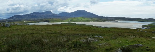
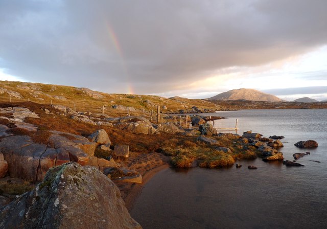
Loch Bràigh a' Mhill is a picturesque freshwater loch located in Ross-shire, Scotland. Situated amidst the stunning Highland scenery, this natural water body offers a serene and tranquil setting for visitors.

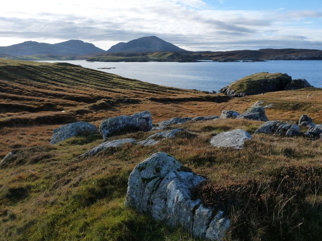
The loch is characterized by its elongated shape, stretching approximately 1.5 kilometers in length and reaching a maximum width of 400 meters. It is nestled within lush green hills and surrounded by dense vegetation, creating a captivating sight for nature enthusiasts.

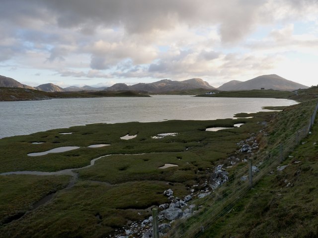
The water of Loch Bràigh a' Mhill is crystal clear and unpolluted, providing a pristine habitat for various aquatic species. It is home to a diverse range of fish, including brown trout, pike, and perch, attracting anglers from near and far. Fishing is a popular activity in this loch, with fishermen often relishing the peaceful atmosphere as they cast their lines.

Surrounding the loch, there is a freshwater marsh that acts as a natural filter, purifying the water and supporting an array of plant species. This marshland is a haven for wildlife, attracting a plethora of bird species, such as herons, ducks, and swans. Birdwatchers can spend hours observing and documenting the avian inhabitants of this marsh.

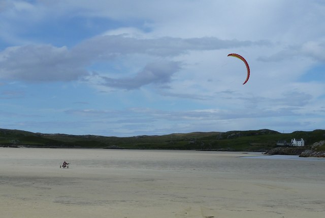
The area around Loch Bràigh a' Mhill offers several walking trails and hiking routes, allowing visitors to explore the stunning landscape and enjoy the panoramic views. The loch serves as a popular destination for outdoor activities, including picnicking, kayaking, and sailing, providing an idyllic retreat for those seeking a peaceful escape in the heart of the Scottish Highlands.

If you have any feedback on the listing, please let us know in the comments section below.

Loch Bràigh a' Mhill Images

Images are sourced within 2km of 58.196203/-7.0595543 or Grid Reference NB0234. Thanks to Geograph Open Source API. All images are credited.

Cappadale Sands
Cappadale Sands
Beach and headland at Carnais
Beach at Carnais
Beach at Carnais
Tom A small tidal island near Carnais.
Tom
A small tidal island near Carnais.
Cappadale Sands The map names this arm of Tràigh Uige as Cappadale Sands. As the tide is in, the sand is only visible through the water, giving it that characteristic Hebridean turquoise colour. It would have been even better in sunshine. The hill on the skyline is Forsnabhal (205 metres), and the houses at the far side of the bay are at Timsgearraidh.
Cappadale Sands
The map names this arm of Tràigh Uige as Cappadale Sands. As the tide is in, the sand is only visible through the water, giving it that characteristic Hebridean turquoise colour. It would have been even better in sunshine. The hill on the skyline is Forsnabhal (205 metres), and the houses at the far side of the bay are at Timsgearraidh.
Càrnais (Carinish) Two cottages overlooking Tràigh Lèire at the head of Cappadale Sands in Uig Bay.
Càrnais (Carinish)
Two cottages overlooking Tràigh Lèire at the head of Cappadale Sands in Uig Bay.
Traigh Uige Taken from next to <a href="https://www.geograph.org.uk/photo/2651138">NB0534 : Little church at Timsgearraidh (Timsgarry)</a> looking over the vast expanse of sand of Traigh Uige, with the mountains of Mealasta beyond.
Traigh Uige
Taken from next to NB0534 : Little church at Timsgearraidh (Timsgarry) looking over the vast expanse of sand of Traigh Uige, with the mountains of Mealasta beyond.
Kite buggy on Traigh Uige Traigh Uige is a fine expanse of flat firm sand, ideal for whizzing about using one of these contraptions. It was going quite fast as it was pulled along by the parachute-like kite. Looks like fun !
Kite buggy on Traigh Uige
Traigh Uige is a fine expanse of flat firm sand, ideal for whizzing about using one of these contraptions. It was going quite fast as it was pulled along by the parachute-like kite. Looks like fun !
Burial ground at Baile-na-Cille An evening view with the last of the light on the clouds over Suaineabhal.
Burial ground at Baile-na-Cille
An evening view with the last of the light on the clouds over Suaineabhal.
Uig Bay with Mealaisbhal beyond Morning view from Baile-na-Cille guesthouse with the burial ground in the foreground.
Uig Bay with Mealaisbhal beyond
Morning view from Baile-na-Cille guesthouse with the burial ground in the foreground.
Traigh Uige at Cradhlastadh The small crofting community of Cradhlastadh, and the sands of Traigh Uige. The hill in the background is Suaineabhal.
Traigh Uige at Cradhlastadh
The small crofting community of Cradhlastadh, and the sands of Traigh Uige. The hill in the background is Suaineabhal.
Cappadale Sands with Carnais Village
Small boat haven at Cradhlastadh Mountains of west Lewis lie across Uig Bay
Small boat haven at Cradhlastadh
Mountains of west Lewis lie across Uig Bay
Sarstol Bheag, Cradhlastadh
Saltings at Tobta On the way to Cradhlastadh
Saltings at Tobta
On the way to Cradhlastadh
A fence ends in Loch Barabhat The last post is fixed in the water, in an often vain attempt, to contain the sheep and cattle.
A fence ends in Loch Barabhat
The last post is fixed in the water, in an often vain attempt, to contain the sheep and cattle.
Old lazy-beds at Cradhlastadh
Camas Uig from the north Mountains of west Lewis in the background
Camas Uig from the north
Mountains of west Lewis in the background
Show me another place!

Loch Bràigh a' Mhill is located at Grid Ref: NB0234 (Lat: 58.196203, Lng: -7.0595543)

Unitary Authority: Na h-Eileanan an Iar

Police Authority: Highlands and Islands

What 3 Words

///resides.reef.eased. Near Carloway, Na h-Eileanan Siar

Related Wikis

Timsgarry

Timsgarry (Scottish Gaelic: Tuimisgearraidh) is a village on the Isle of Lewis, in the Outer Hebrides, Scotland. Timsgarry is home to the Baile na Cille...

Camas Uig

Camas Uig (Uig Bay) is a bay on the west coast of the Isle of Lewis, in the Outer Hebrides of Scotland. The Lewis Chessmen were discovered in the dunes...

Ardroil

Ardroil (Scottish Gaelic: Eadar Dhà Fhadhail) is a village on the Isle of Lewis in the Outer Hebrides, Scotland. Ardroil is within the parish of Uig....

Uig, Lewis

Uig (Scottish Gaelic: Ùig [uːkʲ]), also known as Sgìr' Ùig, is a civil parish and community in the west of the Isle of Lewis in the Outer Hebrides, Scotland...

Have you been to Loch Bràigh a' Mhill?

Leave your review of Loch Bràigh a' Mhill below (or comments, questions and feedback).