Am Bràigh-lochan
Lake, Pool, Pond, Freshwater Marsh in Inverness-shire
Scotland
Am Bràigh-lochan
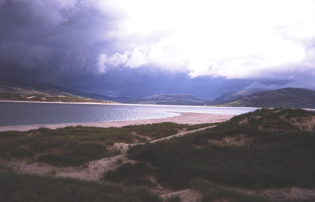
Am Bràigh-lochan is a freshwater loch located in Inverness-shire, Scotland. It is situated in a remote and picturesque area, surrounded by rolling hills and lush greenery, making it a popular spot for nature enthusiasts and outdoor enthusiasts.
The loch itself is relatively small, with a surface area of approximately 10 hectares. It is characterized by its crystal-clear waters, which are fed by natural springs and streams that flow from the surrounding hills. This ensures a constant supply of fresh water, making it an ideal habitat for various species of aquatic plants and animals.
The shores of Am Bràigh-lochan are lined with reeds and other vegetation, creating a rich and diverse freshwater marsh ecosystem. This marshland provides an important breeding ground and habitat for a wide range of bird species, including ducks, swans, and various wading birds. It is also home to numerous species of fish, such as brown trout and perch, which attract anglers from far and wide.
Visitors to Am Bràigh-lochan can enjoy a range of activities, including fishing, birdwatching, and hiking. There are several well-maintained trails that surround the loch, offering stunning views of the surrounding landscape. The peaceful and tranquil atmosphere of the area makes it an ideal spot for relaxation and contemplation.
Overall, Am Bràigh-lochan is a beautiful and ecologically diverse freshwater loch in Inverness-shire. Its stunning natural surroundings, abundant wildlife, and recreational opportunities make it a must-visit destination for nature lovers and outdoor enthusiasts alike.
If you have any feedback on the listing, please let us know in the comments section below.
Am Bràigh-lochan Images
Images are sourced within 2km of 57.906111/-7.0225674 or Grid Reference NB0201. Thanks to Geograph Open Source API. All images are credited.
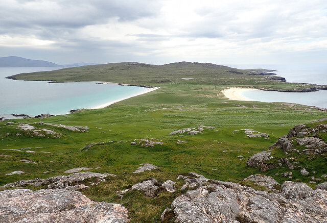
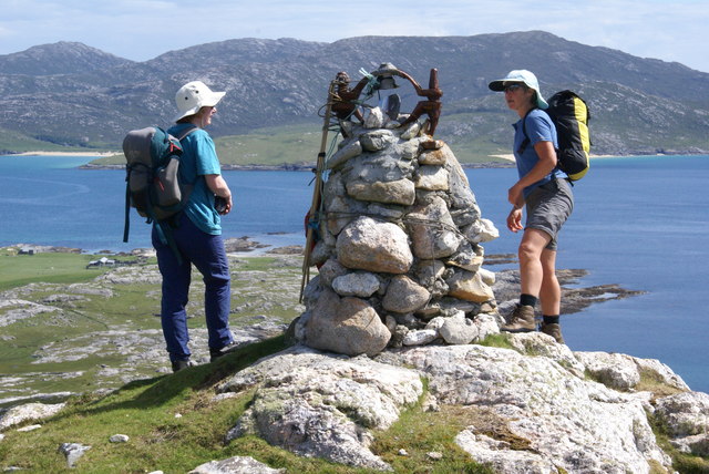
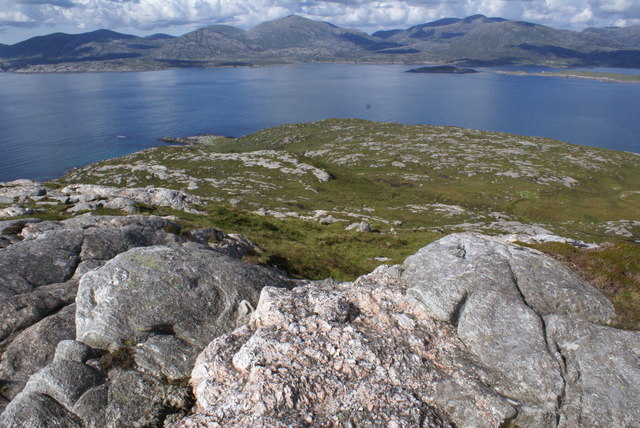
![Ben Raah [Beinn RÃ ] Pabbay, Scarp and Taransay with Sea Harris. Landed to the south and climbed the Marilyn with Martin Richardson, Jim Bloomer, Alex Cameron and Jonathan Whitehead on a lovely afternoon.
Name: Ben Raah [Beinn Rà]
Hill number: 1606
Height: 267m / 876ft
Area: 24B: Harris and Nearby Islands
Class: Ma,2
Grid ref: NB 03438 01900
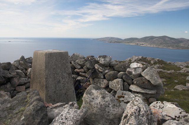
Summit feature: small pile of stones 35m E of trig point
Drop: 267m
Col: Sea](https://s3.geograph.org.uk/geophotos/03/68/48/3684811_56ded9c9.jpg)
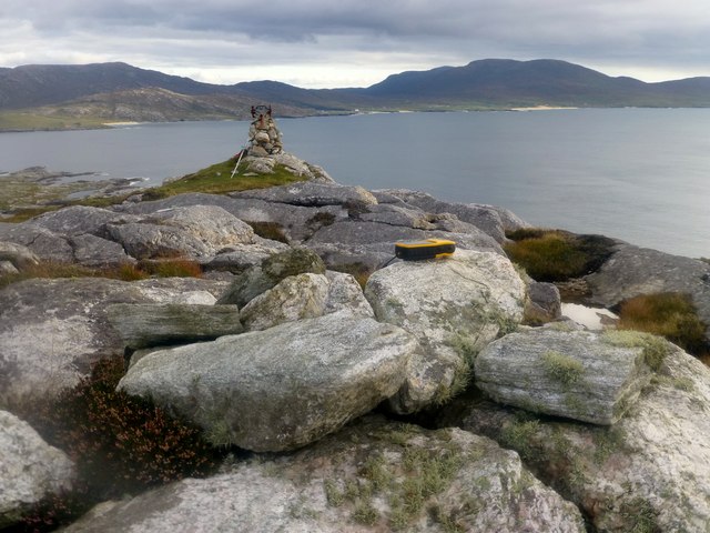
![Lower Slopes Of Ben Raah [Beinn RÃ ] Climbing up the lower slopes of Ben Raah [Beinn Rà] on Taransay.](https://s3.geograph.org.uk/geophotos/03/68/54/3685479_57724ab2.jpg)
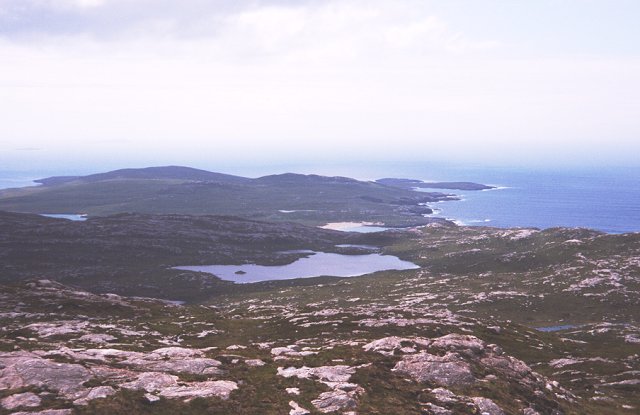
![View Towards A Distant Ceapabhal A view towards a distance Ceapabhal on South Harris from the lower slopes of Ben Raah [Beinn Rà]. Loch an Dùin and Loch Sionadail are seen on Taransay.](https://s1.geograph.org.uk/geophotos/03/68/54/3685497_3605f17b.jpg)
Am Bràigh-lochan is located at Grid Ref: NB0201 (Lat: 57.906111, Lng: -7.0225674)
Unitary Authority: Na h-Eileanan an Iar
Police Authority: Highlands and Islands
What 3 Words
///castle.nerd.script. Near Tarbert, Na h-Eileanan Siar
Nearby Locations
Related Wikis

Taransay
Taransay (Scottish Gaelic: Tarasaigh, pronounced [ˈt̪ʰaɾas̪aj]) is an island in the Outer Hebrides of Scotland. It was the host of the British television...

Soay Beag
Soay Beag (Scottish Gaelic: Sòdhaigh Beag) is a small, uninhabited tidal island in West Loch Tarbert, between the northern and southern parts of Harris...

Soay Mòr
Soay Mòr (Scottish Gaelic: Sòdhaigh Mòr) is an island in West Loch Tarbert, between the northern and southern parts of Harris. The uninhabited island is...

Luskentyre
Luskentyre (Scottish Gaelic: Losgaintir) is a sparse settlement on the west coast of Harris, in the Outer Hebrides, Scotland. Luskentyre is situated within...
Nearby Amenities
Located within 500m of 57.906111,-7.0225674Have you been to Am Bràigh-lochan?
Leave your review of Am Bràigh-lochan below (or comments, questions and feedback).