Loch na Bèirè

Lake, Pool, Pond, Freshwater Marsh in Inverness-shire

Scotland

Loch na Bèirè

Flodda causeway
Flodda causeway Credit: Catherine Morgan

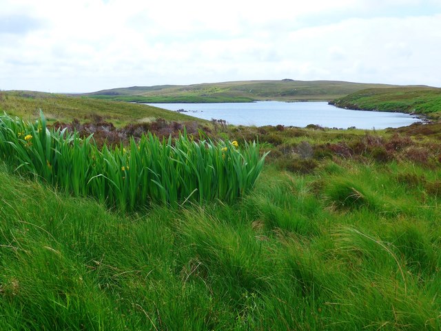
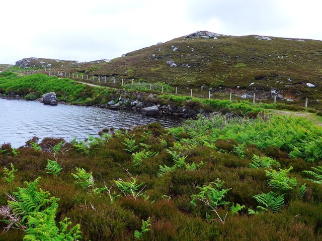
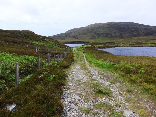
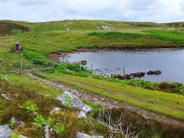
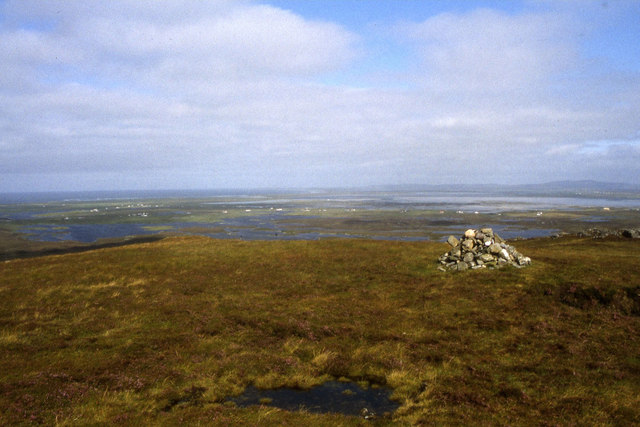
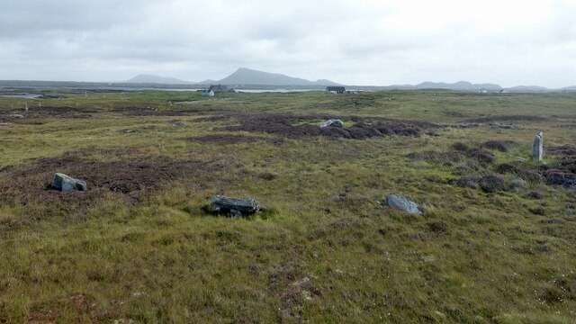
Loch na Bèirè is a serene and picturesque freshwater loch located in Inverness-shire, Scotland. Nestled amidst the stunning Scottish Highlands, this natural gem offers breathtaking views and an array of wildlife and vegetation.

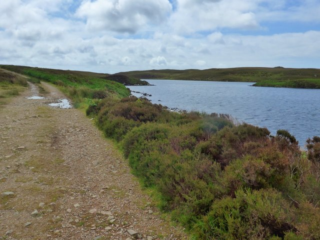
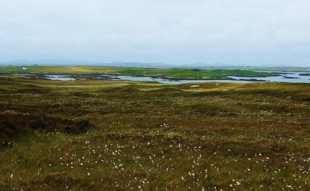
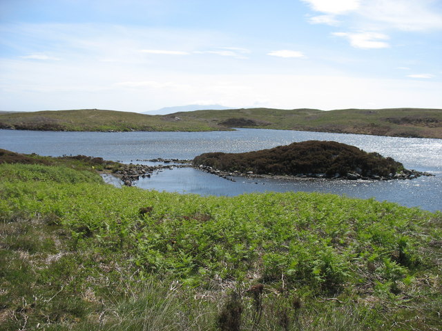
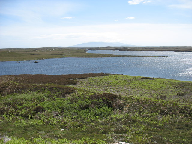
Covering an area of approximately 10 hectares, Loch na Bèirè is characterized by its tranquil waters and lush surroundings. The loch sits at an elevation of around 200 meters above sea level, providing a peaceful and secluded ambiance for visitors.

The loch is fed by several small streams that flow down from the surrounding hills, ensuring a constant supply of freshwater. Its crystal-clear waters are home to a variety of aquatic life, including trout and other fish species. Anglers often visit Loch na Bèirè to try their luck and enjoy the peacefulness of the surroundings.

The loch is also surrounded by a diverse range of vegetation, including reed beds and wetland plants. This creates a unique ecosystem and provides a habitat for numerous bird species, such as ducks, swans, and herons. Birdwatchers can be seen observing and documenting the avian life that thrives in and around the loch.

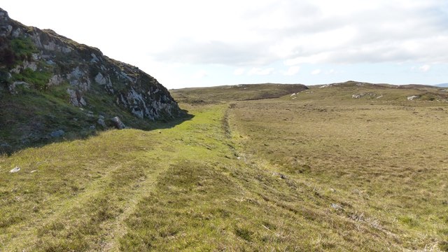
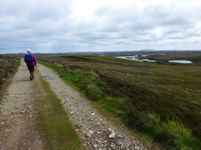
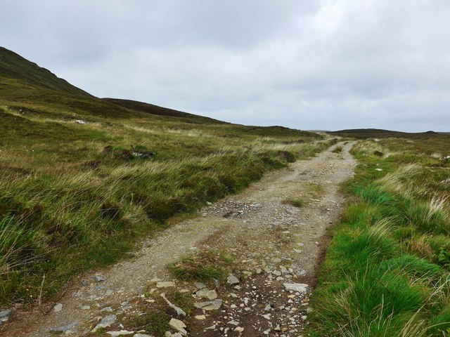
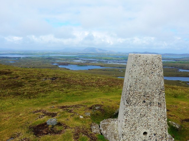
Loch na Bèirè is a haven for nature lovers and outdoor enthusiasts. Its tranquil atmosphere and stunning scenery make it an ideal spot for hiking, picnicking, and simply soaking in the beauty of nature. Visitors can explore the area by foot, following the scenic trails that meander along the loch's edge.

Overall, Loch na Bèirè offers a peaceful retreat in the heart of Inverness-shire, where visitors can immerse themselves in the beauty of nature and enjoy the serenity of a freshwater loch.

If you have any feedback on the listing, please let us know in the comments section below.

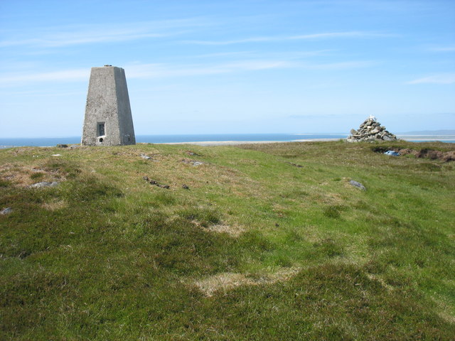
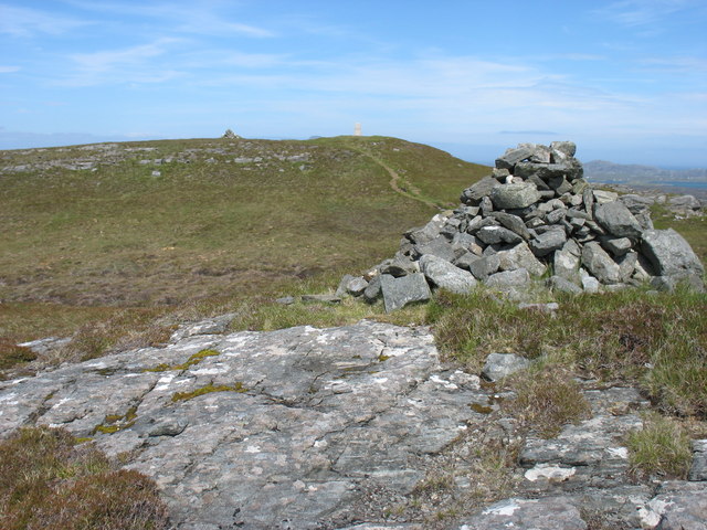
Loch na Bèirè Images

Images are sourced within 2km of 57.466881/-7.2841677 or Grid Reference NF8354. Thanks to Geograph Open Source API. All images are credited.

Flodda causeway
Flodda causeway
Causeway on Sgaraileòd track, Benbecula This is an excellent track for most of its length. After leaving the metalled section, the grassed part leads to Sgaraileòd.  Where there was a risk of flooding or in order to overcome marshy conditions, several sections have been built up as causeways as here. Labour must have been very cheap in those days.
Causeway on Sgaraileòd track, Benbecula
This is an excellent track for most of its length. After leaving the metalled section, the grassed part leads to Sgaraileòd. Where there was a risk of flooding or in order to overcome marshy conditions, several sections have been built up as causeways as here. Labour must have been very cheap in those days.
Flag irises and Loch Ba Una By the track to Sgaraileod.
Flag irises and Loch Ba Una
By the track to Sgaraileod.
The track to Sgaraileod Loch Ba Una to the right.
The track to Sgaraileod
Loch Ba Una to the right.
The track to Sgaraileod The island-dotted Loch Heirmeadail ahead to the right.
The track to Sgaraileod
The island-dotted Loch Heirmeadail ahead to the right.
The track to Sgaraileod On the left, the slopes of Ruabhal, the highest point on Benbecula (124m).
The track to Sgaraileod
On the left, the slopes of Ruabhal, the highest point on Benbecula (124m).
Small causeway between two lochs This is on the track to Sgaraileod and the loch in the photo is Loch na Deighe fo Thuath;  to the right, off image, lies Loch na Deighe fo Dheas.
Small causeway between two lochs
This is on the track to Sgaraileod and the loch in the photo is Loch na Deighe fo Thuath; to the right, off image, lies Loch na Deighe fo Dheas.
The track back from Sgaraileod The track here crosses a small causeway between, on the right, Loch na Deighe fo Thuath and on the left, Loch na Deighe fo Dheas.
The track back from Sgaraileod
The track here crosses a small causeway between, on the right, Loch na Deighe fo Thuath and on the left, Loch na Deighe fo Dheas.
The track to Roisinis Loch an Tairbh to the right.  The sheepfold shown by the OS in this area can just be seen as a fenced structure on the horizon.
The track to Roisinis
Loch an Tairbh to the right. The sheepfold shown by the OS in this area can just be seen as a fenced structure on the horizon.
Old ruined sheiling by the Roisinis track The OS marks a cup-marked stone by this ruin.
Old ruined sheiling by the Roisinis track
The OS marks a cup-marked stone by this ruin.
Bog cotton and moorland to sea loch Oban Uaine Houses on Grimsay may just be seen in the distance.
Bog cotton and moorland to sea loch Oban Uaine
Houses on Grimsay may just be seen in the distance.
Summit trig on Ruabhal Looking towards Grimsay and North Uist.
Summit trig on Ruabhal
Looking towards Grimsay and North Uist.
Summit of Ruabhal, Benbecula
Suidheachadh Beag stone circle and chambered cairn Two large stones inside the stone circle may represent the remains of a chambered cairn. <span class="nowrap"><a title="https://canmore.org.uk/site/10187/benbecula-suidheachadh-beag" rel="nofollow ugc noopener" href="https://canmore.org.uk/site/10187/benbecula-suidheachadh-beag">Link</a><img style="margin-left:2px;" alt="External link" title="External link - shift click to open in new window" src="https://s1.geograph.org.uk/img/external.png" width="10" height="10"/></span>
Suidheachadh Beag stone circle and chambered cairn
Two large stones inside the stone circle may represent the remains of a chambered cairn. LinkExternal link
Loch Ba Una
Loch Ba Una
Loch Theirmeadail This photo was taken on my visit to Ruaval (Ruabhal), the highest point on Benbecula. The hills in the far distance comprise the Hecla / Beinn Mhor group, about 20km away on South Uist.
Loch Theirmeadail
This photo was taken on my visit to Ruaval (Ruabhal), the highest point on Benbecula. The hills in the far distance comprise the Hecla / Beinn Mhor group, about 20km away on South Uist.
Ruaval (Ruabhal) summit Near the summit of Ruaval are a trig point and two fairly large cairns. This photo suggests, though it does not prove, that the trig point is at the true highest point. Taken in conjunction with <a href="https://www.geograph.org.uk/photo/2537593">NF8253 : Ruaval (Ruabhal) from the lower cairn</a>, I think that the supremacy of the trig point is beyond doubt.
Ruaval is the highest point of Benbecula. As this island is mostly low-lying, it gives excellent views in all directions.
Ruaval (Ruabhal) summit
Near the summit of Ruaval are a trig point and two fairly large cairns. This photo suggests, though it does not prove, that the trig point is at the true highest point. Taken in conjunction with NF8253 : Ruaval (Ruabhal) from the lower cairn, I think that the supremacy of the trig point is beyond doubt. Ruaval is the highest point of Benbecula. As this island is mostly low-lying, it gives excellent views in all directions.
Ruaval (Ruabhal) from the lower cairn I think that this image, in conjunction with <a href="https://www.geograph.org.uk/photo/2537563">NF8253 : Ruaval (Ruabhal) summit</a>, is conclusive evidence that the trig point is at the summit of the hill.
Cairns, especially on hills which are not major attractions for hillwalkers, are often in locations prominent from below rather than at true summits. This may explain the position of these two cairns.
Ruaval (Ruabhal) from the lower cairn
I think that this image, in conjunction with NF8253 : Ruaval (Ruabhal) summit, is conclusive evidence that the trig point is at the summit of the hill. Cairns, especially on hills which are not major attractions for hillwalkers, are often in locations prominent from below rather than at true summits. This may explain the position of these two cairns.
Show me another place!

Loch na Bèirè is located at Grid Ref: NF8354 (Lat: 57.466881, Lng: -7.2841677)

Unitary Authority: Na h-Eileanan an Iar

Police Authority: Highlands and Islands

What 3 Words

///smuggled.force.darkens. Near Balivanich, Na h-Eileanan Siar

Related Wikis

Flodaigh

Flodaigh is a tidal island lying to the north of Benbecula and south of Grimsay in the Outer Hebrides, Scotland. It is connected to Benbecula by a causeway...

Uist

Uist is a group of six islands that are part of the Outer Hebridean Archipelago, which is part of the Outer Hebrides of Scotland. North Uist and South...

Benbecula

Benbecula ( ; Scottish Gaelic: Beinn nam Fadhla or Beinn na Faoghla) is an island of the Outer Hebrides in the Atlantic Ocean off the west coast of Scotland...

Uachdar

Uachdar (Scottish Gaelic: An t-Uachdar [ən̪ˠ ˈt̪ʰuəxkəɾ]) is a settlement on the Outer Hebridean Island of Benbecula. Uachdar is within the parish of South...

Have you been to Loch na Bèirè?

Leave your review of Loch na Bèirè below (or comments, questions and feedback).