Loch an Droma

Lake, Pool, Pond, Freshwater Marsh in Inverness-shire

Scotland

Loch an Droma

Outside Talla Chairinis, North Uist Outside a community hall
Outside Talla Chairinis, North Uist Credit: Tim Ball

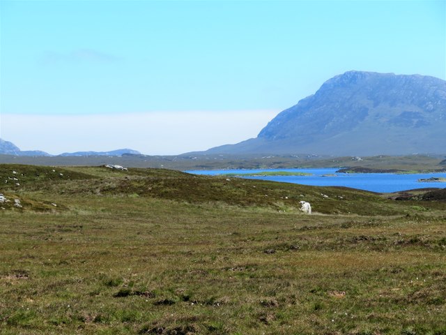
Loch an Droma is a picturesque freshwater loch located in Inverness-shire, Scotland. Nestled amidst the scenic beauty of the Scottish Highlands, it is a popular destination for nature lovers and outdoor enthusiasts.

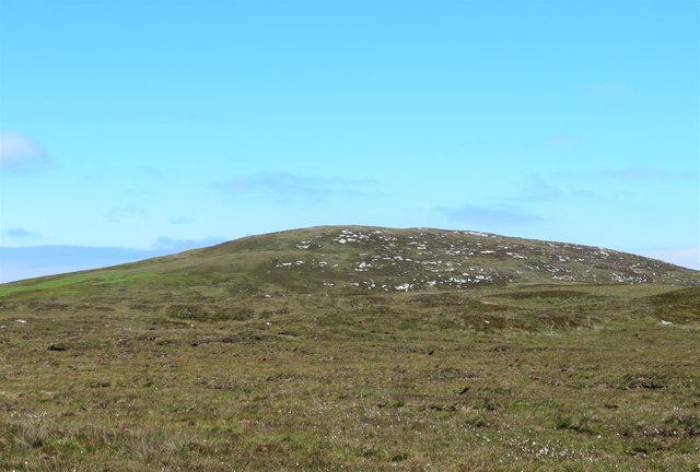
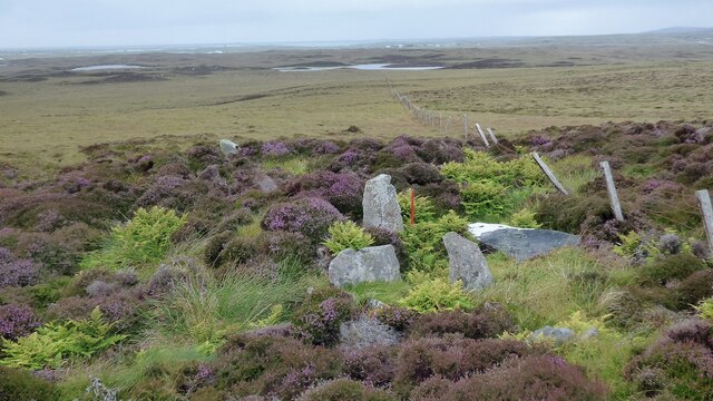
Covering an area of approximately 60 hectares, Loch an Droma boasts crystal clear waters and is surrounded by rolling hills and dense forests, adding to its natural charm. The loch is fed by several small streams and its water is sourced from rainwater and snowmelt from the surrounding mountains. As a result, the water is incredibly pure and supports a diverse range of flora and fauna.

The loch serves as a habitat for various aquatic species, including trout and salmon, making it a haven for fishing enthusiasts. Additionally, the surrounding marshes and wetlands are home to a wide array of bird species, such as ducks, swans, and herons, providing ample opportunities for birdwatching.

Visitors to Loch an Droma can partake in a range of recreational activities. Fishing is a popular pastime, with anglers drawn to the loch's abundant fish population. The calm and serene surroundings also make it an ideal location for boating and kayaking. For those seeking a more relaxed experience, walking trails along the loch offer stunning views and opportunities to immerse oneself in the tranquility of nature.

Overall, Loch an Droma is a hidden gem in Inverness-shire, offering a peaceful retreat amidst breathtaking landscapes. Its rich biodiversity and recreational offerings make it a must-visit destination for nature enthusiasts and those looking to escape the hustle and bustle of everyday life.

If you have any feedback on the listing, please let us know in the comments section below.

Loch an Droma Images

Images are sourced within 2km of 57.533847/-7.3060441 or Grid Reference NF8261. Thanks to Geograph Open Source API. All images are credited.

Outside Talla Chairinis, North Uist Outside a community hall
Outside Talla Chairinis, North Uist
Outside a community hall
Blar Chairinis Site of battle in 1601.
Blar Chairinis
Site of battle in 1601.
The ruins of Trinity Temple (Teampull na Trianaid) According to the plaque "Medieval monastery and college of European significance, founded by Beathag, daughter of Somhairle (Somerled).  Enlarged about 1350 to 1390 by Amie Mic Ruarie, first wife of John, Lord of the Isles.  Reconstructed in the 16th century.  Destroyed after the reformation.  Later restored in the 19th century by Dotair Ban."
The ruins of Trinity Temple (Teampull na Trianaid)
According to the plaque "Medieval monastery and college of European significance, founded by Beathag, daughter of Somhairle (Somerled). Enlarged about 1350 to 1390 by Amie Mic Ruarie, first wife of John, Lord of the Isles. Reconstructed in the 16th century. Destroyed after the reformation. Later restored in the 19th century by Dotair Ban."
Field and houses at Carinish And also the site of Feith na Fala (The ditch of blood) - a battle waged in 1601 between the MacLeods and the MacDonalds.
Field and houses at Carinish
And also the site of Feith na Fala (The ditch of blood) - a battle waged in 1601 between the MacLeods and the MacDonalds.
Bagh a’ Ghriasaiche
Bagh a’ Ghriasaiche
Fèithe na Fala - The ditch of blood
View from Temple View Hotel Teampull na Trionaid is a ruined 13th-century church and seminary at Carinish, North Uist, Scotland. Amie mac Ruari is said to have rebuilt the church in the 14th century after her divorce from John of Islay, Lord of the Isles. The ruins are protected as a scheduled monument.
View from Temple View Hotel
Teampull na Trionaid is a ruined 13th-century church and seminary at Carinish, North Uist, Scotland. Amie mac Ruari is said to have rebuilt the church in the 14th century after her divorce from John of Islay, Lord of the Isles. The ruins are protected as a scheduled monument.
Closer to the temple The ruins of Trinity Temple (Teampull na Trianaid)
Closer to the temple
The ruins of Trinity Temple (Teampull na Trianaid)
Free Church, Cairinis Current OS maps show this as a church, but older versions show it as a pub, which was its original purpose. Enough said.
Free Church, Cairinis
Current OS maps show this as a church, but older versions show it as a pub, which was its original purpose. Enough said.
A not very useful gate A rusty old metal gate at the point where a fence once crossed the track.
A not very useful gate
A rusty old metal gate at the point where a fence once crossed the track.
Track above Loch Creag nan Speireag This track, which is indistinct in places, forms part of the Hebridean Way, a relatively new walking route through the Western Isles.
Track above Loch Creag nan Speireag
This track, which is indistinct in places, forms part of the Hebridean Way, a relatively new walking route through the Western Isles.
Cotton grass, Creag nan Speireag Looking over cotton grass towards Loch nan Speireag and the houses at Gearraidh Cladach.
Cotton grass, Creag nan Speireag
Looking over cotton grass towards Loch nan Speireag and the houses at Gearraidh Cladach.
East from Creag nan Speireag Some 200m from the Hebridean Way path which probably cuts the corner of this square and provides some very 'soft' walking over damp moors. This diversion to a low rise gives a view eastwards towards the oddly shaped Loch Carabhat and distant Eabhal.
East from Creag nan Speireag
Some 200m from the Hebridean Way path which probably cuts the corner of this square and provides some very 'soft' walking over damp moors. This diversion to a low rise gives a view eastwards towards the oddly shaped Loch Carabhat and distant Eabhal.
View towards Beinn na Coille Although this view is across the tiny Loch na Meirle, it remains hidden from sight in a small fold of the moor. Further progress into this square was made difficult by soft ground through old peat workings.
View towards Beinn na Coille
Although this view is across the tiny Loch na Meirle, it remains hidden from sight in a small fold of the moor. Further progress into this square was made difficult by soft ground through old peat workings.
Caravat Barp chambered cairn and shieling Large Neolithic long cairn and later historic shieling or shelter (Scale 1m). <span class="nowrap"><a title="https://canmore.org.uk/site/10254/north-uist-carinish-caravat-barp" rel="nofollow ugc noopener" href="https://canmore.org.uk/site/10254/north-uist-carinish-caravat-barp">Link</a><img style="margin-left:2px;" alt="External link" title="External link - shift click to open in new window" src="https://s1.geograph.org.uk/img/external.png" width="10" height="10"/></span>
Caravat Barp chambered cairn and shieling
Large Neolithic long cairn and later historic shieling or shelter (Scale 1m). LinkExternal link
Carinish stone circle Sadly the road cuts through this stone circle. <span class="nowrap"><a title="https://canmore.org.uk/site/10249/north-uist-carinish" rel="nofollow ugc noopener" href="https://canmore.org.uk/site/10249/north-uist-carinish">Link</a><img style="margin-left:2px;" alt="External link" title="External link - shift click to open in new window" src="https://s1.geograph.org.uk/img/external.png" width="10" height="10"/></span>
Carinish stone circle
Sadly the road cuts through this stone circle. LinkExternal link
Craonaval chambered cairn Damaged remains of a chambered cairn hiding in the heather. <span class="nowrap"><a title="https://canmore.org.uk/site/10293/north-uist-craonaval" rel="nofollow ugc noopener" href="https://canmore.org.uk/site/10293/north-uist-craonaval">Link</a><img style="margin-left:2px;" alt="External link" title="External link - shift click to open in new window" src="https://s1.geograph.org.uk/img/external.png" width="10" height="10"/></span>
Craonaval chambered cairn
Damaged remains of a chambered cairn hiding in the heather. LinkExternal link
Two cairns and shielings at Craonaval The stone structures in the foreground are the remains of shielings built into the top of a cairn. <span class="nowrap"><a title="https://canmore.org.uk/site/10284/north-uist-craonaval-south" rel="nofollow ugc noopener" href="https://canmore.org.uk/site/10284/north-uist-craonaval-south">Link</a><img style="margin-left:2px;" alt="External link" title="External link - shift click to open in new window" src="https://s1.geograph.org.uk/img/external.png" width="10" height="10"/></span> A second cairn is visible as a green mound in the middle distance. This cairn contains a possible chamber. <span class="nowrap"><a title="https://canmore.org.uk/site/10253/north-uist-craonaval-north" rel="nofollow ugc noopener" href="https://canmore.org.uk/site/10253/north-uist-craonaval-north">Link</a><img style="margin-left:2px;" alt="External link" title="External link - shift click to open in new window" src="https://s1.geograph.org.uk/img/external.png" width="10" height="10"/></span>
Two cairns and shielings at Craonaval
The stone structures in the foreground are the remains of shielings built into the top of a cairn. LinkExternal link A second cairn is visible as a green mound in the middle distance. This cairn contains a possible chamber. LinkExternal link
Show me another place!

Loch an Droma is located at Grid Ref: NF8261 (Lat: 57.533847, Lng: -7.3060441)

Unitary Authority: Na h-Eileanan an Iar

Police Authority: Highlands and Islands

What 3 Words

///fear.eyepieces.richer. Near Balivanich, Na h-Eileanan Siar

Related Wikis

Carinish

Carinish (Scottish Gaelic: Càirinis), is a hamlet on North Uist, in the Outer Hebrides, Scotland. It is in the south of the island, about two miles (three...

Battle of Carinish

The Battle of Carinish was a Scottish clan battle fought in North Uist in 1601. It was part of a year of feuding between Clan MacLeod of Dunvegan and the...

Teampull na Trionaid

Teampull na Trionaid ("trinity church") is a ruined 13th-century Augustinian nunnery at Carinish, on North Uist, in the Outer Hebrides of Scotland. �...

Bail' Iochdrach

Bail' Iochdrach or Baliochrach (Scottish Gaelic: Am Baile Ìochdrach) is a village on Benbecula in the Outer Hebrides, Scotland. Baliochrach is within the...

Nearby Amenities

Located within 500m of 57.533847,-7.3060441
Power: pole
Lat/Long: 57.5310504/-7.3119485
Power: pole
Lat/Long: 57.5321332/-7.3124045
Power: pole
Lat/Long: 57.5325738/-7.3130992
Power: pole
Lat/Long: 57.5330633/-7.3138261
The data included in this document is from www.openstreetmap.org. The data is made available under ODbL.

Have you been to Loch an Droma?

Leave your review of Loch an Droma below (or comments, questions and feedback).