Loch nan Smalag

Lake, Pool, Pond, Freshwater Marsh in Inverness-shire

Scotland

Loch nan Smalag

Beinn Ruigh Choinnich from the ferry
Beinn Ruigh Choinnich from the ferry Credit: Alpin Stewart

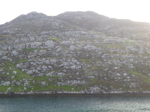
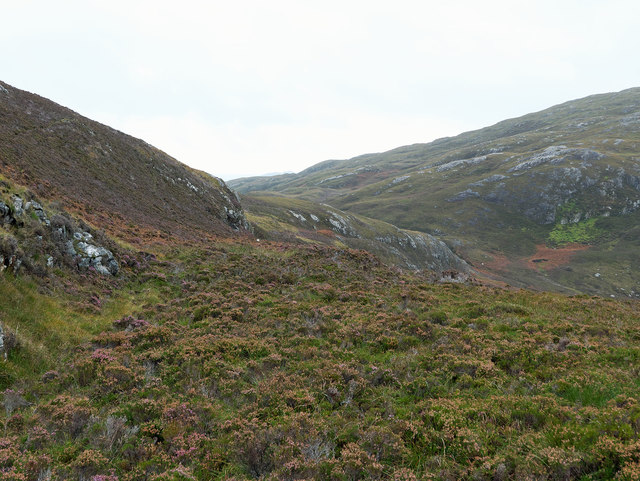
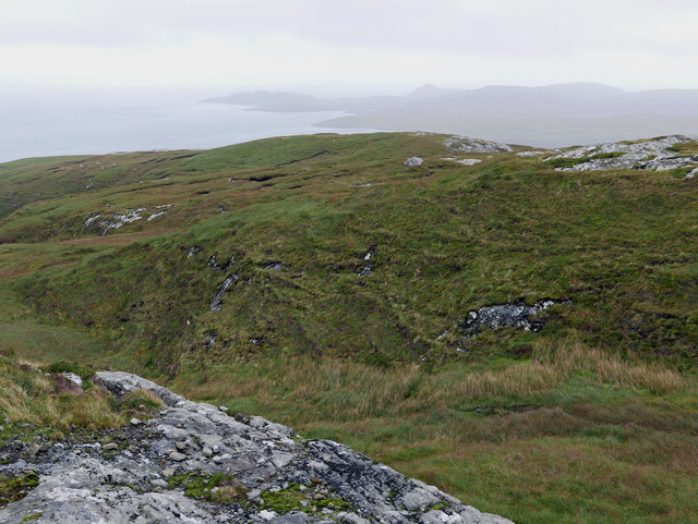
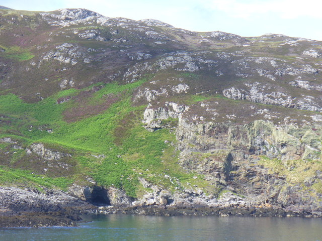
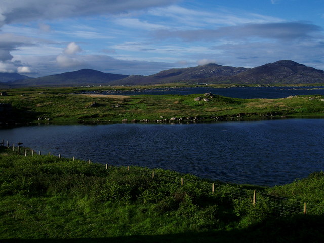
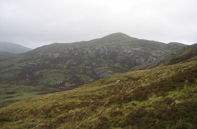
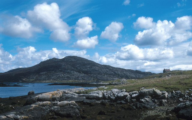
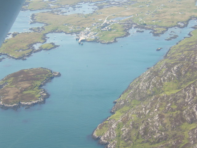
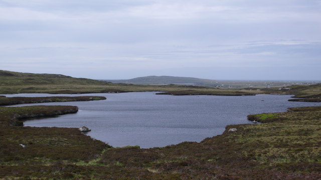
Loch nan Smalag is a picturesque freshwater loch located in Inverness-shire, Scotland. Nestled amidst the stunning Scottish Highlands, it is surrounded by rolling hills and dense forests, offering a tranquil and idyllic setting for nature enthusiasts and visitors seeking to escape the hustle and bustle of everyday life.

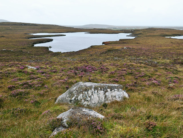
Covering an area of approximately 50 acres, Loch nan Smalag is relatively small compared to other nearby lochs, but its beauty and natural charm make it an enchanting destination. The loch is known for its crystal-clear waters, which reflect the surrounding landscape, creating a mesmerizing sight. It is also home to a variety of aquatic flora and fauna, making it a haven for wildlife lovers and birdwatchers.

The loch's shores are adorned with lush vegetation, including vibrant wildflowers and tall grasses, enhancing its scenic beauty. The surrounding marshland adds to the diversity of the area, providing a habitat for numerous species of water-loving plants and animals.

Visitors can enjoy a range of activities at Loch nan Smalag, such as fishing for brown trout, which thrive in its pristine waters. The loch also offers opportunities for boating and kayaking, allowing visitors to explore its calm and serene environment at their own pace.

Access to Loch nan Smalag is relatively easy, with a well-maintained path leading from the nearest road, providing a gentle walk through the surrounding countryside. The loch is a popular spot for picnicking and peaceful relaxation, offering a space to unwind and appreciate the natural beauty of Inverness-shire.

If you have any feedback on the listing, please let us know in the comments section below.

Loch nan Smalag Images

Images are sourced within 2km of 57.166489/-7.2961815 or Grid Reference NF7920. Thanks to Geograph Open Source API. All images are credited.

Beinn Ruigh Choinnich from the ferry
The summit of Triuirebheinn Looking just west of north towards Stulabhal <a href="https://www.geograph.org.uk/gridref/NF8024">NF8024</a>, with Loch Stulabhal on the left, and the much smaller Loch Shurabhat <a href="https://www.geograph.org.uk/gridref/NF7824">NF7824</a> beyond.
The summit of Triuirebheinn
Looking just west of north towards Stulabhal NF8024, with Loch Stulabhal on the left, and the much smaller Loch Shurabhat NF7824 beyond.
Above Loch nan Smalag Looking back as one takes a line across the trackless moorland to climb Triuirebheinn.
Above Loch nan Smalag
Looking back as one takes a line across the trackless moorland to climb Triuirebheinn.
View towards Bealach an Easain A region that sees few walkers and evidence of sheep only from their tracks.
View towards Bealach an Easain
A region that sees few walkers and evidence of sheep only from their tracks.
Steep ground on Triuirebheinn Beside a natural line for descending the hill.
Steep ground on Triuirebheinn
Beside a natural line for descending the hill.
From Triuirebheinn a glimpse of the coastline south of Loch Boisdale A misty day that spoiled the views from the climb up Triuirebheinn.
From Triuirebheinn a glimpse of the coastline south of Loch Boisdale
A misty day that spoiled the views from the climb up Triuirebheinn.
Summit cairn of Triuirebheinn Good to see others had marked the spot.
Summit cairn of Triuirebheinn
Good to see others had marked the spot.
Side of Triuirebheinn Looking towards the island of Stulaigh and a salmon farm sited in the bay to its north.
Side of Triuirebheinn
Looking towards the island of Stulaigh and a salmon farm sited in the bay to its north.
Distant view of Loch nan Arm Between Triuirebheinn and Stulabhal lies Loch nan Arm in a col.  Brown bracken highlights its position in the image.  Loch nan Arm has been likened to an extinct flooded volcanic crater and at one time the loch was thought to be the most beautiful place in the Hebrides.  Regrettably with a forecast of worsening weather our party did not choose to visit this fabled spot.  Geograph does have a close view - see Richard Webb's <a href="https://www.geograph.org.uk/photo/1171914">NF8122 : Loch Nan Arm</a>.  A battle between the Vikings and Picts was fought near the loch.
Distant view of Loch nan Arm
Between Triuirebheinn and Stulabhal lies Loch nan Arm in a col. Brown bracken highlights its position in the image. Loch nan Arm has been likened to an extinct flooded volcanic crater and at one time the loch was thought to be the most beautiful place in the Hebrides. Regrettably with a forecast of worsening weather our party did not choose to visit this fabled spot. Geograph does have a close view - see Richard Webb's NF8122 : Loch Nan Arm. A battle between the Vikings and Picts was fought near the loch.
Coastline Below Beinn Ruigh Choinnich Rocky shore on the north of the sea loch, Loch Baghasdail / Loch Boisdale. Risen sea levels have created a "drowned landscape".
Coastline Below Beinn Ruigh Choinnich
Rocky shore on the north of the sea loch, Loch Baghasdail / Loch Boisdale. Risen sea levels have created a "drowned landscape".
Beinn Ruigh Choinnich from South Lochboisdale View over Eileanan Iasgaich and Loch Boisdale with Beinn Ruigh on the right, Stulabhal in the centre and Airneabhal to the left
Beinn Ruigh Choinnich from South Lochboisdale
View over Eileanan Iasgaich and Loch Boisdale with Beinn Ruigh on the right, Stulabhal in the centre and Airneabhal to the left
Triuirebheinn from the slopes of Beinn Ruigh Choinnich. Rough going on the hills north of Lochboisdale/Loch Baghasdail.
Triuirebheinn from the slopes of Beinn Ruigh Choinnich.
Rough going on the hills north of Lochboisdale/Loch Baghasdail.
Beinn Ruigh Choinnich
Loch Baghasdail Gasaigh is on the left - the white-washed buildings of Lochboisdale, with the ferry-point, are in the centre-distance.
Loch Baghasdail
Gasaigh is on the left - the white-washed buildings of Lochboisdale, with the ferry-point, are in the centre-distance.
Summit of Triuirebheinn Looking northward up the east coast of South Uist.
Summit of Triuirebheinn
Looking northward up the east coast of South Uist.
Loch nan Smalag
Loch nan Smalag
Triuirebheinn hillside The short dry ground on this hill gave easy walking.  Stulabhal in the distance.
Triuirebheinn hillside
The short dry ground on this hill gave easy walking. Stulabhal in the distance.
Triuirebheinn Hillside Short heather and grass predominate on this hill.
Triuirebheinn Hillside
Short heather and grass predominate on this hill.
Show me another place!

Loch nan Smalag is located at Grid Ref: NF7920 (Lat: 57.166489, Lng: -7.2961815)

Unitary Authority: Na h-Eileanan an Iar

Police Authority: Highlands and Islands

What 3 Words

///campers.jolt.coins. Near Lochboisdale, Na h-Eileanan Siar

Related Wikis

Auratote

Auratote (Scottish Gaelic: Oratobht) is a location on South Uist in the Outer Hebrides, Scotland. Auratote is within the parish of South Uist. == References... ==

Beinn Ruigh Choinnich

Beinn Ruigh Choinnich is a hill which overlooks the port of Lochboisdale on the east coast of the island of South Uist in the Outer Hebrides Scotland....

Lochboisdale

Lochboisdale (Scottish Gaelic: Loch Baghasdail [ɫ̪ɔx ˈbɤːs̪t̪ɪl]) is the main village and port on the island of South Uist, Outer Hebrides, Scotland. Lochboisdale...

Eileanan Iasgaich

Na h-Eileanan Iasgaich comprise a small uninhabited archipelago in Loch Boisdale, in the south east of the island of South Uist, in the Outer Hebrides...

Have you been to Loch nan Smalag?

Leave your review of Loch nan Smalag below (or comments, questions and feedback).