Orkney Islands

Island Group in Orkney

Scotland

Orkney Islands

Track going away from The Ouse This track is sign posted To The Odin Stone at the upper end.  However, finding the Odin Stone is very difficult.
Track going away from The Ouse Credit: Peter Amsden

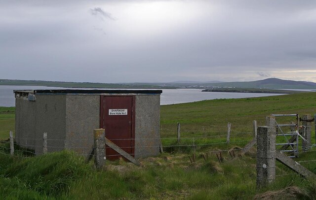
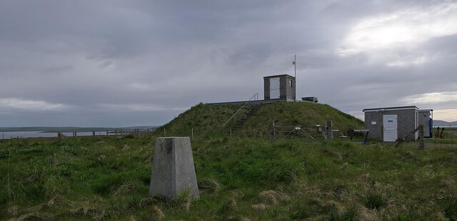
The Orkney Islands are an archipelago located off the northeastern coast of Scotland. Comprising around 70 islands, with only 20 inhabited, Orkney is a picturesque and historically rich destination. The largest island in the group is known simply as "Mainland," where the majority of the population resides.

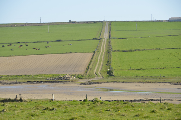
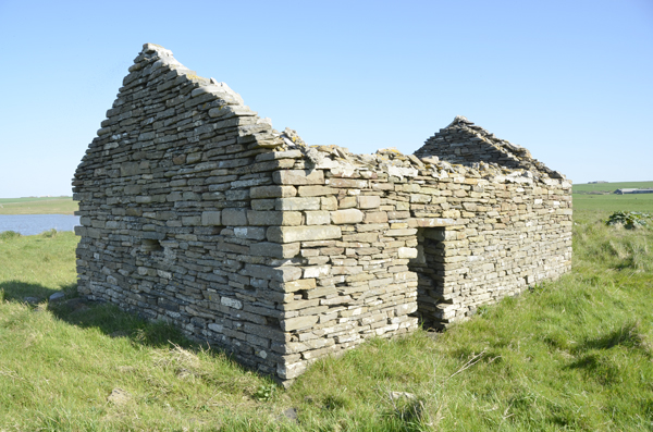
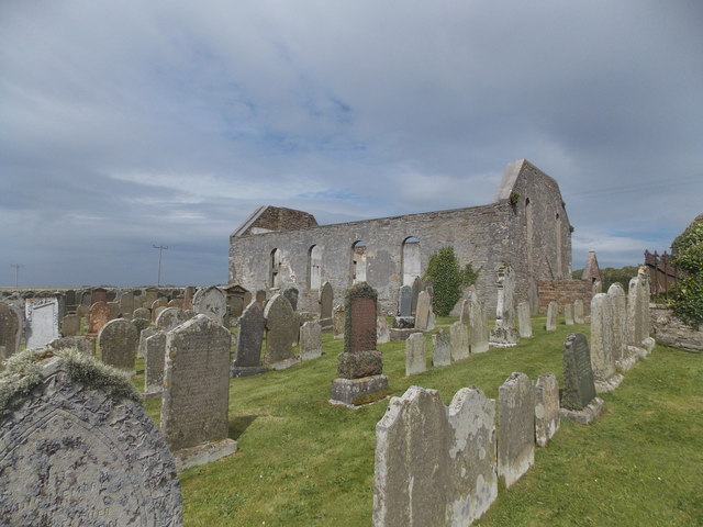
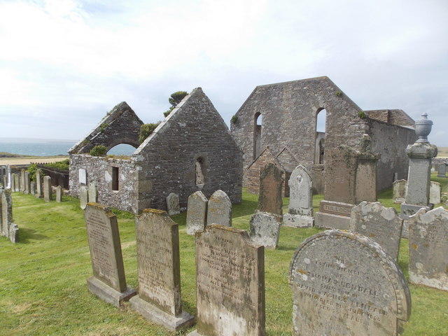
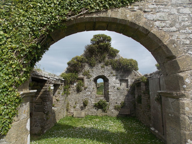
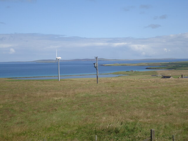
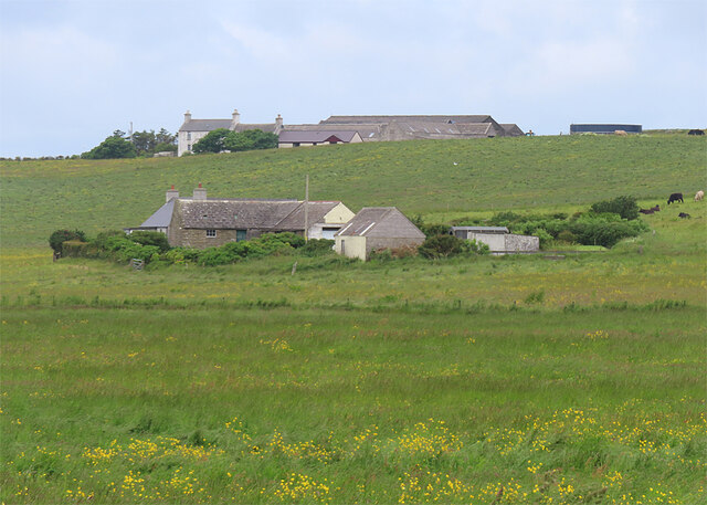
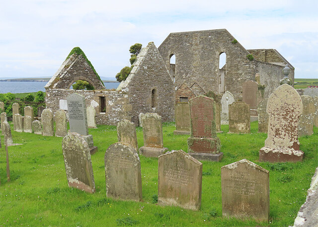
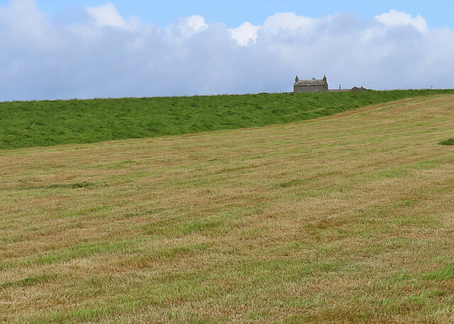
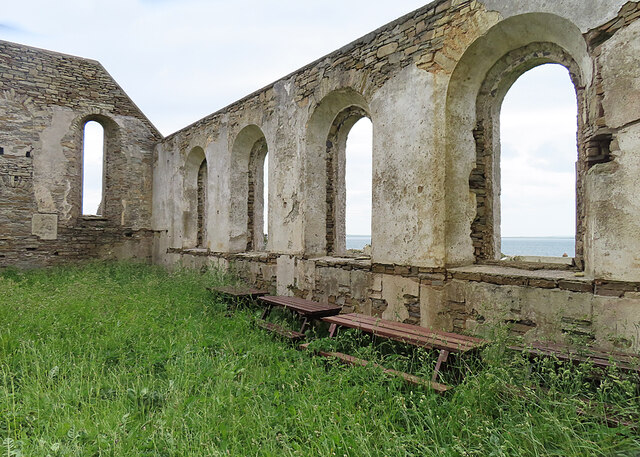
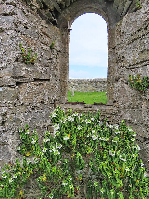
Orkney has a diverse landscape, featuring rugged cliffs, sandy beaches, rolling hills, and fertile farmland. The islands boast a unique blend of natural beauty and ancient heritage. The landscape is dotted with numerous archaeological sites, including the UNESCO World Heritage Sites of Skara Brae, Maeshowe, and the Ring of Brodgar. These Neolithic sites offer fascinating insights into the lives of the islands' early inhabitants.

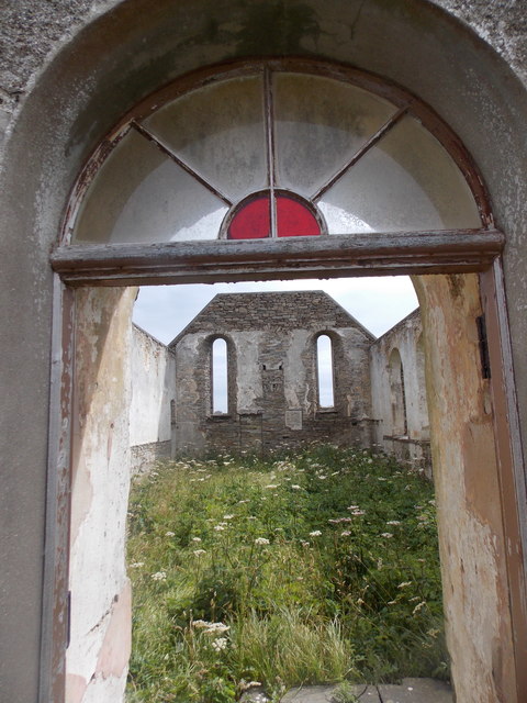
The islands are also home to several charming towns and villages, each with its own character and history. Kirkwall, the capital of Orkney, is a bustling town with a rich Viking heritage and a magnificent 12th-century cathedral, St. Magnus Cathedral. Stromness, a picturesque coastal town, is known for its narrow winding streets and historic waterfront.

Orkney's waters are teeming with marine life, making it a haven for wildlife enthusiasts. Seals, dolphins, and a wide variety of seabirds can often be spotted along the coast. The islands also have a thriving arts and crafts scene, with local artisans producing unique works inspired by the surrounding natural beauty.

With its stunning landscapes, rich history, and warm hospitality, the Orkney Islands offer a truly unforgettable experience for visitors seeking a blend of natural wonders and cultural heritage.

If you have any feedback on the listing, please let us know in the comments section below.

Orkney Islands Images

Images are sourced within 2km of 59.043231/-2.8824673 or Grid Reference HY4917. Thanks to Geograph Open Source API. All images are credited.

Track going away from The Ouse This track is sign posted To The Odin Stone at the upper end.  However, finding the Odin Stone is very difficult.
Track going away from The Ouse
This track is sign posted To The Odin Stone at the upper end. However, finding the Odin Stone is very difficult.
Old building near to the location of Odin Stone At least that is the theory. Finding the said Odin Stone is another matter.
Old building near to the location of Odin Stone
At least that is the theory. Finding the said Odin Stone is another matter.
Aerogenerator on Shapinsay Taken from the Shetland-Orkney ferry at dusk. Exact position to be ascertained.
Aerogenerator on Shapinsay
Taken from the Shetland-Orkney ferry at dusk. Exact position to be ascertained.
Shapinsay: South Church The ruined church has an unusually positioned bell, in the little enclosure ahead of us, which makes me think that it was originally a small tower.
Shapinsay: South Church
The ruined church has an unusually positioned bell, in the little enclosure ahead of us, which makes me think that it was originally a small tower.
Shapinsay: inside the South Church A sad sight, it is clearly many years since <a href="https://www.geograph.org.uk/photo/4714432">HY5016 : Shapinsay: South Church</a> last hosted a congregation.
Shapinsay: inside the South Church
A sad sight, it is clearly many years since HY5016 : Shapinsay: South Church last hosted a congregation.
Shapinsay: the South Church from the southeast Another view of <a href="https://www.geograph.org.uk/photo/4714432">HY5016 : Shapinsay: South Church</a>. The picture was cunningly taken in the briefest of moments when a child, the son of a man mowing the grass, was hidden behind one of the gravestones.
Shapinsay: the South Church from the southeast
Another view of HY5016 : Shapinsay: South Church. The picture was cunningly taken in the briefest of moments when a child, the son of a man mowing the grass, was hidden behind one of the gravestones.
Shapinsay: old toilet (?) at South Church Situated in a small brick/stone compound at the east end of <a href="https://www.geograph.org.uk/photo/4714432">HY5016 : Shapinsay: South Church</a>, the thing on the wall is clearly a cistern but below it seems to be some kind of small furnace - definitely not something to go on!
Shapinsay: old toilet (?) at South Church
Situated in a small brick/stone compound at the east end of HY5016 : Shapinsay: South Church, the thing on the wall is clearly a cistern but below it seems to be some kind of small furnace - definitely not something to go on!
Shapinsay: the South Church from the east This view of <a href="https://www.geograph.org.uk/photo/4714432">HY5016 : Shapinsay: South Church</a> takes in the Balfour family's burial compound, a separate building on the east side of the churchyard.
Shapinsay: the South Church from the east
This view of HY5016 : Shapinsay: South Church takes in the Balfour family's burial compound, a separate building on the east side of the churchyard.
Shapinsay: the Balfour burial compound Looking rather like a little ruined church itself, the Balfours' burial place is this building in the churchyard of the South Church - see <a href="https://www.geograph.org.uk/photo/4714441">HY5016 : Shapinsay: the South Church from the east</a>.
Shapinsay: the Balfour burial compound
Looking rather like a little ruined church itself, the Balfours' burial place is this building in the churchyard of the South Church - see HY5016 : Shapinsay: the South Church from the east.
Water infrastructure, Shapinsay, Orkney The building appears to be disused and I assume that the borehole became redundant when a mains water pipe was laid between Orkney Mainland and Shapinsay in 2012.
Water infrastructure, Shapinsay, Orkney
The building appears to be disused and I assume that the borehole became redundant when a mains water pipe was laid between Orkney Mainland and Shapinsay in 2012.
Triangulation pillar and reservoir, Shapinsay, Orkney Shapinsay's water supply used to be from boreholes (eg <a href="https://www.geograph.org.uk/photo/7197001">HY5116 : Water infrastructure, Shapinsay, Orkney</a>) but since 2012 the island has been supplied by a mains water pipe from Orkney Mainland.
Triangulation pillar and reservoir, Shapinsay, Orkney
Shapinsay's water supply used to be from boreholes (eg HY5116 : Water infrastructure, Shapinsay, Orkney) but since 2012 the island has been supplied by a mains water pipe from Orkney Mainland.
From Shapinsay summit
Looking towards Housebay The foreground here is in square, but the two farms, Housebay and Hannatoft, are in the next square.
Looking towards Housebay
The foreground here is in square, but the two farms, Housebay and Hannatoft, are in the next square.
South Kirk Both the kirk, built in 1822, and the Balfour Burial Aisle on the left, are Category B Listed. See <span class="nowrap"><a title="https://portal.historicenvironment.scot/designation/LB18612" rel="nofollow ugc noopener" href="https://portal.historicenvironment.scot/designation/LB18612">Link</a><img style="margin-left:2px;" alt="External link" title="External link - shift click to open in new window" src="https://s1.geograph.org.uk/img/external.png" width="10" height="10"/></span> and <span class="nowrap"><a title="https://portal.historicenvironment.scot/designation/LB18613" rel="nofollow ugc noopener" href="https://portal.historicenvironment.scot/designation/LB18613">Link</a><img style="margin-left:2px;" alt="External link" title="External link - shift click to open in new window" src="https://s1.geograph.org.uk/img/external.png" width="10" height="10"/></span> for information.
South Kirk
Both the kirk, built in 1822, and the Balfour Burial Aisle on the left, are Category B Listed. See LinkExternal link and LinkExternal link for information.
Hamar The isolated house stands above fields being harvested for hay.
Hamar
The isolated house stands above fields being harvested for hay.
Ground-level Belfry Outside the ruins of South Church.
Ground-level Belfry
Outside the ruins of South Church.
South Kirk Inside the kirk are several picnic benches.
South Kirk
Inside the kirk are several picnic benches.
Window of the Balfour Aisle The north-facing window of <span class="nowrap"><a title="https://portal.historicenvironment.scot/designation/LB18613" rel="nofollow ugc noopener" href="https://portal.historicenvironment.scot/designation/LB18613">Link</a><img style="margin-left:2px;" alt="External link" title="External link - shift click to open in new window" src="https://s1.geograph.org.uk/img/external.png" width="10" height="10"/></span>.
Window of the Balfour Aisle
The north-facing window of LinkExternal link.
Show me another place!

Orkney Islands is located at Grid Ref: HY4917 (Lat: 59.043231, Lng: -2.8824673)

Unitary Authority: Orkney Islands

Police Authority: Highlands and Islands

What 3 Words

///prominent.purses.entertainer. Near Balfour, Orkney Islands

Nearby Locations

Orkney Islands

Related Wikis

Shapinsay

Shapinsay (, Scots: Shapinsee) is one of the Orkney Islands off the north coast of mainland Scotland. There is one village on the island, Balfour, from...

Mill Dam

Mill Dam is a wetland in western Shapinsay, in Orkney, Scotland. This water body was not shown on the 1840 survey map of the island, since it is a man...

The Ouse

The Ouse is a tidal estuary in northern Shapinsay, Orkney Islands. This water body has been shown on early maps of the island in a very similar shape to...

Balfour, Orkney

Balfour is a village on the island of Shapinsay, Orkney. The village is situated on Elwick Bay, which was used as an anchorage by Haakon IV of Norway before...

Lairo Water

Lairo Water is a surface water body known as an ayre situated on the western coast of Shapinsay in the Orkney Islands. This brackish water body is separated...

Balfour Castle

Balfour Castle is a historic building on the southwest of Shapinsay, Orkney Islands. Though built around an older structure that dates at least from the...

Vasa Loch

Vasa Loch is a brackish lagoon in southwestern Shapinsay, Orkney Islands. (Ordnance, 2002) This water body has been shown on early maps of the island...

Helliar Holm

Helliar Holm is an uninhabited island off the coast of Shapinsay in the Orkney Islands, Scotland. It is home to a 42-foot-tall (13 m) lighthouse, which...

Nearby Amenities

Located within 500m of 59.043231,-2.8824673
Place Of Worship
North Church
Addr Postcode: KW17 2EA
Religion: christian
Lat/Long: 59.0403202/-2.878568
Material: wood
Power: pole
Lat/Long: 59.0453754/-2.8762661
Material: wood
Power: pole
Lat/Long: 59.044986/-2.8776893
Material: wood
Power: pole
Lat/Long: 59.0446148/-2.8789711
Material: wood
Power: pole
Lat/Long: 59.0442643/-2.8802227
Material: wood
Power: pole
Lat/Long: 59.0438438/-2.8816106
Material: wood
Power: pole
Lat/Long: 59.0434232/-2.8830741
Material: wood
Power: pole
Lat/Long: 59.0430053/-2.8845276
Material: wood
Power: pole
Lat/Long: 59.0426029/-2.8845629
Material: wood
Power: pole
Lat/Long: 59.0425847/-2.8859608
Material: wood
Power: pole
Lat/Long: 59.0426159/-2.8857236
Material: wood
Power: pole
Lat/Long: 59.0421771/-2.8874093
Material: wood
Power: pole
Lat/Long: 59.0417903/-2.8888122
Material: wood
Power: pole
Lat/Long: 59.0413542/-2.8902203
Power: pole
Lat/Long: 59.0412183/-2.8833666
Power: pole
Lat/Long: 59.0418737/-2.8833666
Power: pole
Lat/Long: 59.042627/-2.8870332
Power: pole
Lat/Long: 59.0426339/-2.888208
Power: pole
Lat/Long: 59.0426188/-2.8894928
Power: pole
Lat/Long: 59.0426215/-2.8908098
Power: pole
Lat/Long: 59.0473748/-2.8801479
Power: pole
Lat/Long: 59.0466984/-2.8801748
Power: pole
Lat/Long: 59.0460458/-2.8802097
Power: pole
Lat/Long: 59.0453933/-2.8801963
Power: pole
Lat/Long: 59.0447724/-2.8802124
Power: pole
Lat/Long: 59.0441323/-2.8802124
Power: pole
Lat/Long: 59.0435349/-2.8802392
Power: pole
Lat/Long: 59.0427416/-2.8800783
Power: pole
Lat/Long: 59.0422476/-2.8800353
Power: pole
Lat/Long: 59.0473564/-2.8841123
Power: pole
Lat/Long: 59.0473343/-2.8824601
Power: pole
Lat/Long: 59.0473302/-2.8812665
Power: pole
Lat/Long: 59.0473426/-2.8789705
Power: pole
Lat/Long: 59.0436977/-2.874231
Power: pole
Lat/Long: 59.0433914/-2.8752074
Power: pole
Lat/Long: 59.0429747/-2.8763956
Power: pole
Lat/Long: 59.0425511/-2.8776053
Power: pole
Lat/Long: 59.0421483/-2.8788471
Power: pole
Lat/Long: 59.0417233/-2.8799683
Generator Method: wind_turbine
Generator Output Electricity: yes
Generator Source: wind
Generator Type: horizontal_axis
Power: generator
Lat/Long: 59.0402828/-2.8830314
Generator Method: wind_turbine
Generator Output Electricity: yes
Generator Source: wind
Generator Type: horizontal_axis
Power: generator
Lat/Long: 59.0407975/-2.8869849
Power: pole
Lat/Long: 59.041319/-2.881068
Power: pole
Lat/Long: 59.0409285/-2.8822589
Power: pole
Lat/Long: 59.0405381/-2.8833854
Power: pole
Lat/Long: 59.0405325/-2.8847131
Power: pole
Lat/Long: 59.0405312/-2.8861052
Power: pole
Lat/Long: 59.0405408/-2.887508
Power: pole
Lat/Long: 59.0400482/-2.8885809
Parking
Lat/Long: 59.0402675/-2.8788599
Power: pole
Lat/Long: 59.0401807/-2.8785786
Power: pole
Lat/Long: 59.0405323/-2.879428
The data included in this document is from www.openstreetmap.org. The data is made available under ODbL.

Have you been to Orkney Islands?

Leave your review of Orkney Islands below (or comments, questions and feedback).