Small Isles

Island Group in Argyllshire

Scotland

Small Isles

Eilean nan Coinein and Eilean Dìomhain
Eilean nan Coinein and Eilean Dìomhain Credit: Alpin Stewart

The Small Isles, located off the western coast of Scotland in Argyllshire, is a picturesque island group comprising four main islands: Eigg, Muck, Rum, and Canna. These islands, collectively spanning over 15,000 acres, offer breathtaking scenery, rich wildlife, and a glimpse into Scotland's history and culture.

Eigg, the largest of the Small Isles, boasts stunning landscapes, including the iconic An Sgurr, a dramatic volcanic ridge that dominates the island's skyline. It is also known for its vibrant community, with around 100 residents who actively engage in sustainable living and renewable energy projects.

Muck, the smallest of the four islands, is renowned for its peaceful atmosphere and fertile lands. It is primarily used for farming, and visitors can enjoy serene walks along its beautiful sandy beaches.

Rum, the second-largest island, is a designated National Nature Reserve, protecting its diverse flora and fauna. Nature lovers can explore its rugged terrain, ancient woodlands, and spot a variety of wildlife, including red deer, golden eagles, and otters. The island is also home to Kinloch Castle, a stunning Victorian mansion that offers a glimpse into the island's history.

Canna, the westernmost of the Small Isles, is another haven for wildlife enthusiasts. Its fertile soil supports a wide range of plants, and the island's cliffs are home to nesting seabirds, including puffins and guillemots. Visitors can also explore the island's archaeological sites, such as the Iron Age fort of Dun Channuill.

The Small Isles, with their unspoiled beauty and rich heritage, offer a tranquil retreat and an opportunity to immerse oneself in Scotland's natural wonders. Whether it's hiking, wildlife spotting, or simply enjoying the peace and serenity of these islands, the Small Isles have something to offer for every visitor.

If you have any feedback on the listing, please let us know in the comments section below.
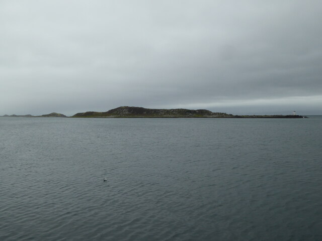
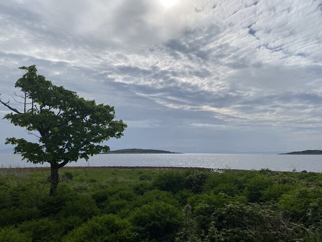
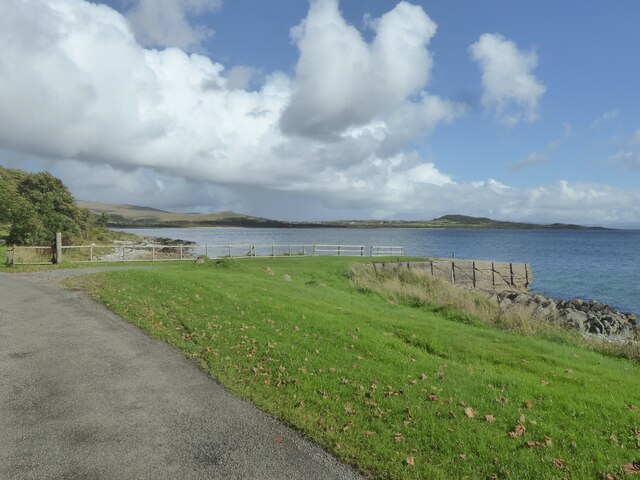
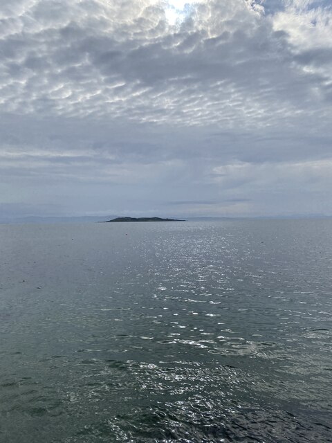
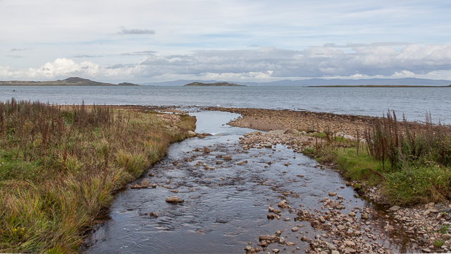
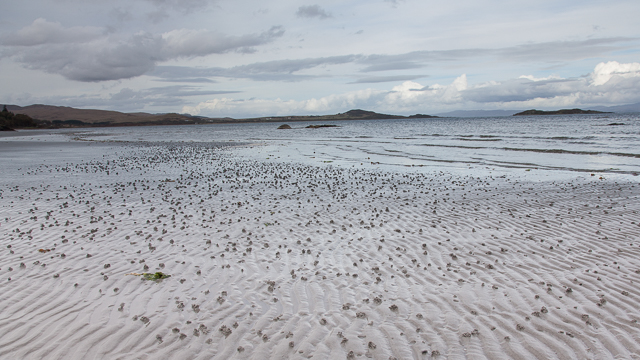
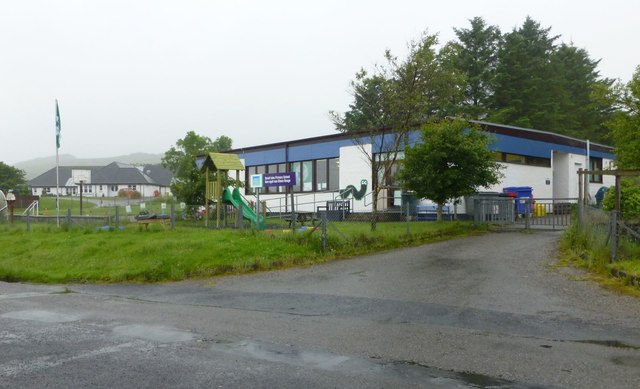
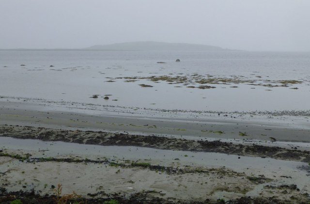
Small Isles Images

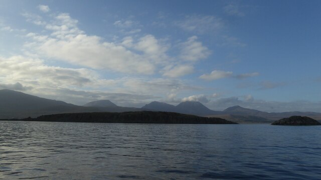
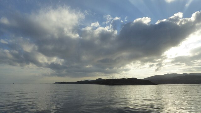
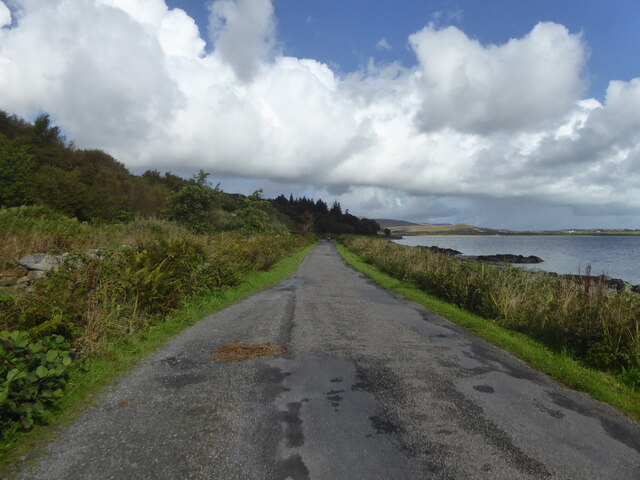
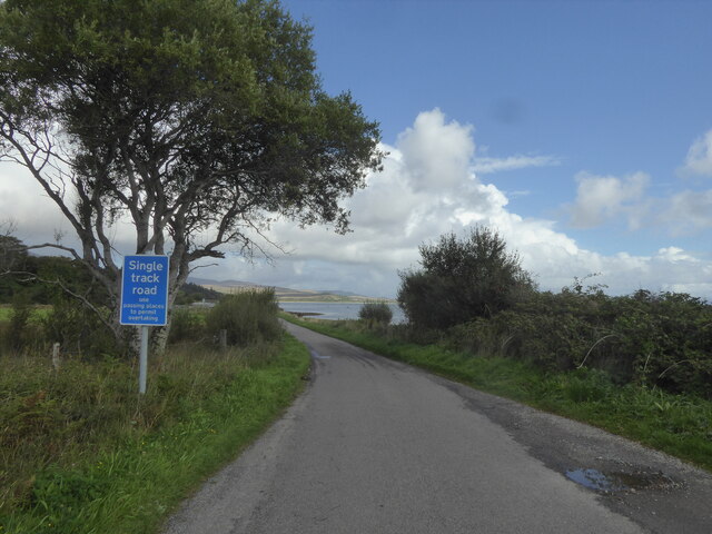
Images are sourced within 2km of 55.849273/-5.9222769 or Grid Reference NR5468. Thanks to Geograph Open Source API. All images are credited.

Eilean nan Coinein and Eilean Dìomhain
Eilean nan Gabhar
Eilean nan Gabhar
A846 near Feolin, Isle of Jura
A846 northbound, Isle of Jura
Eilean nan Gabhar from the end of Jura Pier
Views out to sea near Carraig an Fhion
Jetty at Carraig Mhic Illiomhair, Isle of Jura
Views out to sea
Views out to sea
OS Bolt - Jura Forest Pier <span class="nowrap"><a title="https://www.bench-marks.org.uk/bm204548" rel="nofollow ugc noopener" href="https://www.bench-marks.org.uk/bm204548">Link</a><img style="margin-left:2px;" alt="External link" title="External link - shift click to open in new window" src="https://s1.geograph.org.uk/img/external.png" width="10" height="10"/></span>
OS Bolt - Jura Forest Pier
Location of OS Bolt - Jura Forest Pier
OS - Jura Forest Pier - Pipe <span class="nowrap"><a title="https://trigpointing.uk/wiki/Pipe" rel="nofollow ugc noopener" href="https://trigpointing.uk/wiki/Pipe">Link</a><img style="margin-left:2px;" alt="External link" title="External link - shift click to open in new window" src="https://s1.geograph.org.uk/img/external.png" width="10" height="10"/></span>
There are 27 instances of a pipe in the OSGB36 list. 22 of these are in common with the T:UK list with 5 additional and one not included. The 5 'extras' are all roof stations, classified by T:UK as Intersected Stations and all are thought to be destroyed. Descriptions of these include 'Iron Pipe', 'Vent Pipe', 'Wtr Twr' and 'Resr Syphon'. The pipe mark at Gugh is not in the OSGB36 list.
OS - Jura Forest Pier - Pipe
LinkExternal link There are 27 instances of a pipe in the OSGB36 list. 22 of these are in common with the T:UK list with 5 additional and one not included. The 5 'extras' are all roof stations, classified by T:UK as Intersected Stations and all are thought to be destroyed. Descriptions of these include 'Iron Pipe', 'Vent Pipe', 'Wtr Twr' and 'Resr Syphon'. The pipe mark at Gugh is not in the OSGB36 list.
Location of OS Bolt - Jura Forest Pier
River flowing into the sea
Sandy beach with lugworm casts
Small Isles Primary School Small Isles Primary serves the island of Jura off the west coast of Scotland which has a population of around two hundred people.  Our families live in Craighouse which is the main village as well as in other communities around the island - Knockrome, Ardfarnal, Tarbert, Inverlussa and Ardlussa.  <span class="nowrap"><a title="http://www.smallisles.argyll-bute.sch.uk/about" rel="nofollow ugc noopener" href="http://www.smallisles.argyll-bute.sch.uk/about">Link</a><img style="margin-left:2px;" alt="External link" title="External link - shift click to open in new window" src="https://s1.geograph.org.uk/img/external.png" width="10" height="10"/></span>
Small Isles Primary School
Small Isles Primary serves the island of Jura off the west coast of Scotland which has a population of around two hundred people. Our families live in Craighouse which is the main village as well as in other communities around the island - Knockrome, Ardfarnal, Tarbert, Inverlussa and Ardlussa. LinkExternal link
Looking across the beach at Feolin Farm Towards Pladda and the other Small Isles.
Looking across the beach at Feolin Farm
Towards Pladda and the other Small Isles.
Rough grassland near Keils Unimproved grassland near Keils.  Spot a Pap!
Rough grassland near Keils
Unimproved grassland near Keils. Spot a Pap!
Abhainn a'Mhinisteir Alternatively known as the Minister's Burn, it is seen here flowing into the Bay of Small Isles.
Abhainn a'Mhinisteir
Alternatively known as the Minister's Burn, it is seen here flowing into the Bay of Small Isles.
Show me another place!

Small Isles is located at Grid Ref: NR5468 (Lat: 55.849273, Lng: -5.9222769)

Unitary Authority: Argyll and Bute

Police Authority: Argyll and West Dunbartonshire

What 3 Words

///probable.cups.afflicted. Near Craighouse, Argyll & Bute

Related Wikis

Small Isles, Argyll

The Small Isles are a group of uninhabited islands east of Jura, in the council area of Argyll and Bute, Scotland. From south to north, the five islands...

Keils

Keils formerly Kilearnadill is a hamlet 0.25 miles (0.40 km) from Craighouse on the island of Jura, in the council area of Argyll and Bute, Scotland. Keils...

Craighouse

Craighouse (Scottish Gaelic: Taigh na Creige) is the main settlement and capital of the Scottish Inner Hebridean island of Jura, in Argyll and Bute. In...
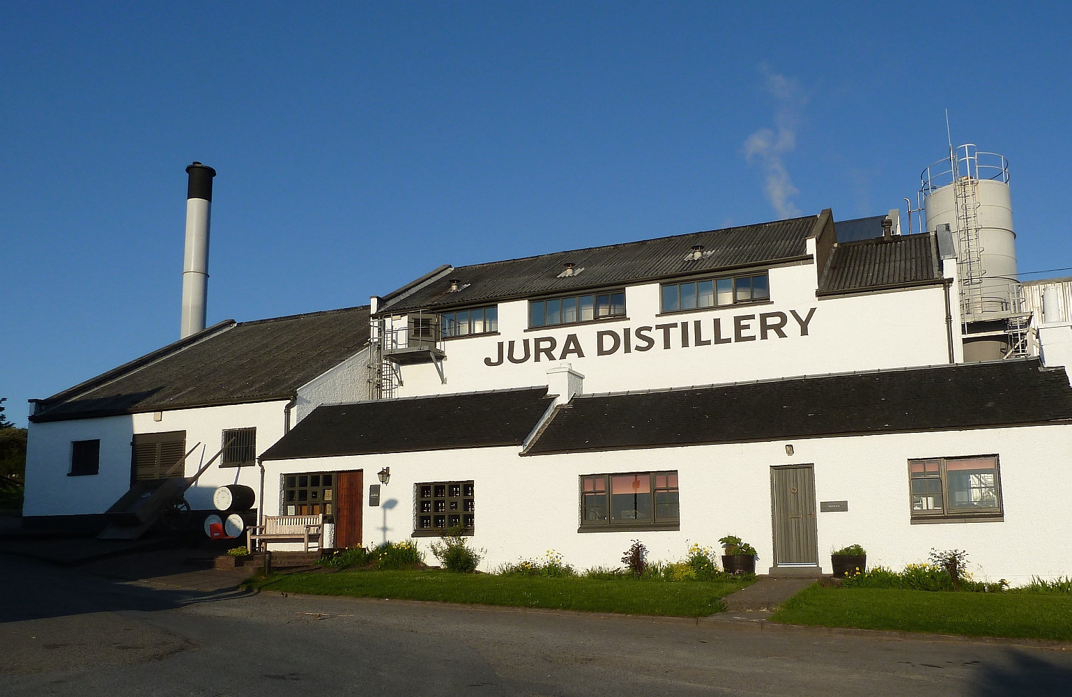
Jura distillery

Jura distillery is a Scotch whisky distillery on the island of Jura in the Inner Hebrides off the West Coast of Scotland. The distillery is operated by...

Nearby Amenities

Located within 500m of 55.849273,-5.9222769
Source: PGS
Lat/Long: 55.8483804/-5.9296515
Source: PGS
Lat/Long: 55.8487192/-5.9300563
Source: PGS
Lat/Long: 55.850625/-5.9295813
Source: PGS
Lat/Long: 55.8509089/-5.9294479
Source: PGS
Lat/Long: 55.8506412/-5.9282607
Source: PGS
Lat/Long: 55.8508181/-5.9277876
Source: PGS
Lat/Long: 55.8506964/-5.9275747
Created By: dmgroom_coastlines
Source: PGS
Lat/Long: 55.850534/-5.927642
Source: PGS
Lat/Long: 55.8503578/-5.9274992
Source: PGS
Lat/Long: 55.8502418/-5.9274717
Source: PGS
Lat/Long: 55.8498699/-5.927861
Source: PGS
Lat/Long: 55.8497303/-5.9280127
Source: PGS
Lat/Long: 55.8496358/-5.9279301
Source: PGS
Lat/Long: 55.849083/-5.9286339
Source: PGS
Lat/Long: 55.8485883/-5.929219
Source: PGS
Lat/Long: 55.84828/-5.9295441
Source: PGS
Lat/Long: 55.8463552/-5.9186325
Source: PGS
Lat/Long: 55.8465138/-5.9192866
Source: PGS
Lat/Long: 55.8467166/-5.9190831
Source: PGS
Lat/Long: 55.8469575/-5.9189543
Source: PGS
Lat/Long: 55.8471159/-5.918733
Source: PGS
Lat/Long: 55.8471262/-5.918611
Source: PGS
Lat/Long: 55.8469696/-5.9183964
Source: PGS
Lat/Long: 55.8466323/-5.9183535
Source: PGS
Lat/Long: 55.8453703/-5.9253043
Source: PGS
Lat/Long: 55.8455468/-5.9252786
Source: PGS
Lat/Long: 55.8458276/-5.9253774
Source: PGS
Lat/Long: 55.8459907/-5.925332
Created By: dmgroom_coastlines
Source: PGS
Lat/Long: 55.846757/-5.924854
Source: PGS
Lat/Long: 55.8468873/-5.924777
Source: PGS
Lat/Long: 55.84768/-5.9249493
Source: PGS
Lat/Long: 55.8479306/-5.9245041
Source: PGS
Lat/Long: 55.8480218/-5.9243426
Source: PGS
Lat/Long: 55.8481095/-5.9240452
Source: PGS
Lat/Long: 55.848277/-5.9238334
Source: PGS
Lat/Long: 55.8483741/-5.9235948
Source: PGS
Lat/Long: 55.8483785/-5.9233561
Source: PGS
Lat/Long: 55.848278/-5.9231913
Source: PGS
Lat/Long: 55.8480659/-5.9229935
Source: PGS
Lat/Long: 55.8477924/-5.922455
Source: PGS
Lat/Long: 55.8479767/-5.9218195
Source: PGS
Lat/Long: 55.8481289/-5.9209466
Source: PGS
Lat/Long: 55.8476506/-5.921222
Source: PGS
Lat/Long: 55.8475705/-5.9215042
Source: PGS
Lat/Long: 55.8467133/-5.9219804
Source: PGS
Lat/Long: 55.8465326/-5.9223055
Source: PGS
Lat/Long: 55.8459371/-5.9227885
Source: PGS
Lat/Long: 55.8457019/-5.9229739
Source: PGS
Lat/Long: 55.8455451/-5.9230718
Source: PGS
Lat/Long: 55.8451499/-5.9235004
Source: PGS
Lat/Long: 55.8450985/-5.9236257
Source: PGS
Lat/Long: 55.8448839/-5.9239712
The data included in this document is from www.openstreetmap.org. The data is made available under ODbL.

Have you been to Small Isles?

Leave your review of Small Isles below (or comments, questions and feedback).