Longships

Island Group in Cornwall

England

Longships

Longships Lighthouse With rocks
Longships Lighthouse Credit: Chris Morgan

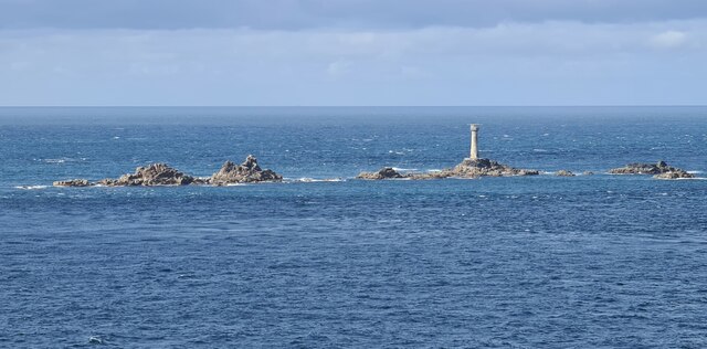
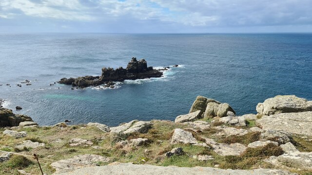
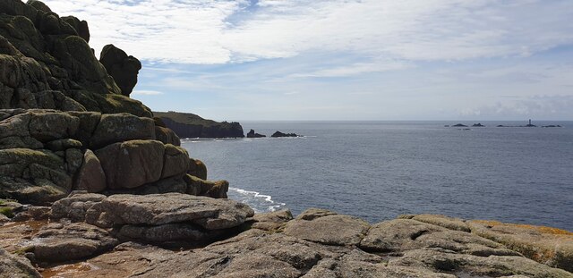
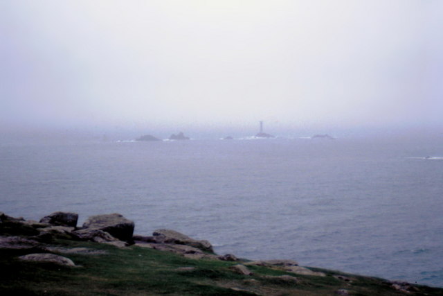
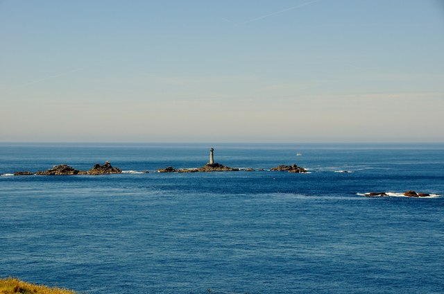
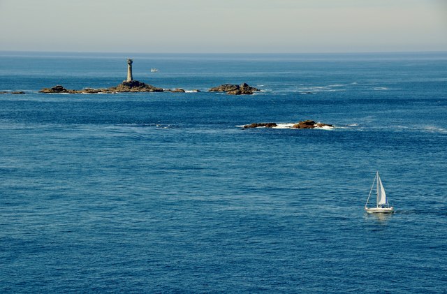
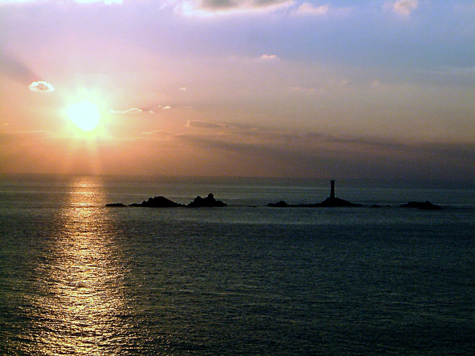
Longships is a group of small rocky islets located approximately 1.2 miles off the coast of Land's End, Cornwall, England. It is a popular destination for tourists and a prominent feature for sailors navigating the treacherous waters of the Atlantic Ocean. The name "Longships" is derived from the Old Norse word "langsker," which means "long rock."

Comprising a total of seven islands, Longships is known for its jagged appearance and harsh conditions. The largest and most notable island is called Carn Bras, which rises to a height of approximately 68 feet above sea level. The other smaller islets are known as Carn Scathe, Carn Nis, Meinek, Men Gurta, Tregear Rocks, and Kettle's Bottom.

The islands are primarily composed of granite and are devoid of vegetation due to strong winds and constant exposure to the elements. They are home to various species of seabirds, including gulls, razorbills, guillemots, and puffins. These birds use the rocky cliffs for nesting and breeding purposes, creating a vibrant and bustling ecosystem.

Longships has a rich maritime history and is infamous for being the site of numerous shipwrecks. The treacherous rocks and strong currents surrounding the islands have claimed many vessels over the centuries, leading to the construction of the Longships Lighthouse in 1795. The lighthouse, standing at approximately 35 meters tall, serves as a vital navigational aid to ships in the area, warning them of the hazardous rocks and helping them safely navigate through the waters.

In summary, Longships is a group of seven rocky islets off the coast of Cornwall, characterized by its rugged appearance, diverse seabird population, and historical significance as a site of shipwrecks. The iconic Longships Lighthouse stands as a beacon of safety for sailors navigating the challenging waters of the Atlantic Ocean.

If you have any feedback on the listing, please let us know in the comments section below.

Longships Images

Images are sourced within 2km of 50.066684/-5.7443986 or Grid Reference SW3225. Thanks to Geograph Open Source API. All images are credited.

Longships Lighthouse With rocks
Longships Lighthouse
With rocks
Armed Knight
Armed Knight
Longships and distant Wolf Rock Lighthouses Taken from Cape Cornwall looking towards Longships Lighthouse with Wolf Rock Lighthouse (Grid ref: SW268119) seen in the distance between the rocks of Tal-y-Maen.
The distance to the Longships is about 4½ miles (7km) and to Wolf Rock about three times as far.
Longships and distant Wolf Rock Lighthouses
Taken from Cape Cornwall looking towards Longships Lighthouse with Wolf Rock Lighthouse (Grid ref: SW268119) seen in the distance between the rocks of Tal-y-Maen. The distance to the Longships is about 4½ miles (7km) and to Wolf Rock about three times as far.
Longships Lighthouse from Cape Cornwall The Longships Lighthouse is the second on these infamous rocks. Construction of this current lighthouse began in 1869 to the designs of William Douglass. It was first lit six years later. It stands 35m (115') high. It is situated about 1½ miles due west of Land's End. This view of it is from Cape Cornwall.
Longships Lighthouse from Cape Cornwall
The Longships Lighthouse is the second on these infamous rocks. Construction of this current lighthouse began in 1869 to the designs of William Douglass. It was first lit six years later. It stands 35m (115') high. It is situated about 1½ miles due west of Land's End. This view of it is from Cape Cornwall.
Longships Lighthouse, off Sennen Cove A view from Sennen Cove of Longships Lighthouse, which is on a group of rocks known as The Longships and Kettle's Bottom.
Longships Lighthouse, off Sennen Cove
A view from Sennen Cove of Longships Lighthouse, which is on a group of rocks known as The Longships and Kettle's Bottom.
Land's End from Sennen Cove A view across the bay to Land's End, with Longships Lighthouse to the right out to sea.
Land's End from Sennen Cove
A view across the bay to Land's End, with Longships Lighthouse to the right out to sea.
Rocks beyond Land's End
Longship's Lighthouse - 1987 Longship's Lighthouse on a misty April day seen from Dr Syntax's Head, Land's End, Cornwall.
Longship's Lighthouse - 1987
Longship's Lighthouse on a misty April day seen from Dr Syntax's Head, Land's End, Cornwall.
Land's End : Longships Islets Longships is the name given to a group of rocky islets situated approximately 11⁄4 miles (2 km) west of Land's End, Cornwall,
Land's End : Longships Islets
Longships is the name given to a group of rocky islets situated approximately 11⁄4 miles (2 km) west of Land's End, Cornwall,
Land's End : Longships Islets Looking across the sea towards a yacht and the islets.
Land's End : Longships Islets
Looking across the sea towards a yacht and the islets.
Land's End : Longships Islets & Lighthouse The Longships Lighthouse stands on Carn Bras, the highest islet which rises 12 metres (39 ft) above high water level. The original tower was built in 1795 to the design of Trinity House architect Samuel Wyatt.
Land's End : Longships Islets & Lighthouse
The Longships Lighthouse stands on Carn Bras, the highest islet which rises 12 metres (39 ft) above high water level. The original tower was built in 1795 to the design of Trinity House architect Samuel Wyatt.
Longships Lighthouse Viewed from Land's End.
Longships Lighthouse
Viewed from Land's End.
A long-shot of Longships A view of the lighthouse into the sun.
A long-shot of Longships
A view of the lighthouse into the sun.
The Longships Wolf Rock lighthouse visible on horizon left
The Longships
Wolf Rock lighthouse visible on horizon left
Longships Lighthouse, Land's End Taken near Armed Knight.
Longships Lighthouse, Land's End
Taken near Armed Knight.
Longships Framed, Land's End
Dr Johnson's Head, Land's End
Land's End Viewed from the coastal path towards Sennen Cove.  The First & Last House can be seen on the far left of the photo.
Land's End
Viewed from the coastal path towards Sennen Cove. The First & Last House can be seen on the far left of the photo.
Show me another place!

Longships is located at Grid Ref: SW3225 (Lat: 50.066684, Lng: -5.7443986)

Unitary Authority: Cornwall

Police Authority: Devon and Cornwall

What 3 Words

///motivates.pancakes.focal. Near Sennen, Cornwall

Related Wikis

Longships, Cornwall

The Longships is the name given to a group of rocky islets situated approximately 11⁄4 miles (2 km) west of Land's End, Cornwall, England, United Kingdom...

Longships Lighthouse

Longships Lighthouse is an active 19th-century lighthouse about 1.25 mi (2.0 km) off the coast of Land's End in Cornwall, England. It is the second lighthouse...

Land's End

Land's End (Cornish Standard Written Form: Penn an Wlas or Pedn an Wlas) is a headland and tourist and holiday complex in western Cornwall, England, United...

MV RMS Mulheim

The RMS Mülheim was a German cargo ship that was built in Romania and launched in May 1999. It was wrecked on 22 March 2003 at Land's End, United Kingdom...

Nearby Amenities

Located within 500m of 50.066684,-5.7443986
Source: PGS
Lat/Long: 50.0650001/-5.7434142
Source: PGS
Lat/Long: 50.0649777/-5.7435456
Source: PGS
Lat/Long: 50.0651731/-5.7438983
Source: PGS
Lat/Long: 50.065261/-5.7439627
Source: PGS
Lat/Long: 50.0652928/-5.7435322
Source: PGS
Lat/Long: 50.064413/-5.7421213
Source: PGS
Lat/Long: 50.0643915/-5.7422702
Source: PGS
Lat/Long: 50.0647513/-5.7427624
Source: PGS
Lat/Long: 50.0648116/-5.7424848
Source: PGS
Lat/Long: 50.0646308/-5.7422648
Longships
Is In: Cornwall, England, UK
Is In Country: England
Is In Country Code: GB
Is In County: Cornwall
Place: locality
Lat/Long: 50.0664188/-5.7441559
The data included in this document is from www.openstreetmap.org. The data is made available under ODbL.

Have you been to Longships?

Leave your review of Longships below (or comments, questions and feedback).