Gartness

Settlement in Stirlingshire

Scotland

Gartness

Blane Bridge Spans the Blane Water
Blane Bridge Credit: Chris Upson

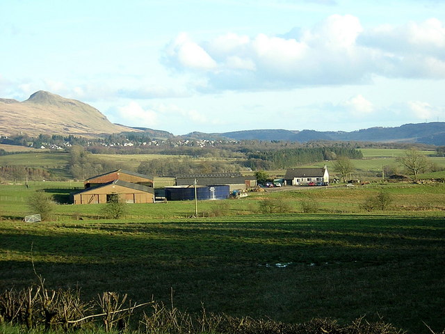
Gartness is a small village located in the Stirlingshire region of Scotland. Situated in the picturesque Endrick Valley, it is surrounded by stunning natural beauty and offers a peaceful and idyllic setting for residents and visitors alike.

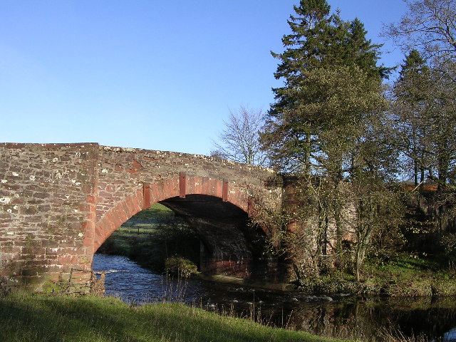
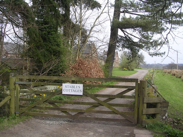
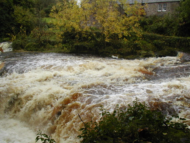
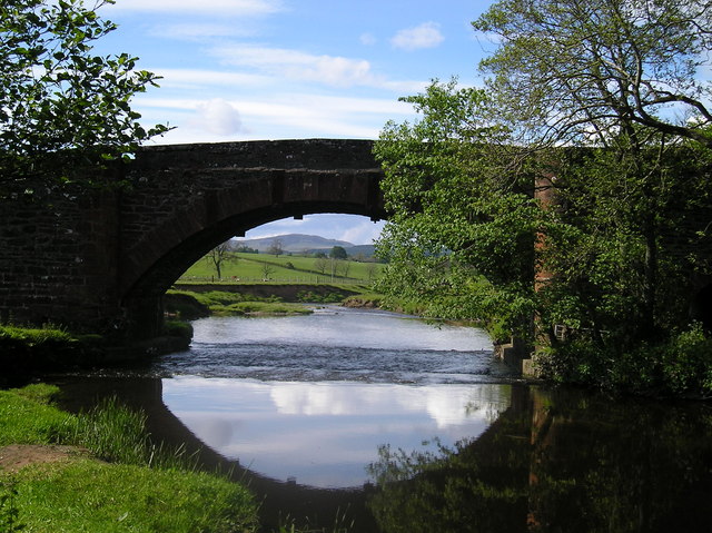
The village is known for its rural charm and historic significance. It is home to several traditional stone cottages and buildings that date back to the 18th and 19th centuries, adding to its quaint and timeless appeal. The nearby Gartness Bridge, also known as the Clachan Bridge, is a notable landmark that has stood since the early 18th century and is considered one of the oldest surviving bridges in Scotland.

Nature enthusiasts will find plenty to explore in Gartness. The village is located near the eastern edge of Loch Lomond and The Trossachs National Park, offering easy access to breathtaking landscapes, hiking trails, and opportunities for outdoor activities such as fishing and birdwatching.

Despite its small size, Gartness has a strong sense of community, with a local pub and social club serving as gathering places for residents. The village also hosts a variety of events throughout the year, including the Gartness Beer Festival and the annual Gartness Duck Race, which draws visitors from near and far.

Overall, Gartness is a charming and historic village nestled in the heart of the Scottish countryside, providing a tranquil and picturesque escape for those seeking a slower pace of life and a connection to nature.

If you have any feedback on the listing, please let us know in the comments section below.
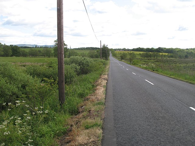
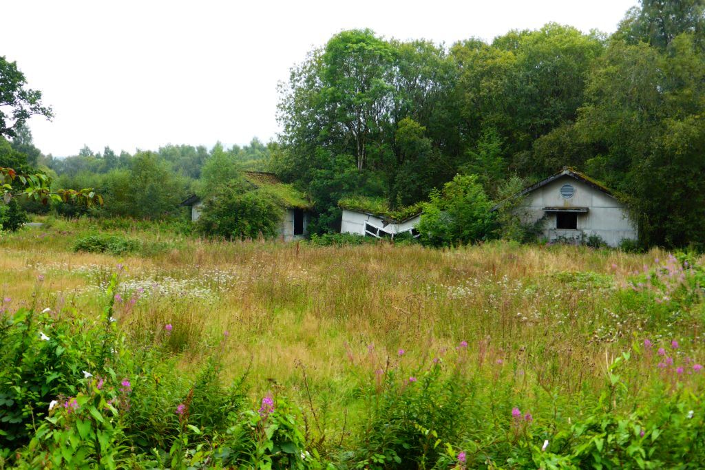
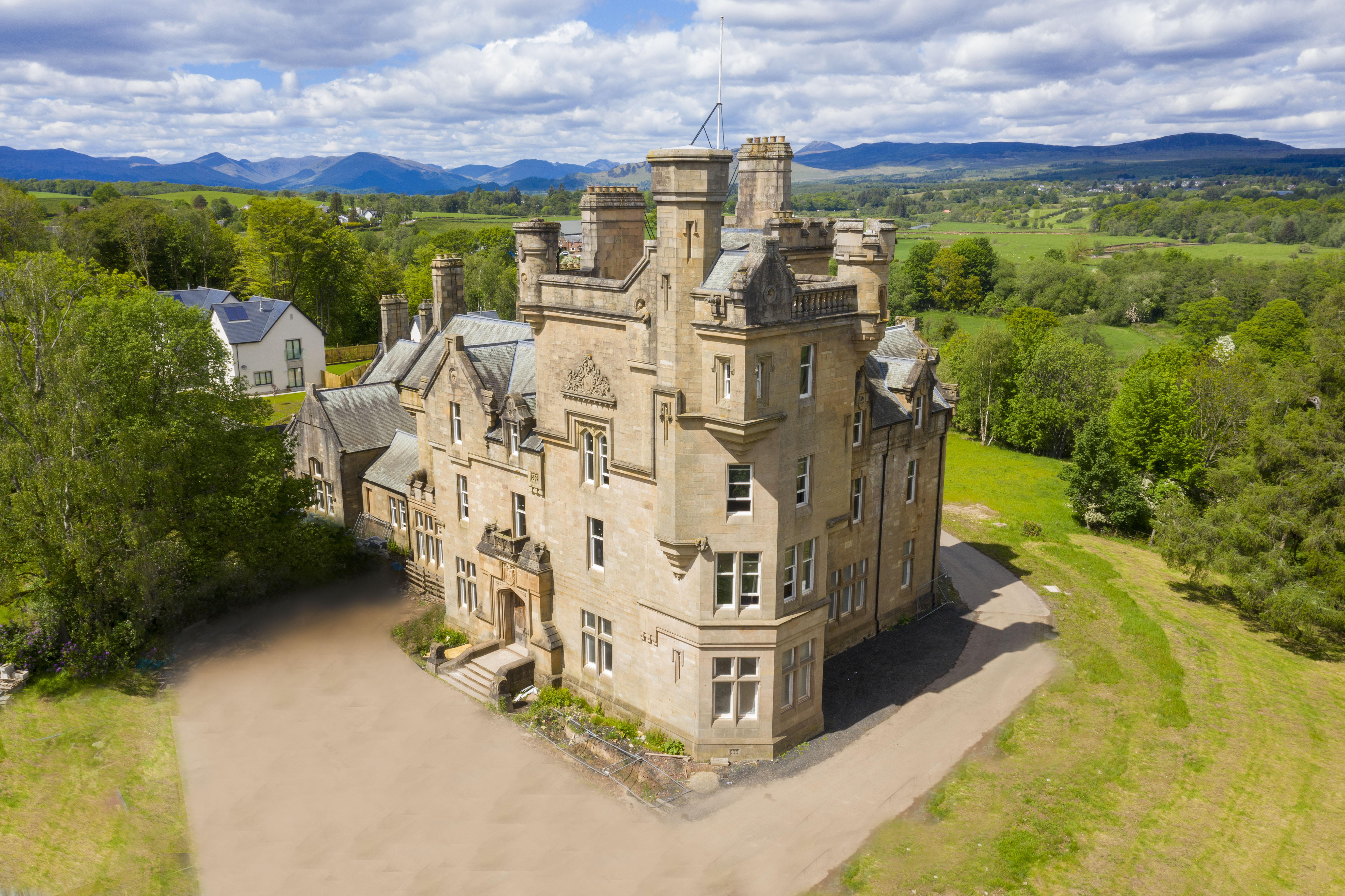
Gartness Images

Images are sourced within 2km of 56.051833/-4.405758 or Grid Reference NS5086. Thanks to Geograph Open Source API. All images are credited.

Blane Bridge Spans the Blane Water
Blane Bridge
Spans the Blane Water
Last House in Killearn Before hitting open countryside to the south west
Last House in Killearn
Before hitting open countryside to the south west
Killearn Cemetery and The Firs
West Highland Way at Gartness Running along the course of a disused railway
West Highland Way at Gartness
Running along the course of a disused railway
Gartness Bridge
Gartness Bridge
Cairnlea Cairnlea viewed from A811 with Killearn and Dumgoyne in the background
Cairnlea
Cairnlea viewed from A811 with Killearn and Dumgoyne in the background
Killearn Bridge Magnificent sandstone bridge spanning the Endrick Water. This bridge is completely invisible from the A81 when you drive across it.
Killearn Bridge
Magnificent sandstone bridge spanning the Endrick Water. This bridge is completely invisible from the A81 when you drive across it.
Footbridge across the Endrick Water A very secluded stretch of river
Footbridge across the Endrick Water
A very secluded stretch of river
Gateway to Carbeth House Private Grounds I didn't feel comfortable to walk through the grounds of Carbeth House, so this was my point of closest approach.
Gateway to Carbeth House Private Grounds
I didn't feel comfortable to walk through the grounds of Carbeth House, so this was my point of closest approach.
Bend in the Endrick Water Sharp bend on secluded stretch of river
Bend in the Endrick Water
Sharp bend on secluded stretch of river
Disused Railway at Meikle Drumquharn
Weir on River Endrick River in Spate
Weir on River Endrick
River in Spate
River Endrick waterfall This area is a very popular spot for watching salmon leap up the falls.  This picture was taken when the river was in spate.  Normally there are three main channels and the drop is about 15 feet. Today the drop was about 5 feet
River Endrick waterfall
This area is a very popular spot for watching salmon leap up the falls. This picture was taken when the river was in spate. Normally there are three main channels and the drop is about 15 feet. Today the drop was about 5 feet
Weir from Gartness Bridge
The Blane Bridge A lovely perfectly formed bridge over the River Blane before it meets the Endrick.
The Blane Bridge
A lovely perfectly formed bridge over the River Blane before it meets the Endrick.
Gartness Road near the Park of Drumquhassle Looking north-westward. This section of road is used by the West Highland Way Path.
Gartness Road near the Park of Drumquhassle
Looking north-westward. This section of road is used by the West Highland Way Path.
Minor road near to Gartacharn Looking northward.
Minor road near to Gartacharn
Looking northward.
Access track to Blairoer Farm Looking south-westward.
Access track to Blairoer Farm
Looking south-westward.
Show me another place!

Gartness is located at Grid Ref: NS5086 (Lat: 56.051833, Lng: -4.405758)

Unitary Authority: Stirling

Police Authority: Forth Valley

What 3 Words

///concerned.chuckle.tulip. Near Killearn, Stirling

Nearby Locations

Gartness

Related Wikis

Gartness

Gartness is a hamlet in Stirling, Scotland. It is located 1.8 miles/2.9 km from Killearn and 3.1 miles/5 km from Drymen. Most pupils attend Killearn Primary...

Gartness railway station

Gartness railway station served the hamlet of Gartness, Stirling, Scotland, from 1856 to 1934 on the Forth and Clyde Junction Railway. == History == The...

A81 road

The A81 road is a major road in Scotland. It runs from Glasgow to Callander via Woodside and Maryhill within the city, as well as Bearsden, Milngavie and...

Killearn railway station

Killearn railway station served the village of Killearn, Stirling, Scotland from 1882 to 1951 on the Blane Valley Railway. == History == The station opened...

Drumquhassle

Drumquhassle was a Roman fort associated with the Gask Ridge in Scotland. It was found from aerial photography in the late 1970s. The name selected for...

Killearn Hospital

Killearn Hospital was a health facility at Killearn in the Stirling council area of Scotland. == History == The hospital was established as one of seven...

Finnich Glen

Finnich Glen in Stirlingshire, is a short, steep glen up to 70 ft deep which runs east from Finnich Bridge on the A809. It was carved from the red sandstone...

Dalnair Castle

Dalnair Castle, also known as Dalnair House, is a Scottish baronial castle dating from around 1884. It is located outside the village of Croftamie in Stirling...

Nearby Amenities

Located within 500m of 56.051833,-4.405758
Gartness
Name Gd: Gart an Easa
Place: hamlet
Source: survey
Lat/Long: 56.0515339/-4.4080955
Hiking: yes
Information: guidepost
Tourism: information
Lat/Long: 56.0517075/-4.4055819
Hiking: yes
Information: guidepost
Tourism: information
Lat/Long: 56.0518407/-4.4042041
Honesty Box
Name En: Honesty Box
Shop: beverages
Lat/Long: 56.0517798/-4.4082466
Site of Castle
Historic: archaeological_site
Source: NLS-OS-1st_Series
Lat/Long: 56.0479769/-4.405803
Power: pole
Lat/Long: 56.0558409/-4.4031453
Power: pole
Lat/Long: 56.0553539/-4.4022543
Power: pole
Lat/Long: 56.0548411/-4.4013109
Power: pole
Lat/Long: 56.0543353/-4.4003926
Power: pole
Lat/Long: 56.0539265/-4.3994095
Power: pole
Lat/Long: 56.0535025/-4.3984473
Power: pole
Lat/Long: 56.0501091/-4.4120436
Power: pole
Lat/Long: 56.0502388/-4.411437
Power: pole
Lat/Long: 56.0505133/-4.410138
Power: pole
Lat/Long: 56.0508369/-4.4090461
Power: pole
Lat/Long: 56.0511488/-4.4092386
Power: pole
Lat/Long: 56.0504573/-4.4088579
Power: pole
Lat/Long: 56.0501278/-4.4086466
Power: pole
Lat/Long: 56.0496699/-4.4084793
Gartness
Historic Railway: station
Railway: site
Wikidata: Q107418155
Wikipedia: en:Gartness railway station
Lat/Long: 56.051113/-4.4115801
The data included in this document is from www.openstreetmap.org. The data is made available under ODbL.

Have you been to Gartness?

Leave your review of Gartness below (or comments, questions and feedback).