Little Ness

Coastal Feature, Headland, Point in Shetland

Scotland

Little Ness

Loch of Papil, Cullivoe
Loch of Papil, Cullivoe Credit: Mike Pennington

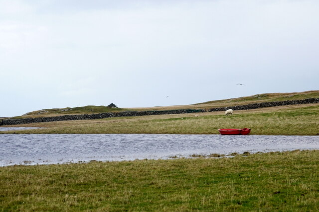
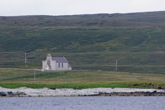
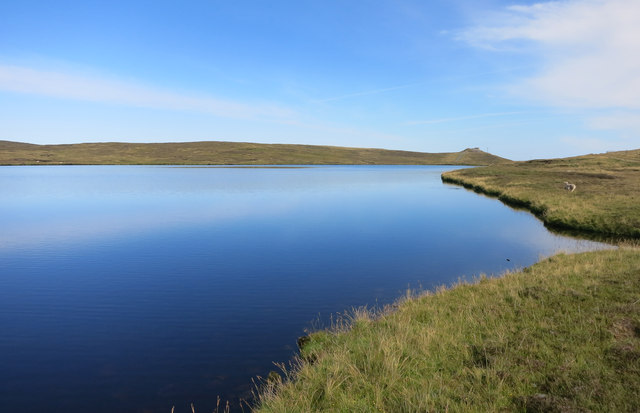
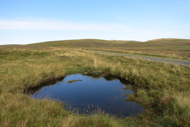
Little Ness is a prominent coastal feature located in the Shetland Islands, Scotland. It is specifically classified as a headland or a point due to its distinctive shape and geographical characteristics. Situated in the western part of the Shetland mainland, Little Ness juts out into the North Atlantic Ocean, offering breathtaking views of the surrounding sea and coastline.

The headland is characterized by its rugged terrain, consisting of steep cliffs that plunge dramatically into the ocean below. These cliffs, composed mainly of sandstone and basalt, have been shaped over thousands of years by erosion from the relentless waves and wind. As a result, they display fascinating geological formations and provide important nesting sites for various seabird species, including puffins, guillemots, and razorbills.

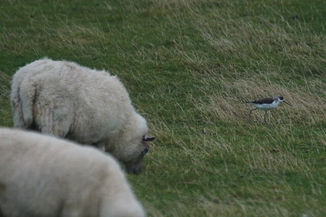
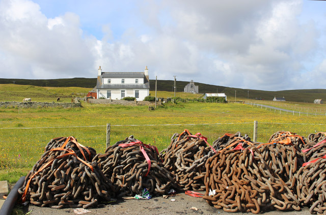
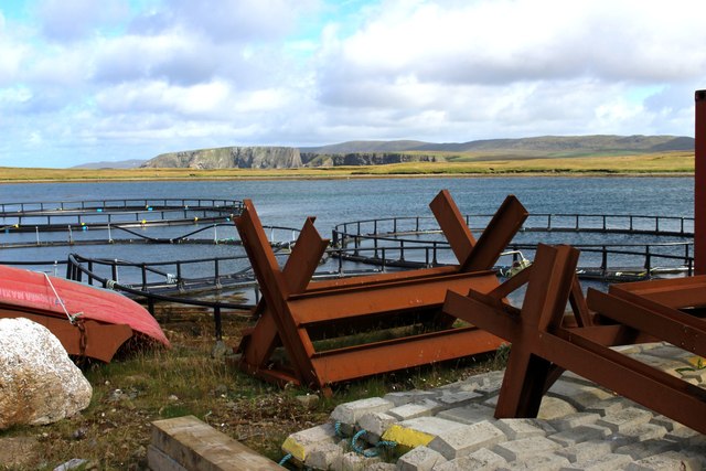
Little Ness is also known for its rich biodiversity. The surrounding waters are teeming with marine life, making it a popular spot for fishing enthusiasts. Seals and otters can often be spotted along the coastline, adding to the area's natural charm and appeal.

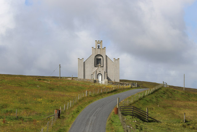
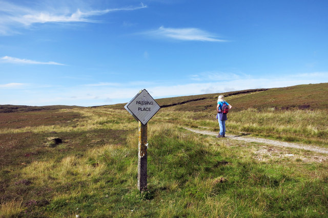
The headland is easily accessible by road, with a car park located nearby for visitors to park their vehicles. From there, a short walk along a well-maintained path leads to the edge of the cliffs, providing breathtaking panoramic views of the ocean and the surrounding landscape.

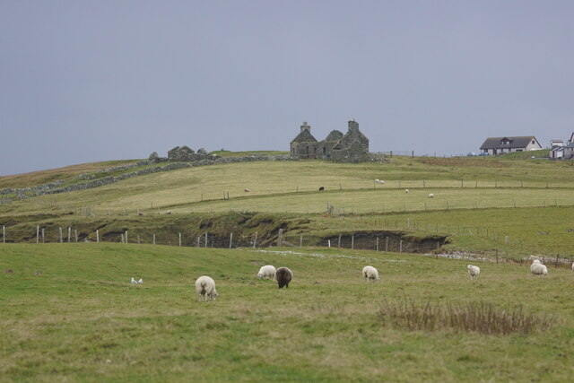
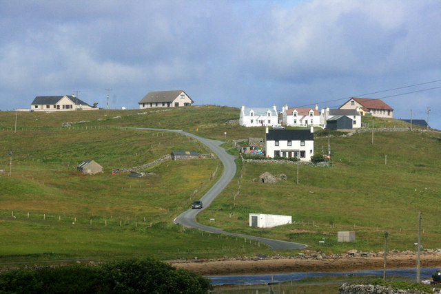
Little Ness is not only a picturesque coastal feature but also a site of historical significance. It is believed to have been inhabited since prehistoric times, with the remains of Iron Age settlements and burial mounds discovered in the vicinity.

In conclusion, Little Ness in Shetland is a captivating headland that offers visitors a unique blend of stunning natural beauty, diverse wildlife, and glimpses into the region's ancient past.

If you have any feedback on the listing, please let us know in the comments section below.

Little Ness Images

Images are sourced within 2km of 60.706764/-1.0051914 or Grid Reference HP5403. Thanks to Geograph Open Source API. All images are credited.

Loch of Papil, Cullivoe
Backhouse, Cullivoe
Backhouse, Cullivoe
Houses at Cullivoe
Houses at Cullivoe
Black-winged Pratincole (Himantopus himantopus), feeding with sheep, Papil, Cullivoe Looking rather incongruous feeding in a field and a long way from the Mediterranean.
Black-winged Pratincole (Himantopus himantopus), feeding with sheep, Papil, Cullivoe
Looking rather incongruous feeding in a field and a long way from the Mediterranean.
Ness of Cullivoe from the sea
Lamba Stack, Blue Mull, from the sea
Blue Mull from the sea
Cullivoe Kirk from the sea
Blue Mull from the sea
Geo south of Lamba Stack, Blue Mull
Chains on the Dockside Piles of chain in the yard at Cullivoe Pier.
Chains on the Dockside
Piles of chain in the yard at Cullivoe Pier.
Cullivoe Church Beside the road down to the pier.
Cullivoe Church
Beside the road down to the pier.
Loch of Brough
Loch of Brough
Small Pool by the Old Road Moorland scenery at the Cullivoe end of the track between there and Sellafirth.
Small Pool by the Old Road
Moorland scenery at the Cullivoe end of the track between there and Sellafirth.
Nobody Passing But Us In the unlikely event of two vehicles meeting along here, this is the place to do it.
Nobody Passing But Us
In the unlikely event of two vehicles meeting along here, this is the place to do it.
Any Old Iron, Cullivoe Dock Some of the assorted stuff in the yard by the busy pier at Cullivoe.
Any Old Iron, Cullivoe Dock
Some of the assorted stuff in the yard by the busy pier at Cullivoe.
Hillside Housing, Cullivoe Places with a nice view over the harbour.
Hillside Housing, Cullivoe
Places with a nice view over the harbour.
Track beside the Loch of Brough
Show me another place!

Little Ness is located at Grid Ref: HP5403 (Lat: 60.706764, Lng: -1.0051914)

Unitary Authority: Shetland Islands

Police Authority: Highlands and Islands

What 3 Words

///perfected.relished.presume. Near Gutcher, Shetland Islands

Related Wikis

Cullivoe

Cullivoe (Old Norse: Kollavágr - Bay of Kolli), is a village on Yell in the Shetland Islands. It is in the north east of the island, near Bluemull Sound...

St Olaf's Church, Unst

St Olaf's Church, Unst is a ruined medieval church located on the island of Unst, in Shetland, Scotland, UK. The church was built in the Celtic style,...

Bluemull Sound

Bluemull Sound is the strait between Unst and Yell in Shetland's North Isles. A ferry service crosses it regularly. Cullivoe is on the Yell side, and the...

Belmont House, Shetland

Belmont House is a neo classical Georgian Country House Estate on the island of Unst, the most northerly of the Shetland Islands, [United Kingdom] and...

Belmont, Shetland

Belmont is a settlement and ferry terminal in southern Unst in the Shetland Islands. The ferry crosses from here to Gutcher in Yell and to Hamars Ness...

Brough Holm

Brough Holm is a small island off Unst, in the North Isles of Shetland. It is off Westing, which as the name implies is on the west coast of Unst. The...

Gloup

Note: Gloup is common in Scottish placenames referring to a sea jet. Gloup is a village in the far north of the island of Yell in the Shetland Islands...

Society of Our Lady of the Isles

The Society of Our Lady of the Isles (SOLI) is a small Anglican religious order for women, founded in the late 20th century. It is located in Shetland...

Nearby Amenities

Located within 500m of 60.706764,-1.0051914
Papil Bay
Natural: bay
Source: OS OpenData StreetView
Lat/Long: 60.7108094/-1.0012703
Cullivoe
Name Is: Kollavogur
Name Non: Kollavágr
Place: village
Wikidata: Q899534
Wikipedia: en:Cullivoe
Lat/Long: 60.7076362/-1.0125482
Barrier: cattle_grid
Lat/Long: 60.7074787/-1.0118381
Shop: convenience
Lat/Long: 60.7077662/-1.012054
Post Office
Cullivoe Post Office
Addr City: Shetland
Addr Country: GB
Addr Postcode: ZE2 9DD
Addr Suburb: Cullivoe
Brand: Post Office
Brand Wikidata: Q1783168
Ref Pol Id: 2318
Website: https://www.postoffice.co.uk/branch-finder/1328492/cullivoe
Lat/Long: 60.7077452/-1.0122123
Bus Stop
Lat/Long: 60.7074145/-1.0121747
Passing Place
Lat/Long: 60.704989/-1.0094266
Passing Place
Lat/Long: 60.7055443/-1.0110894
Passing Place
Lat/Long: 60.708353/-1.0133536
Power: pole
Lat/Long: 60.7065351/-1.0081803
Power: pole
Lat/Long: 60.7060561/-1.0081857
Power: pole
Lat/Long: 60.7057713/-1.0081776
Power: pole
Lat/Long: 60.7054379/-1.0081669
Power: pole
Lat/Long: 60.7052358/-1.0074937
Power: pole
Lat/Long: 60.7047529/-1.0081535
Power: pole
Lat/Long: 60.7048342/-1.0062384
Power: pole
Lat/Long: 60.7046216/-1.0055276
Power: pole
Lat/Long: 60.7042594/-1.0044011
Power: pole
Lat/Long: 60.7039496/-1.0041221
Power: pole
Lat/Long: 60.7039247/-1.0033175
Power: pole
Lat/Long: 60.7041701/-1.0067695
Power: pole
Lat/Long: 60.7037278/-1.0080033
Power: pole
Lat/Long: 60.70429/-1.0081501
Power: pole
Lat/Long: 60.703106/-1.0097011
Power: pole
Lat/Long: 60.7036888/-1.0098942
Power: pole
Lat/Long: 60.7043096/-1.0100659
Power: pole
Lat/Long: 60.7051141/-1.0103556
Power: pole
Lat/Long: 60.7059737/-1.0106372
Barrier: cattle_grid
Lat/Long: 60.7062723/-1.0108415
Power: pole
Lat/Long: 60.7064869/-1.0108008
Power: pole
Lat/Long: 60.7072913/-1.0119233
Power: pole
Lat/Long: 60.7079045/-1.0112675
Power: pole
Lat/Long: 60.708205/-1.011635
Power: pole
Lat/Long: 60.7083717/-1.0118362
Power: pole
Lat/Long: 60.7089451/-1.0125255
Generator Method: wind_turbine
Generator Source: wind
Power: generator
Lat/Long: 60.7067504/-1.0130232
Power: pole
Lat/Long: 60.7049885/-1.0089802
Power: pole
Lat/Long: 60.7051013/-1.0085806
Power: pole
Lat/Long: 60.7069231/-1.0081957
Barrier: cattle_grid
Lat/Long: 60.7072132/-1.0111737
Power: pole
Lat/Long: 60.7071713/-1.0110349
Power: pole
Lat/Long: 60.7035129/-1.0057721
Power: pole
Lat/Long: 60.703735/-1.0049447
Power: pole
Lat/Long: 60.7038982/-1.0027383
Power: pole
Lat/Long: 60.7035375/-1.0018532
Power: pole
Lat/Long: 60.7052281/-1.0081628
The data included in this document is from www.openstreetmap.org. The data is made available under ODbL.

Have you been to Little Ness?

Leave your review of Little Ness below (or comments, questions and feedback).