Big Ness

Coastal Feature, Headland, Point in Shetland

Scotland

Big Ness

Noss ferry approaching the Bressay shore
Noss ferry approaching the Bressay shore Credit: Mike Pennington

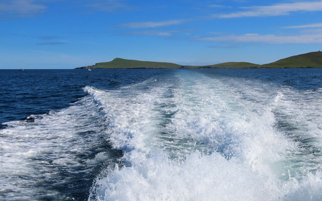
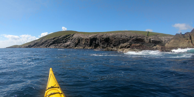
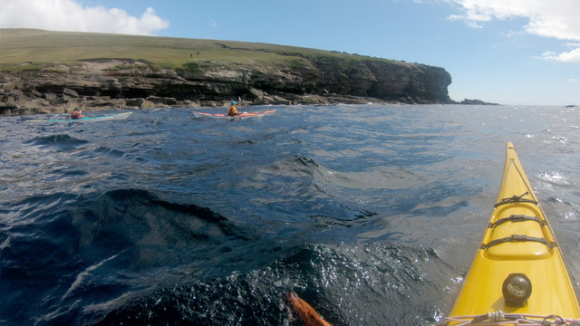
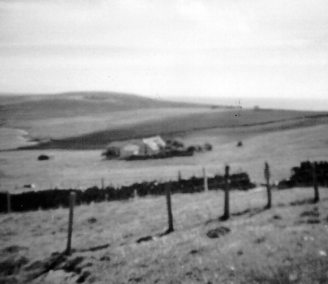
Big Ness is a prominent coastal feature located in the Shetland Islands, which are part of Scotland. It is a headland situated on the southwestern coast of the mainland of Shetland. This geographical formation extends into the North Atlantic Ocean, marking the boundary between the Atlantic waters and the coastline.

Big Ness is characterized by its rugged cliffs, rising to approximately 60 meters in height. The headland is composed of sandstone and shale rock formations, which have been shaped over millions of years by the relentless action of wind, waves, and tides. The cliffs exhibit distinct layers, revealing the geological history of the area.

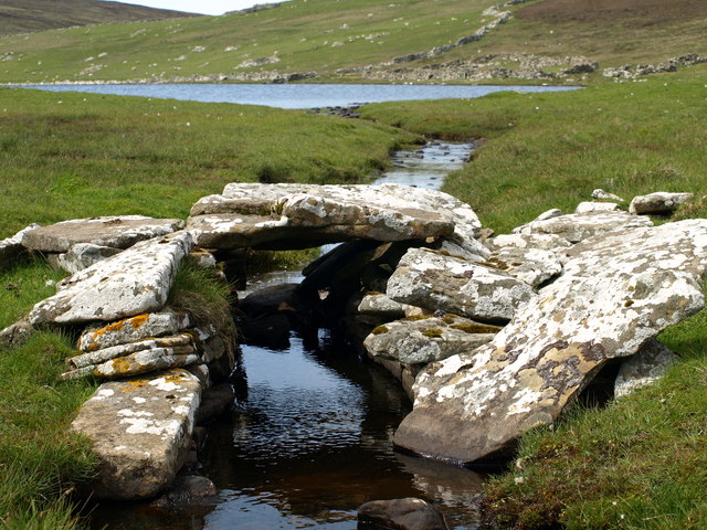
The headland serves as an essential landmark for sailors and fishermen due to its prominent position in the coastal landscape. It offers panoramic views of the surrounding coastline, with its picturesque beaches, coves, and bays. The area is also home to a diverse range of marine and birdlife, making it a popular spot for nature enthusiasts and birdwatchers.

Big Ness is accessible to visitors, with a well-maintained footpath that leads to its summit. This path offers hikers and walkers the opportunity to explore the headland's natural beauty up close, while also providing breathtaking views of the surrounding ocean and the nearby islands.

Overall, Big Ness is a significant coastal feature in Shetland, offering a unique blend of natural beauty, geological interest, and important navigational significance. Its stunning cliffs, diverse wildlife, and accessibility make it a must-visit spot for both locals and tourists alike.

If you have any feedback on the listing, please let us know in the comments section below.

Big Ness Images

Images are sourced within 2km of 60.148836/-1.0464194 or Grid Reference HU5340. Thanks to Geograph Open Source API. All images are credited.

Noss ferry approaching the Bressay shore
Gungstie, Noss, from Noss Sound
Noss-sound, Bressay, from Noss Sound
Noss National Nature Reserve Taken from a tour boat moored in Nesti Voe, Noss, Shetland, I am looking west to Big Ness where the wardens of Noss National Nature Reserve are located. NatureScot operates an inflatable ferry boat across Noss Sound (beyond the buildings pictured) during the summer months to allow walkers to get from Bressay to Noss.
Noss National Nature Reserve
Taken from a tour boat moored in Nesti Voe, Noss, Shetland, I am looking west to Big Ness where the wardens of Noss National Nature Reserve are located. NatureScot operates an inflatable ferry boat across Noss Sound (beyond the buildings pictured) during the summer months to allow walkers to get from Bressay to Noss.
Gungstie, Noss I am looking back as we leave Noss Sound, Shetland, on our way back to Lerwick.  The rocky outcrop of Gungstie is to the right of shot and the distinctive Hill of Setter (to the south of Noss) can be seen in the distance.
Gungstie, Noss
I am looking back as we leave Noss Sound, Shetland, on our way back to Lerwick. The rocky outcrop of Gungstie is to the right of shot and the distinctive Hill of Setter (to the south of Noss) can be seen in the distance.
Hill of Setter, Noss Taken as we pass north east along the coast of Bressay, en route back to Lerwick, Shetland, I am looking back towards the distinctive Hill of Setter on Noss.
Hill of Setter, Noss
Taken as we pass north east along the coast of Bressay, en route back to Lerwick, Shetland, I am looking back towards the distinctive Hill of Setter on Noss.
Geo of Vatsvie More of an embayment than a deep cleft, the Geo of Vatsvie cuts into Old Red Sandstone on the east coast of Bressay's Loder Head peninsula. There's swell coming in from the east, reflecting off the foot of the rocks and rushing back towards the kayak which always makes getting in close fun. Not far ahead the Island of Noss starts to provide more shelter and the sea becomes pretty much flat - great for nervous tourists on the tiny RIB passenger ferry, but  a bit dull for sea kayaks. The opposite side of Noss was to provide a lot more excitement...
Geo of Vatsvie
More of an embayment than a deep cleft, the Geo of Vatsvie cuts into Old Red Sandstone on the east coast of Bressay's Loder Head peninsula. There's swell coming in from the east, reflecting off the foot of the rocks and rushing back towards the kayak which always makes getting in close fun. Not far ahead the Island of Noss starts to provide more shelter and the sea becomes pretty much flat - great for nervous tourists on the tiny RIB passenger ferry, but a bit dull for sea kayaks. The opposite side of Noss was to provide a lot more excitement...
Getting onto the Noss ferry Whilst the Bressay ferry used to get here takes vehicles and has a "proper" dock, the Noss ferry is only for very small numbers of pedestrians, so needs no more than a set of steps down to sea level. There's no timetable - when the ferryman notices that there are people waiting, he will come across to get them. Whether this works on foggy days is another question entirely, and not one we needed answered, as we were visiting in our own boats, just popping over to look at the ferry terminal out of curiosity.
Getting onto the Noss ferry
Whilst the Bressay ferry used to get here takes vehicles and has a "proper" dock, the Noss ferry is only for very small numbers of pedestrians, so needs no more than a set of steps down to sea level. There's no timetable - when the ferryman notices that there are people waiting, he will come across to get them. Whether this works on foggy days is another question entirely, and not one we needed answered, as we were visiting in our own boats, just popping over to look at the ferry terminal out of curiosity.
Paddling down Noss Sound Somehow, using a map, one always thinks of heading south as "down" though, of course, on average, the sea is level, and as we were going against the very start of the flood tide we might actually be going a tiny bit uphill ! Tidal flows at Noss are generally insignificant except in this shallow channel, and we were going anticlockwise round the island more to have the sun behind us on the scenic side than to take any advantage of the flow. The boat powering away from us had been stationary as we arrived, but seemed to form a sudden desire to leave as (or perhaps before) their clients realised just how much closer to the wildlife sea kayakers can get than anyone in a big boat. The Sound had already given us close encounters with Seals, Eider, Cormorants and Terns diving in just metres away. The outer side promised huge numbers of Gannets and Razorbills...
Paddling down Noss Sound
Somehow, using a map, one always thinks of heading south as "down" though, of course, on average, the sea is level, and as we were going against the very start of the flood tide we might actually be going a tiny bit uphill ! Tidal flows at Noss are generally insignificant except in this shallow channel, and we were going anticlockwise round the island more to have the sun behind us on the scenic side than to take any advantage of the flow. The boat powering away from us had been stationary as we arrived, but seemed to form a sudden desire to leave as (or perhaps before) their clients realised just how much closer to the wildlife sea kayakers can get than anyone in a big boat. The Sound had already given us close encounters with Seals, Eider, Cormorants and Terns diving in just metres away. The outer side promised huge numbers of Gannets and Razorbills...
Landing on Noss Although, coming from Voe of Cullingsborough round Loder Head, we hadn't paddled very far to reach Noss, the island offers few other landing places apart from the west side, facing Bressay across Noss Sound. Thus our group stopped for an early lunch in anticipation that we would be on the water for rather longer to complete our trip all the way round. This beach is just north of the tourist ferry landing, out of their way, and even seemed quite sheltered (we'd had a very windy 24 hours the previous day and the open sea was still quite lumpy, whilst here in the Sound it was essentially flat).
Landing on Noss
Although, coming from Voe of Cullingsborough round Loder Head, we hadn't paddled very far to reach Noss, the island offers few other landing places apart from the west side, facing Bressay across Noss Sound. Thus our group stopped for an early lunch in anticipation that we would be on the water for rather longer to complete our trip all the way round. This beach is just north of the tourist ferry landing, out of their way, and even seemed quite sheltered (we'd had a very windy 24 hours the previous day and the open sea was still quite lumpy, whilst here in the Sound it was essentially flat).
Rounding Big Ness into Nesti Voe Big Ness is really quite a small peninsula, ending in these low shoreline rocks. Beyond to the left is Nesti Voe, with a big beach, but an onshore wind, so not what we wanted for a lunch stop. Across the Voe is Turr Ness, a somewhat rockier and longer peninsula with enough height to conceal our onward route to reach the east coast of Noss. The hill in partial shadow is Hill of Setter, rising to 181m directly above the cliffs and gannetry of Noss Head, though you'd scarcely guess that seeing it from the west. The whole island is a nature reserve, gentle slopes being mainly inhabited by chaps in camouflage jackets carrying large cameras and even bigger tripods. Must be something worthwhile to see then, so let's keep paddling !
Rounding Big Ness into Nesti Voe
Big Ness is really quite a small peninsula, ending in these low shoreline rocks. Beyond to the left is Nesti Voe, with a big beach, but an onshore wind, so not what we wanted for a lunch stop. Across the Voe is Turr Ness, a somewhat rockier and longer peninsula with enough height to conceal our onward route to reach the east coast of Noss. The hill in partial shadow is Hill of Setter, rising to 181m directly above the cliffs and gannetry of Noss Head, though you'd scarcely guess that seeing it from the west. The whole island is a nature reserve, gentle slopes being mainly inhabited by chaps in camouflage jackets carrying large cameras and even bigger tripods. Must be something worthwhile to see then, so let's keep paddling !
Coastguard Lookout, Ander Hill from Setter, Bressay Historic Environment Scotland Scheduled Monument the Admiralty lookout station was built between 1912 and 1917. In addition to the tower, an underground shelter, accessed by a ground-level trapdoor, a cast-iron water-pump and a concrete footing with the remains of a wooden signalling pole survive in close proximity. The now floorless concrete tower commands fantastic views reaching as far as Foula and Sumburgh Head on a fine day. The building was in use as a coastguard lookout until it was abandoned in 1969.
Coastguard Lookout, Ander Hill from Setter, Bressay
Historic Environment Scotland Scheduled Monument the Admiralty lookout station was built between 1912 and 1917. In addition to the tower, an underground shelter, accessed by a ground-level trapdoor, a cast-iron water-pump and a concrete footing with the remains of a wooden signalling pole survive in close proximity. The now floorless concrete tower commands fantastic views reaching as far as Foula and Sumburgh Head on a fine day. The building was in use as a coastguard lookout until it was abandoned in 1969.
Ander Hill, Bressay, from Noss Sound
Mansie's Berg, Noss, from the sea
The Noss ferry on the Bressay side of Noss Sound
A Clapper Bridge Loch of Grimsetter & the Clapper Bridge across Mill Burn, Bressay.
A Clapper Bridge
Loch of Grimsetter & the Clapper Bridge across Mill Burn, Bressay.
Paddling past the Point and Geos of Hovie Although we'd picked the sheltered side of Shetland after a day of high wind on our crossing from mainland Scotland, there was still some swell setting in from the east. Across that, wind waves from the southwest made for interesting conditions round the south side of Noss, with confused water particularly around the headland ahead of us. It still seemed less work than the people on the slopes of Hill of Setter who were trekking across above us with a big camera and heavy-looking tripod. It's a bit of a toss-up as to who would get the closer views of the Gannets and Razorbills - we would certainly feel safer down here than teetering on the cliff edge in the gusty wind, and find Razorbills rafting on the surface, but then they'd probably get better photos than those below in the waves !
Paddling past the Point and Geos of Hovie
Although we'd picked the sheltered side of Shetland after a day of high wind on our crossing from mainland Scotland, there was still some swell setting in from the east. Across that, wind waves from the southwest made for interesting conditions round the south side of Noss, with confused water particularly around the headland ahead of us. It still seemed less work than the people on the slopes of Hill of Setter who were trekking across above us with a big camera and heavy-looking tripod. It's a bit of a toss-up as to who would get the closer views of the Gannets and Razorbills - we would certainly feel safer down here than teetering on the cliff edge in the gusty wind, and find Razorbills rafting on the surface, but then they'd probably get better photos than those below in the waves !
Gorie Croft Croft above the Loch of Grimsetter, Bressay.
Gorie Croft
Croft above the Loch of Grimsetter, Bressay.
Show me another place!

Big Ness is located at Grid Ref: HU5340 (Lat: 60.148836, Lng: -1.0464194)

Unitary Authority: Shetland Islands

Police Authority: Highlands and Islands

What 3 Words

///encounter.managers.windpipe. Near Lerwick, Shetland Islands

Related Wikis

Isle of Noss

The Isle of Noss or Noss (Scots: Noss) is a small, previously inhabited island in Shetland, Scotland. Noss is separated from the island of Bressay by the...

Broch of Cullingsburgh

The Broch of Cullingsburgh is an Iron Age broch located in the Shetland islands. == Location == Located on Bressay, off the east coast of mainland Shetland...

Bressay

Bressay (Scots: Bressa) is a populated island in the Shetland archipelago of Scotland. == Geography and geology == Bressay lies due south of Whalsay, west...

Voe of Cullingsburgh

Voe of Cullingsburgh is a large sea loch off the Shetland island of Bressay, voe meaning "sea inlet" in Shetland dialect. The local spelling of the name...

Holm of Noss

The Holm of Noss or Cradle Holm is an uninhabited islet of the Shetland Islands. It is about 48m at its highest point. == Geography and geology == It is...

Bressay transmitting station

Bressay transmitting station is a broadcasting transmission facility for the Shetland Islands, located on the isle of Bressay, owned and operated by Arqiva...

Gardie House

Gardie House is an 18th-century estate house on Bressay in Shetland, Scotland. Located opposite Lerwick, across the Bressay Sound, Gardie is described...

Lerwick and Bressay Parish Church

Lerwick and Bressay Parish Church is the largest Church of Scotland congregation in Shetland, serving the islands' capital Lerwick and the surrounding...

Nearby Amenities

Located within 500m of 60.148836,-1.0464194
Noss Nature Reserve
Information: office
Tourism: information
Lat/Long: 60.14987/-1.0461409
Barrier: chain
Lat/Long: 60.1489842/-1.055411
Ferry Terminal
Lat/Long: 60.1503265/-1.0463554
Toilets
Lat/Long: 60.1498457/-1.045852
Bench
Lat/Long: 60.149096/-1.0551693
Defibrillator
Emergency: defibrillator
Lat/Long: 60.1499218/-1.046026
Shower
Access: yes
Lat/Long: 60.1498588/-1.04587
Ranger Station
Noss Visitor Centre
Lat/Long: 60.1498938/-1.046043
Nesti Voe
Natural: bay
Lat/Long: 60.1488538/-1.0440445
Ferry Terminal
Lat/Long: 60.1505317/-1.0492851
Beginning section 1
Tourism: viewpoint
Lat/Long: 60.152069/-1.044615
End section 10/ beginning section 11
Tourism: viewpoint
Lat/Long: 60.1451124/-1.0433236
The data included in this document is from www.openstreetmap.org. The data is made available under ODbL.

Have you been to Big Ness?

Leave your review of Big Ness below (or comments, questions and feedback).