Chourdon Point
Coastal Feature, Headland, Point in Durham
England
Chourdon Point

Chourdon Point is a prominent coastal feature located in Durham, England. Situated on the eastern coast, this headland juts out into the North Sea, offering breathtaking views of the surrounding landscape. The point is named after the nearby village of Chourdon, which is known for its picturesque charm and close proximity to the sea.
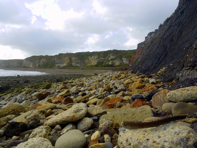
At Chourdon Point, visitors can experience the raw power of the ocean as they stand on the rocky headland. The point is characterized by its rugged cliffs, which have been shaped over centuries by the relentless crashing waves. These cliffs provide a habitat for various bird species, making the point a popular spot for birdwatchers.
The point is also known for its stunning coastal walks, offering visitors the chance to explore the dramatic landscape and enjoy the fresh sea air. The path meanders along the cliff edge, providing panoramic views of the North Sea and the surrounding countryside. On a clear day, one can even catch a glimpse of the distant Farne Islands.
Aside from its natural beauty, Chourdon Point also holds historical significance. The area has been inhabited for centuries, and remnants of ancient settlements and fortifications can still be found in the vicinity. Exploring the area, visitors may stumble upon archaeological sites and learn about the rich history of the region.
Overall, Chourdon Point is a captivating coastal feature, offering a combination of natural beauty, wildlife, and historical intrigue. Whether one is seeking a peaceful stroll along the cliffs or a chance to immerse themselves in the area's history, Chourdon Point has something to offer everyone.
If you have any feedback on the listing, please let us know in the comments section below.
Chourdon Point Images
Images are sourced within 2km of 54.811841/-1.3166836 or Grid Reference NZ4446. Thanks to Geograph Open Source API. All images are credited.


Chourdon Point is located at Grid Ref: NZ4446 (Lat: 54.811841, Lng: -1.3166836)
Unitary Authority: County Durham
Police Authority: Durham
What 3 Words
///decide.gangway.televise. Near Hawthorn, Co. Durham
Nearby Locations
Related Wikis

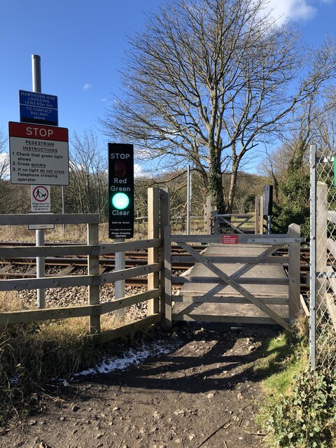
Hawthorn Quarry
Hawthorn Quarry is a Site of Special Scientific Interest in the Easington district of east County Durham, England. It is a working quarry, currently operated...

Hawthorn Dene
Hawthorn Dene is a Site of Special Scientific Interest in the Easington district of County Durham, England. The site occupies the incised valley of Hawthorn...
Dawdon
Dawdon is a former pit community to the south of Seaham, County Durham, England. An area of the beach near Dawdon (known locally as "the Blast", a former...
Hawthorn, County Durham
Hawthorn is a village in County Durham, England. It is situated between Seaham and Easington. The only public building in the village of Hawthorn is the...
Stony Cut, Cold Hesledon
Stony Cut, Cold Hesledon is a Site of Special Scientific Interest in the Easington district of north-east County Durham, England. It consists of a shallow...
Hope Wood Academy
54.7898°N 1.3362°W / 54.7898; -1.3362 Hope Wood Academy is an academy based in Easington Colliery, County Durham. The school caters for pupils aged 2...
Easington Colliery
Easington Colliery is a town in County Durham, England, known for a history of coal mining. It is situated to the north of Horden, a short distance to...
Easington railway station
Easington railway station served the town of Easington Colliery and Easington Village in County Durham, North East England. It was located on the Durham...
Nearby Amenities
Located within 500m of 54.811841,-1.3166836Have you been to Chourdon Point?
Leave your review of Chourdon Point below (or comments, questions and feedback).