Skaag

Coastal Feature, Headland, Point in Shetland

Scotland

Skaag

No Ness from the air
No Ness from the air Credit: Mike Pennington

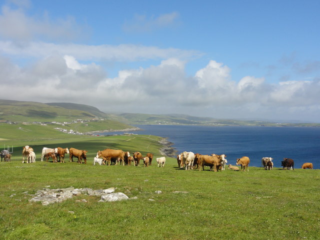
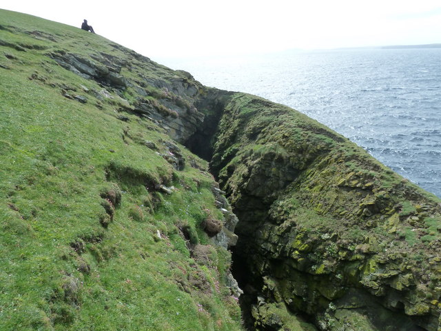
Skaag is a prominent coastal feature located in the Shetland Islands, an archipelago in Scotland. It is classified as a headland or a point, jutting out into the North Sea. Situated on the southwestern coast of the Shetland mainland, Skaag is known for its rugged and dramatic landscape.

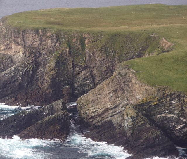
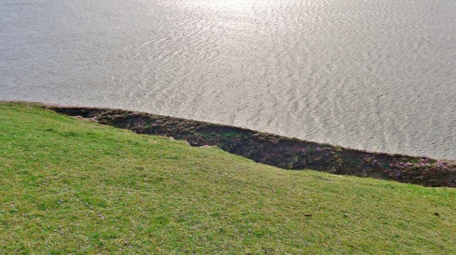
The headland is characterized by steep cliffs that rise dramatically from the sea, reaching heights of up to 100 meters in some places. These cliffs are composed of sedimentary rock formations, creating a visually striking backdrop against the crashing waves of the North Sea.

Skaag offers breathtaking panoramic views of the surrounding coastline and the vast expanse of the sea. The headland is a popular spot for nature enthusiasts and photographers due to its stunning natural beauty. Visitors can often spot various seabirds nesting on the cliffs, including puffins, fulmars, and guillemots.

In addition to its scenic appeal, Skaag also holds historical significance. The headland is believed to have been inhabited since ancient times, with archaeological remains suggesting human activity dating back thousands of years. It is also rumored to have been a lookout point during Viking times, providing strategic views of approaching ships.

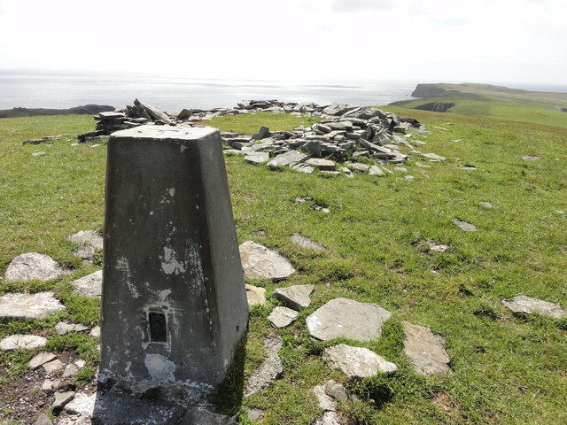
Access to Skaag is relatively easy, with a well-maintained footpath leading to the headland from a nearby parking area. However, caution is advised when exploring the area, as the cliffs can be unstable and dangerous. Nevertheless, Skaag remains a must-visit destination for those seeking natural beauty, historical intrigue, and a glimpse into the rich cultural heritage of the Shetland Islands.

If you have any feedback on the listing, please let us know in the comments section below.

Skaag Images

Images are sourced within 2km of 59.976769/-1.2139422 or Grid Reference HU4321. Thanks to Geograph Open Source API. All images are credited.

No Ness from the air
Loch of Noness from the air
Noness, Sandwick, from the air
No Ness, Sandwick, from the air
Plastic Pig One of the many abandoned cars on Shetland, a Reliant fibreglass car full of rubbish which appears to have been there a long time.
Plastic Pig
One of the many abandoned cars on Shetland, a Reliant fibreglass car full of rubbish which appears to have been there a long time.
End of the road End of the road view at Noness out to sea
End of the road
End of the road view at Noness out to sea
Grazing cattle Grazing cattle with a view out to the sea
Grazing cattle
Grazing cattle with a view out to the sea
Triangulation Station Ordnance Survey triangulation station TP1791 - Burraland
Triangulation Station
Ordnance Survey triangulation station TP1791 - Burraland
Wart, Sandwick
Wart, Sandwick
The No Ness road at Ware Geo
Buildings at the end of the No Ness road
Looking down on Skaag The thrift is growing in profusion on this separate piece of land.
Looking down on Skaag
The thrift is growing in profusion on this separate piece of land.
Natural arches at Vins Taing
Cliffs at No Ness Thrift growing by the cliff edges.
Cliffs at No Ness
Thrift growing by the cliff edges.
View of Two Brochs, Shetland, UK The Broch of Mousa (left) and the Broch of Burraland (right).
View of Two Brochs, Shetland, UK
The Broch of Mousa (left) and the Broch of Burraland (right).
Good pasture above the cliffs At The Houll. On return journey from trip to see Mousa broch.
Good pasture above the cliffs
At The Houll. On return journey from trip to see Mousa broch.
Broch of Burraland This Broch sits opposite, directly across Mousa Sound, the very famous and much photographed Broch of Mousa.
The site is largely undisturbed but in natural ruin.
More information here - <span class="nowrap"><a title="https://communities.uhi.ac.uk/sh01sc/weblog/3414.html" rel="nofollow ugc noopener" href="https://communities.uhi.ac.uk/sh01sc/weblog/3414.html">Link</a><img style="margin-left:2px;" alt="External link" title="External link - shift click to open in new window" src="https://s1.geograph.org.uk/img/external.png" width="10" height="10"/></span>
Broch of Burraland
This Broch sits opposite, directly across Mousa Sound, the very famous and much photographed Broch of Mousa. The site is largely undisturbed but in natural ruin. More information here - LinkExternal link
Skaag This scary and very deep fissure is in a grid square of its own.
In wet or windy conditions, it is a dangerous location
The word does not easily translate but it's a good one for the feature!
Skaag
This scary and very deep fissure is in a grid square of its own. In wet or windy conditions, it is a dangerous location The word does not easily translate but it's a good one for the feature!
Show me another place!

Skaag is located at Grid Ref: HU4321 (Lat: 59.976769, Lng: -1.2139422)

Unitary Authority: Shetland Islands

Police Authority: Highlands and Islands

What 3 Words

///wash.tiny.flattens. Near Sandwick, Shetland Islands

Related Wikis

Sandwick, Dunrossness

see also Sandwick, Whalsay and Sandwick, Orkney Sandwick (Old Norse: Sandvik "Sandy Bay") is a village and an ancient parish in the Shetland Islands,...

Broch of Mousa

Broch of Mousa (or Mousa Broch) is a preserved Iron Age broch or round tower. It is on the island of Mousa in Shetland, Scotland. It is the tallest broch...

Levenwick

Levenwick is a small village about 17 miles (27 km) south of Lerwick, on the east side of the South Mainland of Shetland, Scotland. It is part of the parish...

Hoswick

Hoswick is a settlement in Sandwick in the south mainland of Shetland, Scotland, on the eastern part of the Dunrossness civil parish. It is separated from...

Have you been to Skaag?

Leave your review of Skaag below (or comments, questions and feedback).