Ness of Hoswick

Coastal Feature, Headland, Point in Shetland

Scotland

Ness of Hoswick

Lay-by beside the A970 road Near Levenwick.
Lay-by beside the A970 road Credit: John Lucas

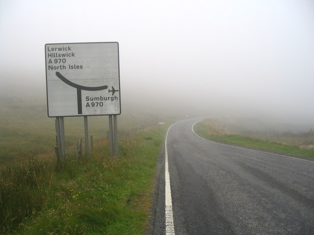
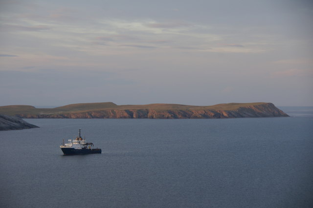
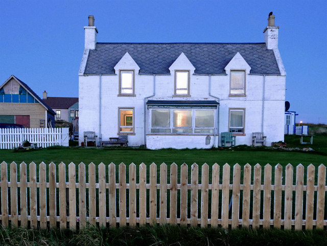
Ness of Hoswick is a prominent coastal feature located on the east coast of Shetland, an archipelago in Scotland. It is a headland that juts out into the North Sea, forming a point that extends into the water. The Ness is situated near the village of Sandwick and is known for its stunning natural beauty and rich history.

The headland is characterized by its rugged cliffs, which rise dramatically from the sea. These cliffs are composed of layers of rock, showcasing the geological history of the region. The area is also home to a variety of seabirds, including puffins, fulmars, and gannets, which nest along the steep cliffs.

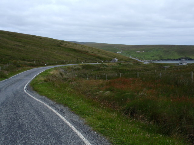
Visitors can access Ness of Hoswick via a footpath that winds along the coastline, offering breathtaking views of the surrounding ocean and nearby islands. The path leads to a small sandy beach, providing a tranquil spot for relaxation and picnicking.

The Ness has a fascinating history, with archaeological evidence suggesting human habitation in the area as far back as the Neolithic period. The remains of ancient settlements, including stone structures and artifacts, have been discovered on the headland, providing valuable insights into Shetland's past.

Today, Ness of Hoswick is a popular destination for nature enthusiasts, history buffs, and hikers. Its picturesque scenery, diverse wildlife, and historical significance make it a must-visit location for anyone exploring the Shetland Islands.

If you have any feedback on the listing, please let us know in the comments section below.

Ness of Hoswick Images

Images are sourced within 2km of 59.98981/-1.2627243 or Grid Reference HU4123. Thanks to Geograph Open Source API. All images are credited.

Lay-by beside the A970 road Near Levenwick.
Lay-by beside the A970 road
Near Levenwick.
Levenwick from the air
B9122, a Single Track Road with Passing Places The B9122 is a narrow, mostly single-track road with passing places. It provides a pleasant diversion from the A970 near Channerwick, travelling to the western (Atlantic) coast at Bigton and then Scousburgh before turning east again to rejoin the A970 at Boddam.
B9122, a Single Track Road with Passing Places
The B9122 is a narrow, mostly single-track road with passing places. It provides a pleasant diversion from the A970 near Channerwick, travelling to the western (Atlantic) coast at Bigton and then Scousburgh before turning east again to rejoin the A970 at Boddam.
B9122 near to Northpunds Volkswagen minibus (RE10 SBO) operating on the Bigton and Quendale Feeder Route (Service 7).
B9122 near to Northpunds
Volkswagen minibus (RE10 SBO) operating on the Bigton and Quendale Feeder Route (Service 7).
Blind Summit on the B9122 The B9122 is a narrow, mostly single-track road with passing places. It provides a pleasant diversion from the A970 near Channerwick, travelling to the western (Atlantic) coast at Bigton and then Scousburgh before turning east again to rejoin the A970 at Boddam.
Blind Summit on the B9122
The B9122 is a narrow, mostly single-track road with passing places. It provides a pleasant diversion from the A970 near Channerwick, travelling to the western (Atlantic) coast at Bigton and then Scousburgh before turning east again to rejoin the A970 at Boddam.
Road sign at junction of B9122 and A970 OK, so you can't see the junction itself - but neither could I in that weather! Apart from a small puddle, there doesn't seem to be anything else of note in this square.
Road sign at junction of B9122 and A970
OK, so you can't see the junction itself - but neither could I in that weather! Apart from a small puddle, there doesn't seem to be anything else of note in this square.
Road B9122 view northeast to Channerwick
NLV Pole Star anchored off Levenwick One of the Northern Lighthouse Board's lighthouse service vessels. Cumlewick Ness is just visible on the left, with No Ness in the background.
NLV Pole Star anchored off Levenwick
One of the Northern Lighthouse Board's lighthouse service vessels. Cumlewick Ness is just visible on the left, with No Ness in the background.
New OSBM Bolt Ordnance Survey New OSBM Bolt described as:
NEW OSBM BOLT ABUT CONCRETE TANK 2.3M SE SIDE RD 5.9M NE W ANG FENCE (86.085m above Lerwick datum, 2nd order, new 1978).
New OSBM Bolt
Ordnance Survey New OSBM Bolt described as: NEW OSBM BOLT ABUT CONCRETE TANK 2.3M SE SIDE RD 5.9M NE W ANG FENCE (86.085m above Lerwick datum, 2nd order, new 1978).
Water processing works Water processing site with a tank located next to the old road.  The tank has an Ordnance Survey New OSBM Bolt described as:
NEW OSBM BOLT ABUT CONCRETE TANK 2.3M SE SIDE RD 5.9M NE W ANG FENCE (86.085m above Lerwick datum, 2nd order, new 1978).
Water processing works
Water processing site with a tank located next to the old road. The tank has an Ordnance Survey New OSBM Bolt described as: NEW OSBM BOLT ABUT CONCRETE TANK 2.3M SE SIDE RD 5.9M NE W ANG FENCE (86.085m above Lerwick datum, 2nd order, new 1978).
Channer Wick View from the road in to Channer Wick
Channer Wick
View from the road in to Channer Wick
The hoverfly Eupeodes corollae, Hoswick This species is a migrant in Shetland, here feeding on Hogweed (Heracleum sphondylium).
The hoverfly Eupeodes corollae, Hoswick
This species is a migrant in Shetland, here feeding on Hogweed (Heracleum sphondylium).
At the Ness of Hoswick Evening was fast approaching and the sky taking on a brownish hue.
At the Ness of Hoswick
Evening was fast approaching and the sky taking on a brownish hue.
The Berg, Ness of Hoswick The Point between Hos Wick and Channer Wick.
The Berg, Ness of Hoswick
The Point between Hos Wick and Channer Wick.
Dusk at Stove by Sandwick One house seemed to stay alive as all others sank into the darkness of the evening.  Lights were on in the rooms and the white facing reflected all the available light.
Dusk at Stove by Sandwick
One house seemed to stay alive as all others sank into the darkness of the evening. Lights were on in the rooms and the white facing reflected all the available light.
The Burn of Channerwick The burn drains a catchment about 5 kms long, north to south, with various tributaries.
The Burn of Channerwick
The burn drains a catchment about 5 kms long, north to south, with various tributaries.
Pund, Channerwick An isolated place overlooking the Burn of Channerwick.
Pund, Channerwick
An isolated place overlooking the Burn of Channerwick.
Show me another place!

Ness of Hoswick is located at Grid Ref: HU4123 (Lat: 59.98981, Lng: -1.2627243)

Unitary Authority: Shetland Islands

Police Authority: Highlands and Islands

What 3 Words

///snacking.define.pancake. Near Sandwick, Shetland Islands

Related Wikis

Hoswick

Hoswick is a settlement in Sandwick in the south mainland of Shetland, Scotland, on the eastern part of the Dunrossness civil parish. It is separated from...

Levenwick

Levenwick is a small village about 17 miles (27 km) south of Lerwick, on the east side of the South Mainland of Shetland, Scotland. It is part of the parish...

Sandwick, Dunrossness

see also Sandwick, Whalsay and Sandwick, OrkneySandwick (Old Norse: Sandvik "Sandy Bay") is a village and an ancient parish in the Shetland Islands, Scotland...

Bigton

Bigton is a small settlement on South Mainland, Shetland, UK. Bigton is within the civil parish of Dunrossness.Bigton lies on the Atlantic coast of the...

Catpund

Catpund is a quarry site in Shetland, Scotland, where steatite vessels were cut from the rock from prehistory onwards. The quarrying marks are still visible...

Broch of Mousa

Broch of Mousa (or Mousa Broch) is a preserved Iron Age broch or round tower. It is on the island of Mousa in Shetland, Scotland. It is the tallest broch...

Clumlie Broch

Clumlie Broch is an Iron Age broch located on Mainland, Shetland, in Scotland (grid reference HU40451811). == Location == Clumlie Broch is located in Dunrossness...

St Ninian's Isle

St Ninian's Isle is a small tied island connected by the largest tombolo in the UK to the south-western coast of the Mainland, Shetland, in Scotland. It...

Nearby Amenities

Located within 500m of 59.98981,-1.2627243
Generator Source: wind
Power: generator
Lat/Long: 59.9923008/-1.2604448
The data included in this document is from www.openstreetmap.org. The data is made available under ODbL.

Have you been to Ness of Hoswick?

Leave your review of Ness of Hoswick below (or comments, questions and feedback).