Beni Taing

Coastal Feature, Headland, Point in Shetland

Scotland

Beni Taing

Lay-by beside the A970 road Near Levenwick.
Lay-by beside the A970 road Credit: John Lucas

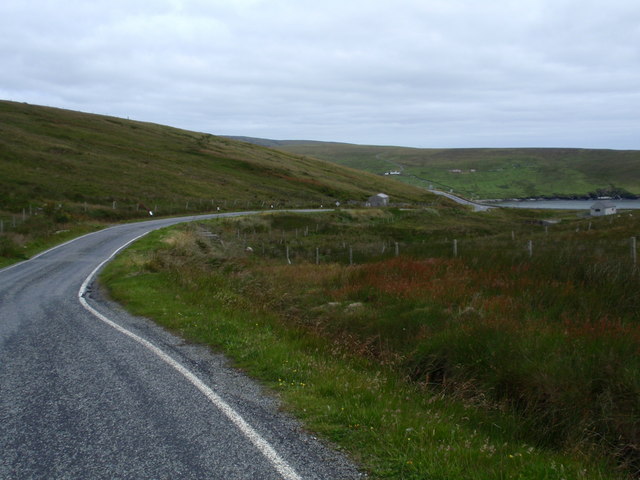
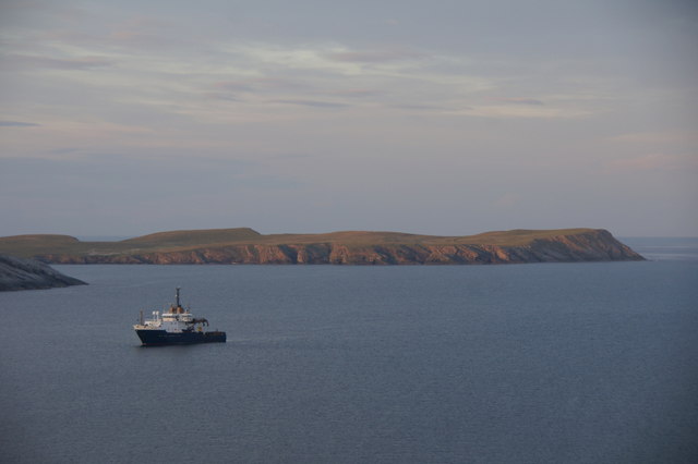
Beni Taing is a prominent coastal feature located in the Shetland Islands, an archipelago in Scotland. It is a headland that extends out into the North Sea, forming a distinct point that juts out into the water. The name "Beni Taing" is derived from the Old Norse language and translates to "bone point," which is fitting given its slender and elongated shape.

This coastal feature is characterized by its rugged and rocky terrain, with steep cliffs that provide stunning panoramic views of the surrounding sea and landscape. The cliffs are composed of sedimentary rocks, primarily sandstone and shale, which have been shaped and eroded over time by the relentless forces of the sea.

Beni Taing is a popular destination for nature enthusiasts, hikers, and photographers, who are drawn to its natural beauty and unique geological formations. The headland is home to a diverse range of flora and fauna, including seabird colonies such as puffins, razorbills, and kittiwakes, which nest on the cliffs during the breeding season.

The area surrounding Beni Taing is also rich in marine life, with seals often seen basking on the rocks and otters occasionally spotted hunting along the shoreline. Additionally, the headland provides a habitat for various plant species, including heather, sea pink, and thrift, which add vibrant splashes of color to the landscape.

Overall, Beni Taing is an outstanding coastal feature that offers visitors a chance to immerse themselves in the awe-inspiring beauty of the Shetland Islands' natural environment.

If you have any feedback on the listing, please let us know in the comments section below.
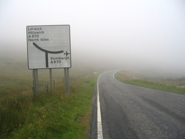
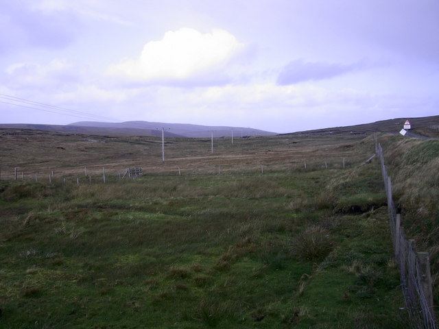
Beni Taing Images

Images are sourced within 2km of 59.982527/-1.2690504 or Grid Reference HU4022. Thanks to Geograph Open Source API. All images are credited.

Lay-by beside the A970 road Near Levenwick.
Lay-by beside the A970 road
Near Levenwick.
Levenwick from the air
Quinni Geo, Levenwick, from the air
B9122, a Single Track Road with Passing Places The B9122 is a narrow, mostly single-track road with passing places. It provides a pleasant diversion from the A970 near Channerwick, travelling to the western (Atlantic) coast at Bigton and then Scousburgh before turning east again to rejoin the A970 at Boddam.
B9122, a Single Track Road with Passing Places
The B9122 is a narrow, mostly single-track road with passing places. It provides a pleasant diversion from the A970 near Channerwick, travelling to the western (Atlantic) coast at Bigton and then Scousburgh before turning east again to rejoin the A970 at Boddam.
B9122 near to Northpunds Volkswagen minibus (RE10 SBO) operating on the Bigton and Quendale Feeder Route (Service 7).
B9122 near to Northpunds
Volkswagen minibus (RE10 SBO) operating on the Bigton and Quendale Feeder Route (Service 7).
Blind Summit on the B9122 The B9122 is a narrow, mostly single-track road with passing places. It provides a pleasant diversion from the A970 near Channerwick, travelling to the western (Atlantic) coast at Bigton and then Scousburgh before turning east again to rejoin the A970 at Boddam.
Blind Summit on the B9122
The B9122 is a narrow, mostly single-track road with passing places. It provides a pleasant diversion from the A970 near Channerwick, travelling to the western (Atlantic) coast at Bigton and then Scousburgh before turning east again to rejoin the A970 at Boddam.
Passing Place on the B9122 The B9122 is a narrow, mostly single-track road with passing places. It provides a pleasant diversion from the A970 near Channerwick, travelling to the western (Atlantic) coast at Bigton and then Scousburgh before turning east again to rejoin the A970 at Boddam.
Passing Place on the B9122
The B9122 is a narrow, mostly single-track road with passing places. It provides a pleasant diversion from the A970 near Channerwick, travelling to the western (Atlantic) coast at Bigton and then Scousburgh before turning east again to rejoin the A970 at Boddam.
Road sign at junction of B9122 and A970 OK, so you can't see the junction itself - but neither could I in that weather! Apart from a small puddle, there doesn't seem to be anything else of note in this square.
Road sign at junction of B9122 and A970
OK, so you can't see the junction itself - but neither could I in that weather! Apart from a small puddle, there doesn't seem to be anything else of note in this square.
Parallel communications The square is peaty moorland: here the B9122 and electricity poles run parallel to the Red Burn
Parallel communications
The square is peaty moorland: here the B9122 and electricity poles run parallel to the Red Burn
Road B9122 view northeast to Channerwick
Red burn of Williamsetter View west to St Ninians isle
Red burn of Williamsetter
View west to St Ninians isle
Blind summit... On the Bigton road - just amused me... (it was brilliant sunshine 5 miles north!)
Blind summit...
On the Bigton road - just amused me... (it was brilliant sunshine 5 miles north!)
NLV Pole Star anchored off Levenwick One of the Northern Lighthouse Board's lighthouse service vessels. Cumlewick Ness is just visible on the left, with No Ness in the background.
NLV Pole Star anchored off Levenwick
One of the Northern Lighthouse Board's lighthouse service vessels. Cumlewick Ness is just visible on the left, with No Ness in the background.
Channer Wick View from the road in to Channer Wick
Channer Wick
View from the road in to Channer Wick
The hoverfly Eupeodes corollae, Hoswick This species is a migrant in Shetland, here feeding on Hogweed (Heracleum sphondylium).
The hoverfly Eupeodes corollae, Hoswick
This species is a migrant in Shetland, here feeding on Hogweed (Heracleum sphondylium).
At the Ness of Hoswick Evening was fast approaching and the sky taking on a brownish hue.
At the Ness of Hoswick
Evening was fast approaching and the sky taking on a brownish hue.
The Berg, Ness of Hoswick The Point between Hos Wick and Channer Wick.
The Berg, Ness of Hoswick
The Point between Hos Wick and Channer Wick.
Show me another place!

Beni Taing is located at Grid Ref: HU4022 (Lat: 59.982527, Lng: -1.2690504)

Unitary Authority: Shetland Islands

Police Authority: Highlands and Islands

What 3 Words

///premature.delivers.grid. Near Sandwick, Shetland Islands

Related Wikis

Levenwick

Levenwick is a small village about 17 miles (27 km) south of Lerwick, on the east side of the South Mainland of Shetland, Scotland. It is part of the parish...

Hoswick

Hoswick is a settlement in Sandwick in the south mainland of Shetland, Scotland, on the eastern part of the Dunrossness civil parish. It is separated from...

Sandwick, Dunrossness

see also Sandwick, Whalsay and Sandwick, Orkney Sandwick (Old Norse: Sandvik "Sandy Bay") is a village and an ancient parish in the Shetland Islands,...

Bigton

Bigton is a small settlement on South Mainland, Shetland, UK. Bigton is within the civil parish of Dunrossness. Bigton lies on the Atlantic coast of the...

Nearby Amenities

Located within 500m of 59.982527,-1.2690504
Northpunds
Place: hamlet
Lat/Long: 59.9819227/-1.2719467
Power: pole
Lat/Long: 59.9864306/-1.2724936
Power: pole
Lat/Long: 59.9860214/-1.2722468
Power: pole
Lat/Long: 59.9849172/-1.2715146
Power: pole
Lat/Long: 59.9849467/-1.2718043
Power: pole
Lat/Long: 59.9859288/-1.2724426
Power: pole
Lat/Long: 59.9862562/-1.2726358
Power: pole
Lat/Long: 59.9844597/-1.2715253
Power: pole
Lat/Long: 59.984029/-1.2715736
Power: pole
Lat/Long: 59.983456/-1.2716246
Power: pole
Lat/Long: 59.9827342/-1.271705
Power: pole
Lat/Long: 59.9820928/-1.2721596
Power: pole
Lat/Long: 59.9814715/-1.272617
Power: pole
Lat/Long: 59.9808193/-1.2730944
Power: pole
Lat/Long: 59.9799471/-1.2737328
Power: pole
Lat/Long: 59.9792506/-1.2742317
Power: pole
Lat/Long: 59.9783256/-1.2710798
Power: pole
Lat/Long: 59.9790363/-1.2711445
Power: pole
Lat/Long: 59.9798627/-1.2712092
Power: pole
Lat/Long: 59.9800753/-1.2712253
Power: pole
Lat/Long: 59.9805145/-1.2712577
Power: pole
Lat/Long: 59.981068/-1.2713039
Power: pole
Lat/Long: 59.9817556/-1.2713709
Power: pole
Lat/Long: 59.9823797/-1.2714171
Power: pole
Lat/Long: 59.9829783/-1.2713778
Power: pole
Lat/Long: 59.9835641/-1.2713316
Power: pole
Lat/Long: 59.984202/-1.2712808
Power: pole
Lat/Long: 59.9800615/-1.2721909
Power: pole
Lat/Long: 59.980036/-1.2734406
Bus Stop
Levenwick Junction
Bus: yes
Fixme: Location unknown
Public Transport: platform
Lat/Long: 59.9823195/-1.2727202
Bus Stop
Levenwick Junction
Bus: yes
Fixme: Location unknown
Public Transport: platform
Lat/Long: 59.9823397/-1.2725285
The data included in this document is from www.openstreetmap.org. The data is made available under ODbL.

Have you been to Beni Taing?

Leave your review of Beni Taing below (or comments, questions and feedback).