West Point of Hestingsgot
Coastal Feature, Headland, Point in Shetland
Scotland
West Point of Hestingsgot

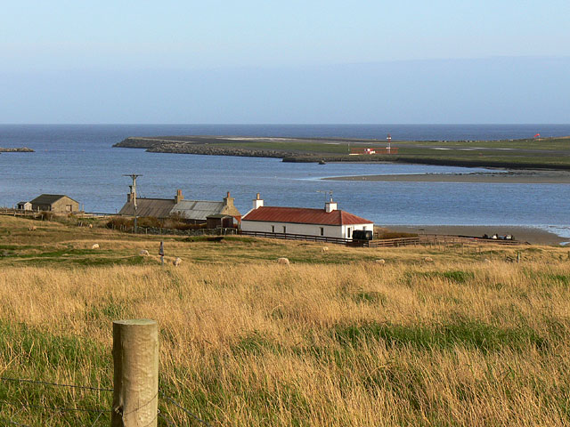
West Point of Hestingsgot, located in the Shetland Islands, is a prominent coastal feature that stands out for its striking headland and unique geological formations. This point is situated on the western coast of the island, overlooking the North Atlantic Ocean. The rugged and rocky nature of the landscape adds to the grandeur of this headland.
The West Point of Hestingsgot is characterized by steep cliffs that rise dramatically from the sea, reaching heights of approximately 100 meters. These cliffs are composed of sedimentary rocks, predominantly sandstone and shale, which display various layers and textures, offering a glimpse into the region's geological history.
In addition to its geological significance, this coastal feature is also known for its diverse birdlife. The cliffs provide nesting sites for several seabird species, including puffins, guillemots, and razorbills. Birdwatchers often flock to the area to observe these magnificent creatures in their natural habitat.
Access to West Point of Hestingsgot is relatively challenging due to the rugged terrain, but there are paths and trails that can be followed by adventurous hikers. Visitors are advised to exercise caution when exploring the area, as the cliffs can be unstable and dangerous.
Overall, West Point of Hestingsgot is a captivating coastal feature that offers breathtaking views of the North Atlantic Ocean and provides a haven for various bird species. It is a must-visit destination for nature enthusiasts and those seeking a unique and rugged coastal experience.
If you have any feedback on the listing, please let us know in the comments section below.
West Point of Hestingsgot Images
Images are sourced within 2km of 59.890472/-1.3164251 or Grid Reference HU3811. Thanks to Geograph Open Source API. All images are credited.


West Point of Hestingsgot is located at Grid Ref: HU3811 (Lat: 59.890472, Lng: -1.3164251)
Unitary Authority: Shetland Islands
Police Authority: Highlands and Islands
What 3 Words
///dignify.image.gold. Near Sumburgh, Shetland Islands
Related Wikis

Toab, Shetland
Toab is the southernmost village on Mainland, Shetland, Scotland. It is part of Virkie and overlooks Sumburgh Airport. Toab is within the parish of Dunrossness...

Exnaboe
Exnaboe, locally referred to as 'bö', is a settlement in the Virkie area of the parish of Dunrossness, South Mainland, Shetland, Scotland, overlooking...
Virkie
Virkie is the most southerly district of Shetland, other than Fair Isle and is best defined as the area south of the Ward Hill in Dunrossness, also locally...
Pool of Virkie
The Pool of Virkie is a tidal lagoon in the parish of Dunrossness, south Mainland, Shetland. == History == The Pool of Virkie, during the late 15th and...

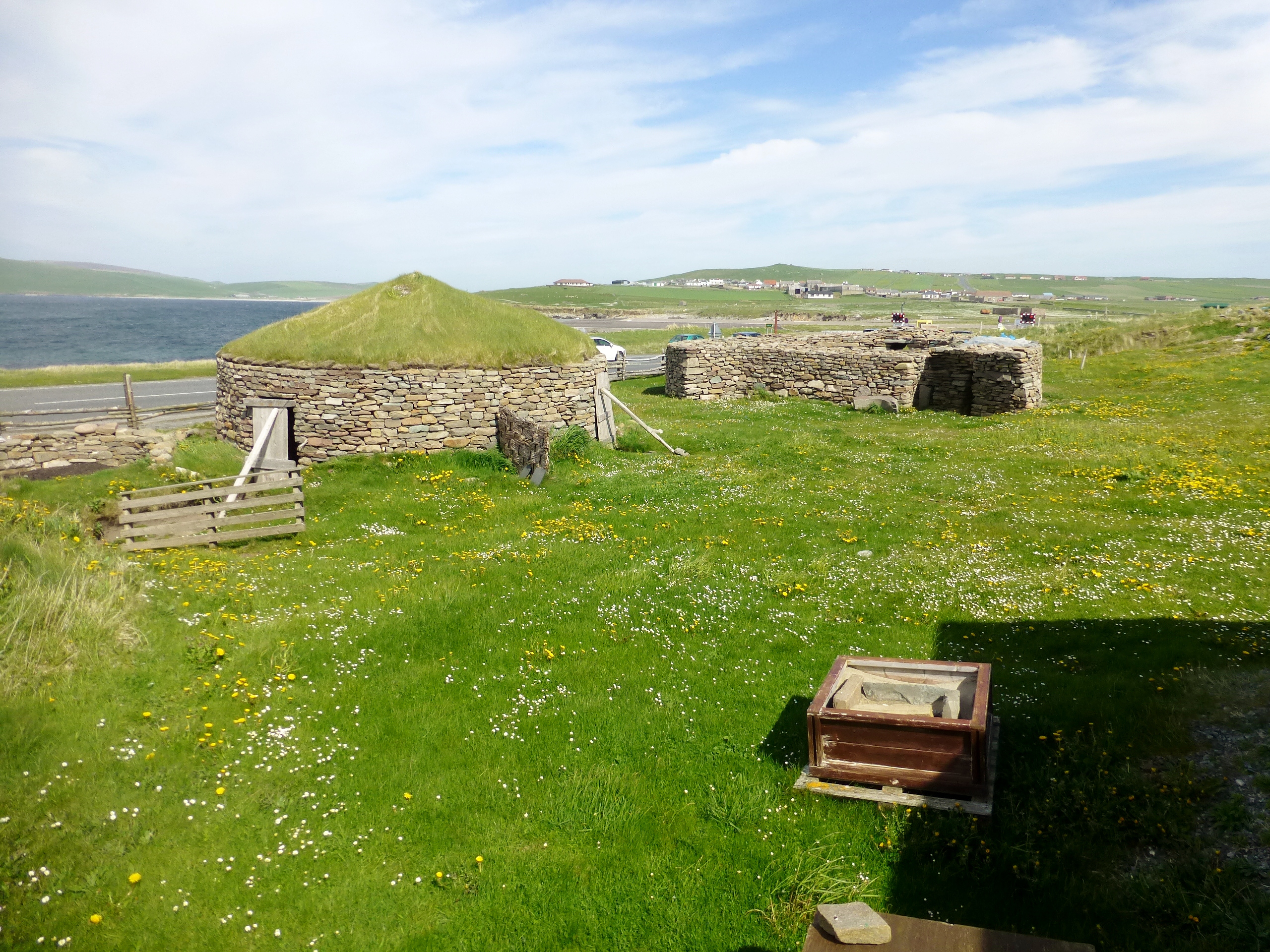
Old Scatness
Old Scatness is an archeological site on Scat Ness, near the village of Scatness, in the parish of Dunrossness in the south end of Mainland, Shetland,...
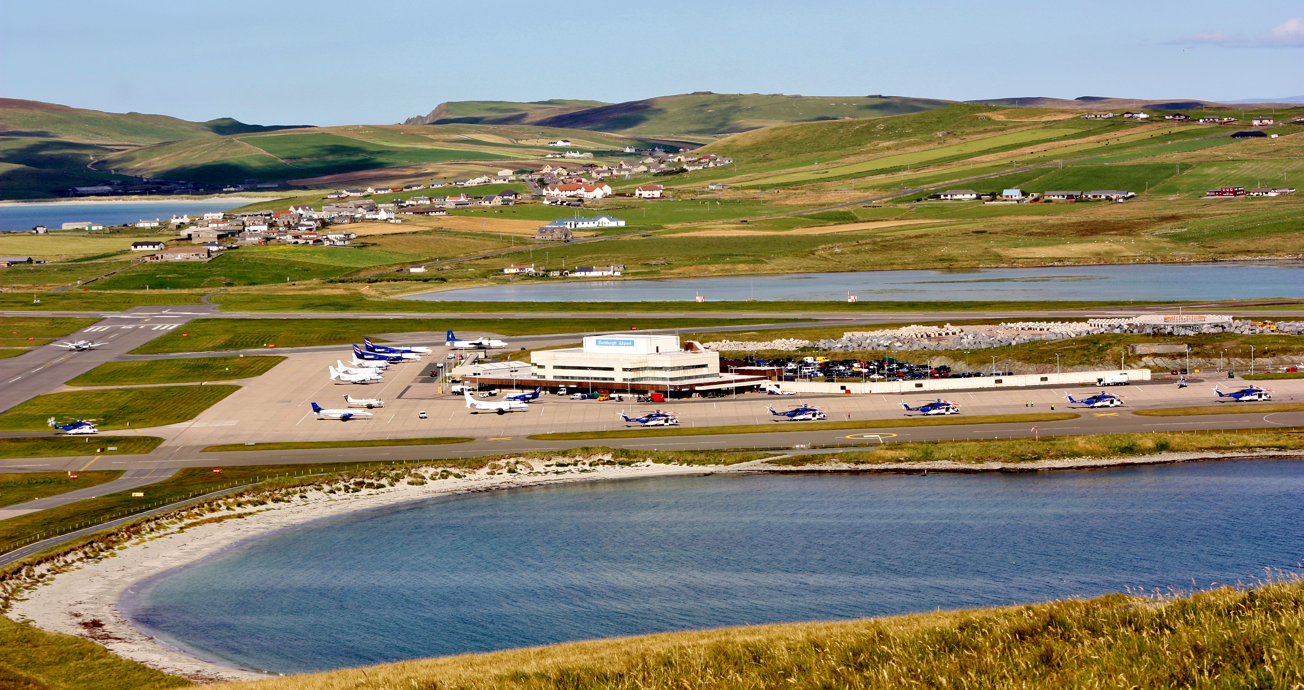
Sumburgh Airport
Sumburgh Airport (IATA: LSI, ICAO: EGPB) is the main airport serving Shetland in Scotland. It is located on the southern tip of the mainland, in the parish...
Scatness
Scatness is a settlement on the headland of Scat Ness at the southern tip of Mainland, Shetland, Scotland, across the West Voe of Sumburgh from Sumburgh...

Dan-Air Flight 0034
Dan-Air Flight 0034 was a fatal accident involving a Hawker Siddeley HS 748 series 1 turboprop aircraft operated by Dan-Air Services Limited on an oil...
Nearby Amenities
Located within 500m of 59.890472,-1.3164251Have you been to West Point of Hestingsgot?
Leave your review of West Point of Hestingsgot below (or comments, questions and feedback).