Ness of Haggrister

Coastal Feature, Headland, Point in Shetland

Scotland

Ness of Haggrister

Mangaster Voe
Mangaster Voe Credit: David Purchase

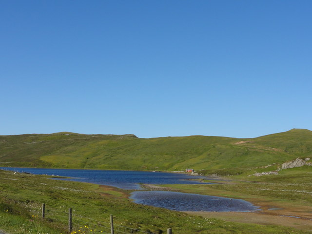
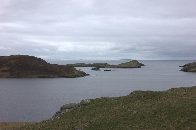
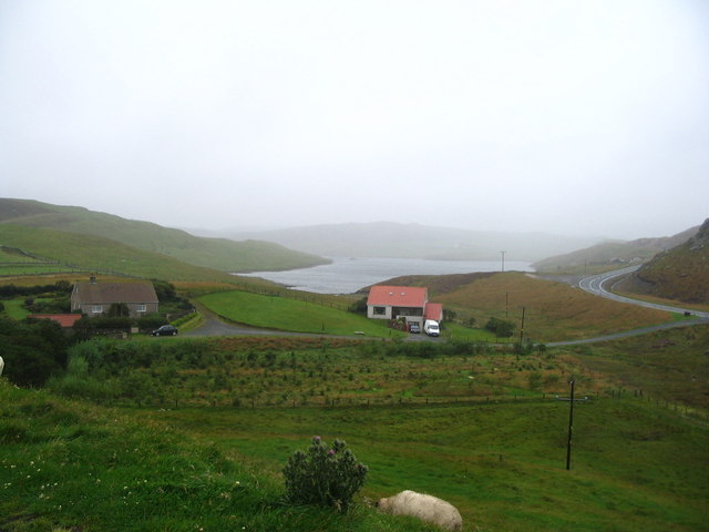
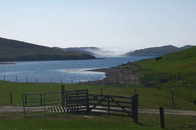
Ness of Haggrister is a prominent headland located on the western coast of the Shetland Islands, Scotland. Jutting out into the North Atlantic Ocean, it is known for its rugged and picturesque beauty. The headland is situated in the parish of Sandsting, near the village of Walls.

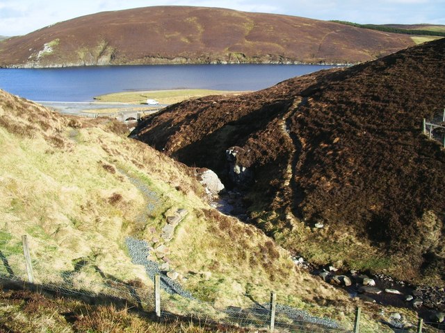
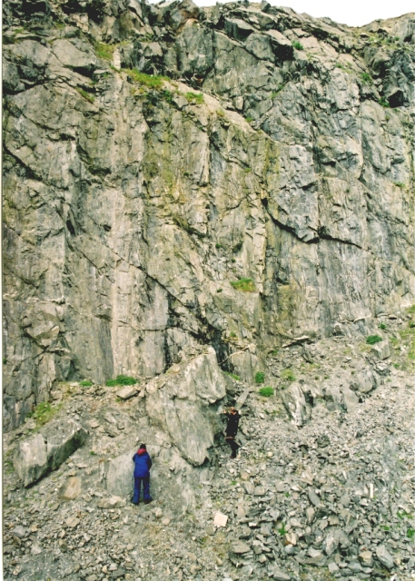
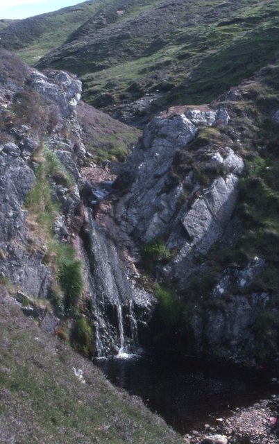
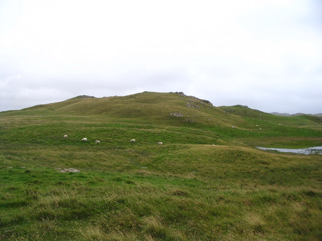
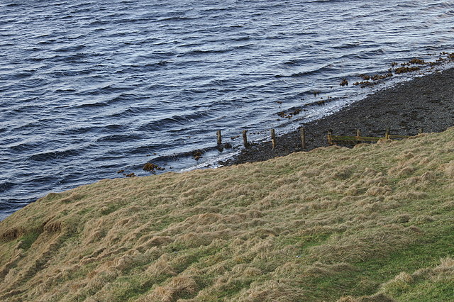
At approximately 40 meters in height, Ness of Haggrister offers stunning panoramic views of the surrounding coastline and the open sea. It is characterized by steep cliffs and rocky outcrops, which act as a natural barrier against the crashing waves. The headland is composed of sedimentary rock formations, displaying layers of sandstone and shale, providing insight into the geological history of the area.

Ness of Haggrister is home to a diverse range of flora and fauna, making it an important site for wildlife enthusiasts and nature lovers. The surrounding waters are teeming with marine life, including seals, dolphins, and various species of fish. Visitors may also spot a variety of seabirds, such as puffins, guillemots, and razorbills, nesting on the cliffs.

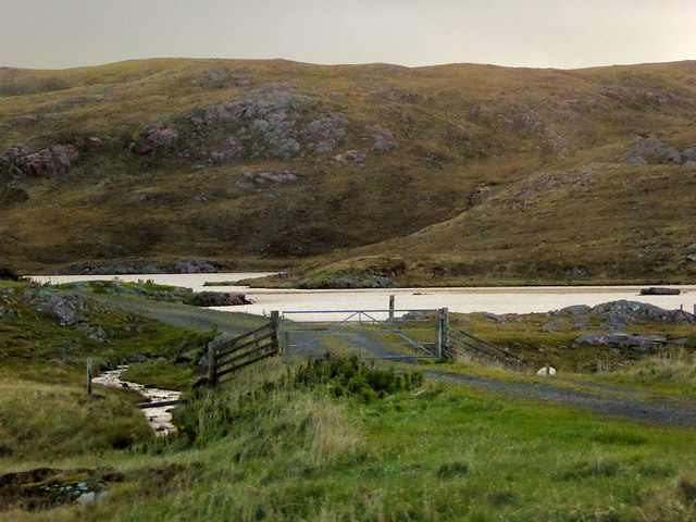
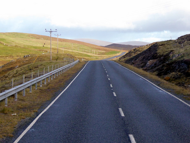
The headland is a popular destination for outdoor activities, including hiking and birdwatching. There are several walking trails that lead to the headland, providing opportunities to explore the rugged coastline and observe the natural beauty of the area. Ness of Haggrister is also a great spot for fishing, with anglers often casting their lines from the rocky shores.

Overall, Ness of Haggrister stands as a remarkable coastal feature in Shetland, offering visitors a unique experience of Scotland's untamed and breathtaking natural landscape.

If you have any feedback on the listing, please let us know in the comments section below.

Ness of Haggrister Images

Images are sourced within 2km of 60.415736/-1.3624314 or Grid Reference HU3570. Thanks to Geograph Open Source API. All images are credited.

Mangaster Voe
Mangaster Voe
The old road Single track remains of the A970 road
The old road
Single track remains of the A970 road
Loch of Lunnister View from the road
Loch of Lunnister
View from the road
Mangaster Voe
Mangaster Voe
Loch of Haggrister
Loch of Haggrister
A970 near Mangaster The A970 runs for 71 miles across most of the length of the "Mainland" in the Shetland Islands. It is a good-quality single-carriageway road for most of its route. Travelling from south to north, the road begins at Grutness near Sumburgh Airport and winds around the many hills and inlets passing close to a number of small villages without going through any large ones before Lerwick. After looping around Lerwick, a short spur runs to Scalloway whilst the main route continues northwards towards Brae where it crosses the narrow isthmus of Mavis Grind. At Sandy Lochs the road splits and a four-mile spur goes through Urafirth to Hillswick. The main route continuing to the right towards its northern terminus at Isbister. This last part of the route tends to be narrower with passing places.

<span class="nowrap"><a title="https://www.sabre-roads.org.uk/wiki/index.php?title=A970" rel="nofollow ugc noopener" href="https://www.sabre-roads.org.uk/wiki/index.php?title=A970">Link</a><img style="margin-left:2px;" alt="External link" title="External link - shift click to open in new window" src="https://s1.geograph.org.uk/img/external.png" width="10" height="10"/></span>  SABRE
A970 near Mangaster
The A970 runs for 71 miles across most of the length of the "Mainland" in the Shetland Islands. It is a good-quality single-carriageway road for most of its route. Travelling from south to north, the road begins at Grutness near Sumburgh Airport and winds around the many hills and inlets passing close to a number of small villages without going through any large ones before Lerwick. After looping around Lerwick, a short spur runs to Scalloway whilst the main route continues northwards towards Brae where it crosses the narrow isthmus of Mavis Grind. At Sandy Lochs the road splits and a four-mile spur goes through Urafirth to Hillswick. The main route continuing to the right towards its northern terminus at Isbister. This last part of the route tends to be narrower with passing places. LinkExternal link SABRE
Northbound A970 near Mangaster The A970 runs for 71 miles across most of the length of the "Mainland" in the Shetland Islands. It is a good-quality single-carriageway road for most of its route. Travelling from south to north, the road begins at Grutness near Sumburgh Airport and winds around the many hills and inlets passing close to a number of small villages without going through any large ones before Lerwick. After looping around Lerwick, a short spur runs to Scalloway whilst the main route continues northwards towards Brae where it crosses the narrow isthmus of Mavis Grind. At Sandy Lochs the road splits and a four-mile spur goes through Urafirth to Hillswick. The main route continuing to the right towards its northern terminus at Isbister. This last part of the route tends to be narrower with passing places.

<span class="nowrap"><a title="https://www.sabre-roads.org.uk/wiki/index.php?title=A970" rel="nofollow ugc noopener" href="https://www.sabre-roads.org.uk/wiki/index.php?title=A970">Link</a><img style="margin-left:2px;" alt="External link" title="External link - shift click to open in new window" src="https://s1.geograph.org.uk/img/external.png" width="10" height="10"/></span>  SABRE
Northbound A970 near Mangaster
The A970 runs for 71 miles across most of the length of the "Mainland" in the Shetland Islands. It is a good-quality single-carriageway road for most of its route. Travelling from south to north, the road begins at Grutness near Sumburgh Airport and winds around the many hills and inlets passing close to a number of small villages without going through any large ones before Lerwick. After looping around Lerwick, a short spur runs to Scalloway whilst the main route continues northwards towards Brae where it crosses the narrow isthmus of Mavis Grind. At Sandy Lochs the road splits and a four-mile spur goes through Urafirth to Hillswick. The main route continuing to the right towards its northern terminus at Isbister. This last part of the route tends to be narrower with passing places. LinkExternal link SABRE
Burn of Valayre, Shetland Photo taken looking northwest down the gorge towards the waters of Voxter Voe
Burn of Valayre, Shetland
Photo taken looking northwest down the gorge towards the waters of Voxter Voe
Valayre Quarry The quarry takes its name from the adjacent burn, and contains an outcrop of the Valayre gneiss. This curious rock can be traced intermittently for 75 km through Mainland and the island of Yell. See also <a href="https://www.geograph.org.uk/gridref/HU5070">HU5070</a>.
Valayre Quarry
The quarry takes its name from the adjacent burn, and contains an outcrop of the Valayre gneiss. This curious rock can be traced intermittently for 75 km through Mainland and the island of Yell. See also HU5070.
Burn of Valayre Not the most impressive waterfall ever!
Burn of Valayre
Not the most impressive waterfall ever!
Head of Mangaster Voe from Isleburgh
The hill of Okra Shun
Voxter Looking down the voe towards mist over Mavis Grind.
Voxter
Looking down the voe towards mist over Mavis Grind.
Scarva Taing A small headland at the mouth of Voxter Voe.
Scarva Taing
A small headland at the mouth of Voxter Voe.
Voxter Voe An extensive sandbank is exposed at low tide, with a fisherman in the voe to the left.
Voxter Voe
An extensive sandbank is exposed at low tide, with a fisherman in the voe to the left.
Pier at the mouth of Voxter Voe A curious place for a pier, as there is no vehicular access.
Pier at the mouth of Voxter Voe
A curious place for a pier, as there is no vehicular access.
Head of Voxter Voe at dusk Looking into the sun, across the mudflats and sandbanks at the head of the voe, which are quite unusually extensive by Shetland standards.
Head of Voxter Voe at dusk
Looking into the sun, across the mudflats and sandbanks at the head of the voe, which are quite unusually extensive by Shetland standards.
Voxter House Currently used as an outdoor activities centre.
Voxter House
Currently used as an outdoor activities centre.
Show me another place!

Ness of Haggrister is located at Grid Ref: HU3570 (Lat: 60.415736, Lng: -1.3624314)

Unitary Authority: Shetland Islands

Police Authority: Highlands and Islands

What 3 Words

///expel.outbursts.taped. Near Brae, Shetland Islands

Nearby Locations

Ness of Haggrister

Related Wikis

Brae

"Brae" is also the Lowland Scots language word for the slope or brow of a hill.Brae (Old Norse: Breiðeið, meaning "the wide isthmus") is a village on the...

Mavis Grind

Mavis Grind (Old Norse: Mæfeiðs grind or Mæveiðs grind, meaning "gate of the narrow isthmus") is a narrow isthmus joining the Northmavine peninsula to...

Sullom

Sullom is a village on the Shetland peninsula of Northmavine, between Haggrister and Bardister. It lies on the northwest side of Sullom Voe, to which it...

Busta Voe

Busta Voe, (HU665350), in the north central Mainland, Shetland, is a sea inlet lying between the village of Brae and the island of Muckle Roe. At the head...
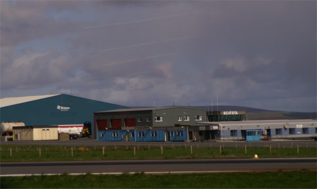
Scatsta Airport

Scatsta Airport (IATA: SCS, ICAO: EGPM), was a commercial airport on the island of Mainland, Shetland in Scotland located 17 nautical miles (31 km; 20...

Delting

Delting is a civil parish and community council area on Mainland, Shetland, Scotland. It includes the Sullom Voe oil terminal and its main settlements...

Sullom Voe

Sullom Voe is an inlet of the North Sea between the parishes of Delting and Northmavine in Shetland, Scotland. It is a location of the Sullom Voe oil terminal...

Gunnister

Gunnister is a small 'abandoned' village at the North-West Mainland in Shetland, Scotland. It is most commonly known for the Gunnister Man - the remains...

Have you been to Ness of Haggrister?

Leave your review of Ness of Haggrister below (or comments, questions and feedback).