Ness of Gillarona

Coastal Feature, Headland, Point in Shetland

Scotland

Ness of Gillarona

Headland to the west of Gilsa Ayre
Headland to the west of Gilsa Ayre Credit: Oliver Dixon

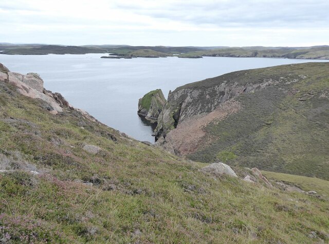
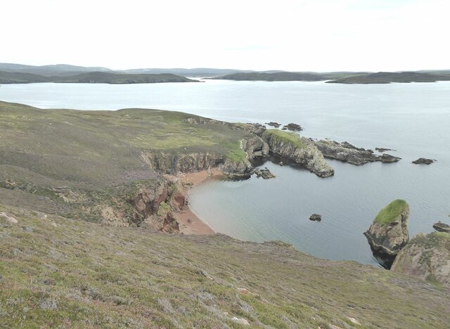
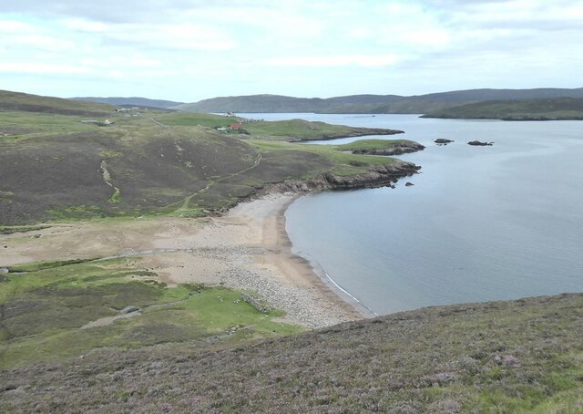
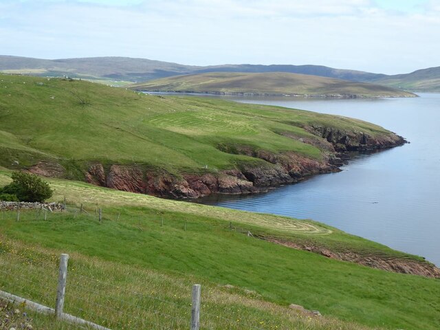
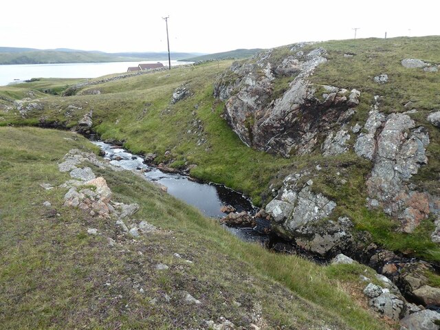
Ness of Gillarona is a prominent coastal feature located in the Shetland Islands, Scotland. It is a headland that juts out into the North Sea, forming a distinct point along the rugged coastline.

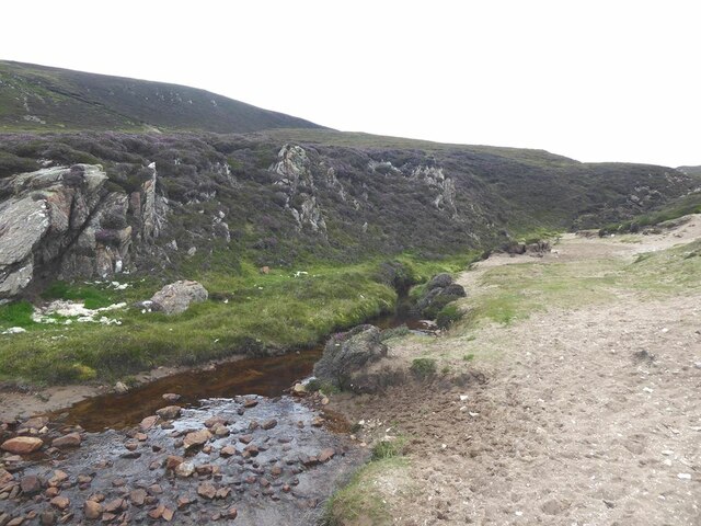
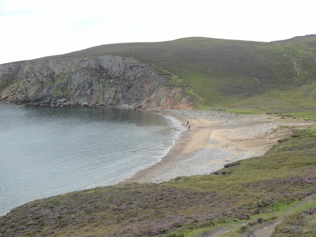
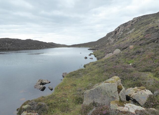
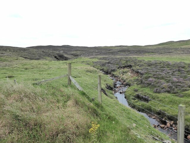
The Ness is characterized by its steep cliffs, which rise dramatically from the surrounding sea. These cliffs, made up of sedimentary rock formations, provide a striking backdrop to the crashing waves below. The area is known for its wild and untamed beauty, with the ever-changing weather and strong winds adding to its allure.

The Ness of Gillarona is a popular spot for birdwatchers and nature enthusiasts. The cliffs provide nesting sites for various seabirds, including puffins, guillemots, and fulmars. Visitors can observe these birds in their natural habitat, watching as they dive into the sea or soar effortlessly above the waves.

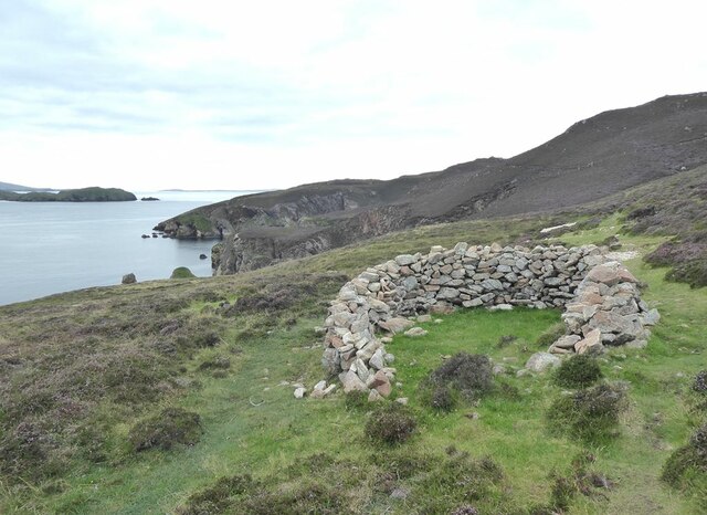
The coastal feature is also of historical and archaeological interest. The remains of an Iron Age broch, a circular stone tower, can be found on the headland. This ancient structure offers insight into the island's early inhabitants and their way of life.

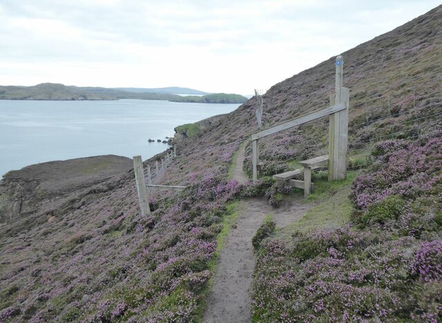
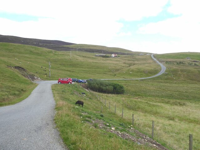
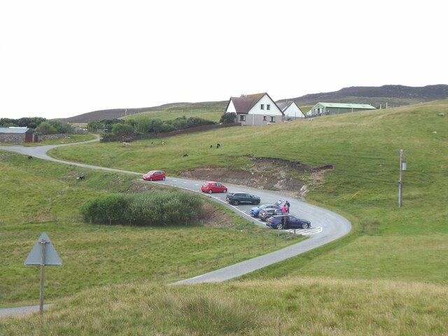
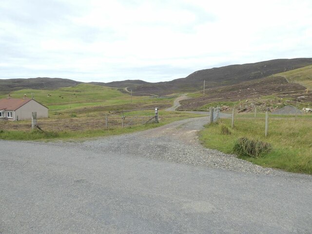
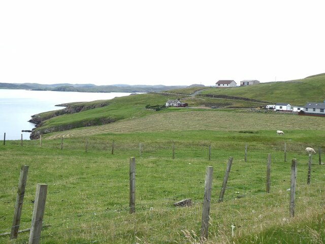
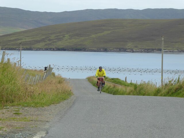
Access to Ness of Gillarona is possible via a narrow road that winds its way along the coastline. Visitors should take caution as the terrain can be uneven and slippery. However, the effort is rewarded with breathtaking views of the surrounding sea and cliffs. Whether it be for birdwatching, exploring history, or simply enjoying the awe-inspiring scenery, Ness of Gillarona is a must-visit destination for anyone exploring the Shetland Islands.

If you have any feedback on the listing, please let us know in the comments section below.

Ness of Gillarona Images

Images are sourced within 2km of 60.347413/-1.4103295 or Grid Reference HU3262. Thanks to Geograph Open Source API. All images are credited.

Headland to the west of Gilsa Ayre
Gilsa Water
Gilsa Water
Two secret beaches at Bungil Accessible only by boat. At the mouth of the bay are the Burki Skerries.
Two secret beaches at Bungil
Accessible only by boat. At the mouth of the bay are the Burki Skerries.
On the path to the Muckle Roe light Beyond the stile, a railing has been installed to protect walkers traversing the extremely steep slope above Bungil.
On the path to the Muckle Roe light
Beyond the stile, a railing has been installed to protect walkers traversing the extremely steep slope above Bungil.
Sheepfold on Burki Hill
Muckle Ayre Beach on the south coast of Muckle Roe.
Muckle Ayre
Beach on the south coast of Muckle Roe.
Mill Burn Where the Mill Burn emerges onto the beach of Muckle Ayre.
Mill Burn
Where the Mill Burn emerges onto the beach of Muckle Ayre.
Muckle Ayre Beach on the south coast of Muckle Roe.
Muckle Ayre
Beach on the south coast of Muckle Roe.
Loch of Brunthill
Loch of Brunthill
End of the road at Little-Ayre The car park at the end of the road which runs along the south side of Muckle Roe caters for many walkers and cyclists, mostly taking the rough road over to South Ham at the north-west corner of the island.
End of the road at Little-Ayre
The car park at the end of the road which runs along the south side of Muckle Roe caters for many walkers and cyclists, mostly taking the rough road over to South Ham at the north-west corner of the island.
Access road to Burki Waters
View across Boat Geo The island of Linga <a href="https://www.geograph.org.uk/gridref/HU3563">HU3563</a> in the middle distance.
View across Boat Geo
The island of Linga HU3563 in the middle distance.
Littleburn Scattering of houses on the south shore of Muckle Roe.
Littleburn
Scattering of houses on the south shore of Muckle Roe.
Hill climb at Knowe Mussel farm in the sea. The island of Linga <a href="https://www.geograph.org.uk/gridref/HU3563">HU3563</a> beyond.
Hill climb at Knowe
Mussel farm in the sea. The island of Linga HU3563 beyond.
Ayredale on Muckle Roe Mussel farm in the sea. The island of Linga <a href="https://www.geograph.org.uk/gridref/HU3563">HU3563</a> beyond.
Ayredale on Muckle Roe
Mussel farm in the sea. The island of Linga HU3563 beyond.
Gorge of the Burn of Scarfataing The map shows a waterfall at this spot. Although a spectacular gorge, any waterfall mush be pretty small.
Gorge of the Burn of Scarfataing
The map shows a waterfall at this spot. Although a spectacular gorge, any waterfall mush be pretty small.
The Burn of Scarfataing
Show me another place!

Ness of Gillarona is located at Grid Ref: HU3262 (Lat: 60.347413, Lng: -1.4103295)

Unitary Authority: Shetland Islands

Police Authority: Highlands and Islands

What 3 Words

///rashers.ties.salaried. Near Brae, Shetland Islands

Related Wikis

Papa Little

Papa Little (Scots: Papa Little; Old Norse: Papey Litla, meaning "the little island of the priests") is an island in St Magnus Bay, Shetland, Scotland...

Muckle Roe

Muckle Roe is an island in Shetland, Scotland, in St. Magnus Bay, to the west of Mainland. It has a population of around 130 people, who mainly croft and...

Linga, Busta Voe

Linga is a small, uninhabited island, 1 km (0.62 mi) east of Muckle Roe in the Shetland Islands. The island is roughly circular in shape and its highest...

Linga (near Vementry)

Linga is one of the Shetland Islands, near Vementry. It is one of many islands in Shetland called Linga. The island is uninhabited. == Geography and... ==

Vementry

Vementry (Old Norse: "Vemunðarey") is an uninhabited Scottish island in Shetland on the north side of the West Mainland, lying south of Muckle Roe. �...

Shetland

Shetland, also called the Shetland Islands and formerly Zetland, is an archipelago in Scotland lying between Orkney, the Faroe Islands, and Norway. It...

Braewick, Sandsting

Braewick is a settlement on the west Mainland of Shetland, Scotland. Braewick is on the western shore of Aith Voe and 1.2 mi (2 km) north of Aith itself...

Busta Voe

Busta Voe, (HU665350), in the north central Mainland, Shetland, is a sea inlet lying between the village of Brae and the island of Muckle Roe. At the head...

Nearby Amenities

Located within 500m of 60.347413,-1.4103295
Power: pole
Lat/Long: 60.3495064/-1.4120275
Power: pole
Lat/Long: 60.3500239/-1.4122984
Power: pole
Lat/Long: 60.350613/-1.4125666
Power: pole
Lat/Long: 60.3493166/-1.4177862
Power: pole
Lat/Long: 60.3498288/-1.4167455
Power: pole
Lat/Long: 60.3502163/-1.4158899
Power: pole
Lat/Long: 60.350686/-1.4149618
Power: pole
Lat/Long: 60.3509606/-1.4137387
Power: pole
Lat/Long: 60.3511146/-1.4128026
Power: pole
Lat/Long: 60.3510469/-1.4110404
Power: pole
Lat/Long: 60.3511796/-1.4101607
Power: pole
Lat/Long: 60.3513587/-1.40912
Power: pole
Lat/Long: 60.3498872/-1.4048123
Power: pole
Lat/Long: 60.3505254/-1.405212
Power: pole
Lat/Long: 60.3511862/-1.405625
Power: pole
Lat/Long: 60.3515882/-1.4081222
The data included in this document is from www.openstreetmap.org. The data is made available under ODbL.

Have you been to Ness of Gillarona?

Leave your review of Ness of Gillarona below (or comments, questions and feedback).