Lothan Ness
Coastal Feature, Headland, Point in Shetland
Scotland
Lothan Ness

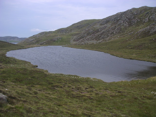
Lothan Ness is a prominent coastal feature located on the Shetland Islands, an archipelago off the northeast coast of Scotland. Positioned in the northern part of the mainland, Lothan Ness is a headland that stretches out into the North Sea, forming a distinct point along the rugged coastline.
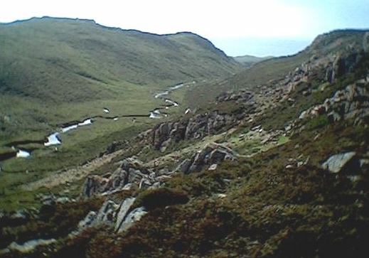
The terrain of Lothan Ness is characterized by dramatic cliffs that rise steeply from the sea, showcasing stunning vistas of the surrounding ocean. The headland is composed mainly of sedimentary rock, with layers of sandstone and shale visible along its craggy edges. These geological formations have been shaped by the relentless pounding of the waves over countless years, creating intricate patterns and textures on the cliff faces.
Lothan Ness is renowned for its rich biodiversity and is home to a diverse range of marine and bird species. The surrounding waters are teeming with marine life, including seals, dolphins, and a variety of fish. Bird enthusiasts can often spot a wide array of seabirds, such as puffins, guillemots, and fulmars, nesting along the cliffs.
This coastal feature also holds historical significance, with evidence of human occupation dating back thousands of years. Archaeological remains have been discovered in the vicinity, providing insight into the lives of early inhabitants of the Shetland Islands.
Lothan Ness is a popular destination for nature lovers, hikers, and photographers, who are drawn to its rugged beauty and the unique wildlife that thrives in its vicinity. Visitors can explore the headland via walking trails that wind along the cliff tops, providing breathtaking views of the surrounding landscape.
If you have any feedback on the listing, please let us know in the comments section below.
Lothan Ness Images
Images are sourced within 2km of 60.389684/-1.428633 or Grid Reference HU3167. Thanks to Geograph Open Source API. All images are credited.


Lothan Ness is located at Grid Ref: HU3167 (Lat: 60.389684, Lng: -1.428633)
Unitary Authority: Shetland Islands
Police Authority: Highlands and Islands
What 3 Words
///cleans.teachers.defected. Near Brae, Shetland Islands
Nearby Locations
Related Wikis

Muckle Roe
Muckle Roe is an island in Shetland, Scotland, in St. Magnus Bay, to the west of Mainland. It has a population of around 130 people, who mainly croft and...

Mavis Grind
Mavis Grind (Old Norse: Mæfeiðs grind or Mæveiðs grind, meaning "gate of the narrow isthmus") is a narrow isthmus joining the Northmavine peninsula to...

Busta Voe
Busta Voe, (HU665350), in the north central Mainland, Shetland, is a sea inlet lying between the village of Brae and the island of Muckle Roe. At the head...

Brae
"Brae" is also the Lowland Scots language word for the slope or brow of a hill.Brae (Old Norse: Breiðeið, meaning "the wide isthmus") is a village on the...
Linga, Busta Voe
Linga is a small, uninhabited island, 1 km (0.62 mi) east of Muckle Roe in the Shetland Islands. The island is roughly circular in shape and its highest...
Linga (near Vementry)
Linga is one of the Shetland Islands, near Vementry. It is one of many islands in Shetland called Linga. The island is uninhabited. == Geography and... ==
Papa Little
Papa Little (Scots: Papa Little; Old Norse: Papey Litla, meaning "the little island of the priests") is an island in St Magnus Bay, Shetland, Scotland...
Gunnister
Gunnister is a small 'abandoned' village at the North-West Mainland in Shetland, Scotland. It is most commonly known for the Gunnister Man - the remains...
Have you been to Lothan Ness?
Leave your review of Lothan Ness below (or comments, questions and feedback).