Swinsi Taing

Coastal Feature, Headland, Point in Shetland

Scotland

Swinsi Taing

Vivilie Loch, Culswick, from the air
Vivilie Loch, Culswick, from the air Credit: Mike Pennington

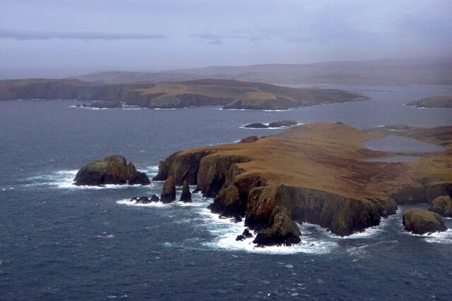
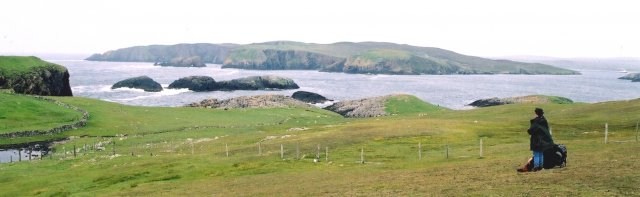
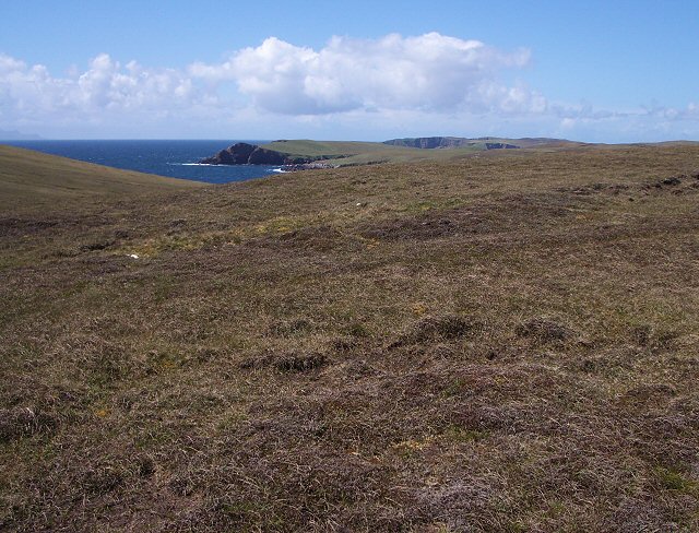
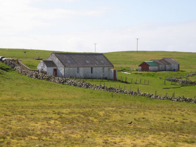
Swinsi Taing is a prominent coastal feature located on the Shetland Islands, an archipelago situated off the northeastern coast of Scotland. Specifically, it is a headland or point that juts out into the North Sea, offering stunning views and unique geological formations.

With its rugged cliffs and rocky shoreline, Swinsi Taing is a popular destination for nature enthusiasts and photographers alike. The headland is known for its dramatic landscapes, characterized by towering cliffs that reach heights of up to 100 feet (30 meters). These cliffs are composed of ancient rock formations, mainly sandstone and shale, which have been shaped by centuries of coastal erosion.

One of the most distinctive features of Swinsi Taing is its sea stacks. These towering pillars of rock stand just offshore, formed through the continual erosion of the cliffs. They provide nesting sites for seabirds, including guillemots, fulmars, and puffins, making it a haven for birdwatchers.

The headland is also home to a diverse array of plant and animal species. The vegetation on Swinsi Taing is typical of coastal habitats, with hardy grasses, wildflowers, and mosses clinging to the rocky terrain. Seals are often spotted lounging on the nearby rocky outcrops, while otters can occasionally be seen hunting in the surrounding waters.

Access to Swinsi Taing is relatively easy, with a footpath leading visitors to the edge of the headland. However, caution is advised as the cliffs can be unstable, and the rough seas can create hazardous conditions. Nonetheless, the breathtaking scenery and abundant wildlife make Swinsi Taing a must-visit destination for those exploring the Shetland Islands.

If you have any feedback on the listing, please let us know in the comments section below.

Swinsi Taing Images

Images are sourced within 2km of 60.180577/-1.5270328 or Grid Reference HU2644. Thanks to Geograph Open Source API. All images are credited.

Vivilie Loch, Culswick, from the air
Drongi Field from the air
Coast at Burga Stack, Culswick, from the air
Broch of Culswick, Shetland Looking SW. Evidence of occupation through many centuries.
Broch of Culswick, Shetland
Looking SW. Evidence of occupation through many centuries.
Burri Geo These two beautiful steep sided islands in Burri Geo are not named on the maps.
Giltarump is the island in the far distance.
Burri Geo
These two beautiful steep sided islands in Burri Geo are not named on the maps. Giltarump is the island in the far distance.
Looking Towards Muckle Flaes and Vaila from Culswick This is the view to seaward from the path to the broch at Culswick. The humps of rock in the middle distance, which is in square, conceal sea caves. Muckle Flaes is the rocky island just offshore, and the island is Vaila.
Looking Towards Muckle Flaes and Vaila from Culswick
This is the view to seaward from the path to the broch at Culswick. The humps of rock in the middle distance, which is in square, conceal sea caves. Muckle Flaes is the rocky island just offshore, and the island is Vaila.
The Stead of Culswick This isolated little bay lies to the south of Culswick. In the distance near the hill top is the little church at Culswick.
The Stead of Culswick
This isolated little bay lies to the south of Culswick. In the distance near the hill top is the little church at Culswick.
Stanypunds Looking over the bog towards the coast. It is just possible to make out Foula on the horizon at the left of the picture.
Stanypunds
Looking over the bog towards the coast. It is just possible to make out Foula on the horizon at the left of the picture.
Sotersta Looking past the ruined crofts at Sotersta with Culswick broch in the distance.
Sotersta
Looking past the ruined crofts at Sotersta with Culswick broch in the distance.
Causeway at Culswick Looking down from the broch at the causeway across the end of the loch. The broch mound is covered with spring squill in flower.
Causeway at Culswick
Looking down from the broch at the causeway across the end of the loch. The broch mound is covered with spring squill in flower.
Coastal view from Culswick broch Looking along the coast from the broch in the direction of Burga Stacks.
Coastal view from Culswick broch
Looking along the coast from the broch in the direction of Burga Stacks.
Pink and blue Sea thrift and spring squill flowering together on the mound of Culswick broch.
Pink and blue
Sea thrift and spring squill flowering together on the mound of Culswick broch.
Track to Culswick The track from the Loch of Sotersta towards Culswick.
Track to Culswick
The track from the Loch of Sotersta towards Culswick.
Croft land at Culswick A ruined croft house in the foreground, but more modern farm buildings in the distance.
Croft land at Culswick
A ruined croft house in the foreground, but more modern farm buildings in the distance.
Road junction The junction of two minor roads, both ending in small crofting communities. Only the direction to Skeld leads off the peninsula.
Road junction
The junction of two minor roads, both ending in small crofting communities. Only the direction to Skeld leads off the peninsula.
Ward of Culswick Trig pillar at top of hill looking westwards with Isle of Vaila in foreground and Foula in the distance
Ward of Culswick
Trig pillar at top of hill looking westwards with Isle of Vaila in foreground and Foula in the distance
Rock formation Rock formation on top of hill just to the NE of the trigpoint, (shown behind rock) with Foula on the horizon
Rock formation
Rock formation on top of hill just to the NE of the trigpoint, (shown behind rock) with Foula on the horizon
Culswick Methodist Chapel
Show me another place!

Swinsi Taing is located at Grid Ref: HU2644 (Lat: 60.180577, Lng: -1.5270328)

Unitary Authority: Shetland Islands

Police Authority: Highlands and Islands

What 3 Words

///isolated.spellings.chops. Near Walls, Shetland Islands

Related Wikis

Broch of Culswick

The Broch of Culswick (also Culswick Broch) is an unexcavated coastal broch in the Shetland Islands of Scotland (grid reference HU25384481). It has...

Westerwick

Westerwick is a settlement on Mainland in Shetland, Scotland. The settlement is within the parish of Sandsting. It faces south with high cliffs on both...

Silwick

Silwick, a once thriving community in the West Mainland, Shetland, Scotland about three miles from Skeld, is now almost deserted. The area has dramatic...

Vaila

Vaila (Old Norse: "Valey") is an island in Shetland, Scotland, lying south of the Westland peninsula of the Shetland Mainland. It has an area of 327 hectares...

Linga, Vaila Sound

Linga is one of the Shetland Islands, near Vaila and Walls on Mainland, Shetland. Its highest elevation is 28 metres (91 ft). In 2014 and 2018 it was...

Skeld

Skeld (Old Norse: Skjolðr, Shield or shelter) refers to two villages on the south side of the West Mainland of Shetland, Scotland. The main village is...

Gruting

Gruting is a hamlet on the island of Mainland, Shetland in Scotland. It is about 1 kilometre (0.62 mi) southwest of the archaeological site of Stanydale...

Burrastow

Burrastow is a location on the west shore of Vaila Sound near the village of Walls on the Shetland Mainland, Scotland. There are two small piers and the...

Have you been to Swinsi Taing?

Leave your review of Swinsi Taing below (or comments, questions and feedback).