Skinhoga

Coastal Feature, Headland, Point in Shetland

Scotland

Skinhoga

Bousta Geo, Sandness
Bousta Geo, Sandness Credit: Mike Pennington

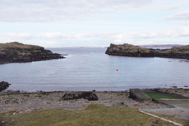
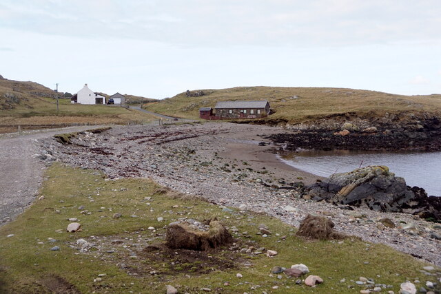
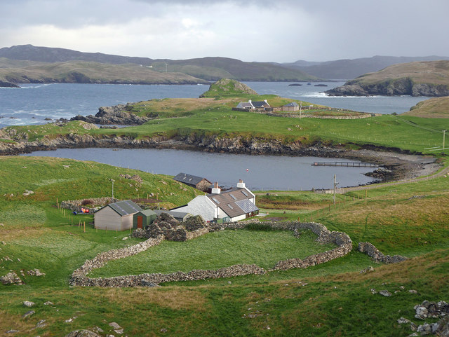
Skinhoga is a prominent coastal feature located in the Shetland Islands, an archipelago in Scotland. Situated on the western coast of the main island, it is specifically categorized as a headland or point due to its distinctive shape and geographical features.

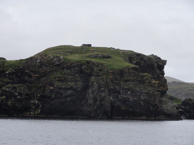
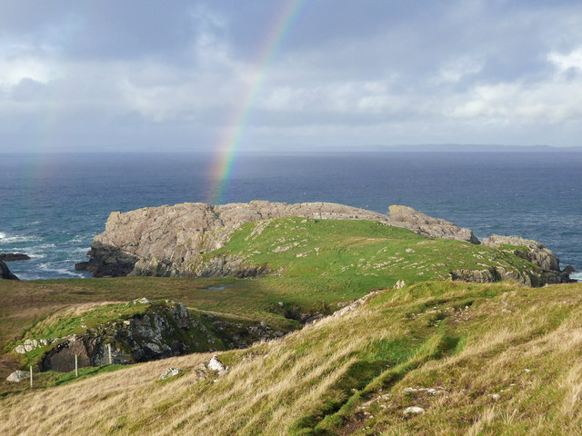
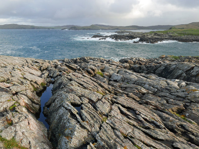
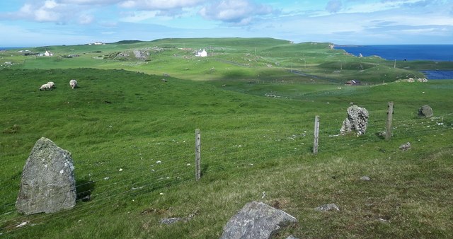
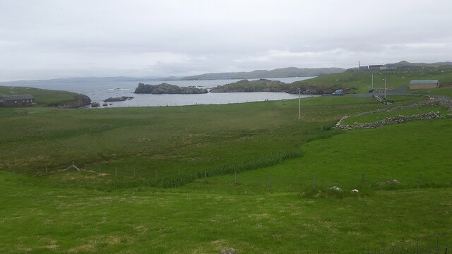
Skinhoga is characterized by its rugged and rocky terrain, jutting out into the North Sea. The headland stretches out into the water, forming a natural promontory that offers breathtaking panoramic views of the surrounding landscape and the vast ocean beyond. The cliffs that line the headland are notably steep and imposing, providing a dramatic backdrop to the coastal scenery.

One of the notable aspects of Skinhoga is its exposed position, making it susceptible to the forceful winds and crashing waves typical of the North Sea. This exposure has resulted in the formation of sea caves and natural arches along the shoreline, adding to the area's allure and natural beauty.

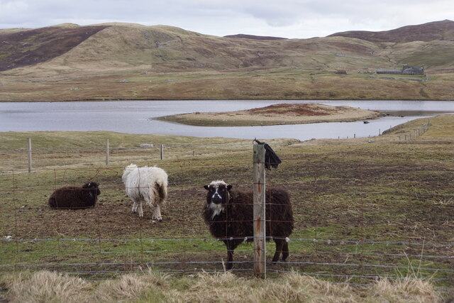
The headland is also home to a diverse range of flora and fauna, with various seabirds nesting in the cliffs and exploring the nearby waters. The surrounding waters are abundant in marine life, making it an attractive spot for fishing and wildlife enthusiasts.

Skinhoga is a popular destination for outdoor enthusiasts and visitors seeking to enjoy the natural wonders of the Shetland Islands. Its stunning vistas, unique geological formations, and ecological diversity make it a must-visit coastal feature in the region.

If you have any feedback on the listing, please let us know in the comments section below.
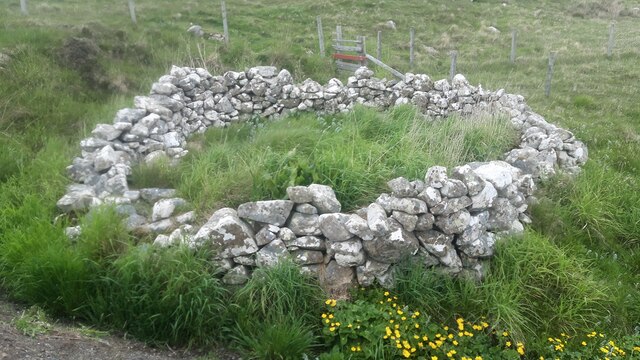
Skinhoga Images

Images are sourced within 2km of 60.304855/-1.5988123 or Grid Reference HU2257. Thanks to Geograph Open Source API. All images are credited.

Bousta Geo, Sandness
Da Bod and Little Bousta, Sandness
Loch of Valtigarth, Sandness
Loch of Collaster, Sandness
Cliff Face View from Papa Stour Ferry
Cliff Face
View from Papa Stour Ferry
Little Bousta, near Sandness, Shetland A croft at the end of the road. Muckle Bousta, the nearest croft to Little Bousta,  is visible over the small bay.
Little Bousta, near Sandness, Shetland
A croft at the end of the road. Muckle Bousta, the nearest croft to Little Bousta, is visible over the small bay.
Hillside behind Little Bousta Good country for sheep. Interesting topography near Bousta.
Hillside behind Little Bousta
Good country for sheep. Interesting topography near Bousta.
Coastline by Skerry of Stools A headland of sharp clean rock projecting into St Magnus Bay.
Coastline by Skerry of Stools
A headland of sharp clean rock projecting into St Magnus Bay.
Rinns of Shurdimires prehistoric stone row A probable single stone row measuring 16.2m long, including two large-sized orthostats and one medium-sized stone situated on the western side of a rock outcrop. The row is orientated north to south. <span class="nowrap"><a title="https://stonerows.wordpress.com/gazetteer/region/rest-of-scotland/rinns-of-shurdimires/" rel="nofollow ugc noopener" href="https://stonerows.wordpress.com/gazetteer/region/rest-of-scotland/rinns-of-shurdimires/">Link</a><img style="margin-left:2px;" alt="External link" title="External link - shift click to open in new window" src="https://s1.geograph.org.uk/img/external.png" width="10" height="10"/></span>
Rinns of Shurdimires prehistoric stone row
A probable single stone row measuring 16.2m long, including two large-sized orthostats and one medium-sized stone situated on the western side of a rock outcrop. The row is orientated north to south. LinkExternal link
Sheepfold next to the road at Bousta
Bay at Bousta
Bay at Bousta
Snaraness View of derelict house at Snaraness from approach road
Snaraness
View of derelict house at Snaraness from approach road
Bay of Garth Looking West across the Bay of Garth
Bay of Garth
Looking West across the Bay of Garth
Djuba Water Djuba Water, Looking towards the Windy Scord. Djuba meaning deep water.
Djuba Water
Djuba Water, Looking towards the Windy Scord. Djuba meaning deep water.
Loch of Collaster Small island in loch with mound feature.
Loch of Collaster
Small island in loch with mound feature.
Muckle Bousta from the shore The inlet at Bousta at low tide looking towards the white painted house called Muckle Bousta on the edge of the Hill of Bousta
Muckle Bousta from the shore
The inlet at Bousta at low tide looking towards the white painted house called Muckle Bousta on the edge of the Hill of Bousta
Snarra Ness and Lang Stack View of Snarra Ness and Lang Stack and Scarvi Stack taken from the Papa Stour ferry.
Snarra Ness and Lang Stack
View of Snarra Ness and Lang Stack and Scarvi Stack taken from the Papa Stour ferry.
Ness loch
Ness loch
Show me another place!

Skinhoga is located at Grid Ref: HU2257 (Lat: 60.304855, Lng: -1.5988123)

Unitary Authority: Shetland Islands

Police Authority: Highlands and Islands

What 3 Words

///stop.bland.ideals. Near Walls, Shetland Islands

Related Wikis

Bousta

Bousta is a settlement on Mainland, in Shetland, Scotland. Bousta is situated in the parish of Walls and Sandness.Scott's Hawkweed is native to the pastures...

Sandness

Sandness (the "d" is not pronounced locally) is a headland and district in the west of Shetland Mainland, Scotland. Sandness was a civil parish, which...

Broch of West Burrafirth

The Broch of West Burrafirth is an Iron Age broch located on the west side of Mainland, Shetland (grid reference HU25625720). == Location == The broch...

Forewick Holm

Forewick Holm is a 1-hectare (2.5-acre) island in the Sound of Papa in the Shetland islands, Scotland. Located between Papa Stour and the Sandness peninsula...

Brei Holm

Brei Holm is a tiny tidal islet in the western Shetland Islands. It is due east of Papa Stour, to which it is connected at low tide, just outside Housa...

Maiden Stack

The Maiden Stack or Frau Stack is a tiny stack in the western Shetland Islands to the north of Brei Holm and east of Housa Voe in Papa Stour. It is so...

Biggings

Biggings is a village on the island of Papa Stour, in Shetland, Scotland. Papa Stour's church is situated at the south of Biggings. A homestead of Duke...

Papa Stour Airstrip

Papa Stour Airstrip is a small airstrip in the village of Biggings on the island of Papa Stour. Shetland, Scotland. == History == Papa Stour Airstrip opened...

Nearby Amenities

Located within 500m of 60.304855,-1.5988123
Power: pole
Lat/Long: 60.3033869/-1.607172
Power: pole
Lat/Long: 60.3034395/-1.6059104
Power: pole
Lat/Long: 60.3031763/-1.6047596
Power: pole
Lat/Long: 60.3029656/-1.6038377
Power: pole
Lat/Long: 60.302763/-1.6029919
Power: pole
Lat/Long: 60.3025764/-1.6022109
Power: pole
Lat/Long: 60.3022673/-1.6009077
Power: pole
Lat/Long: 60.3020613/-1.6000088
Power: pole
Lat/Long: 60.3020555/-1.5993225
Power: pole
Lat/Long: 60.3020532/-1.5979107
Power: pole
Lat/Long: 60.3025249/-1.6047527
Power: pole
Lat/Long: 60.3017796/-1.6047458
Power: pole
Lat/Long: 60.3033113/-1.6009319
Power: pole
Lat/Long: 60.3030732/-1.6013571
The data included in this document is from www.openstreetmap.org. The data is made available under ODbL.

Have you been to Skinhoga?

Leave your review of Skinhoga below (or comments, questions and feedback).