Breigeo Head
Coastal Feature, Headland, Point in Shetland
Scotland
Breigeo Head
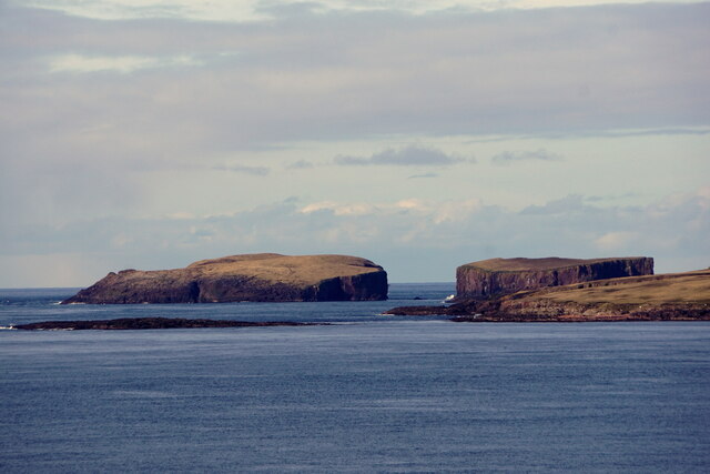
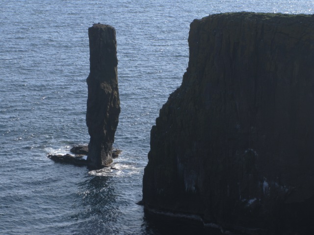
Breigeo Head is a prominent coastal feature located in the Shetland Islands, an archipelago lying off the north coast of mainland Scotland. It is a headland that juts out into the North Atlantic Ocean, forming a distinctive point along the coastline.
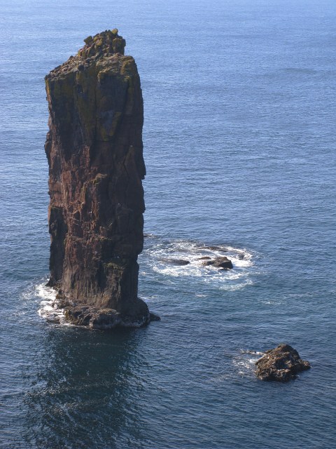
Situated on the west coast of the Shetland Mainland, Breigeo Head offers breathtaking views of the surrounding seascape. Its rugged cliffs, reaching heights of up to 100 meters, provide a dramatic backdrop against the crashing waves below. The headland is composed mainly of sedimentary rocks, such as sandstone and shale, which have been shaped over millennia by the powerful forces of erosion.
Breigeo Head is an important site for seabird colonies, attracting thousands of nesting birds during the breeding season. Species such as guillemots, razorbills, puffins, and fulmars can be observed perched on the sheer cliffs, while gannets and kittiwakes soar overhead. The area is also home to a variety of marine life, including seals and porpoises, which can often be spotted swimming in the waters surrounding the headland.
Access to Breigeo Head is possible via a network of walking trails that wind their way through the rugged Shetland landscape. These trails offer visitors the opportunity to explore the headland and its surroundings, providing stunning panoramic views of the coastline and the distant islands.
Breigeo Head is not only a natural wonder but also holds historical and cultural significance. It has been inhabited and used by humans for thousands of years, with archaeological remains found in the area dating back to the Iron Age. Today, it stands as a testament to the raw beauty of the Shetland Islands and serves as a haven for wildlife enthusiasts, hikers, and nature lovers alike.
If you have any feedback on the listing, please let us know in the comments section below.
Breigeo Head Images
Images are sourced within 2km of 60.325243/-1.7250325 or Grid Reference HU1560. Thanks to Geograph Open Source API. All images are credited.


Breigeo Head is located at Grid Ref: HU1560 (Lat: 60.325243, Lng: -1.7250325)
Unitary Authority: Shetland Islands
Police Authority: Highlands and Islands
What 3 Words
///promising.clockwork.blurs. Near Walls, Shetland Islands
Nearby Locations
Related Wikis

Papa Stour
Papa Stour (Scots: Papa Stour) is one of the Shetland Islands in Scotland, with a population of under fifteen people, some of whom immigrated after an...

Papa Stour Airstrip
Papa Stour Airstrip is a small airstrip in the village of Biggings on the island of Papa Stour. Shetland, Scotland. == History == Papa Stour Airstrip opened...

Biggings
Biggings is a village on the island of Papa Stour, in Shetland, Scotland. Papa Stour's church is situated at the south of Biggings. A homestead of Duke...
Forewick Holm
Forewick Holm is a 1-hectare (2.5-acre) island in the Sound of Papa in the Shetland islands, Scotland. Located between Papa Stour and the Sandness peninsula...
Brei Holm
Brei Holm is a tiny tidal islet in the western Shetland Islands. It is due east of Papa Stour, to which it is connected at low tide, just outside Housa...
Maiden Stack
The Maiden Stack or Frau Stack is a tiny stack in the western Shetland Islands to the north of Brei Holm and east of Housa Voe in Papa Stour. It is so...

Sandness
Sandness (the "d" is not pronounced locally) is a headland and district in the west of Shetland Mainland, Scotland. Sandness was a civil parish, which...

Ve Skerries
The Ve Skerries or Vee Skerries (Old Norse: Vestan sker, West Skerries) are a group of low skerries (rocky islands) three miles (4.8 km) north west of...
Have you been to Breigeo Head?
Leave your review of Breigeo Head below (or comments, questions and feedback).