Cockpit Head

Coastal Feature, Headland, Point in Dorset

England

Cockpit Head

Lulworth Cove Cliffs at Lulworth.
Lulworth Cove Credit: Wayland Smith

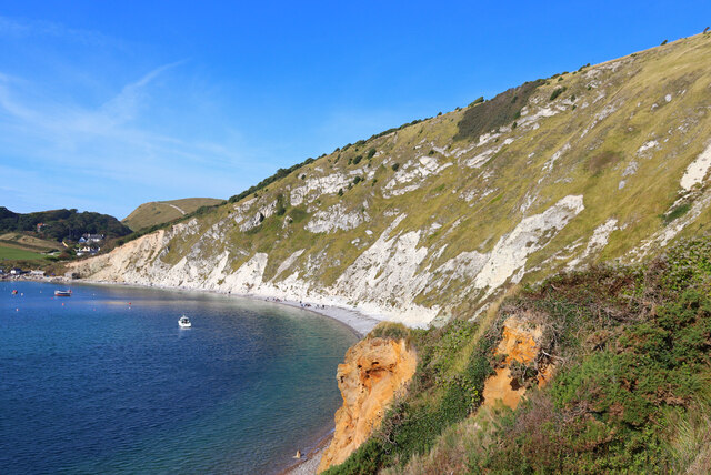
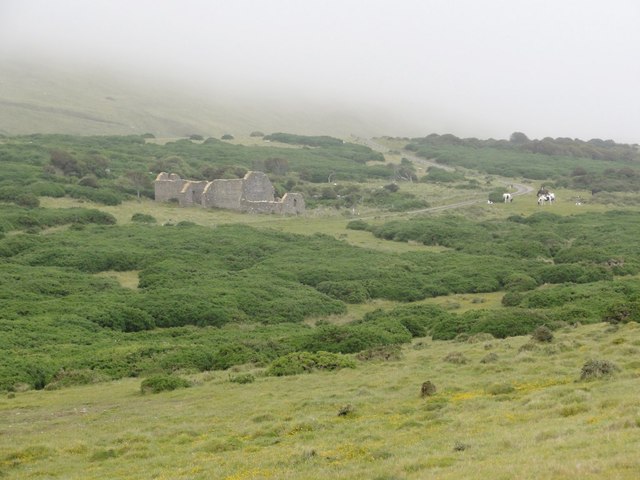
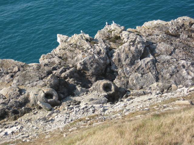
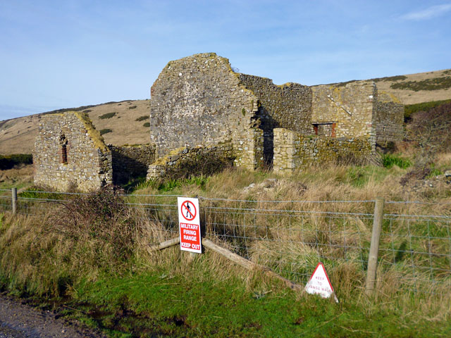
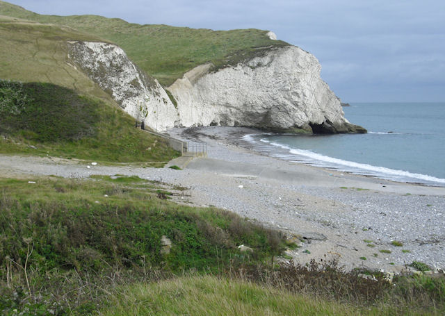
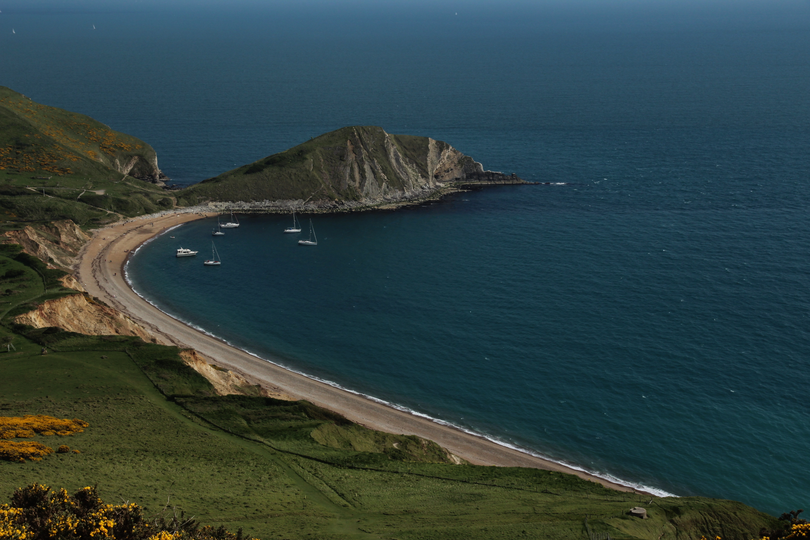
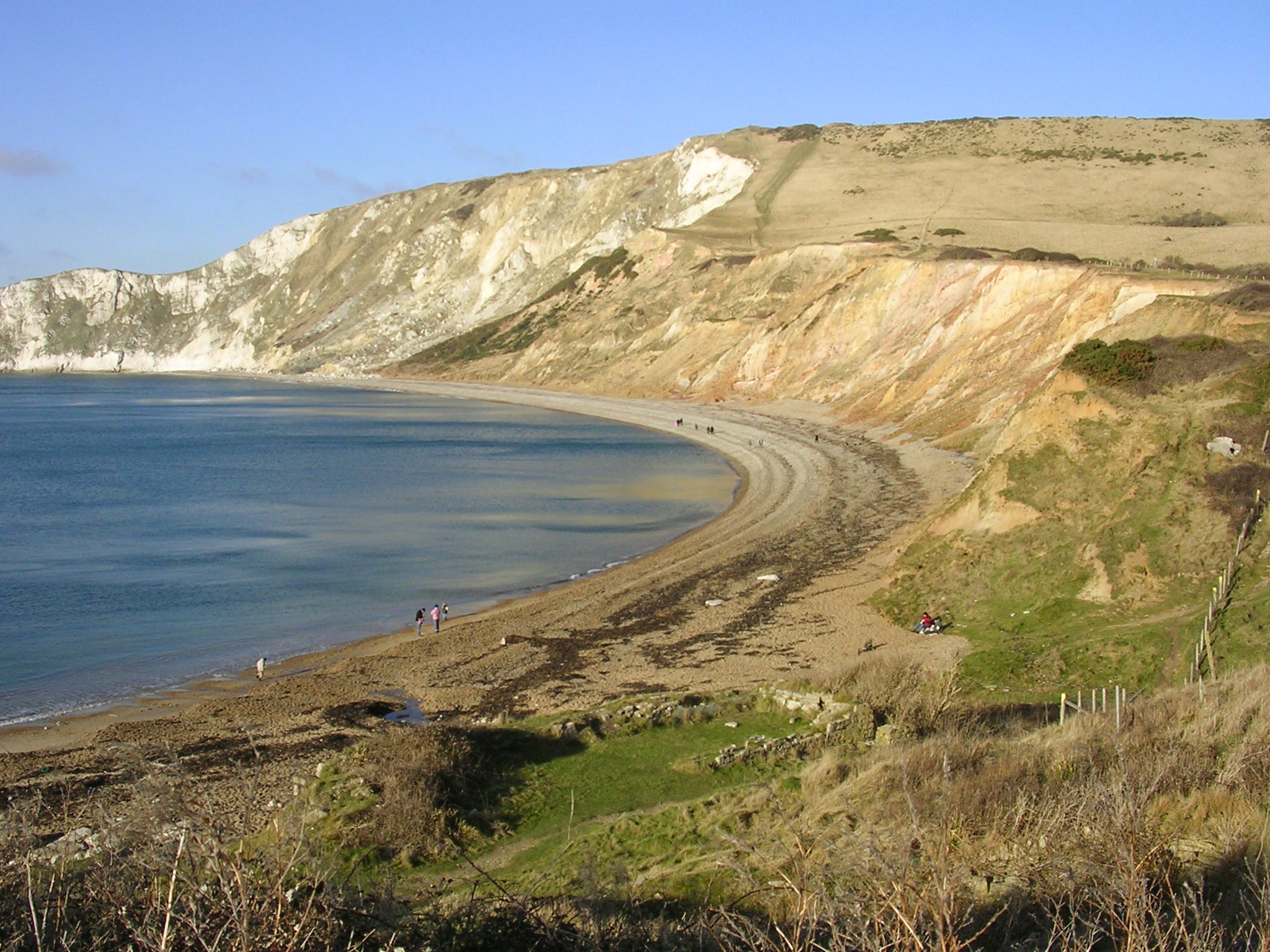
Cockpit Head is a prominent coastal feature located in Dorset, England. It is classified as a headland or point, jutting out into the English Channel. The headland is situated near the village of Worth Matravers, between the popular tourist destinations of Swanage and Lulworth Cove.

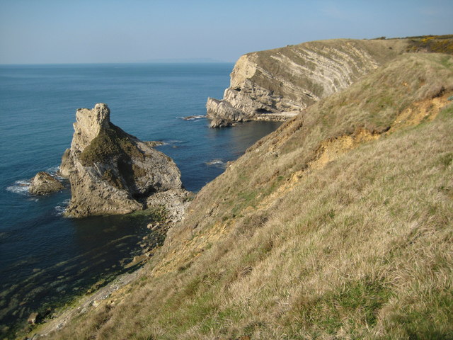
The name "Cockpit Head" is derived from a natural rock formation that resembles a cockpit, which is a term used to describe a pit or enclosure used for cockfighting. This unique geological formation adds to the charm and allure of the area, making it a popular attraction for visitors.

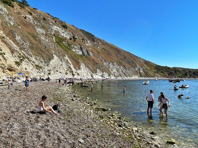
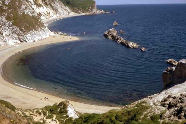
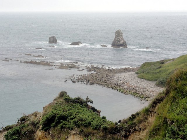
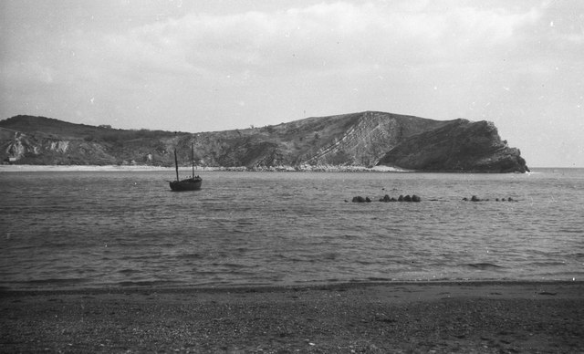
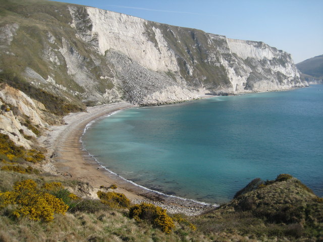
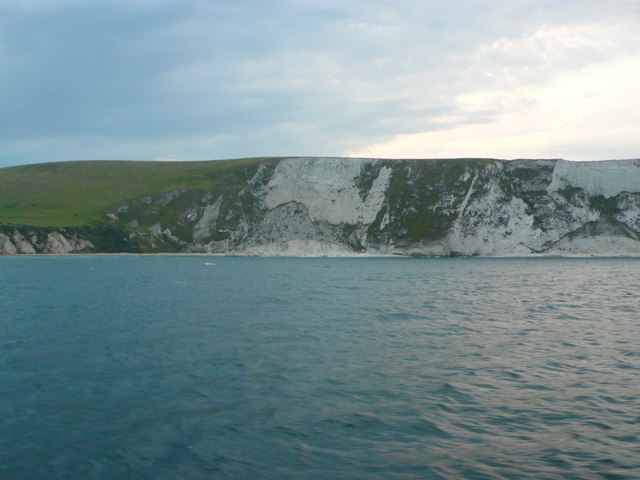
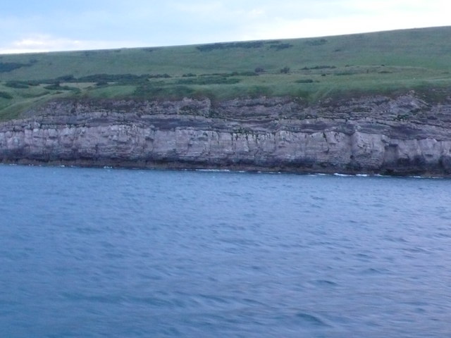
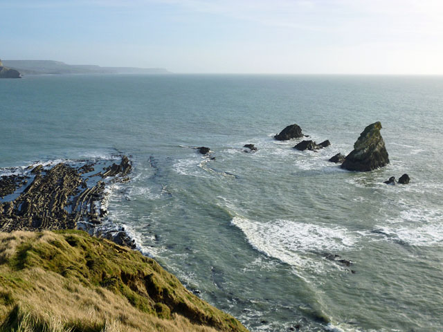
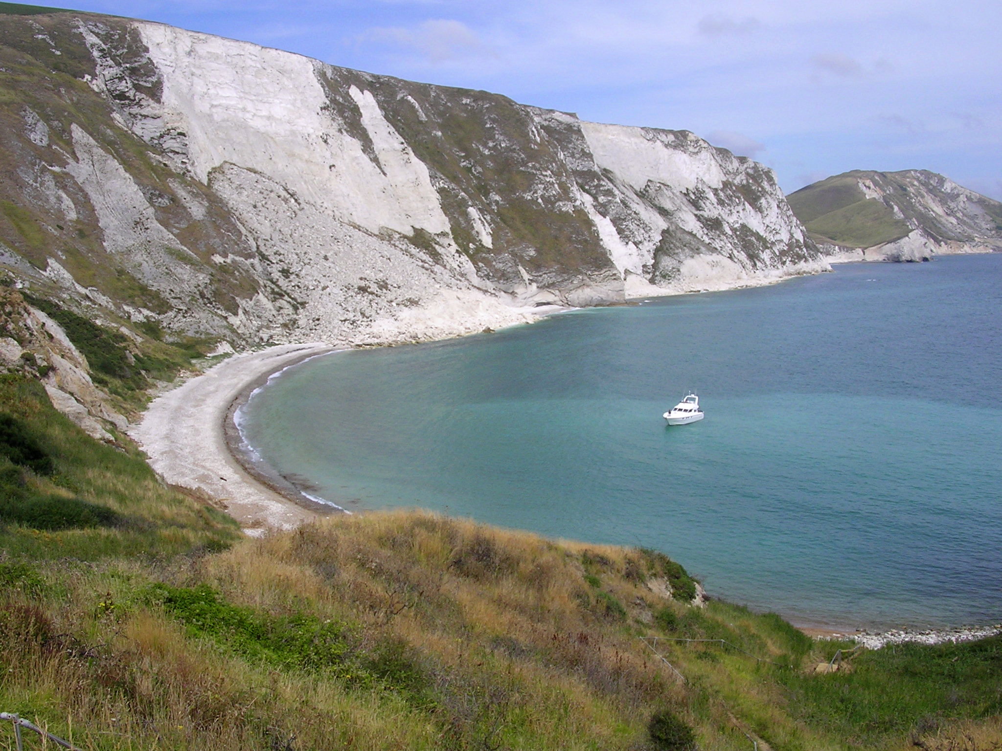
The headland offers breathtaking panoramic views of the surrounding coastline, providing visitors with a perfect vantage point to admire the rugged cliffs, crystal-clear waters, and picturesque landscapes. On a clear day, it is even possible to see as far as the Isle of Wight.

Cockpit Head is a haven for wildlife enthusiasts, as it supports a diverse range of flora and fauna. The surrounding area is home to various species of seabirds, including gulls, fulmars, and cormorants. It is also not uncommon to spot dolphins and seals swimming in the waters below.

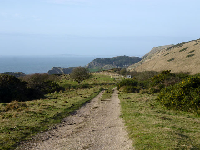
Access to Cockpit Head is relatively easy, with several footpaths and trails leading to the headland from nearby villages. The South West Coast Path, a renowned long-distance trail, also passes through the area, allowing hikers to explore the stunning coastal scenery.

Overall, Cockpit Head offers a perfect blend of natural beauty, geological curiosity, and wildlife diversity, making it an ideal destination for nature lovers and outdoor enthusiasts.

If you have any feedback on the listing, please let us know in the comments section below.

Cockpit Head Images

Images are sourced within 2km of 50.621455/-2.2175014 or Grid Reference SY8480. Thanks to Geograph Open Source API. All images are credited.

Lulworth Cove Cliffs at Lulworth.
Lulworth Cove
Cliffs at Lulworth.
Lulworth Cove
Lulworth Cove
Lulworth Cove Fairly quiet autumn day.
Lulworth Cove
Fairly quiet autumn day.
Mupe Ledges and Mupe Rocks Looking down onto the headland from above Mupe Bay.
Mupe Ledges and Mupe Rocks
Looking down onto the headland from above Mupe Bay.
Little Bindon Looking toward the derelict farmhouse on the military range below Bindon Hill which is shrouded in cloud.
Little Bindon
Looking toward the derelict farmhouse on the military range below Bindon Hill which is shrouded in cloud.
Lulworth Cove View of the eastern side of the cove with the photographer standing a few metres south of the 8000 northing grid line which approximates to the left hand side of the image.
Lulworth Cove
View of the eastern side of the cove with the photographer standing a few metres south of the 8000 northing grid line which approximates to the left hand side of the image.
Rock Strata, Lulworth Cove Steeply sloping rock strata are clearly seen at Pepler's Point, just east of the entrance to Lulworth Cove.
Rock Strata, Lulworth Cove
Steeply sloping rock strata are clearly seen at Pepler's Point, just east of the entrance to Lulworth Cove.
Lulworth Cove While camping at Knoll Cottage, Blacknoll. My childhood log reads "start to cook chops. Stay night". Tough chops, obviously.
Lulworth Cove
While camping at Knoll Cottage, Blacknoll. My childhood log reads "start to cook chops. Stay night". Tough chops, obviously.
Mupe Rocks Mupe Rocks consist of harder limestone rocks hence they are more durable against the erosion of the sea, here they viewed from the coast path above Mupe Bay.
Mupe Rocks
Mupe Rocks consist of harder limestone rocks hence they are more durable against the erosion of the sea, here they viewed from the coast path above Mupe Bay.
Mupe Bay The high chalk cliffs of Bindon Hill tower above Mupe Bay. Thousands of tonnes of rock lie at the foot of the cliff as a result of huge rockfall.
Mupe Bay
The high chalk cliffs of Bindon Hill tower above Mupe Bay. Thousands of tonnes of rock lie at the foot of the cliff as a result of huge rockfall.
Entrance into the Lulworth Range The fence and entrance into the Lulworth range pictured from within.
Entrance into the Lulworth Range
The fence and entrance into the Lulworth range pictured from within.
Fossil forest, Lulworth These fossilised tree stumps are only accessible whilst the Lulworth range is open to the public.
Fossil forest, Lulworth
These fossilised tree stumps are only accessible whilst the Lulworth range is open to the public.
World War II pill box A World War II pill box overlooking the sea above Smugglers Cove.  The South Coast Path passes this pill box which is situated on the Lulworth military range.
World War II pill box
A World War II pill box overlooking the sea above Smugglers Cove. The South Coast Path passes this pill box which is situated on the Lulworth military range.
Mupe Bay View of the cliffs above the bay from a boat cruising along the coast approximately 600m offshore. The right hand side of the image is in SY8480. The geology is chalk on the right hand side overlying the softer Lower Cretaceous Wealden strata on the left.
Mupe Bay
View of the cliffs above the bay from a boat cruising along the coast approximately 600m offshore. The right hand side of the image is in SY8480. The geology is chalk on the right hand side overlying the softer Lower Cretaceous Wealden strata on the left.
Cliffs at Bindon Hill These low cliffs lie between Lulworth cove in the west and Mupe Rocks in the east and the lowest cliffs are Portland stone over which lie the Purbeck beds. These are the hard resistant rocks that are seen clearly at Lulworth and Durdle door. This is where the fossil forest is found.
Cliffs at Bindon Hill
These low cliffs lie between Lulworth cove in the west and Mupe Rocks in the east and the lowest cliffs are Portland stone over which lie the Purbeck beds. These are the hard resistant rocks that are seen clearly at Lulworth and Durdle door. This is where the fossil forest is found.
Ruin, Lulworth Ranges Maps of the last 120 years have shown this without a name or function, although earlier it does not seem to have been a ruin. It is by a footpath (a track) through the ranges, open most weekends.
Ruin, Lulworth Ranges
Maps of the last 120 years have shown this without a name or function, although earlier it does not seem to have been a ruin. It is by a footpath (a track) through the ranges, open most weekends.
Mupe Ledges and some of Mupe Rocks Mupe Rocks continue in a line to the right, getting closer in. St. Aldhelm's Head is in the distance.
Mupe Ledges and some of Mupe Rocks
Mupe Rocks continue in a line to the right, getting closer in. St. Aldhelm's Head is in the distance.
Lulworth Ranges - track This is used by one of the footpaths which are open when the ranges are not being used, usually most weekends. Where paths follow tracks such as this, the walking is easy, but some paths go off track and feature some diabolical gradients, usually supplied with never-ending steps.
Lulworth Ranges - track
This is used by one of the footpaths which are open when the ranges are not being used, usually most weekends. Where paths follow tracks such as this, the walking is easy, but some paths go off track and feature some diabolical gradients, usually supplied with never-ending steps.
Show me another place!

Cockpit Head is located at Grid Ref: SY8480 (Lat: 50.621455, Lng: -2.2175014)

Unitary Authority: Dorset

Police Authority: Dorset

What 3 Words

///airbrush.orbit.comfort. Near Wool, Dorset

Related Wikis

Mupe Bay

Mupe Bay is a bay with a shingle beach to the east of Lulworth Cove in Dorset, England, and is part of the Jurassic Coast World Heritage Site. The bay...

Arish Mell

Arish Mell is a small embayment and beach between Mupe and Worbarrow Bays in Dorset, England and is part of the Jurassic Coast and the South West Coast...

Bindon Hill

Bindon Hill is an extensive Iron Age earthwork enclosing a coastal hill area on the Jurassic Coast near Lulworth Cove in Dorset, England, about 19 kilometres...

Cow Corner

Cow Corner is the north-western end of Worbarrow Bay, a small secluded bay on the south coast of the Isle of Purbeck in Dorset, England. == Location... ==

Worbarrow Bay

Worbarrow Bay is a large broad and shallow bay just to the east of Lulworth Cove on the Isle of Purbeck, Dorset, England. == Location == Worbarrow Bay...

Lulworth Abbey

Lulworth Abbey was a Trappist monastery at East Lulworth in Dorset, England, established as a priory in 1796 by Thomas Weld for refugee French Trappist...

Flower's Barrow

Flower’s Barrow is an Iron Age hillfort, built over 2500 years ago, above Worbarrow Bay in Dorset on the south coast of England. == Location == Flower...

Lulworth Camp

Lulworth Camp is a British Army base that is home to the Armoured Fighting Vehicle Gunnery School and runs the Lulworth Ranges on the southern coast of...

Nearby Amenities

Located within 500m of 50.621455,-2.2175014
Source: PGS
Lat/Long: 50.6190043/-2.2225618
Source: PGS
Lat/Long: 50.6192377/-2.2222499
Source: PGS
Lat/Long: 50.6200898/-2.2204248
Source: PGS
Lat/Long: 50.6202191/-2.2194914
Source: PGS
Lat/Long: 50.620294/-2.2188799
Source: PGS
Lat/Long: 50.6203144/-2.2182147
Source: PGS
Lat/Long: 50.6202191/-2.2175817
Source: PGS
Lat/Long: 50.6201714/-2.2173135
Source: PGS
Lat/Long: 50.6203484/-2.2172384
Source: PGS
Lat/Long: 50.6206139/-2.2163908
Source: PGS
Lat/Long: 50.6206071/-2.2152857
Source: PGS
Lat/Long: 50.6206071/-2.214127
Source: PGS
Lat/Long: 50.6206207/-2.2135262
Source: PGS
Lat/Long: 50.6207228/-2.2128074
Source: PGS
Lat/Long: 50.6209815/-2.2116379
Source: PGS
Lat/Long: 50.6210427/-2.2107367
The data included in this document is from www.openstreetmap.org. The data is made available under ODbL.

Have you been to Cockpit Head?

Leave your review of Cockpit Head below (or comments, questions and feedback).