Aultbea

Settlement in Ross-shire

Scotland

Aultbea

Moorland on Druim Breac Fairly rough stuff between here and the forestry.  Beinn Ghobhlach is the peak in the distance.
Moorland on Druim Breac Credit: Nigel Brown

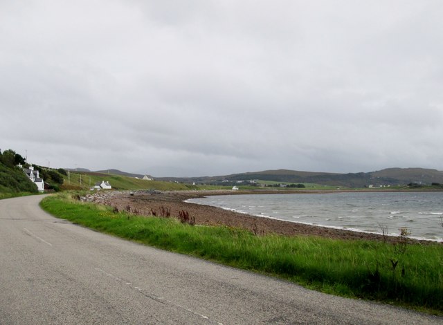
Aultbea is a small village located in the administrative county of Ross-shire, Scotland. Situated on the northwestern coast of the Scottish Highlands, it lies on the shores of Loch Ewe, a sea loch known for its stunning beauty and rich history.

With a population of around 300 people, Aultbea is a close-knit community that offers a peaceful and idyllic lifestyle. The village is surrounded by picturesque landscapes, including rolling hills, rugged mountains, and the sparkling waters of the loch. The tranquil atmosphere and breathtaking scenery make Aultbea a popular destination for nature lovers, hikers, and outdoor enthusiasts.

The village is well-connected to nearby towns and cities, with the A832 road providing easy access to the wider region. Despite its small size, Aultbea boasts a range of amenities, including a post office, a convenience store, a cafe, and a pub, ensuring residents have access to essential services.

Aultbea has a rich maritime heritage, which is evident in its historic buildings and landmarks. During World War II, Loch Ewe served as a vital naval base, and remnants of this era can still be seen today, including the impressive Inverewe Gardens, which were established as a naval fuel depot during the war.

Overall, Aultbea offers a peaceful and scenic retreat for those seeking a slower pace of life amidst the natural beauty of the Scottish Highlands.

If you have any feedback on the listing, please let us know in the comments section below.

Aultbea Images

Images are sourced within 2km of 57.839242/-5.580579 or Grid Reference NG8788. Thanks to Geograph Open Source API. All images are credited.

Moorland on Druim Breac Fairly rough stuff between here and the forestry.  Beinn Ghobhlach is the peak in the distance.
Moorland on Druim Breac
Fairly rough stuff between here and the forestry. Beinn Ghobhlach is the peak in the distance.
Moorland around the Fèith Bhàn Very flat, and probably very damp, moorland around the stream. Beinn Dearg Mhòr is the prominence in the distance; as hills of that name go (Big Red Hill), this is probably fairly feeble.
Moorland around the Fèith Bhàn
Very flat, and probably very damp, moorland around the stream. Beinn Dearg Mhòr is the prominence in the distance; as hills of that name go (Big Red Hill), this is probably fairly feeble.
Road  following  loch  side  toward  Aultbea
Road following loch side toward Aultbea
Road beside Loch Ewe entering Ormiscaig Looking north-westward.
Road beside Loch Ewe entering Ormiscaig
Looking north-westward.
Coastline by Bualnaluib Small coastal crofting community.
Coastline by Bualnaluib
Small coastal crofting community.
Bog, bog and more bog There's nothing else to say about this square.
Bog, bog and more bog
There's nothing else to say about this square.
Sea shore near Ormiscaig With some of the houses of Ormiscaig beyond.
Sea shore near Ormiscaig
With some of the houses of Ormiscaig beyond.
Loch Ewe viewpoint The information board describes the importance of Loch Ewe as a base for the Arctic convoys that supplied Russia during WW2. Merchant ships and their Naval escorts would assemble in the loch before the hazardous voyage north. 

The loch is still used a NATO ship refuelling point at the pier below. The Isle of Ewe is in the background.
Loch Ewe viewpoint
The information board describes the importance of Loch Ewe as a base for the Arctic convoys that supplied Russia during WW2. Merchant ships and their Naval escorts would assemble in the loch before the hazardous voyage north. The loch is still used a NATO ship refuelling point at the pier below. The Isle of Ewe is in the background.
Ship at the fuelling jetty, Loch Ewe A ship at the NATO refuelling jetty with the Isle of Ewe beyond.
Ship at the fuelling jetty, Loch Ewe
A ship at the NATO refuelling jetty with the Isle of Ewe beyond.
Russian Arctic Convoy Exhibition, Aultbea A comprehensive collection of photographs, memorabilia and artefacts from the WW2 supply convoys that assembled in Loch Ewe prior to their journey to northern Russian ports. See also <a href="https://www.geograph.org.uk/photo/6960054">NG8787 : Loch Ewe viewpoint</a>.
Russian Arctic Convoy Exhibition, Aultbea
A comprehensive collection of photographs, memorabilia and artefacts from the WW2 supply convoys that assembled in Loch Ewe prior to their journey to northern Russian ports. See also NG8787 : Loch Ewe viewpoint.
Aultbea and Loch Ewe
Aultbea foreshore The cream-coloured building on the left is the Aultbea Hall, now closed.
Aultbea foreshore
The cream-coloured building on the left is the Aultbea Hall, now closed.
Aultbea Stores Well-stocked village shop on the shores of Loch Ewe.
Aultbea Stores
Well-stocked village shop on the shores of Loch Ewe.
Coastal road at Aultbea The road connects Mellon Charles with Aultbea and the A832.
Coastal road at Aultbea
The road connects Mellon Charles with Aultbea and the A832.
Pier at Aird Point, Aultbea
Aultbea Hall A former community hall - we were told locally that the building was now unserviceable and that plans were in hand to use a church hall at the south end of the village.
Aultbea Hall
A former community hall - we were told locally that the building was now unserviceable and that plans were in hand to use a church hall at the south end of the village.
Refuelling jetty, Loch Ewe Seen from the shore at Aultbea.
Refuelling jetty, Loch Ewe
Seen from the shore at Aultbea.
Refuelling Jetty, Loch Ewe Now operated by The Oil and Pipeline Agency on behalf of the Secretary of State for Defence.
Refuelling Jetty, Loch Ewe
Now operated by The Oil and Pipeline Agency on behalf of the Secretary of State for Defence.
Show me another place!

Aultbea is located at Grid Ref: NG8788 (Lat: 57.839242, Lng: -5.580579)

Unitary Authority: Highland

Police Authority: Highlands and Islands

What 3 Words

///tasty.impulses.champions. Near Gairloch, Highland

Nearby Locations

Drumchork Aultbea

Related Wikis

Aultbea

Aultbea (Gaelic: An t-Allt Beithe) is a small coastal fishing village in the North-West Highlands of Scotland. It is situated on the southeast shore of...

Loch Ewe distillery

Loch Ewe distillery in Drumchork near Aultbea in the Scottish Highlands was the smallest legally operated distillery in Scotland. It was set up in 2005...
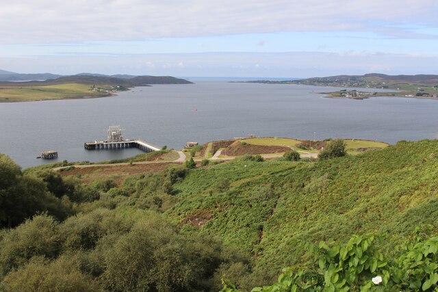
Loch Ewe

Loch Ewe (Scottish Gaelic: Loch Iùbh) is a sea loch in the region of Wester Ross in the Northwest Highlands of Scotland. The shores are inhabited by a...

Isle of Ewe

The Isle of Ewe (Scottish Gaelic: Eilean Iùbh) is a small Scottish island on the west coast of Ross and Cromarty. The island is inhabited by a single family...
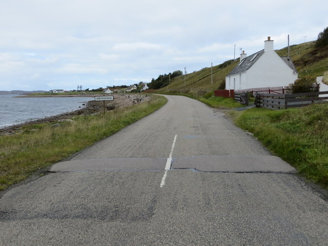
Ormiscaig

Ormiscaig (Scottish Gaelic: Ormasgaig) is a remote crofting village on the north east shore of Loch Ewe in Achnasheen, Ross-shire, Scottish Highlands and...
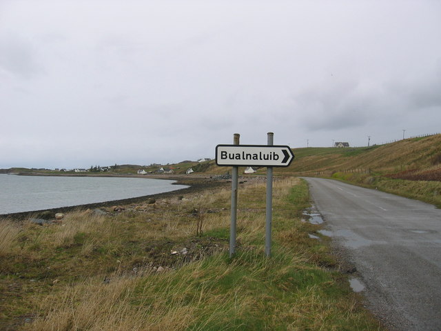
Mellon Charles

Mellon Charles (Scottish Gaelic: Meallan Theàrlaich) is a remote crofting village on the north east shore of Loch Ewe near Gairloch in Wester Ross, in...

Laide

Laide (Scottish Gaelic: An Leathad) is a small village in the northwest of the Highlands of Scotland. It is situated on the southern shore of Gruinard...

Sand, Highland

Sand (Scottish Gaelic: Sannda) is a small hamlet, located on the southern shore of Gruinard Bay, and lying to the west of the village of Laide in Ross...

Nearby Amenities

Located within 500m of 57.839242,-5.580579
Source: PGS
Lat/Long: 57.8406922/-5.5883411
Source: PGS
Lat/Long: 57.8404676/-5.5873338
Source: PGS
Lat/Long: 57.840255/-5.5863927
Source: PGS
Lat/Long: 57.839936/-5.5855355
Source: PGS
Lat/Long: 57.8395831/-5.5849263
Source: PGS
Lat/Long: 57.8395939/-5.584604
Source: PGS
Lat/Long: 57.8397275/-5.5842787
Source: PGS
Lat/Long: 57.839711/-5.5838057
Source: PGS
Lat/Long: 57.8396647/-5.5837975
Source: PGS
Lat/Long: 57.8396369/-5.5838572
Source: PGS
Lat/Long: 57.8395162/-5.5846103
Source: PGS
Lat/Long: 57.8387372/-5.5845563
Source: PGS
Lat/Long: 57.8386086/-5.5845066
Source: PGS
Lat/Long: 57.8383906/-5.5840533
Source: PGS
Lat/Long: 57.8376684/-5.5833054
Source: PGS
Lat/Long: 57.8375163/-5.5831645
Created By: almien_coastlines
Source: PGS
Lat/Long: 57.837449/-5.583112
Source: PGS
Lat/Long: 57.8371964/-5.582944
Source: PGS
Lat/Long: 57.8369816/-5.5827886
Source: PGS
Lat/Long: 57.8364747/-5.5823453
Source: PGS
Lat/Long: 57.8361378/-5.5820373
Source: PGS
Lat/Long: 57.835259/-5.5819614
Source: PGS
Lat/Long: 57.8349696/-5.5821696
Post Office
Source: OS_OpenData_StreetView
Lat/Long: 57.8404352/-5.585809
Aultbea
Name En: Aultbea
Name Gd: An t-Allt Beithe
Place: village
Wikidata: Q772427
Wikipedia: en:Aultbea
Lat/Long: 57.8406849/-5.5836719
Aultbea Hotel
Email: aultbeahotel@btconnect.com
Phone: +44 1445 731201
Tourism: hotel
Website: https://www.aultbeahotel.co.uk/
Lat/Long: 57.8389977/-5.5842937
Toilets
Fee: no
Source: OpenStreetBugs
Wheelchair: no
Lat/Long: 57.8393059/-5.5837486
Post Box
Operator: Royal Mail
Operator Wikidata: Q638098
Post Box Mounting: building
Post Box Type: wall
Ref: IV22 213
Source: survey
Lat/Long: 57.8404594/-5.5859859
Power: pole
Lat/Long: 57.8355696/-5.5777303
Power: pole
Lat/Long: 57.8365093/-5.5786095
Power: pole
Lat/Long: 57.8369399/-5.5792929
Power: pole
Lat/Long: 57.8374445/-5.5801335
Power: pole
Lat/Long: 57.8379874/-5.5810196
Power: pole
Lat/Long: 57.8386035/-5.5820503
Power: pole
Lat/Long: 57.8388639/-5.5826621
Power: pole
Lat/Long: 57.8383343/-5.5818133
Power: pole
Lat/Long: 57.8379492/-5.5811629
Power: pole
Lat/Long: 57.8374878/-5.5804932
Power: pole
Lat/Long: 57.8370756/-5.5798235
Power: pole
Lat/Long: 57.8364858/-5.5787982
Power: pole
Lat/Long: 57.8359503/-5.5783022
Power: pole
Lat/Long: 57.8355659/-5.5779329
Power: pole
Lat/Long: 57.8407387/-5.5843681
Power: pole
Lat/Long: 57.841101/-5.5853216
Power: pole
Lat/Long: 57.841459/-5.5862862
Power: pole
Lat/Long: 57.8418037/-5.5871819
Power: pole
Lat/Long: 57.840669/-5.5861898
Power: pole
Lat/Long: 57.8404343/-5.5854801
Power: pole
Lat/Long: 57.8401915/-5.5847553
Power: pole
Lat/Long: 57.8399311/-5.583996
Power: pole
Lat/Long: 57.8397624/-5.5835151
Power: pole
Lat/Long: 57.8418979/-5.5751191
Power: pole
Lat/Long: 57.8416636/-5.5744638
Power: pole
Lat/Long: 57.8414259/-5.5737841
Power: pole
Lat/Long: 57.8412168/-5.5731614
Power: pole
Lat/Long: 57.839308/-5.5834081
Power: pole
Lat/Long: 57.8396641/-5.5794092
Power: pole
Lat/Long: 57.8395137/-5.5784931
Power: pole
Lat/Long: 57.8393869/-5.577776
Power: pole
Lat/Long: 57.8392323/-5.5770954
Power: pole
Lat/Long: 57.8390804/-5.5764202
Power: pole
Lat/Long: 57.8389543/-5.5758679
Power: pole
Lat/Long: 57.8384249/-5.5752489
Power: pole
Lat/Long: 57.8385628/-5.5753157
Power: pole
Lat/Long: 57.8387049/-5.5753916
Power: pole
Lat/Long: 57.8391076/-5.5758758
Power: pole
Lat/Long: 57.839196/-5.5758313
Power: pole
Lat/Long: 57.8404513/-5.5793568
Power: pole
Lat/Long: 57.8398104/-5.5775195
Power: pole
Lat/Long: 57.8400117/-5.5773977
Power: pole
Lat/Long: 57.8401727/-5.5762252
Power: pole
Lat/Long: 57.8396899/-5.5760276
Alex Forbes & Son
Addr Street: Aultbea
Description: Garage
Opening Hours: Mo-Fr 08:00-17:00
Phone: +441445731200
Shop: car_repair
Lat/Long: 57.8403566/-5.5825052
Recycling
Recycling Type: container
Lat/Long: 57.839788/-5.5841808
The data included in this document is from www.openstreetmap.org. The data is made available under ODbL.

Have you been to Aultbea?

Leave your review of Aultbea below (or comments, questions and feedback).